-
Curaçao
March 12, 2026 /Curaçao is one of those Caribbean islands that surprises visitors almost immediately. The water is impossibly clear, the coastline alternates between wild cliffs and hidden coves, and the capital, Willemstad, looks more like a small Dutch town painted in bright tropical colors than a typical Caribbean port.
Located just 65 kilometers off the coast of Venezuela, Curaçao sits outside the hurricane belt and enjoys a dry, sunny climate year-round. This geography shapes much of the island’s character. The landscape is rugged and arid rather than lush, dominated by cacti, low shrubs, and rocky hills. Beaches are rarely long stretches of sand. Instead, they tend to be small coves where limestone cliffs drop into turquoise water, creating some of the best snorkeling and diving conditions in the Caribbean.
Curaçao’s history is layered and complex, shaped by Indigenous cultures, European colonization, and centuries of global trade.
Before Europeans arrived, the island was inhabited by the Arawak Caquetío people, who had migrated from the northern coast of South America. They lived primarily from fishing, agriculture, and trade with mainland communities.
In 1499 the island was encountered by Spanish explorers led by Alonso de Ojeda. Spain initially considered Curaçao of limited value due to its dry climate and lack of precious metals, and for several decades it remained sparsely populated.
Everything changed in 1634, when the Dutch West India Company captured the island from Spain. The Dutch quickly recognized Curaçao’s strategic importance. Its natural deep harbor, the Schottegat, became one of the most important ports in the Caribbean. During the 17th and 18th centuries, Willemstad developed into a major trading hub linking Europe, Africa, and the Americas.
Like much of the Caribbean, Curaçao was deeply involved in the transatlantic slave trade. Enslaved Africans were brought to the island and redistributed across the region. This painful chapter left a lasting cultural imprint that still shapes Curaçao’s identity today.
Slavery was officially abolished in the Dutch colonies in 1863, after which the island gradually transitioned toward commerce, shipping, and later oil refining. In the 20th century, the construction of a large Royal Dutch Shell refinerytransformed Curaçao into a key energy hub in the southern Caribbean.
Today Curaçao is a constituent country within the Kingdom of the Netherlands, alongside Aruba and Sint Maarten. While it has internal self-government, the Netherlands remains responsible for defense and foreign affairs.
Culture and Identity
One of Curaçao’s most distinctive features is its cultural mix. The island’s population reflects centuries of migration and trade, blending African, Dutch, Spanish, Portuguese, and Caribbean influences.
This diversity is reflected in the languages spoken. Papiamentu, a Creole language that combines elements of Portuguese, Spanish, Dutch, African languages, and Arawak, is widely spoken and forms an important part of the island’s identity. Dutch and English are also official languages, and Spanish is commonly heard due to the proximity of Venezuela and Colombia.
Religion, food, music, and architecture all reveal this cultural layering. Dutch colonial buildings line the waterfront in Willemstad, Caribbean rhythms fill the streets during festivals, and local cuisine mixes African, Latin American, and European traditions.
Willemstad and the Heart of the Island
Most visitors arrive through Willemstad, a UNESCO World Heritage Site famous for its pastel-colored colonial buildings along the harbor. The city is divided into two historic districts, Punda and Otrobanda, connected by the floating Queen Emma Bridge. Walking through these neighborhoods gives an immediate sense of Curaçao’s maritime past and its cosmopolitan character.
Beyond the capital, the island quickly becomes quieter and more natural. The western side of Curaçao is dotted with national parks, small beaches, and traditional fishing villages, while the northern coast is dramatic and rugged, where the Caribbean waves crash directly against limestone cliffs.
What Makes Curaçao Different
Compared with many Caribbean islands, Curaçao feels less like a resort destination and more like a place with a strong local identity. The beaches are spectacular but rarely crowded. The island rewards exploration, from hidden coves and snorkeling spots to small local restaurants and historic neighborhoods.
It is also an island of contrasts. Within a short drive you can move from colorful colonial streets to cactus-covered hills, from calm turquoise bays to wild, wind-swept cliffs.
For travelers willing to explore beyond the main beaches, Curaçao reveals itself as a place shaped by history, trade, migration, and the sea.
Day 1
Morning: Cas Abao Beach
Start the day at Cas Abao Beach, one of the most famous beaches on the island and a good introduction to Curaçao’s coastline.
Unlike many of the small rocky coves around the island, Cas Abao is wide and sandy, with calm turquoise water protected by the surrounding cliffs. The beach is very well maintained and offers good facilities. There are sunbeds, umbrellas, showers, and a beach bar. For families, it is also one of the easiest beaches to enjoy with children.
The water is exceptionally clear, and snorkeling is excellent along the rocky edges of the bay. Fish tend to concentrate near the cliffs, where coral formations create natural shelters. Even a short swim can reveal parrotfish, angelfish, and sometimes sea turtles.
The only drawback is that Cas Abao is popular. It is best to arrive in the morning, ideally before 10:00, when the beach is still quiet and the water is perfectly calm.
Afternoon: Playa Daai Booi
In the afternoon drive about fifteen minutes north to Playa Daai Booi. This beach has a completely different atmosphere.
Daai Booi is much smaller and more local. Fishermen often keep their colorful boats on the sand, and the beach feels less organized and more authentic. There are usually fewer visitors, especially later in the day.
The bay is deep and narrow, surrounded by cliffs, which makes the water calm and excellent for snorkeling. Sea turtles are often seen here, especially near the rocky areas on the sides of the beach.
There is a simple beach bar where you can buy drinks and basic food. The setting is relaxed and unpretentious, which makes it a pleasant contrast after the more structured environment of Cas Abao.
Late afternoon is a particularly nice time to visit, when the light becomes softer and many people leave the beach.
Evening: Dinner at Landhuis Daniel
After the beach, drive a few minutes inland to Landhuis Daniel, one of the most charming places to have dinner in this part of the island.
The restaurant is located inside a restored 18th-century plantation house (a landhuis), part of the colonial estates that once structured agricultural life on the island. The building itself is beautiful, with thick stone walls, a shaded courtyard, and a relaxed open-air dining area.
The cuisine focuses on Caribbean and Dutch-Caribbean dishes, prepared with local ingredients. Typical plates include grilled fish, Caribbean stews, and slow-cooked meats. The atmosphere is informal but refined, and the setting feels very authentic compared with many tourist restaurants closer to Willemstad.
After a day of beaches and sun, it is the perfect place to end the first day on the island before heading back to your accommodation.
Day 2
The Story of Blue Curaçao at Landhuis Chobolobo
One of the most interesting cultural stops in Curaçao is Landhuis Chobolobo, the historic distillery where the island’s famous Curaçao liqueur is produced.
While most visitors know the bright blue bottles from cocktail bars around the world, few realize that the drink originates from a very specific local fruit and a centuries-old tradition that began on this island.
The key ingredient of Curaçao liqueur is the Laraha, a bitter orange that grows only on the island.
The fruit originally descended from the Valencia orange, introduced by Spanish settlers in the 16th century. Curaçao’s dry climate and rocky soil transformed the fruit over time through natural mutation. The result was something quite different from the original orange. The Laraha became extremely bitter and essentially inedible, but its peel developed a very intense aromatic oil.
Harvesting the fruit requires care. The oranges cannot simply be pulled from the tree because the branches are fragile. Instead they are cut with knives and collected by hand. Once harvested, the fruit is opened and the pulp is discarded, often used as compost. Only the peel is kept for the liqueur.
The peels are then sun-dried for several days, which concentrates the aromatic oils responsible for the distinctive citrus aroma.
After drying, the peels are placed in small fabric bags that resemble large tea bags. These bags contain not only Laraha peel but also a blend of spices. The exact proportions remain secret, but they include ingredients such as cardamom and cloves, traditionally imported from India.
Sugar for the liqueur is sourced from Colombia, while the neutral alcohol base historically comes from the Netherlands. The alcohol used for extraction is extremely strong, about 96 percent, and is poured over the spice-filled bags inside the distillation system.
The distillery still uses a copper still that is more than 120 years old, and remarkably it remains fully operational. The spice bags steep in alcohol for about ten days, slowly releasing the aromatic oils. The result is a concentrated citrus extract.
After this extraction stage, the concentrate is transferred into tanks where it is diluted and sweetened. A typical batch may include roughly 280 liters of concentrate and around 400 kilograms of sugar.
From there, the liquid becomes the base of Curaçao liqueur.
Originally, Curaçao liqueur was colorless, similar to other orange liqueurs such as triple sec. In fact, Curaçao-style liqueur was already known in Europe before the modern brand identity of Blue Curaçao emerged.
In the 1960s, producers introduced bright colors to distinguish the product visually and make it more appealing for cocktails. Blue became the most iconic version, representing the Caribbean sea surrounding the island. Other colors were also introduced:
Green for the island’s cacti
Yellow for the tropical sun
Red for the sunset
Despite the different colors, they are all chemically the same triple sec, typically bottled at about 31 percent alcohol.
The bottle itself is distinctive and was deliberately designed to represent the Laraha fruit.
Its round shape mimics the orange, the textured glass reflects the fruit’s rough peel, and the small decorative element around the neck represents the branch from which the fruit grows. While the brand patented the bottle design, it is of course impossible to patent the island or the fruit itself.
All bottles and caps are imported and fully recyclable, and the distillery emphasizes avoiding plastic in the packaging process.
The filling machine used in the factory is also historic. It does not fill bottles completely to the top, so each bottle must be manually topped up before sealing.
Production at Landhuis Chobolobo remains relatively artisanal compared with industrial spirits.
In a typical small production cycle of around twenty days, the distillery produces roughly 2,000 bottles. The concentrated base is now produced continuously, but when the factory shifts fully to the classic triple sec production, output can reach about 160,000 bottles per year.
Over time the distillery expanded the range with additional flavored liqueurs. Unlike the classic Curaçao, these are not based on Laraha peel and are bottled at lower alcohol levels, around 26 percent.
Examples include flavors such as Chocolate Coffee, Rum Raisin, and Tamarind, which was introduced in 2016.
An interesting historical note involves the distillery’s ownership. At one point the senior owners were Jewish, which meant that the production process followed kosher requirements. For this reason, the distillery still maintains kosher certification, and a rabbi visits periodically to verify compliance with the rules.
Besides the liqueurs, the distillery also produces a few small specialty items derived from the same aromatic oils, including things such as cooling lotions and fragrances, sometimes marketed under names like Glacier.
The tour at Landhuis Chobolobo offers a rare chance to see the full story of Curaçao liqueur, from the unusual Laraha fruit to the century-old copper still that still drives production today.
It is a reminder that behind the bright blue bottles seen in bars across the world there is a very local product, rooted in the island’s climate, agriculture, and history.
Visiting the Curaçao Ostrich Farm
The second stop of the day is a place that surprises many visitors: the Curaçao Ostrich Farm. Located in the dry northeastern part of the island, the farm sits in a landscape of cacti, dust, and low hills that feels almost African. In fact, the climate here is remarkably similar to parts of Namibia and South Africa, which is why ostriches adapt so well to this environment.
The farm was established in the late 1990s and today hosts hundreds of ostriches, making it one of the largest ostrich farms outside Africa. Visits are organized as guided tours, usually by open safari truck, which drives through the different enclosures while guides explain the biology and behavior of these unusual birds.
Ostriches are remarkable animals. They are the largest birds on Earth, reaching up to 2.5 meters in height and weighing well over 100 kilograms. Despite their size, they are built for speed rather than flight. Their powerful legs allow them to run at up to 70 km/h, making them the fastest birds on land.
Each foot has only two toes, a unique feature among birds. One of them forms a large, hoof-like structure that acts almost like a running shoe, giving them stability and propulsion when sprinting across open terrain.
Another interesting detail guides often point out concerns the difference between males and females, which is surprisingly easy to see.
Male ostriches have striking black feathers with white wing and tail plumes, while females are covered in soft grey-brown feathers that provide camouflage when nesting.
One amusing observation visitors quickly notice is that female ostriches have a noticeably featherless rear end. This bare patch of skin helps with temperature regulation and hygiene, especially when the birds are sitting on eggs during long incubation periods. The exposed skin allows heat to dissipate more efficiently in hot climates like Curaçao.
It also gives the females a rather distinctive appearance when they walk away from the tour vehicles, something that guides often jokingly point out during the visit.
One of the most striking things visitors see on the tour is the ostrich egg, which is enormous compared with chicken eggs. A single egg can weigh around 1.5 kilograms and is roughly equivalent to two dozen chicken eggs.
The shell is extremely thick and strong. Guides often demonstrate that it can support the weight of a person standing on it without breaking. In cooking terms, one egg is enough to prepare a massive omelet that can feed a large group.
One of the most famous myths about ostriches is that they bury their heads in the sand when frightened. In reality, they do not do this. The misunderstanding comes from the way ostriches lower their heads to the ground when turning eggs during nesting or when searching for food.
From a distance, this posture can give the illusion that the head has disappeared underground.
Although ostriches look almost comical, they can be surprisingly aggressive when they feel threatened. Their legs are extremely powerful, and a defensive kick can be dangerous.
Each foot has a sharp claw that can reach several centimeters in length. In the wild, ostriches use these kicks to defend themselves against predators such as lions. For this reason, the farm’s guides emphasize that visitors should never try to approach the animals outside the controlled areas.
Another surprising fact is that ostriches often swallow small stones. These stones accumulate in the bird’s gizzard and help grind food during digestion, functioning almost like natural teeth.
Their diet consists mostly of plants, seeds, and insects, but they are opportunistic eaters and will sometimes swallow small objects if available.
Historically, ostriches were farmed for several products. Their feathers were once extremely valuable in the fashion industry, especially in the 19th century. Today, farms focus more on meat, leather, and eggs.
Ostrich leather is particularly prized because it is both durable and flexible, and its distinctive pattern of feather follicles gives it a recognizable texture used in luxury goods.
The presence of an ostrich farm might seem unexpected in the Caribbean, but Curaçao’s environment actually makes it suitable. The island is relatively dry compared with other Caribbean destinations, with cactus landscapes and open terrain that resemble the birds’ native habitats.
The result is an unusual but memorable experience, especially for families. After a few days of beaches and turquoise water, visiting the ostrich farm adds a completely different side to the island.
Day 3
The third day combines one of the most spectacular beaches on the island with an afternoon exploring the historic center of Willemstad.
Morning: Grote Knip
Start the morning at Playa Kenepa Grandi, better known as Grote Knip. Many consider it the most beautiful beach on the island.
The viewpoint above the beach already offers one of the most iconic panoramas in Curaçao. From the cliff you can see the entire bay below, a perfect crescent of white sand framed by rocky hills and bright turquoise water.
The beach itself is simple and natural. There are a few basic facilities, but the main attraction is the water. Visibility is excellent and snorkeling along the rocky sides of the bay often reveals schools of tropical fish and occasionally sea turtles.
Access to Grote Knip is free, which is relatively rare on the island, and this makes it popular with locals. Arriving early in the morning is the best way to enjoy the beach before it becomes crowded.
Afternoon: Walking Through Willemstad
The afternoon is dedicated to exploring Willemstad, whose historic center is a UNESCO World Heritage Site.
It is worth stopping briefly at the large Curaçao Sign. These oversized colorful letters spelling Curaçao have become a popular photo spot on the island. The sign is located along the waterfront near the cruise terminal, with the harbor and the city skyline as a backdrop.
It is a quick stop, but it gives a nice panoramic view of the harbor and is a fun place for a photo before heading into the historic center.
The most recognizable view is the row of colorful Dutch colonial houses lining the harbor in the district of Punda. The buildings, painted in pastel tones of yellow, blue, and pink, reflect in the water and create one of the most distinctive urban landscapes in the Caribbean.
Punda and Otrobanda, the two historic halves of the city, are connected by the famous Queen Emma Bridge, a floating pontoon bridge that opens to allow ships into the harbor. Walking across it while boats pass through the channel is one of the classic experiences in the city.
Spend some time wandering through the narrow streets behind the waterfront, where small shops, cafés, and historic buildings reveal the Dutch colonial heritage of the island.
A good stop in the afternoon is Gio’s Gelateria, located just steps from the harbor.
Despite being in the Caribbean, the gelato is very authentic. Classic Italian flavors like pistachio, stracciatella, and hazelnut sit alongside more tropical options. Sitting outside with a cone while watching people cross the bridge and boats entering the harbor is one of the small pleasures of visiting Willemstad.
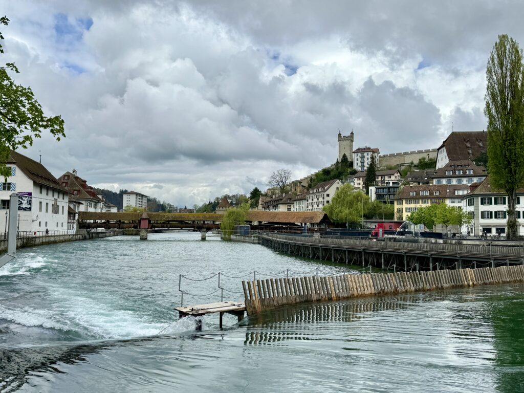
Dinner: Pasawa Box Eatery
For dinner head to Pasawa Box Eatery, a lively street-food style food hall rather than a traditional restaurant.
The venue is built around a collection of small food stands, each serving different styles of cuisine. Visitors can mix and match dishes, from Caribbean flavors to international street food. The atmosphere is informal and energetic, with communal tables and a constant flow of people picking up food from different stalls.
It is a very different experience from the more classic restaurants on the island. Instead of a formal dinner, the evening becomes more like a casual food market, where everyone can try different dishes and flavors.
After a day that started on one of Curaçao’s most beautiful beaches and ended wandering the colorful streets of Willemstad, it is a relaxed and fun way to close the day.
-
Seoul
November 16, 2025 /To understand South Korea is to understand transformation.
In just a few generations, it evolved from the ashes of war into one of the world’s most innovative nations — a place where tradition and technology move in step, not in conflict.
The Han River cuts through Seoul like a shimmering boundary: north of the river lies the old city, where palaces and hanoks whisper of Confucian order; south of it, glass towers rise over shopping districts and neon boulevards.
Locals like to say, “Everything new is south of the river; everything true is north.”
And that’s where this day begins.Gyeongbokgung Palace — Where the Heavens Aligned with Stone and Wood
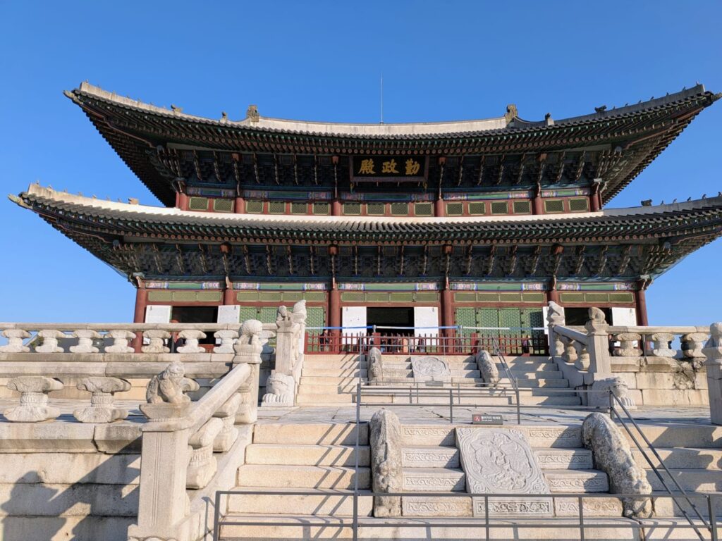
At the northern edge of Seoul, protected by Mount Bugaksan and facing the wide Han River, rises Gyeongbokgung Palace (경복궁) — “The Palace Greatly Blessed by Heaven.” Built in 1395 by King Taejo, the founder of the Joseon dynasty (1392–1897), it was not just a royal residence: it was the cosmic center of a new nation grounded in Confucian philosophy, moral governance, and harmony with nature.
For more than five centuries, the Joseon rulers shaped Korea’s identity through Neo-Confucian philosophy, elevating scholarship, etiquette, and moral discipline above luxury.
Their palaces were designed as moral diagrams rather than monuments to wealth — each gate, courtyard, and hall aligned with heaven’s geometry. Gyeongbokgung became the spiritual and political center of this vision: a city within a city, where architecture embodied virtue.The palace stands on a site chosen through pungsu-jiri, Korea’s interpretation of feng shui.
To the north, Mount Bugaksan protects like a guardian wall; to the south, the Han River carries life and prosperity; to the east rises the Blue Dragon (vitality), to the west the White Tiger (strength).
This balance between mountain and water, shadow and flow, was thought to harmonize the cosmic forces that sustained the realm.Constructed from Korean red pine and granite, the palace reflects quiet strength. Its beams are painted in dancheong — patterns of mineral reds, greens, blues, yellows, and whites — each color with purpose: red for dignity, green for renewal, blue for harmony, yellow for balance, white for purity.
Under morning light, the pigments shimmer like living calligraphy against the grey stone.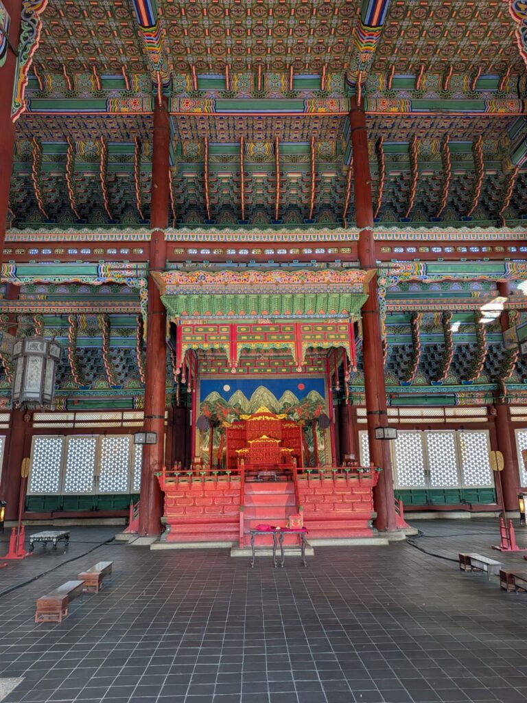
Passing through Gwanghwamun Gate, visitors enter the vast courtyard of Geunjeongjeon Hall, the throne room and first original building of the palace.
The stone pavement is uneven by design — scattering the sun’s glare during ceremonies and reminding all that perfection belongs only to the heavens.
Every axis draws the gaze from earth to mountain, reinforcing the Confucian ideal that the ruler is a bridge between the two.The palace’s tranquility was shattered in 1592, when Japan invaded during the Imjin Wars and burned almost everything to ashes.
It remained in ruins until 1867, when King Gojong ordered its grand reconstruction — more than 400 buildings and 7 000 rooms reborn from stone foundations.
But tragedy returned under Japanese occupation (1910–1945): most halls were again demolished, and the massive Government-General Building was erected before the main gate to dominate Korea’s symbol of sovereignty.
After independence, restoration became an act of national healing. The colonial structure was torn down in 1995, exactly six centuries after Gyeongbokgung’s founding, and the palace slowly reclaimed its horizon.West of the throne hall stands Gyeonghoeru Pavilion (경회루), completed in 1412 under King Taejong — the second major building of the complex and one of the few to survive the centuries.
Built above an artificial pond on 48 granite pillars, it was the stage for royal banquets and receptions. Its reflection doubles in still water, symbolizing the perfect harmony between heaven and earth.Inside, the doors hang from the ceiling, not the floor, lifted or lowered with ropes to control breeze and light — an ingenious design centuries ahead of its time.
When opened, the pavilion dissolves into air and water, its pillars mirrored by rippling lotus leaves; at night, the lanterns transform it into a floating constellation.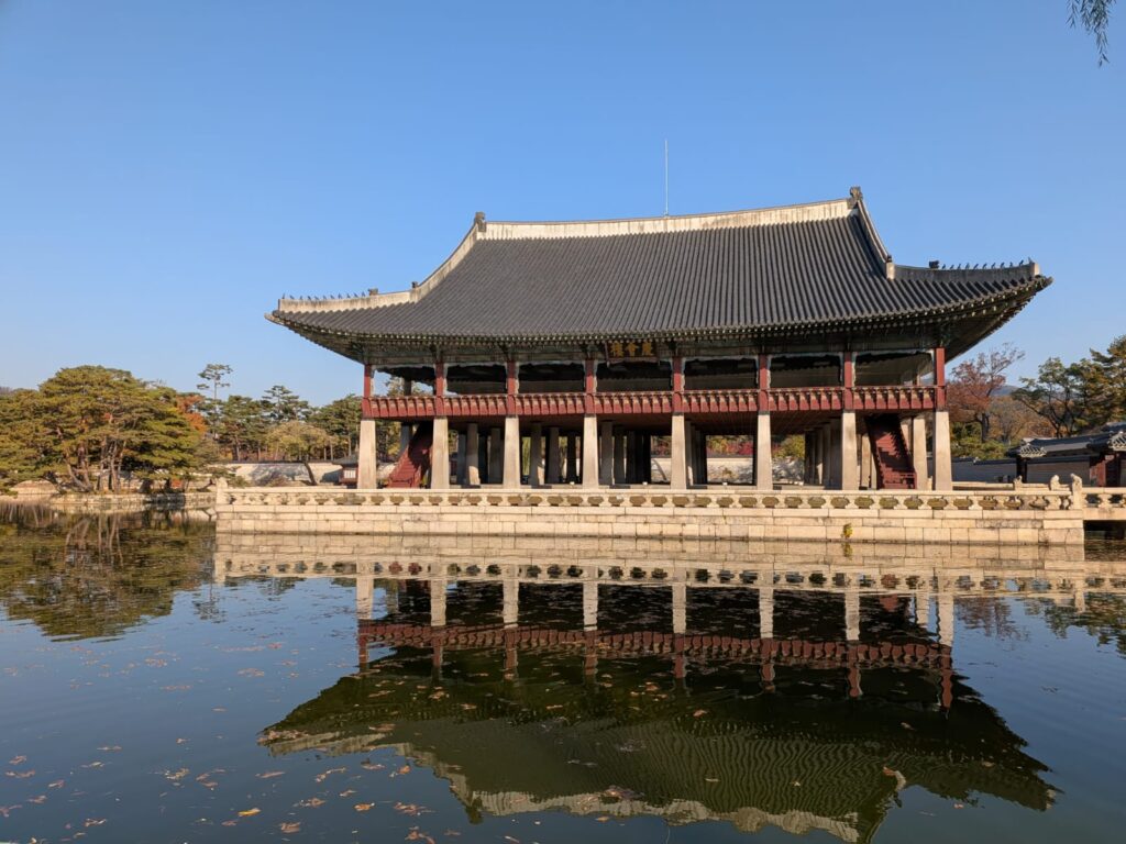
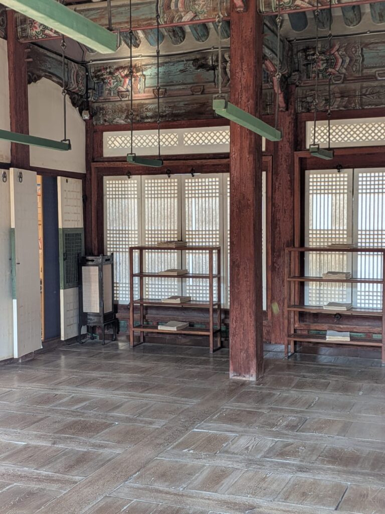
Behind the ceremonial courtyards lies Gangnyeongjeon Hall (강녕전), the king’s living quarters — a faithful reconstruction of the originals.
The residence was divided into three wings for the seasons: a south-facing suite with heated ondol floors for winter, a cool northern wing for summer, and a central set of rooms for spring and autumn.Despite his title, the king lived with almost no privacy. Attendants and scribes surrounded him day and night. His bed was plain wood, his workspace minimal — a writing table, scrolls of the Confucian Classics, and little else.
The ground outside was covered in gravel, so that every footstep produced a crunch, alerting guards to intruders in the night.
Even meals carried symbolism: the king ate with brass chopsticks, believed to change color on contact with poison — a quiet ritual of vigilance.There was no toilet inside the chambers. Instead, the king used a porcelain or brass vessel, which the court physician examined each morning to assess his health.
Afterward, the contents were used to fertilize a small plot within the palace grounds where the “royal rice” was grown — grain imbued, it was said, with the vitality of the sovereign himself.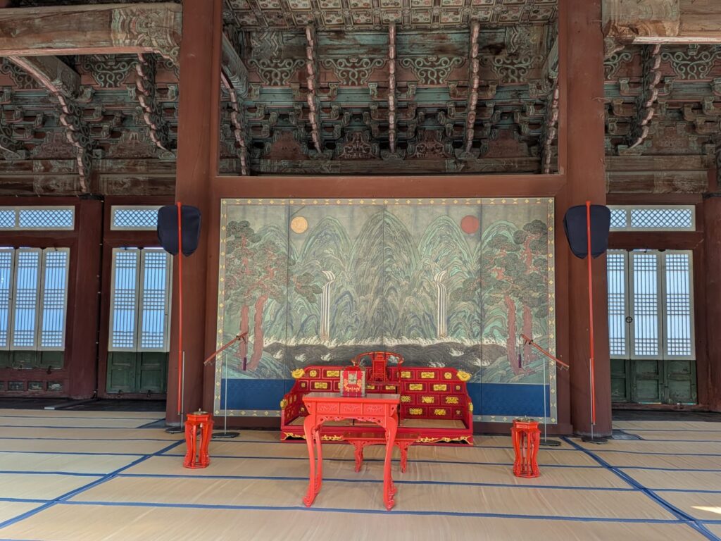
Today, Gyeongbokgung has reawakened.
Every morning and afternoon, the Changing of the Guard ceremony unfolds at Gwanghwamun Gate — soldiers in crimson and cobalt robes march to the beat of great drums, horns echo off granite walls, and banners of phoenix and tiger rise against the skyline.
It is a reconstruction, yet it feels profoundly real — a gesture of continuity, the echo of an empire that measured time in rituals, not clocks.Gyeongbokgung endures as more than a monument. It is a breathing map of Korean history — of balance, discipline, and rebirth.
Walk its uneven stones, listen to the gravel whisper behind the royal chambers, and watch the reflection of the pavilion tremble in the pond.
Here, between mountain and river, Seoul still remembers how to align with the heavens.Dongdaemun Design Plaza — Where Seoul Curves Toward the Future
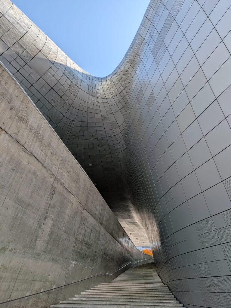
If Gyeongbokgung embodies the symmetry and order of the past, the Dongdaemun Design Plaza (DDP) expresses the pulse of the future.
It stands on sacred historical ground — the former site of Heunginjimun, the “Great East Gate,” one of the four gates that once enclosed the old capital.
For centuries, this was the city’s threshold: merchants, scholars, and travelers entered Seoul through this very point.
Now, the DDP rises in its place like a comet fallen to earth — a seamless fusion of design, memory, and technology.Designed by the late Zaha Hadid, whose visionary curves reshaped contemporary architecture, the DDP was inaugurated in 2014 as Seoul’s new icon of creativity.
Its organic form — fluid, continuous, almost alive — is built from 45,000 unique aluminum panels, each one digitally modeled and fitted using Samsung’s advanced engineering systems.
The result is a metallic skin that bends light like silk, a building that appears to move even when it stands still.Beneath the surface lies another layer of history.
During excavation, workers unearthed long-buried sections of the original Joseon-era fortress wall, fragments of Seoul’s ancient boundary. Instead of covering them, the architects preserved the stones in situ, integrating them into the Dongdaemun History & Culture Park that surrounds the plaza.
Here, the city’s medieval foundations literally support its futuristic architecture — the perfect metaphor for Seoul itself, a place where the past is never erased, only transformed.The DDP also carries more recent ghosts.
During the Japanese colonial period (1910–1945), this very site hosted the Dongdaemun Stadium, where baseball and athletic events were held under occupation.
Those stadiums — symbols of both imported culture and political control — were demolished to make way for the new plaza, turning a site once marked by domination into one dedicated to imagination and art.
Even today, traces of the old stands remain beneath the walkways, a quiet reminder of how deeply history layers itself under every Seoul street.Inside, the building unfolds like a living organism: galleries, design studios, and fluid exhibition spaces connected by gently sloping ramps.
A baseball training area was even installed inside during the building’s early tests — a playful nod to the site’s past and to the precision of its acoustics.
As you move through it, the walls curve without angles, and the light seems to pour rather than shine.At sunset, the DDP becomes a spectacle.
Its aluminum surface reflects the fading sky, shifting from pearl grey to violet, and finally to deep cobalt under the city lights.
Around it, the park glows softly, and the surviving stones of the Joseon wall appear suspended between centuries — the old gate illuminated behind a building that belongs to tomorrow.The Art Hall is the heart of the DDP, a monumental, open space that hosts rotating exhibitions of art, fashion, and technology.
It’s a building designed not just to display creativity, but to be creative — light glides across curved walls like brushstrokes, and shadows themselves become part of the show. Major exhibitions have ranged from avant-garde fashion retrospectives to immersive digital art. The acoustics are so refined that, during construction, engineers famously tested them with a baseball field installed inside — a surreal yet perfectly Seoul-like image, blending play and precision. Walking through, you feel suspended between sculpture and atmosphere: sound softens, reflections bend, and the city outside seems to dissolve into light. Beneath the sweeping exterior lies the Design Lab, the beating heart of the complex. Here, designers, startups, and students share workspaces where ideas move faster than daylight.
The building’s open-plan concept encourages collaboration — 3D printers hum beside hand-drawn sketches, and exhibition booths transform daily into new experiments of Korean creativity. Next to it, the Design Market operates almost 24 hours a day, a luminous bazaar of books, crafts, home décor, and concept products. It’s half gallery, half night market — the perfect place to feel the city’s nocturnal energy.
From here, you can step directly into the world of Seoul’s young creators: graphic designers, ceramic artists, and architects who treat the DDP as both workplace and muse.
When construction began, archaeologists discovered remnants of the original Joseon-era fortress wall buried under the site. Instead of removing them, the architects wove them into the new complex — a gesture of profound respect.
Walking through the Dongdaemun History & Culture Park, you see centuries overlap: granite stones from the 15th century resting under LED lights, fragments of the old city walls displayed beside the glass façade of Hadid’s design. This ground carries deeper echoes.
During the Japanese colonial period (1910–1945), the same site was home to Dongdaemun Stadium, where baseball and athletic competitions took place under occupation.
The stadium was later demolished to make way for the DDP, turning a place once tied to domination into one of imagination — from control to creativity.
A few traces of the old stands remain, like quiet fossils under the plaza’s modern walkways.Bukchon Hanok Village — Time Suspended Among Wooden Roofs
From the futuristic shimmer of Dongdaemun, the path winds back toward stillness — to Bukchon Hanok Village, where Seoul slows down and exhales.
Perched on a hill between Gyeongbokgung Palace and Changdeokgung Palace, Bukchon is a labyrinth of narrow alleys lined with hanok — traditional Korean houses built in wood, clay, and stone. Their curved tiled roofs rise and fall like waves frozen in time, a landscape that feels more like memory than city.The name Bukchon means “Northern Village”, and for six centuries this has been home to Seoul’s nobility: high-ranking scholars, ministers, and courtiers of the Joseon dynasty.
Unlike the reconstructed palace or the futuristic plaza, Bukchon is alive and inhabited — a real neighborhood where residents hang laundry under eaves carved centuries ago, and the scent of pine mingles with the sound of schoolchildren’s footsteps on stone.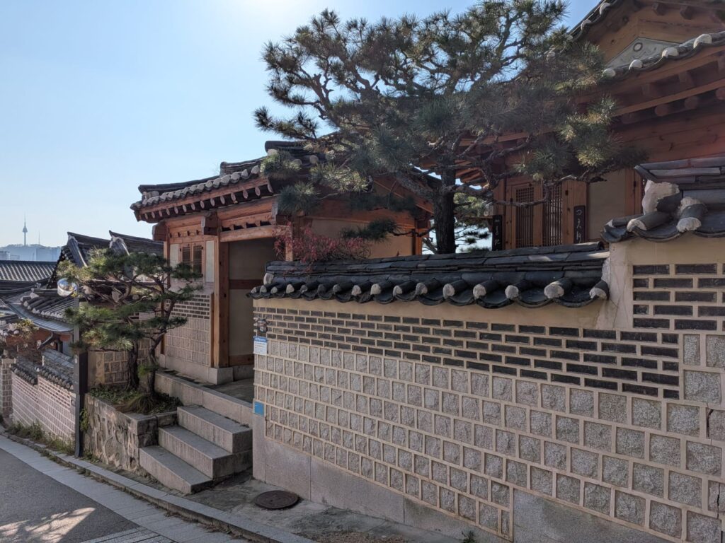
Each hanok follows the principles of pungsu-jiri, the same geomantic harmony that shaped the royal palaces.
Wooden beams breathe with the seasons; heated ondol floors warm the interiors in winter; open courtyards catch breezes in summer.
From certain alleys, the tiled roofs frame the skyline — a surreal blend of past and present, with the spires of modern Seoul rising gently beyond the ancient ridges.Inside some of the preserved houses, visitors can glimpse fragments of daily life: calligraphy brushes laid beside rice-paper windows, lacquer bowls glinting in soft light, a quiet rhythm of tea being poured.
Many hanok now host craft studios, galleries, and tea houses, allowing guests to step inside without disturbing the families who still live next door.
The experience is deeply tactile — the scent of warm wood, the echo of your steps on uneven stones, the faint hum of a fan behind a paper door.Bukchon is also a place of silence and respect.
Signs gently remind visitors to whisper, as most homes remain private dwellings. The balance here is delicate — beauty coexisting with the ordinary.
Even the air feels slower, as if the city itself pauses in reverence.
Gangnam — The Pulse of Modern Seoul
As daylight fades, the city crosses the river — literally.
South of the Han, Seoul becomes a different world: glass towers replace tiled roofs, traffic hums like electricity, and neon veins light up the skyline.
This is Gangnam (강남, “south of the river”) — a symbol of South Korea’s transformation from post-war austerity to global modernity.In just a few decades, Gangnam evolved from farmland into one of the most futuristic cityscapes in Asia.
Wide boulevards lined with flagship stores and tech headquarters announce the ambitions of a nation that rebuilt itself not just quickly, but brilliantly.
It’s a district where fortune, fashion, and innovation converge — and yet, beneath the surface, you can still feel the same Confucian rhythm that ordered Gyeongbokgung: precision, discipline, and an obsession with harmony, now translated into glass, steel, and data.The streets around Gangnam Station pulse with energy — commuters, students, and travelers moving in every direction, screens glowing like lanterns.
Cafés spill onto sidewalks, K-pop beats echo from every corner, and digital billboards flash faces more famous than kings.
This is the Seoul of now — endlessly connected, eternally awake.A short walk from the main avenue, COEX Mall stretches like a city beneath the city: a maze of restaurants, boutiques, art spaces, and the iconic Starfield Library, where thousands of books climb toward a ceiling of light.
Nearby, the SMTOWN complex celebrates the country’s pop culture empire, while sleek electric cars glide silently along the broad avenues.
Even the crosswalks here seem choreographed — the choreography of a city that’s always performing itself.But Gangnam is not all noise and glass.
Step a few streets away and you find quiet alleys lined with minimalist cafés, boutique design studios, and rooftop bars where the skyline reflects in every window.
From there, you can look north across the river — toward Gyeongbokgung, Bukchon, and the mountains beyond — and realize that Seoul is not two cities, but one story told in two directions:
the past written in wood and stone; the future in light and motion. -
Spain
June 25, 2025 / -
Rio de Janeiro
June 25, 2025 /Rio de Janeiro isn’t just beaches and samba. It’s a spectacular city where nature collides with urban life in the most dramatic way—mountains plunging into the sea, jungle meeting pavement, and colonial facades framed by graffiti and bougainvillea. In just four days, you can capture the essence of the Cidade Maravilhosa, from sunrise on mountaintops to nights dancing in centuries-old streets.

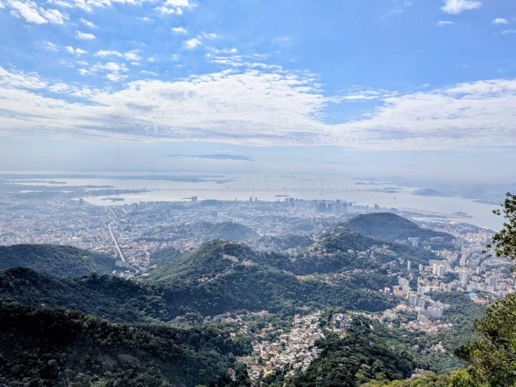
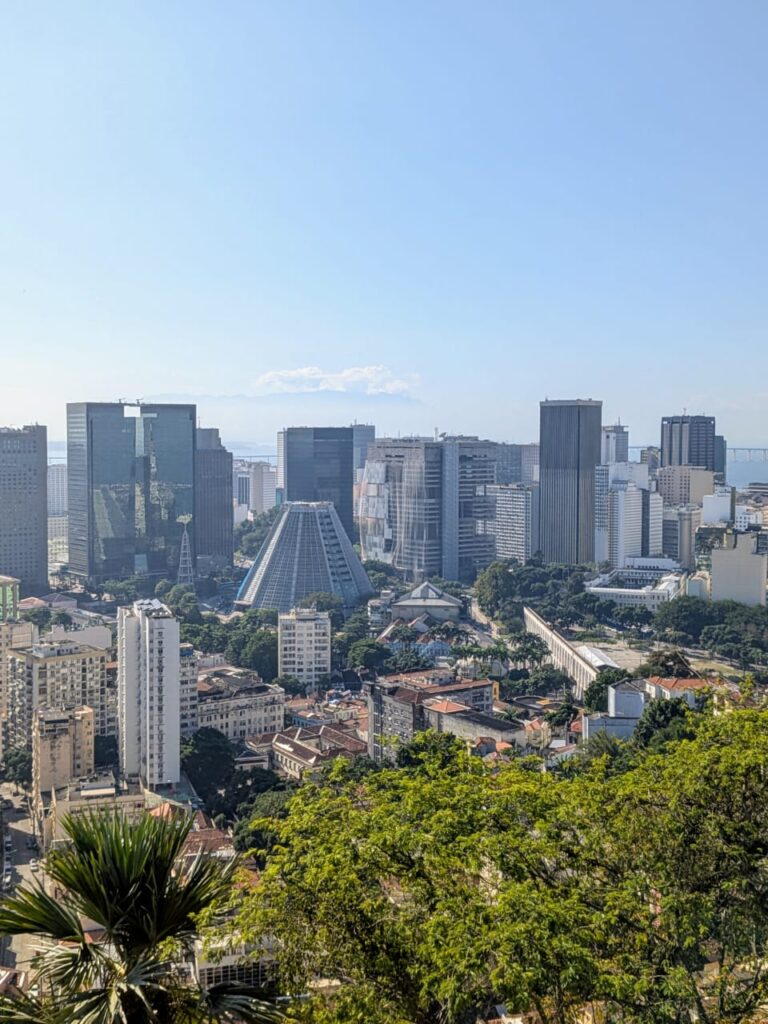
To really appreciate Rio de Janeiro, you have to picture it first. The city unfurls along Brazil’s southeastern coast in a spectacular tangle of granite mountains, golden beaches, and deep tropical forests. The southern part of Rio is where most visitors spend their time: neighborhoods like Copacabana, Ipanema, and Leblon hug the Atlantic shoreline, framed by dramatic peaks like the Dois Irmãos and Pedra da Gávea. Between the mountains, a narrow river was dammed to form the Lagoa Rodrigo de Freitas, a mirror-like lagoon ringed by bike paths and overlooked by the towering Christ the Redeemer.
To the north lies the historic city center, the Centro, where colonial churches, financial buildings, and samba bars crowd together. Nearby, the massive Maracanã Stadium rises like a temple to Brazilian football. On the eastern edge of the city, Sugarloaf Mountain (Pão de Açúcar) juts out into the bay like a giant sentinel, offering some of the most iconic views in South America.
And across the 13-kilometer-long Rio–Niterói Bridge, you reach Niterói, a quieter, charming city with beaches, modernist architecture (including Oscar Niemeyer’s spaceship-like museum), and a spectacular view looking back at Rio’s skyline—one of the rare places where you can actually see all of Rio at once.
Founded by the Portuguese in 1565 as a strategic port to defend against French colonists, Rio later became the capital of the Portuguese Empire in exile, and then Brazil’s own capital until 1960. But more than political history, what defines Rio is its energy: vibrant, chaotic, sensuous. The rhythm of samba pulses beneath your feet, even when the streets are still. Over the next four days, we’ll explore its peaks and promenades, beaches and backstreets—always with music in the air and ocean at your side.
North Rio 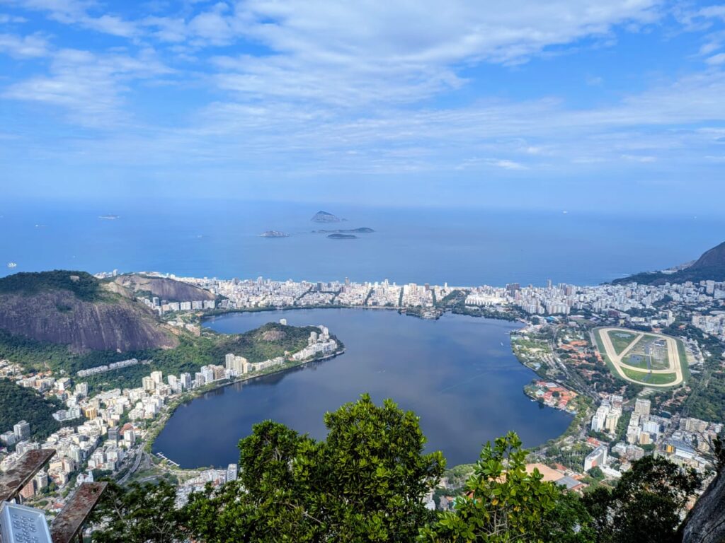
South Rio Day 1 - Postcards and Promenades: Sugarloaf and the Beaches
Your first morning in Rio starts with one of the city’s most iconic sights: Sugarloaf Mountain (Pão de Açúcar). The name dates back to colonial times when blocks of refined sugar were shaped like rounded cones—just like this towering granite peak. Two separate cable cars take you first to Morro da Urca and then to the summit, where the city stretches out beneath you: beaches, favelas, jungle, sea. It’s especially magical in the early morning light, before the crowds and the haze roll in.
After descending, head toward Copacabana. The long curving beach, with its classic black-and-white tiled promenade, is pure Rio. You’ll see locals jogging, playing beach volleyball, or sipping fresh coconut water at street kiosks. Continue west and you’ll hit Ipanema—stylish, elegant, with art galleries tucked between modernist apartment buildings. If time allows, end the day at Posto 9, where locals gather to watch the sun set behind the Dois Irmãos hills. The sky turns pink, music drifts on the breeze, and the rhythm of the city starts to slow.
Day 2 - Christ the Redeemer and Colonial Corners
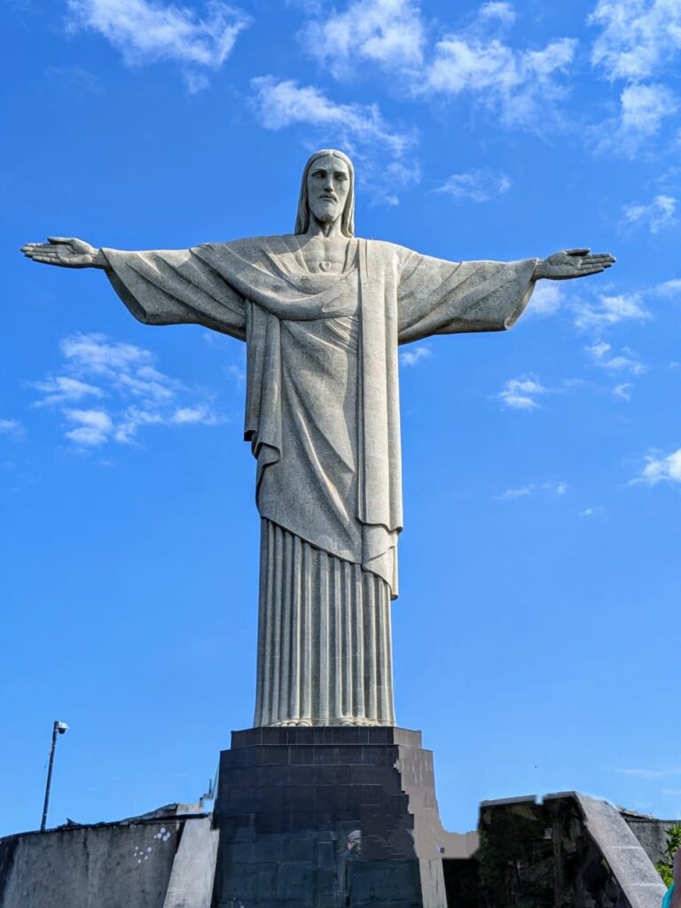
No journey through Rio would be complete without visiting Christ the Redeemer, nestled atop Corcovado within Tijuca National Park, the largest urban forest in the world. The best route is the charming cog train that travels through dense rainforest—this historic rail, originally built in the late 19th century, became a gateway to the statue once slaves were freed, intended as a gesture of gratitude to Christ .
Construction of the monument began in the 1920s and it was unveiled in 1931. It’s built of reinforced concrete, covered entirely in soapstone tiles mined in Minas Gerais. Interestingly, the head and hands were sculpted in France under sculptor Paul Landowski’s direction—and it’s said the hands were modeled after a Brazilian woman’s, bringing a touch of local humanity to the piece.
Today, you ride through the heart of the forest, glimpsing the lush canopy restored during Emperor Pedro II’s era—reforested by freed slaves to protect the city’s water sources between 1861 and 1887—and now alive with waterfalls, monkeys, and toucans.
From the summit, you stand beneath the vast arms of Christ and gaze upon all of Rio—from sparkling beaches to the tangled hills speckled with favelas. It’s a powerful fusion of human history, engineering, nature, and faith. For safety, stick to the train path, avoid hiking the trail after dark, and skip quieter paths that edge into less secure areas.
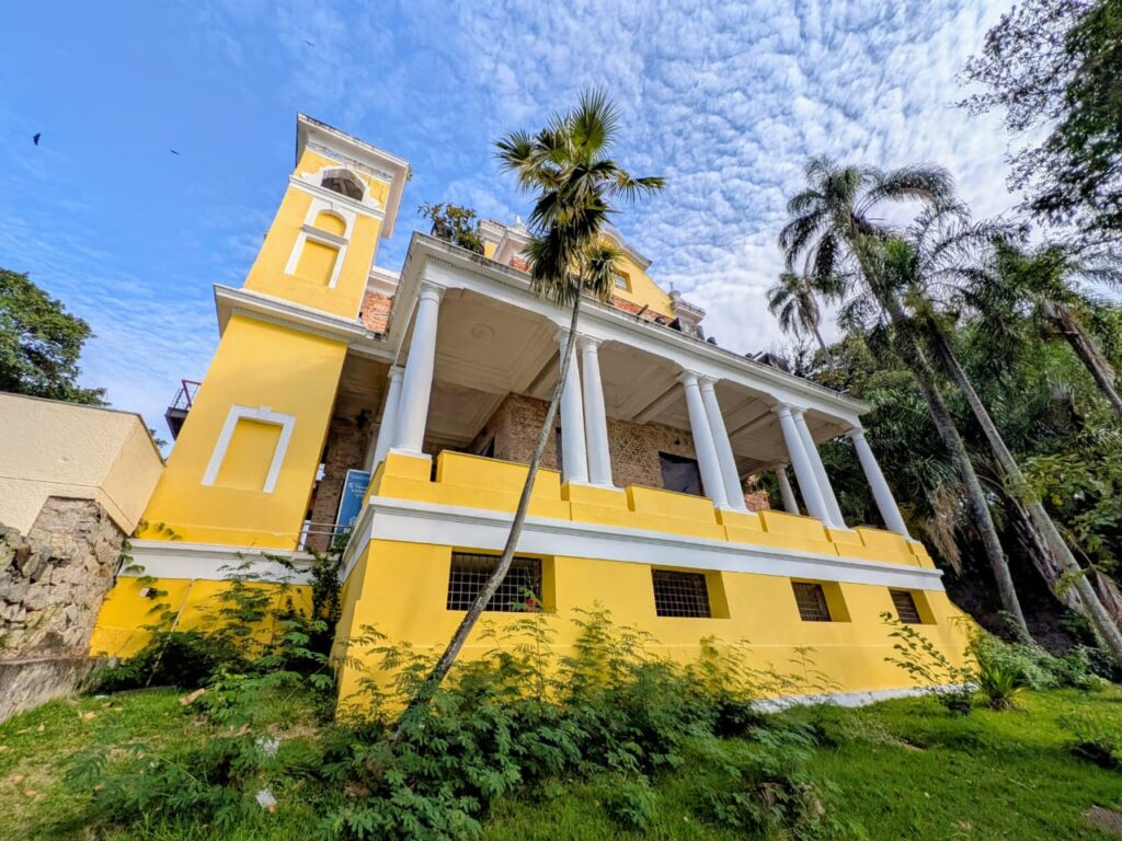
After your morning at Christ the Redeemer, spend the afternoon wandering through Santa Teresa, a bohemian enclave perched on the hills above downtown Rio. The neighborhood originated in the 1750s around a Carmelite convent built on Morro Desterro, named in honor of St. Teresa of Ávila. In its early days, the area attracted upper-class families seeking refuge from yellow fever—elegant French-inspired villas still line the winding, cobbled streets above lush valleys .
Santa Teresa’s charm comes alive with the iconic bonde tram, the historic yellow streetcar that, since the late 1800s, has climbed over the majestic Carioca Aqueduct (Arcos da Lapa) and snaked through the neighborhood along ancient tram lines. The aqueduct itself once carried clean water to the city but eventually became obsolete—and even turned into a source of sewage overflow—until repurposed for urban transport.
By the mid-20th century, Santa Teresa declined, but in the 1970s and 1980s a new generation of artists, poets, and musicians began buying up the grand villas. Their studios and galleries turned the area into “Rio’s Montmartre,” a creative pulse that still beats today in places like Parque das Ruínas, where a once-abandoned mansion now hosts concerts framed by sweeping city views.
One of the neighborhood’s cultural treasures is the Glória Maria Municipal Park, formerly known as Parque das Ruínas. Once the grand mansion of socialite and Belle Époque patroness Laurinda Santos Lobo, the estate became a gathering place for artists and intellectuals in the early 1900s. The house was later abandoned until the 1990s, when the city restored the ruins and reimagined them as a cultural center with galleries, concert spaces, and an open-air theater.
This spot is more than a ruin—it’s a panoramic vantage point offering sweeping views of Guanabara Bay and the Centro, framed by the skeletal remains of ornate walls and contemporary steel beams. In 2023, it was renamed in honor of beloved journalist Glória Maria, and now features walls painted by Brazilian street artist Kobra, a vibrant homage that blends past and present in technicolor.
After your morning at Christ the Redeemer, spend the afternoon wandering through Santa Teresa, a bohemian enclave perched on the hills above downtown Rio. The neighborhood originated in the 1750s around a Carmelite convent built on Morro Desterro, named in honor of St. Teresa of Ávila. In its early days, the area attracted upper-class families seeking refuge from yellow fever—elegant French-inspired villas still line the winding, cobbled streets above lush valleys .
Santa Teresa’s charm comes alive with the iconic bonde tram, the historic yellow streetcar that, since the late 1800s, has climbed over the majestic Carioca Aqueduct (Arcos da Lapa) and snaked through the neighborhood along ancient tram lines. The aqueduct itself once carried clean water to the city but eventually became obsolete—and even turned into a source of sewage overflow—until repurposed for urban transport.
By the mid-20th century, Santa Teresa declined, but in the 1970s and 1980s a new generation of artists, poets, and musicians began buying up the grand villas. Their studios and galleries turned the area into “Rio’s Montmartre,” a creative pulse that still beats today in places like Parque das Ruínas, where a once-abandoned mansion now hosts concerts framed by sweeping city views.
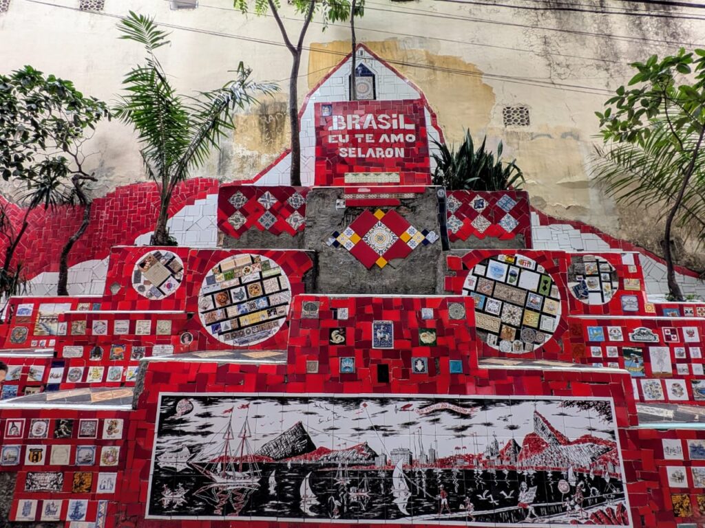
After visiting Parque Glória Maria, make your way downhill toward one of Rio’s most astonishing—and emotional—works of public art: the Escadaria Selarón. This 125‑meter staircase of 215 steps connects Lapa and Santa Teresa, its every tile a story.
Chilean-born artist Jorge Selarón began tiling the steps in 1990 as a modest tribute to his adopted home, Brazil, splashing the steps in green, yellow, and blue—the colors of the Brazilian flag. Neighbors scoffed, but Selarón, who had already roamed more than 50 countries, remained devoted. Sourcing broken tiles from local dump heaps and discarded building sites, he first covered his doorstep, then steadily expanded—never stopping, declaring his work “a crazy and unique dream” that would only end the day he died.
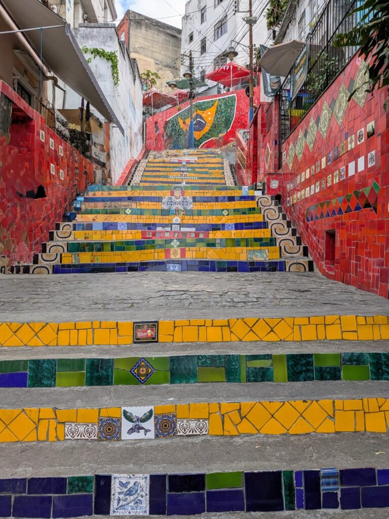
Over time, visitors began donating tiles from around the world. The steps now feature over 2,000 distinct tiles from more than 60 countries, a living mosaic that evolves as Obsessively as the city itself. Selarón continually replaced tiles—breaking and rearranging sections—to keep the installation fresh, likening it to a living artwork with “never complete” status.
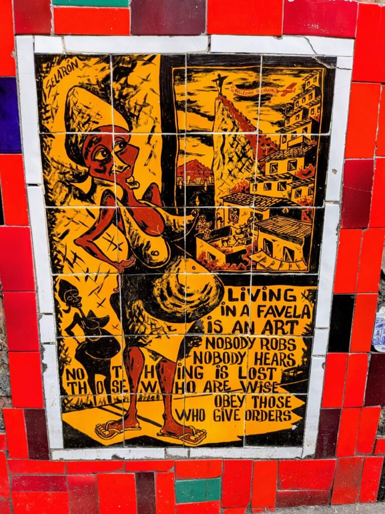
Among the most haunting motifs are nearly 300 hand-painted tiles of a pregnant Black woman. The image first appeared in his paintings from 1977 and carried into the steps, a figure Selarón said represented “a personal problem from my past”. Some scholars connect this image to his late wife, who died while pregnant—an echo of grief embedded in mosaic.
Selarón lived at the base of the steps and became part of the scene: painting by day, chatting with visitors by night. He funded his work by selling portraits—often of the pregnant woman—and postcards, fueling his obsession with color and narrative. In 2005, in recognition of his cultural contribution, the city officially declared the stairs part of Rio’s heritage and made him an honorary carioca.
Tragically, on January 10 2013, Selarón was found dead on his own stairs, burned—some suspecting suicide, others suspecting foul play after he’d received threats. His final act, it seems, was closing the full circle of his “never‑ending” creation—and as he predicted, the staircase did end the day he died.
Today, the steps pulse with life: tourists hunting for tiles from their countries, musicians filming videos (U2, Snoop Dogg), and locals stepping through color and memory. This is no static monument—it’s a testament to devotion, memory, diaspora, and grief… and an unforgettable, surreal Rio moment.
Day 3 - A Tropical Jungle Within the City
Few cities in the world can boast a rainforest within city limits, but Rio can. The Tijuca National Park is a miracle of reforestation—once cleared for coffee plantations in the 19th century, today it’s a thriving ecosystem and the lungs of the city. You could spend an entire day hiking here. One popular route leads to Pedra Bonita, a rocky summit with sweeping views of the beaches and the statue of Christ in the distance.
Along the way, you might encounter waterfalls, howler monkeys, or flashes of bright toucans. For those who prefer something less strenuous, a guided jeep tour offers a comfortable but immersive option. Later in the day, cool off at the Jardim Botânico, founded in 1808 by the Portuguese king João VI. With its towering imperial palms, orchid pavilions, and giant water lilies, the garden is a peaceful escape from the heat and traffic—a place to slow down and breathe.
Day 4 - Football, Museums, and a Final Sunset
Begin your final day at Maracanã, one of the most storied football stadiums in the world. Even if you’re not a sports fan, the tour is worth it—walk through the locker rooms, stand at pitch-side, and imagine the roar of 78,000 fans. It’s not just a stadium, but a temple to Brazilian identity.
In the afternoon, if you’re in the mood for more culture, head to the futuristic Museum of Tomorrow (Museu do Amanhã), built on the former docks with sweeping lines and science-driven exhibits on climate, cities, and the future of humanity. Or if you prefer something slower, explore the refined streets of Leblon, the city’s most upscale neighborhood, where you can browse bookstores, sip a quiet espresso, or do some last-minute shopping.
As the sun begins to sink, join locals at Mureta da Urca. It’s not a formal bar or even a restaurant—just a stone wall by the bay where people gather with cold beer, conversation, and a view of the boats bobbing in the harbor. It’s humble, authentic, and oddly perfect—just like Rio.
-
Palma de Mallorca
May 26, 2024 /Day 1 - A Day Through The Old Town

When you think of Mallorca, you probably imagine sandy beaches and a swim in the ocean. And while that’s definitely a great thing to do when visiting this island, Mallorca also has a fantastic city break destination: Palma de Mallorca.
Palma’s picturesque Old Town is a must-visit, no matter how much time you have. Even if you’re having a little wander through it, it’s worth your time. The streets are beautiful, with little squares and small but atmospheric alleyways. There are many cafes in the Old Town too, which give you a perfect excuse to sit down for a bit and enjoy some people watching.
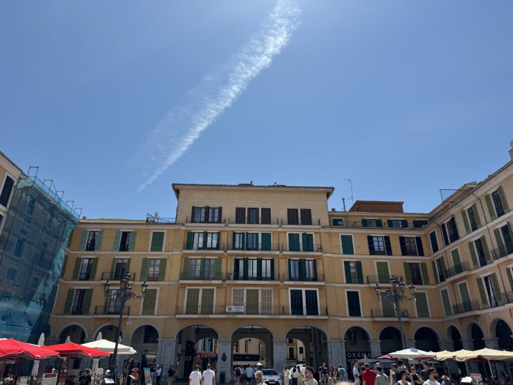
While you walk through the historic center of Palma, start the day in Plaza Mayor or Placa Major, as the English use to call it. This is where most of the markets and events in Mallorca take place. The rectangular square with a porticoed perimeter is similar with Plaza Mayor from Madrid, but at a much smaller scale. The houses built around the square all have yellow facades and green shutters, creating a very picturesque scenery. The buildings surrounding it are mostly offices or private residences, with cafes and restaurants on the ground floor. Some of the main streets of Palma branch out from the square.
On some days of the week, the plaza hosts an artisan market, whilst in January, it functions as the starting point for the feast day of Sant Sebastià.
It is a vibrant place today, bursting with life and fun, but things weren’t always so cheerful. The plaza is built on the site of the San Felipe Nerí Convent, which until 1838, was the seat of the Inquisition.
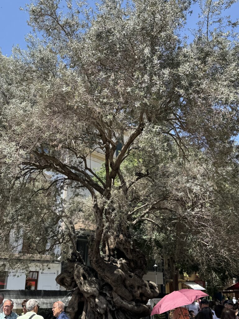
One square in the Old Town that you should add to your Palma itinerary is Plaça de Cort. The Plaça de Cort derives its name from having been the place where feudal court gatherings once took place. Today, it’s a lively area with cafes and restaurants surrounding it. This charming square in the heart of the city is famous for Olivera de Cort, opposite to the beautiful Town Hall. This is a 600-year-old olive tree brought to Palma in 1989 from the Pedruixella Petit estate in Pollença as a sign of peace. Many people think they can see faces in it, especially an ear, which came to be known as the ‘Orella de Mallorca’.
You will find some nice restaurants around the square, so you can have lunch here or grab a coffee to keep you energised for the rest of the day.
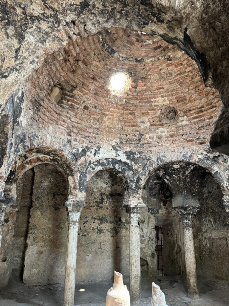
If you take a walk along the old medieval streets of Palma not far from the Cathedral you will see signs pointing the way to Banys Àrabs. Built during the time of the Moors in the 10th century but brought back to light only 100 years ago, the Arab Baths are possibly the only thing left from Medieval Palma. They were initially placed in the orchard of a manor house known as the Can Fontirroig, which probably belonged to a wealthy Moor. They date from the 10th to 12th centuries and are some of the few remains of the Arab city, Medina Mayurqa.
As every other Spanish city which was part of the Al Andalus Empire, Mallorca has a large Muslim heritage. Arab baths, or hammams, were customary back in the 10th century, and an important part of the community, where people would go to clean not only their their bodies, but also their souls. The water is considered sacred in Islam, and the hammam is one of the oldest surviving bath traditions in the world.
The Arab baths in Palma is one of the last remaining pieces of evidence of the Moorish occupation. Whilst they are small, they are well preserved and provide a glimpse into what it used to look like to go to the baths back in the 10th century. What is interesting about these baths is that the columns are all different, as they were built with remains from other dynasties that occupied Mallorca before the Moors. There is a preserved caldarium and tepidarium and some lovely gardens where visitors would have cooled off after their hot bath all those hundreds of years ago.
Today the half-orange tepidarium, with its columns and shafts of shifting sunshine, is perfectly integrated into a garden. Some people like to come here to read or simply enjoy a sandwich when they get a break from their busy day. So, the purpose of the garden was preserved, as it was a good place for guests to cool off after taking a steamy bath.
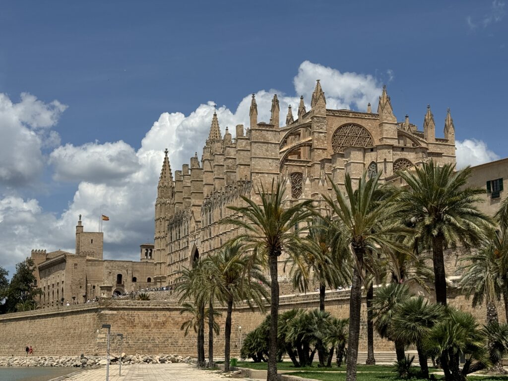
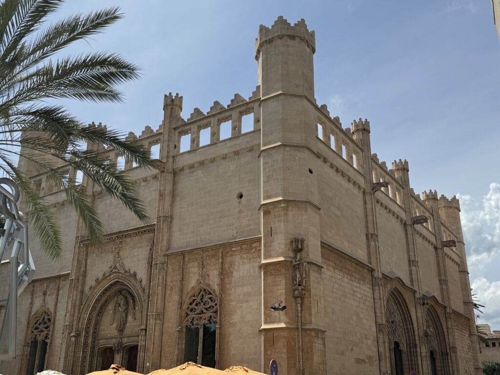
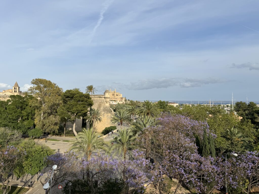
We can say that the Cathedral-Basilica of Santa María de Mallorca, also known as La Seu, is the heart and soul of the city. The Cathedral is located on the site of what was once the main mosque of Medina Mayurka, the capital of Muslim Mallorca for three centuries. The mosque was used as an interim church following the Christian reconquest in 1229. The construction of this impressive Levantine Gothic-style building began in the 13th century, on the orders of King Jaume I of Aragon, and was completed in the 1630s. after one voyage that he and his men took to the island. As they sailed toward it, they encountered a savage sea with strong winds and high waves that put them in great danger. The king swore that if they reached Mallorca safely, he would build a huge cathedral. And he kept his word, erecting one of the tallest cathedrals in Europe.
In front of the cathedral, you can also find Parc de la Mar. This artificial lake shows beautiful reflections of the cathedral. Near it, there are some places to sit and soak up the view of this impressive piece of architecture.
Some of the cathedral’s towers reach over 20 meters and the cathedral contains one of the largest stained glass windows in the world (with more than 1,200 pieces).
While the cathedral is very impressive to look at from the outside, going inside to see the beautifully decorated interior and the light pouring in through the stained glass windows. It has one of the tallest naves in the world, reaching 44 meters. As you enter the cathedral, you will be amazed by the multitude of stained glass windows (61 in total) that filter the light and add a rosy sheen across the floor and walls. This special design feature earned La Seu the name of ‘Cathedral of Light’. The slim pillars supporting the roof are apparently some of the slimmest load-bearing pillars in the world.
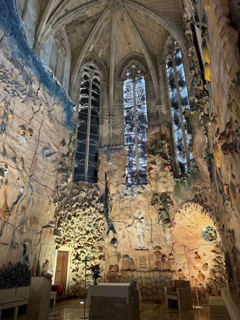
In 1901 Antoni Gaudi was invited to take over the restoration of the cathedral. Due to some misunderstanding the project was cancelled, but some of Gaudi’s ideas were still implemented. He is responsible for the beautiful stained glass in the Gothic windows of the Royal Chapel. He was helped by his disciple, Joan Rubió i Bellver, who designed some iconic buildings in Soller. One of the most striking architectural elements inside the Cathedral is the mural in the Chapel of Sant Pere, sculpted in terracotta by the local artist Miquel Barceló. The images represent scenes from the Gospel of St John, relating to the Last Supper, which the chapel is dedicated to. The colours and the details are so surreal, and at a first glance it does resemble Gaudi’s style.
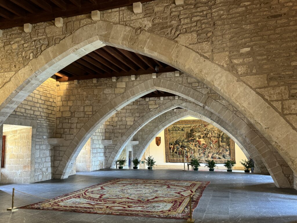
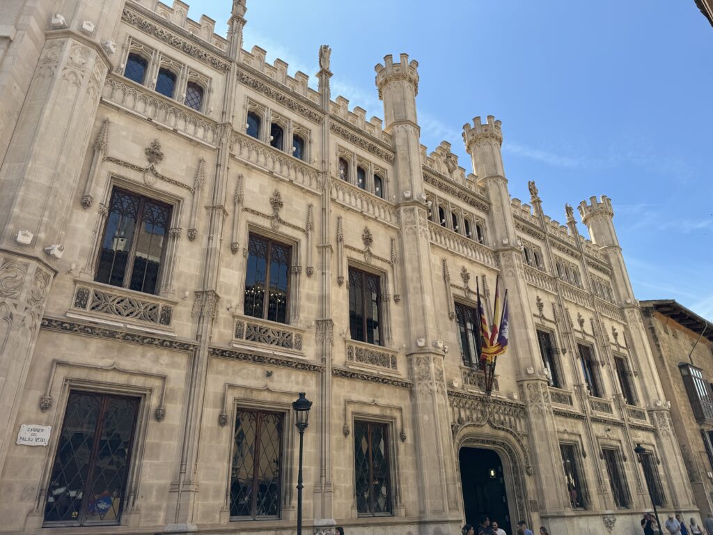
The Royal Palace of La Almudaina is located next to the cathedral, is a must-see place in Palma if you’re visiting the city in one day. It is the official residence of the kings of Spain during their visits to Mallorca. The palace as it is today was built over an old Roman fort back in the 10th century, by the Muslims when it used to be the seat of the Emir when Palma was under Arab rule. It was rebuilt in the 13h century, after the Christians conquered Mallorca and King Jaime I of Aragon came to the throne.
What’s special about the Almudaina is the combination of Gothic and Moorish styles that reflect the multiple cultural layers which influenced the architecture of the City of Palma. Over the years, the palace has been modified over and over again, in different architectural styles. Whilst the ground floor has a medieval architecture, the first floor, which was added to the Palace in the 16th century, is decorated with more recent furniture.
First-time visitors find it intriguing and splendid at the same time, especially as they discover the 14th chapel of Saint Anna, with its enormous stained-glass window and beautifully decorated state apartments.
Lonja of Palma is one of the greatest representations of Gothic architecture in Mallorca. It is located in the La Lonja Square, in the historic center of the city, near the port. It was built between the fifteenth century by Guillem Sagrera and was once the headquarters of the Colegio de los Mercaderes, who were in charge of the regulation and protection of trade and the maintenance of the port. Visiting the interior is worth your while.
One of the best ways to end the day in Palma is a cocktail at the Sky Bar at Hostal Cuba. Located on the rooftop of an iconic building in the lively Santa Catalina neighborhood, the happy hour also comes with unbeatable views over the marina and the Cathedral. The roof terrace is small so booking is advised.
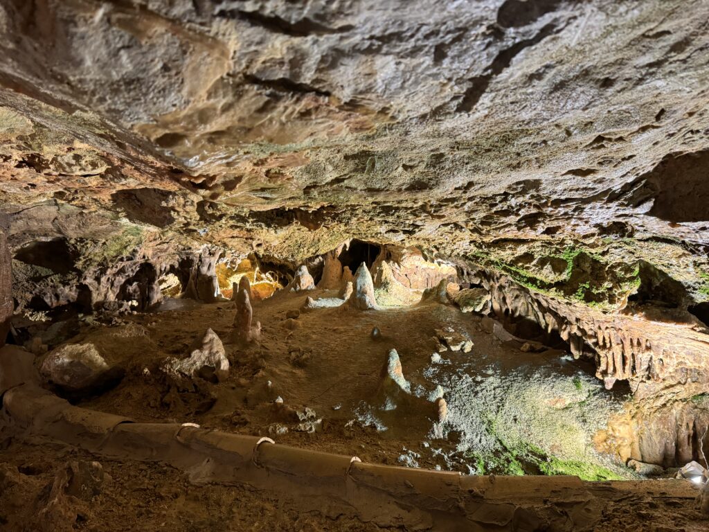
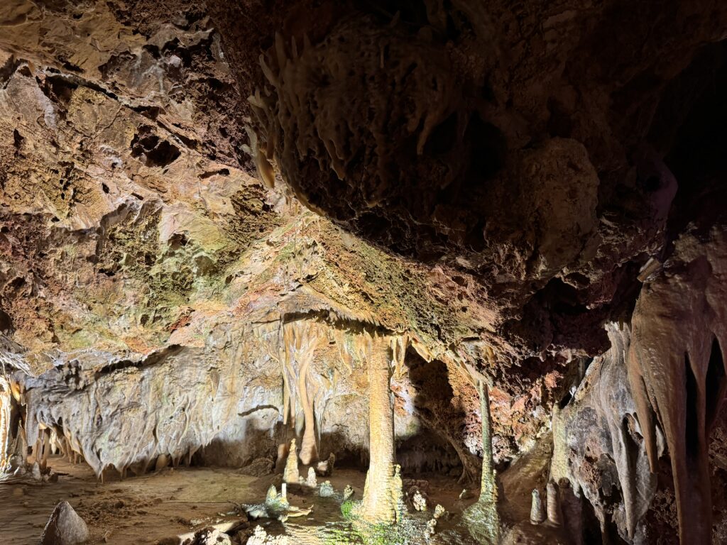
Day 2 - Cuevas de Genova
Discovered by accident in 1906, the Genova Caves (sometimes known as the Caves or Coves of Genova) have since become one of the most popular day trip destinations from Palma de Mallorca. They are only accessible via small-group guided tours which take approximately 30 minutes and run throughout the day. Admire the caves’ thousands of icicle-like stalactites and stalagmites, or book a convenient combination ticket that includes a Mallorcan tapas lunch at the restaurant above.
Discovered accidentally during the construction of a well in the year 1906, these caves form a set of underground galleries of calcareous origin joined by corridors formed in a completely natural way. These caves are in the middle of the residential neighbourhood of Genova, which belongs to the municipality of Palma de Mallorca. The caves stretch along an extension of almost 1 km, reaching up to 36 m deep.
A trip to Mallorca should take you to at least one of the caves on the island, because there’s something serene and mysterious about all of them. Until not too long ago, they were used as smugglers’ hiding places or even as some sort of apartments for the locals. Today, Mallorca offers five caves open to visitors – three of them on the east coast, one in the northwestern part of the island, and the fifth in the district of Génova in Palma. For cave lovers, it’s worth to visit each of them, because no cave in Mallorca is equal to the other. Each one has its particularity and beauty.
The exact number of Mallorquin caves is unknown. Some speak of 200 caves in Mallorca, whereas others mention 300. According to experts, the total number of caves, however, could amount to more than 4,000, as most of them are very difficult to locate, because they’re situated in private properties or in inaccessible places.
Thanks to the variety of mineral colours, and its great concentration of eccentric formations, the colour stands out notably for the multitude of espeleatemas coraloide, something rare and hard to find (formations that are also known as popcorn or cauliflower). The place also has a huge natural irrigation of constant fresh water all year round, which favours the environment to be always very wet, a phenomenon that stands out remarkably in this aspect on the other 4 tourist caves that are on the island, giving to this corner of nature a value much appreciated.
-
Bilbao
May 9, 2024 /Day 1 - The Modern City
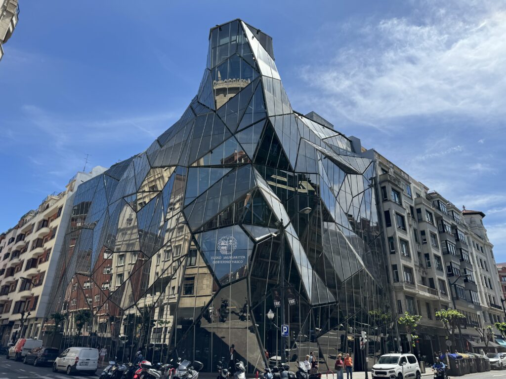
Take the time to walk the streets of Bilbao admiring the eclectic mix of architectural styles, walking along the riverside paths and sampling some pintxo with a drink. This walk will take you past the city’s most notable historic and contemporary buildings. Head towards the most famous building in the city, the Guggenheim Bilbao museum, a titanium masterpiece inaugurated in 1997 that changed the way of conceiving architecture. Frank Gary’s colossal Guggenheim Bilbao Museum is the most impressive building in the city. The museum, filled with works by some of the most important contemporary artists, has managed to make Bilbao the vibrant creative center it is today. For many travelers it is the main reason to visit the city.
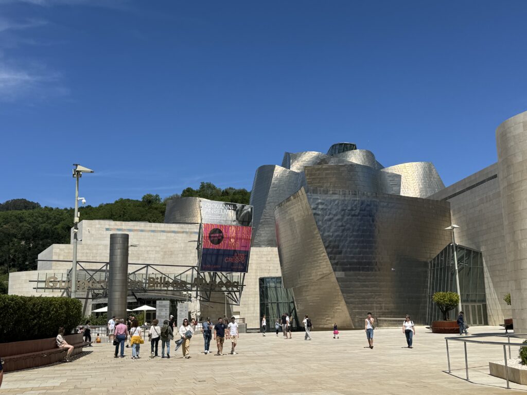
For most visitors, the real star is the architecture. Designed by Frank Gehry, the museum is a succession of shapes, fluid caps, headlands, ships, towers, and winged fins,all covered in glittering titanium plates. It is a magnificent vision. Take all the time you need to observe the shapes and colors that change as the light changes. The Guggenheim Bilbao dominates the area of the city facing the river, and its appearance and the surrounding atmosphere change depending on the light. The site where the museum stands was a disused industrial area; the city’s past was dominated by industry and shipping ships and fisheries is evoked by its shape, which some consider similar to a ship or a fish shimmering. After the collapse of the shipping business and heavy industry, the administration committed itself to a regeneration project of the city. One of the main requirements was the construction of a world-class exhibition space, and from that idea, the Guggenheim Bilbao was born. Since its opening in 1997, the museum has contributed to transforming Bilbao from a declining industrial city to a center of culture and interacting with the city’s historical and geographical context. The construction also reflects the interests of Gehry, who, in previous works, had already made use of industrial materials. The shiny titanium plates that cover most of the building like gigantic scales are reportedly inspired by the architect’s passion for fish
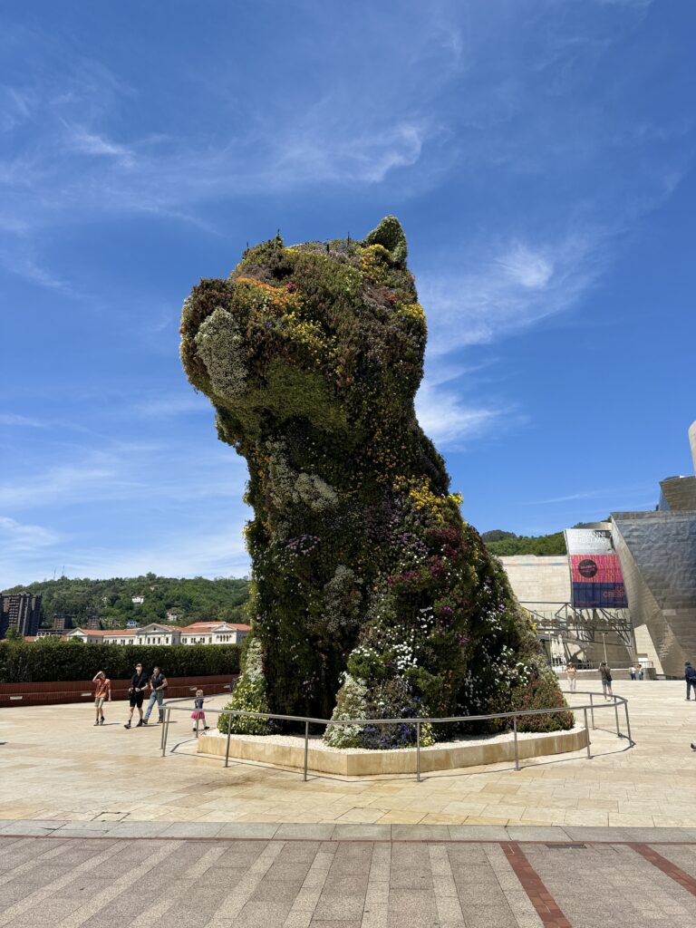
Outside on the side of the museum facing the city, it rises 12 m Puppy, a terrier made with thousands of flowers: Jeff Koons’ work was only supposed to be a temporary installation but Bilbao has become fond of “El Poop”. The bilbainos will tell you that the dog arrived first and then they had to build a kennel for him.
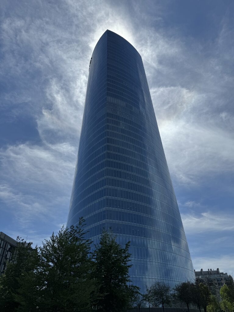
Keep walking along the riverside, and you will find on your left the obelisk-like Iberdrola Tower, which rises from the southern bank and is a 41-story gleaming glass office complex of at 165 meters. Opened in 2012, it’s the tallest building in the Region.
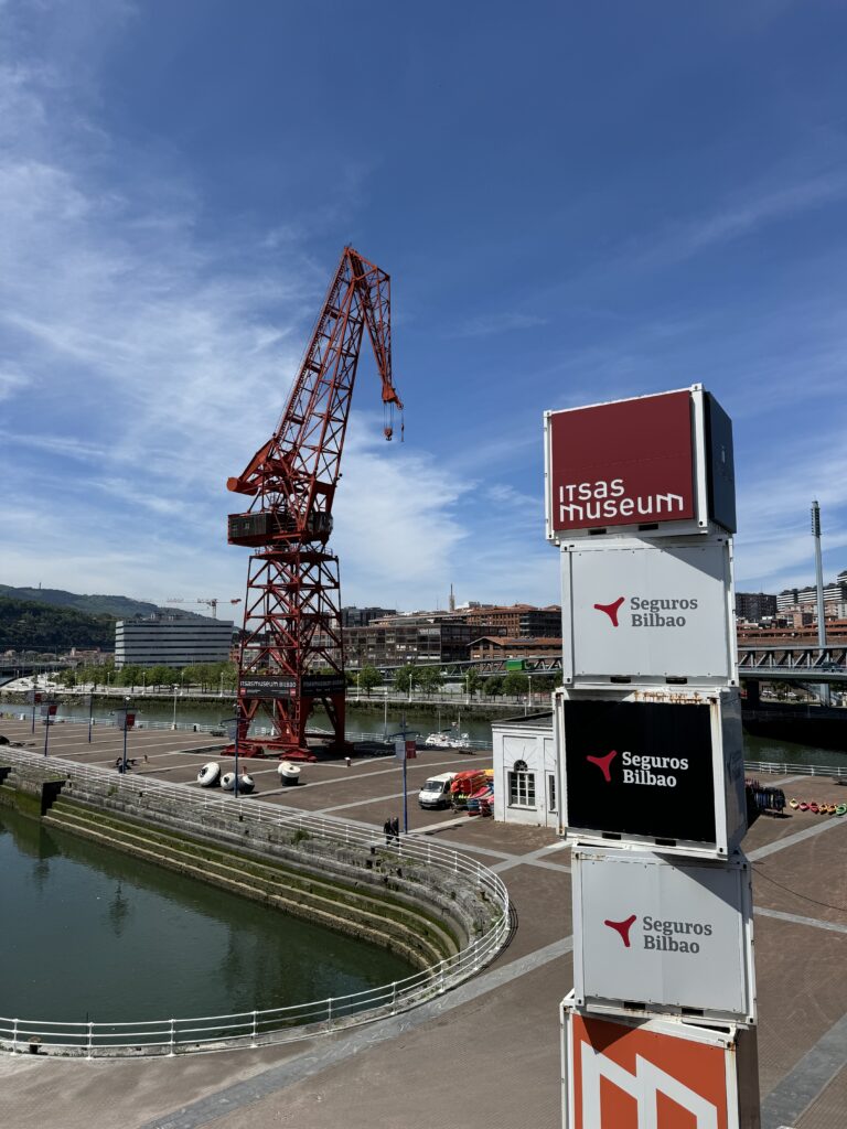
To get an idea of Bilbao’s industrial past stop in front of the city’s Maritime Museum, the Itsasmuseum. On the western side in front of the dry docks look for the bright red “Carola” crane once used for shipbuilding. This interactive Maritime museum recreates the sea depths of Bilbao and the Basque Maritime history. Begin your visit by watching the 10-minute video that summarizes the history of the city from the 14th century to today, then walk around the two floors of the exhibition, which illustrate the ancient techniques of naval construction, the tragic shipwrecks (and innovative rescue practices of the time), and the threat of pirates. You will also find detailed model ships, including a life-size reproduction of the Falua del Consulado, a barge from 1511 used by the consular authority. Outside you can climb on a series of boats.
Take a walk in the Parque de Doña Casilda de Iturrizar with the gazebo for the bands and the ponds for the ducks. Embellished with maples, limes, cedars, palms and as 70 other species of trees, this elegant English-style park was completed in 1920 the highlight is the pond full of ducks and swans.
The Jardines Albia, dominated by the sixteenth-century Iglesias San Vicente Martir and with a fountain in the center are perfect for a break. Then continue to the headquarters of the Basque Ministry of Health, which was only completed in 2008 and since then it has become a landmark of the city. Composed of sheets of glass and steel it was designed by Juan Coll-Barreu.
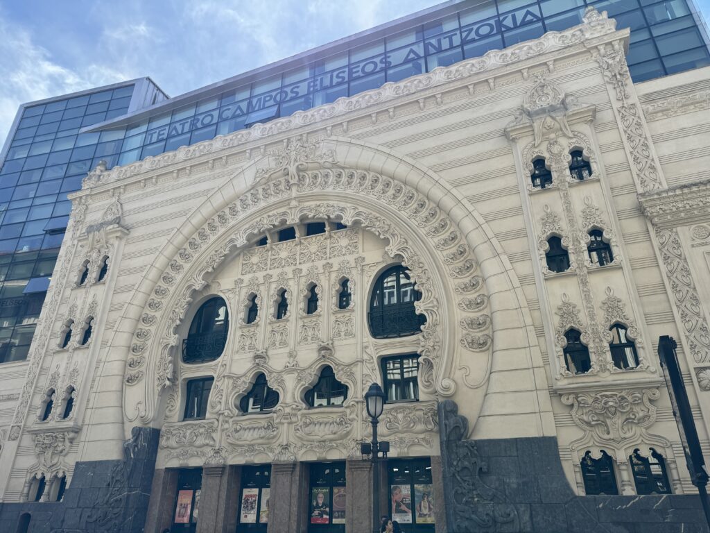
Another nearby art nouveau masterpiece is the Campos Eliseos theatre. Restored to its art nouveau splendor and modernized in 2010 to accommodate contemporary productions, this masterpiece was built in 1902. Today, it hosts theatrical performances, musicals, dance, comedy concerts, puppet and magic shows, and sometimes cinema screenings. The multi-level main hall has a capacity of over 800 people while the more intimate domed hall on the top floor can accommodate 250 spectators.
Another Art Nouveau treasure of the city is the Bilbao Concordia railway station built in 1902.
Day 2
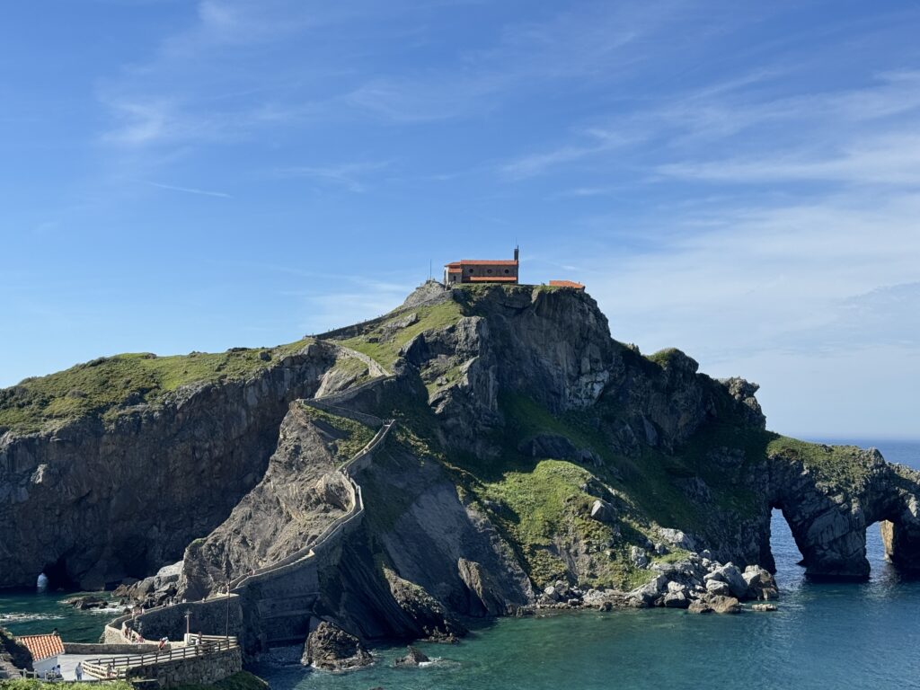
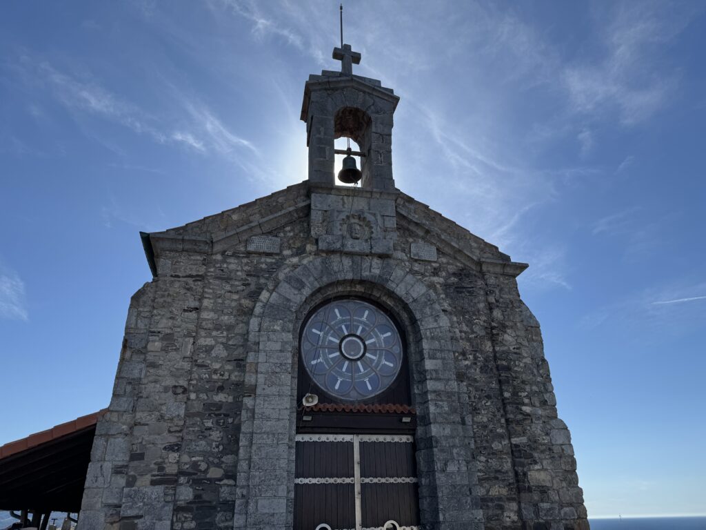
10 km northwest of Bilbao is one of the most photographed places in the Basque Country: the rocky island of San Juan de Gaztelugatxe. Connected to the mainland via a stone walkway with 241 steps, it’s surmounted by a hermitage, the Ermita de Saint Juan de Gaztelugatxe, built by the Knights Templar in the 10th century. Due to its popularity skyrocketing after becoming a Dragonstone in the seventh season of Game of Thrones, to access it it is necessary to book online. According to local tradition it takes its name from Saint John the Baptist who visited the island.
-
Lucern
April 8, 2024 /The best way to see the architecture of Lucerne’s colourful Altstadt (old town) is on foot. This 2-kilometre walking route travels through both Neustadt (new town) and Altstadt. It takes about an hour to walk, depending on the time spent at each spot.
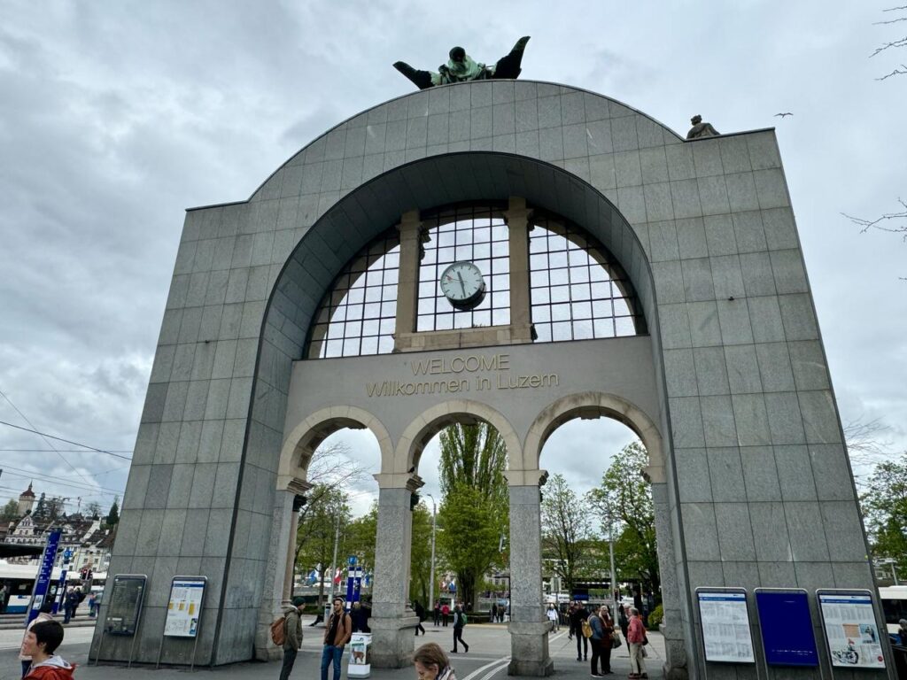
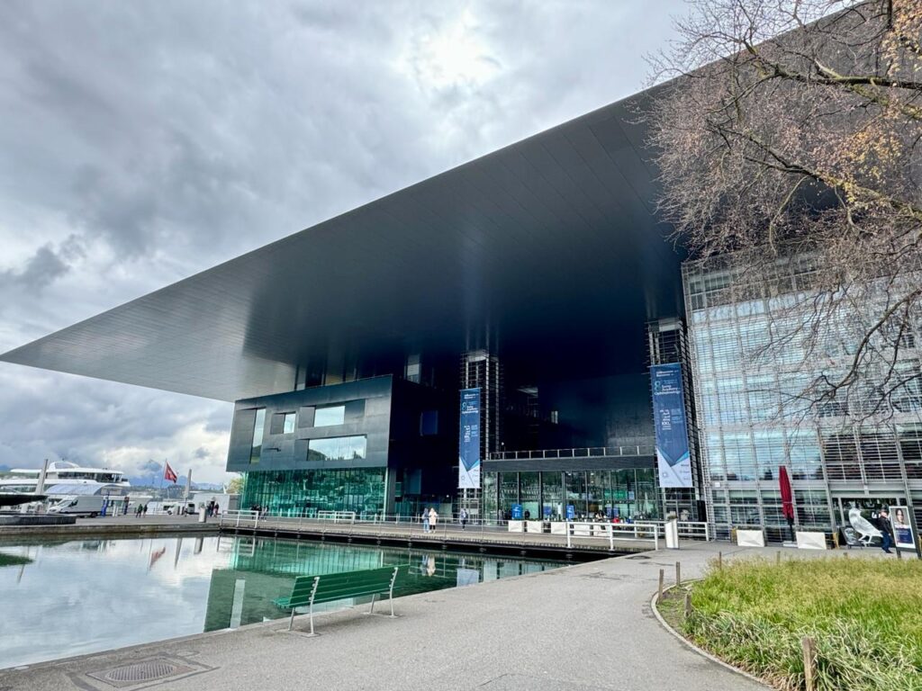
Begin at the Bahnhofplatz, the huge transit hub with a parking garage beneath. The Zentralstrasse, Lucerne’s main train station, is to the south. The original train station was destroyed by fire in early 1971. Its grand main entrance was saved and stands in the middle of the Bahnhofplatz, like a gateway to the city. To the east of the plaza is a huge building, one of the few modern-looking buildings in this part of the city, the Culture and Convention Center. Opened in 2000, the Kultur und Kongresszentrum Lucerne (or KKL Lucerne) has three parts: an 1840-seat concert hall, multi-function Lucerne Hall and the convention centre. There are a number of restaurants and cafes which are convenient to the dock on the lake. The striking, glass-and-steel building’s design has won international praise for the concert hall’s amazing acoustics. Its unique ceiling, special sound-absorbing doorways and an inaudible ventilation system create complete silence enriching performance sound.
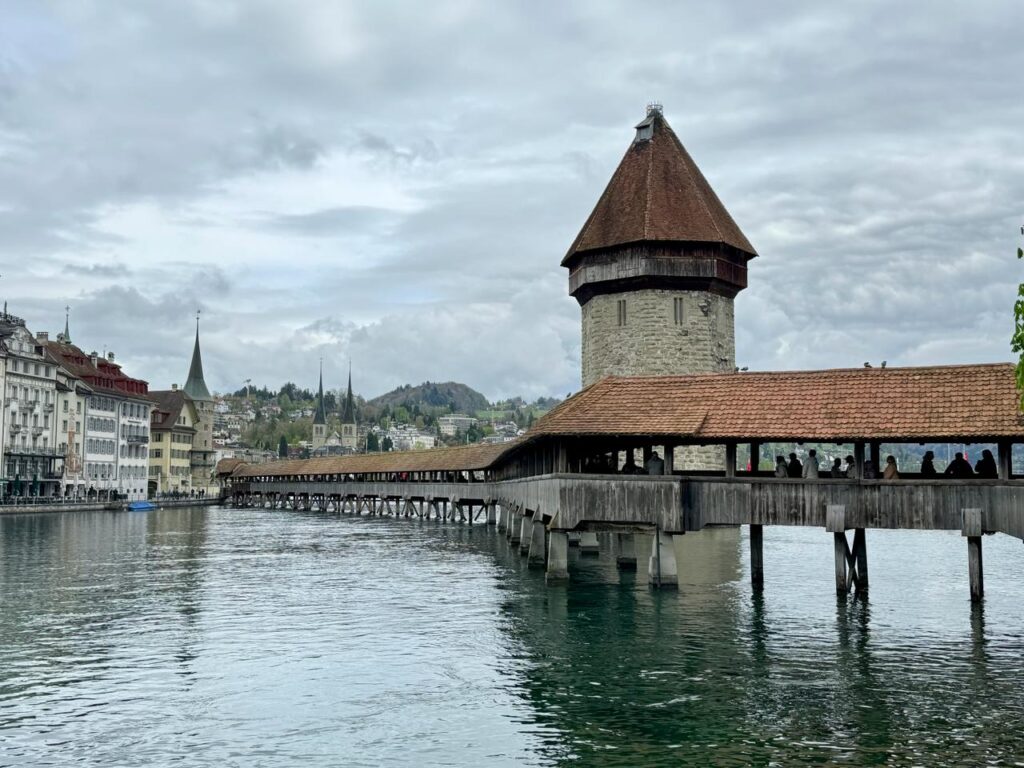
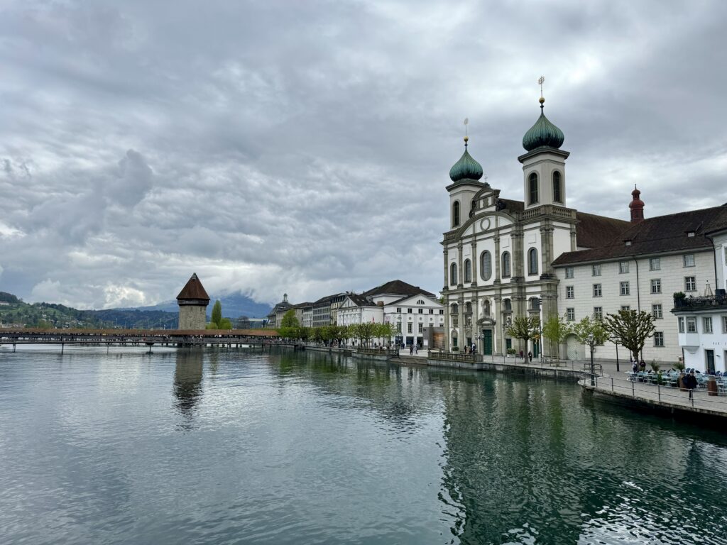
Walk back to the Bahnhofplatz and continue west along the river to the 14th-century Kapellbrücke, one of Lucerne’s most recognized landmarks. The winding, wooden, covered bridge is over 200 metres long. It was built across the Reuss River as part of the city’s defensive system. Partway along the bridge, the 8-sided, stone Water Tower is original and older than the bridge. Over the centuries, the tower was used as the city treasury, dungeon prison and archive. A 1993 fire began in a boat moored to the bridge. The fire spread to the bridge destroying a large portion of it. Both ends of the bridge survived as did the stone tower. The tower’s gabbled roof was destroyed. Walk across a portion of the bridge to see the triangular roof panels. The original panels were painted in the 17th-century, recording the development of Lucerne and Switzerland up to that point. The 1993 fire burned 81 of the 111 panels. The panels found in the centre are originals which were in storage during the fire. The paintings were sponsored by wealthy families. To recognize their charity, the family coats of arms were added to the paintings.
")
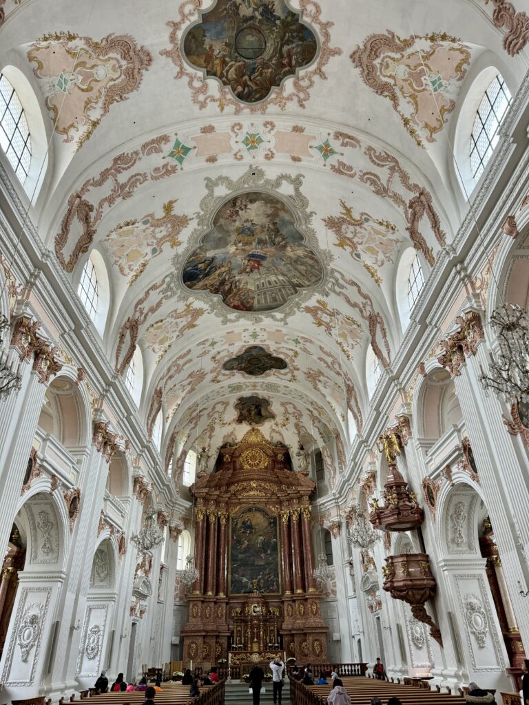
Follow the river west to the Jesuitenkirche. The large, 17th-century church was the first Baroque church in Switzerland. Its two, onion-domed towers were added in 1893. It is dedicated to Francis Xavier, co-founder of the Jesuit order. While the exterior is Baroque, the interior was redone in the mid-18th century in Rococo style. The interior is beautiful. The ceiling murals celebrate Xavier’s life and afterlife. The church’s large organ is used by Lucerne’s music school. Enjoy the music if they happen to be practising.
Walk west on Bahnhofstrasse to the next intersection. To the left, at the end of the street is the Franziskanerkirche. The beautiful, 13th-century, Gothic-style church has a large pipe organ and stunning paintings. Over the centuries the interior has undergone extensive renovation but has kept its 17th-century choir stalls and the wooden pulpit.
Return to Bahnhofstrasse and continue west. Turn right onto Pfistergasse. Walk to almost the next major cross street. Turn right and walk through an arched entrance along a covered walkway. This leads to the next covered bridge.
The 15th-century, covered, pedestrian Spreuer Bridge is original. It is smaller Chapel Bridge and has avoided fire for more than 6 centuries. Its roof panels are a series of paintings, called Dance of Death by Kaspar Meglinger, created to remind the townspeople, who crossed the bridge daily, that death cannot be escaped regardless of social class. The far end of the bridge was designed for wagons delivering supplies to three mills nearby. Since the middle ages, there have been mills in this area harnessing the power of the river. A fire in 1875 destroyed all but one. It was removed in 1890 making way for the city’s first hydroelectric power plant. Those turbines generated power for 90 years. They were replaced by the current power plant in 1996. Look toward the lake. It receives its water from snow melt. A movable dam was designed in the mid-19th century to control lake levels and protect lakeside towns from flooding. In the spring, the dam is opened by removing wooden pickets, allowing the river to flow. As the lake’s water level drops, the wooden pickets are put back in place extending the dam across the river and slowing the flow. We visited in late May and the dam was partway across the river channel. By winter, the dam is entirely in place, cutting the flow to almost nothing across the main river channel. This keeps the lake level high enough for some boats.
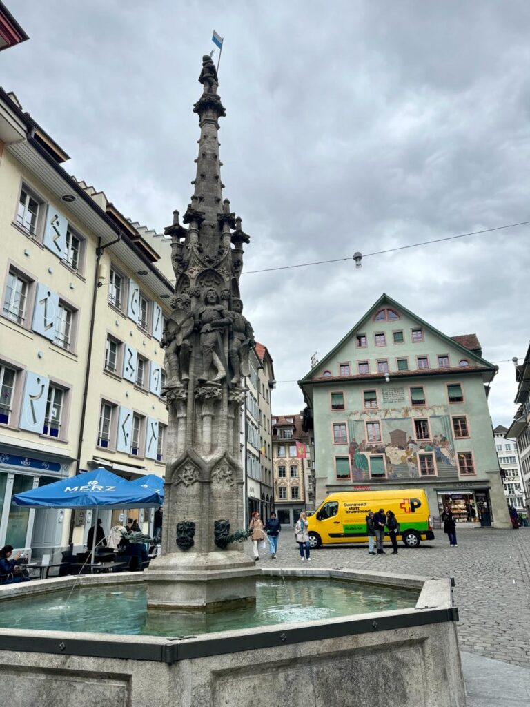
From the bridge, walk to the right into the pedestrian square called the Muhlenplatz. This is the start of the old town. At the top of the square, turn right and walk a block to Weinmarktgasse. Walk a block to the pretty city square, the Weinmarkt. This was a marketplace for wine. The 15th-century fountain has carvings of soldiers. They were to remind citizens that the town was tough and strong. Enjoy the beautiful paintings on building fronts in the square.
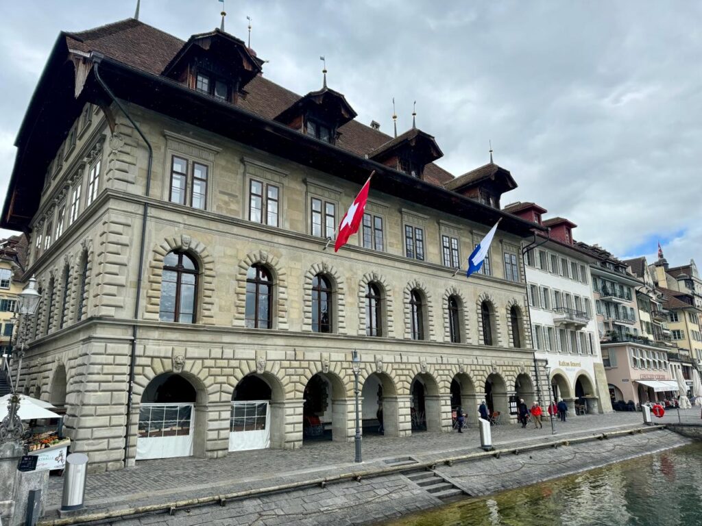
Continue up the street to the Hirschenplatz. This square got its name from the Hirschen Hotel which is long gone. Its sign still hangs in the square. Turn right, walk a block then turn left onto Kornmarkt. Walk to the square outside the Rathaus Stradt beside the Town Hall clock. The first town council meeting was held in this late Renaissance-style town hall in 1606. The building continues to be used for council meetings.
Walk Furrengass to St. Peter’s Chapel. The bridge was called Kapellbrücke due to its proximity to church.
The Fritschibrunnen is in the plaza to the north of the church. Locals gather at this fountain early in the morning on the first Thursday seven weeks before Easter to start the Fasnacht festival. This is Lucerne’s annual Mardi Gras and one of their biggest parties of the year. There are parades, dancing, singing and drinking through the entire seven-day festival. Locals often take time off and visitors are encouraged to join in.
From St. Peter’s Chapel, walk east along the river to Lake Lucerne. Walk the sidewalk north and east following the lakeshore. The main street, Löwenstrasse, turns left. Follow it, turning immediately right onto St. Leodegarstrasse. Walk to the church with the beautiful bell towers. The beautiful, 17th-century late-Renaissance Hofkirche St Leodegar has twin, Gothic, bell towers. The church was part of a monastery founded in 750. A 1633 fire destroyed all but the bell towers. Inside, see the beautiful, white stonework and the vaulted ceiling. The 17th-century organ is one of Switzerland’s finest.
Walk back out to the main street, Löwenstrasse, and walk north about 4 blocks to the Lowenplatz and the Bourbaki Panorama.
The 10-metre-tall Bourbaki Panorama was painted in 1881 by Edouard Castres. It portrays, in a very lifelike, 360-degree view, the surrender of French troops to the neutral Swiss. At the end of the Franco-Prussian War in 1871, the French troops refused to surrender to the winning Germans. The panorama was touched up in the year 2000. Many panoramic theatres were built in the 19th century in Europe and the United States.
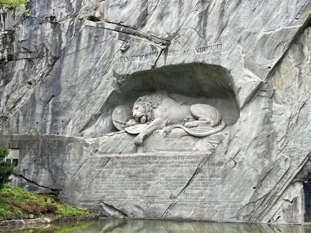
Walk to one of Lucerne’s more well-known tourist attractions, the Lowendenkmal, about a block north, on Denkmalstasse, the Lion Monument. The sculpture of a dying lion was carved into the stone, cliff-face in the 1820s. It is 10 metres long and 6 metres tall. It memorializes the Swiss soldiers who died defending King Louis 16th in the 1792 Paris attack during the French Revolution. This beautiful park was a sandstone quarry when the lion was carved.
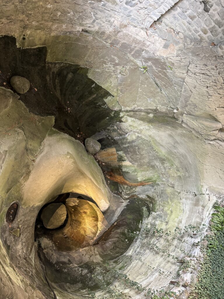
Adjoining the park to the north is the Gletschergarten.
Sixteen potholes, called kettles, were revealed when glaciers melted in the area 20,000 years ago. In 1873, the Amrein family built the Glacier Garden around the kettles. Enjoy walking the paths through the rocks and plants. The Amreins collected all manner of items which are displayed in the museum’s eclectic collection. A mirror maze recreating Granada Spain’s Alhambra was created for the 1896 Geneva National Exhibition. It was moved to the garden in 1899.
Walk back down Denkmalstrasse to Lowenplatz. From the square, continue 2 blocks south to Hofstrasse. Turn right onto Museggstrasse. This street runs parallel to the watchtowers and old walls of the city constructed around 1400. Veer right onto Schirmertorweg and climb up to the Museggmauer. Walk the path on top of the old city ramparts, for stunning views of the city and Lake Lucerne. There are 9 stone towers, some open to the public. The wall and the towers (including the Schirmerturm, Männliturm, Wachtturm, Zytturm) date back to late 14th century.
-
Hong Kong
December 2, 2023 /Day 1 - Hong Kong Park and East Promenade
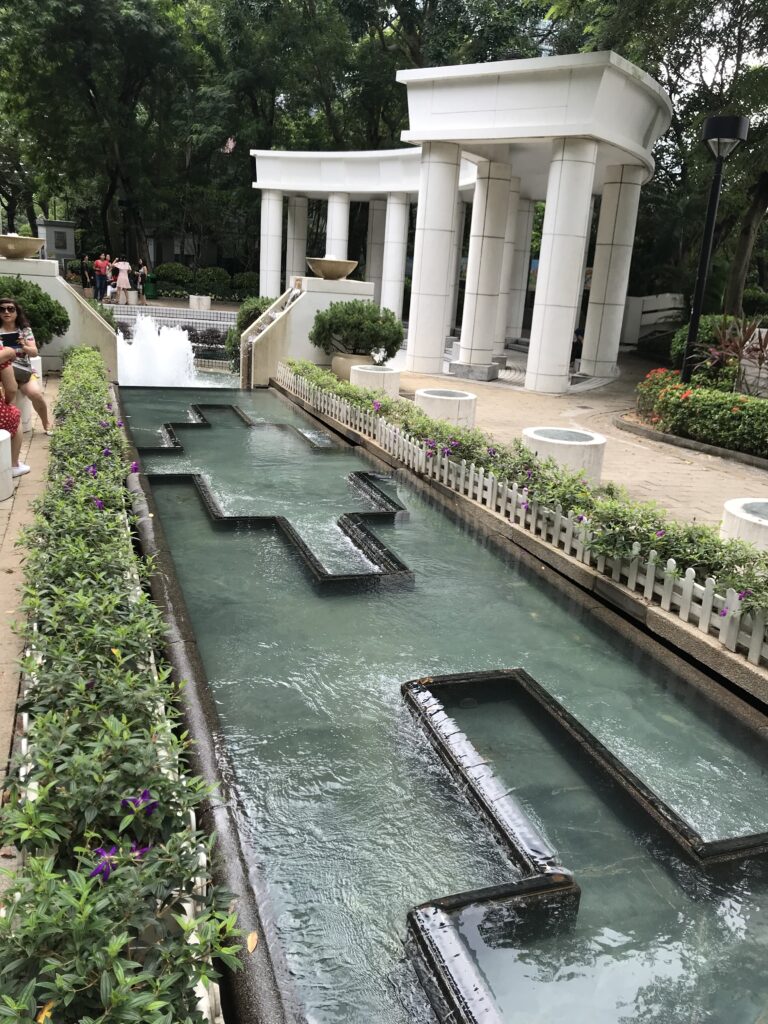
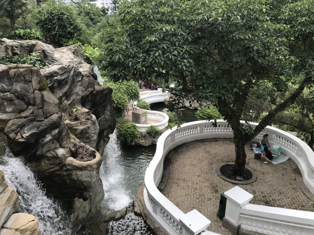
The Hong Kong Park is one of the most unique parks in the world, having been designed to highlight its artificial elements, including the square with the fountain, the greenhouse, the ponds and waterfalls (favored by couples getting married in the marriage office inside the park), the playground, and the taichi garden. The park covers an area of 8 hectares and, despite its artificiality, is very beautiful; bordered by a wall of skyscrapers on one side and mountains on the other, it is an excellent subject for spectacular photographs.
Take the Start Ferry towards Kowloon.
A visit to Hong Kong is not complete without a ride on the Star Ferry, a legendary fleet of diesel-electric ferries with names like Morning Star and Twinkling Star. The 10-minute crossing, spectacular at any time of day thanks to the enchanting view of the skyscrapers and mountains, is probably the cheapest cruise in the world. Upon arrival, a crew member throws the mooring rope to a colleague who catches it with a hooked pole, just as in 1888 when the first ship docked.
The Star Ferry was established in 1888 by Dorabjee Nowrojee, a Parsi originally from Bombay. At that time, almost all local residents crossed the harbor on sampans. Nowrojee bought a steamboat for private use and made it the first Star Ferry. Parsis believe in the Persian religion of Zoroastrianism, of which the five-pointed star in the Star Ferry logo is an ancient symbol.
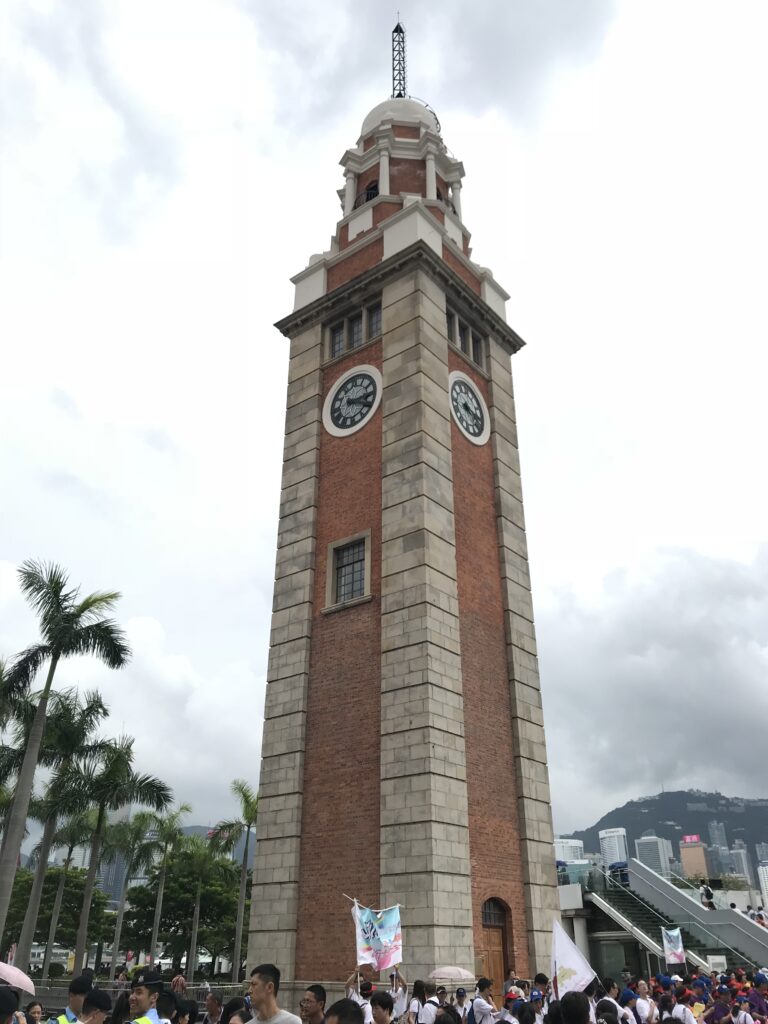
In 1910, near the Kowloon Concourse, the Kowloon-Canton Railway was built to connect Hong Kong with the mainland. On Christmas Day 1941, the governor of the colony took the ferry to Tsim Sha Tsui, where he surrendered to the Japanese in the halls of the Peninsula Hotel. Today, you can still see the Clock Tower, the clock tower of the original railway station. In 1966, thousands of people gathered at the Tsim Sha Tsui pier to oppose a proposal to increase ferry fares by 5 cents. The demonstration led to a riot on Nathan Rd, the first in a long series of social unrest that led to colonial reforms.
The Hong Kong Island pier is a rather nondescript Edwardian reproduction of the old Edinburgh PI pier (which had a clock tower), demolished despite strong opposition from city residents. The Kowloon pier, on the other hand, has remained unchanged.
Tsim Sha Tsui (TST), which means ‘sharp, sandy promontory,’ is a vibrant district occupying the southern tip of the Kowloon Peninsula. Renowned mainly for its shops and restaurants, it is also rich in museums and performance spaces. With a population composed of Chinese, Indians, Filipinos, Nepalese, Africans, and Europeans, this is the most cosmopolitan area in Hong Kong.
A good starting point for a walk is the Former Kowloon-Canton Railway (KCR) Clock Tower (p25), near the Star Ferry Concourse. The red brick and granite tower is a monument to the steam engine era. The clocks started operating on March 22, 1921, and have only stopped during the Japanese occupation.
The splendid view of Victoria Harbour makes this walk one of the most beautiful in Hong Kong. Walk it during the day to take photographs, visit museums, and observe the hustle and bustle of boats, loving couples, and tourists. After sunset, as you go to dinner or take the Star Ferry, you’ll see it magically transform, with skyscrapers shining in neon lights.
Beyond the Cultural Centre and the Museum of Art, you reach the Avenue of Stars, Hong Kong’s understated tribute to the past glories of its film industry, where the 2.5-meter-tall bronze statue of Bruce Lee stands out. Almost all of this area will remain closed for renovation until the end of 2018. Just past the Avenue of Stars, there are stairs and an elevator leading to the charming Tsim Sha Tsui East Podium Garden and the Middle Road Children’s Playground.
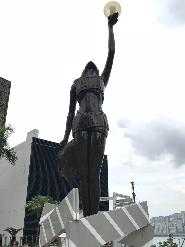
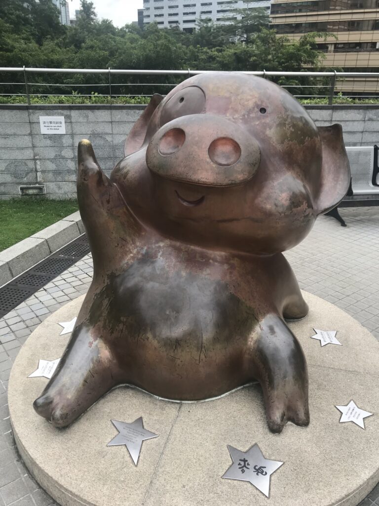
From the Promenade, every evening you can admire the Symphony of Lights, a somewhat kitschy light and music show that starts at 20:00. Pieces of Chinese classical music play in time with flashes of light emitted by the skyscrapers of Hong Kong Island across the harbor.
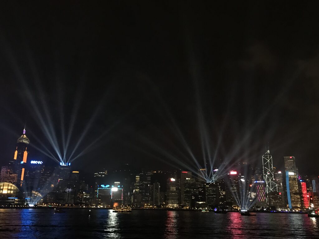
Day 2 - The forgotten streets of Wan Chai
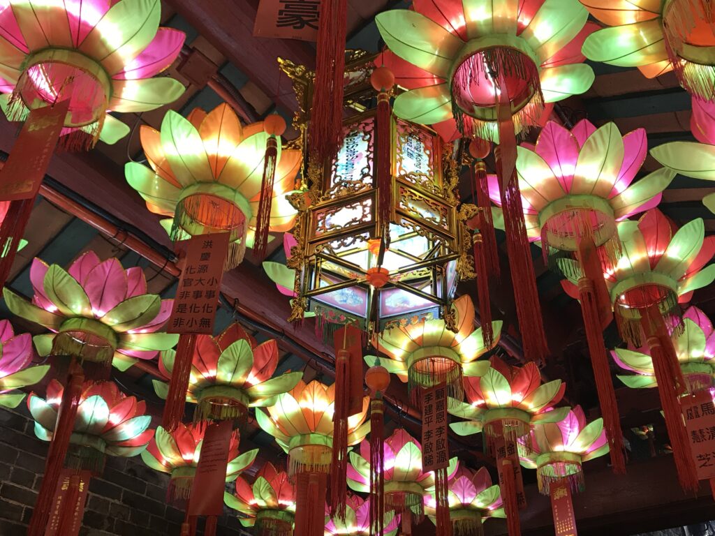
Once, the coastline of Wan Chai ran close to the tram tracks on Johnston Rd, but after extensive reclamation works, it was moved further north. During that era, the area of Queen’s Rd East and Johnston Rd was a fishing village with shrines and temples overlooking the sea. After the arrival of the British, some shipyards were built along the bay, and the European residents who could not afford to live on Victoria Peak began to build their homes on the hills south of Queen’s Rd East. Despite the new Wan Chai being a spectacular commercial district with skyscrapers and five-star hotels, for those who love to explore, the area south of the tram tracks is certainly more interesting.
A short walk along Stone Nullah Lane will lead you to the majestic temple built in 1863 in honor of the Taoist sea god Pak Tai. The imposing temple, the largest on Hong Kong Island, has a roof decorated with Shíwán ceramic statues inspired by Cantonese opera and is representative of the Lingnan style (i.e., the architecture of the Cantonese area). The main temple houses a 3-meter tall copper statue of Pak Tai, crafted during the Ming dynasty.
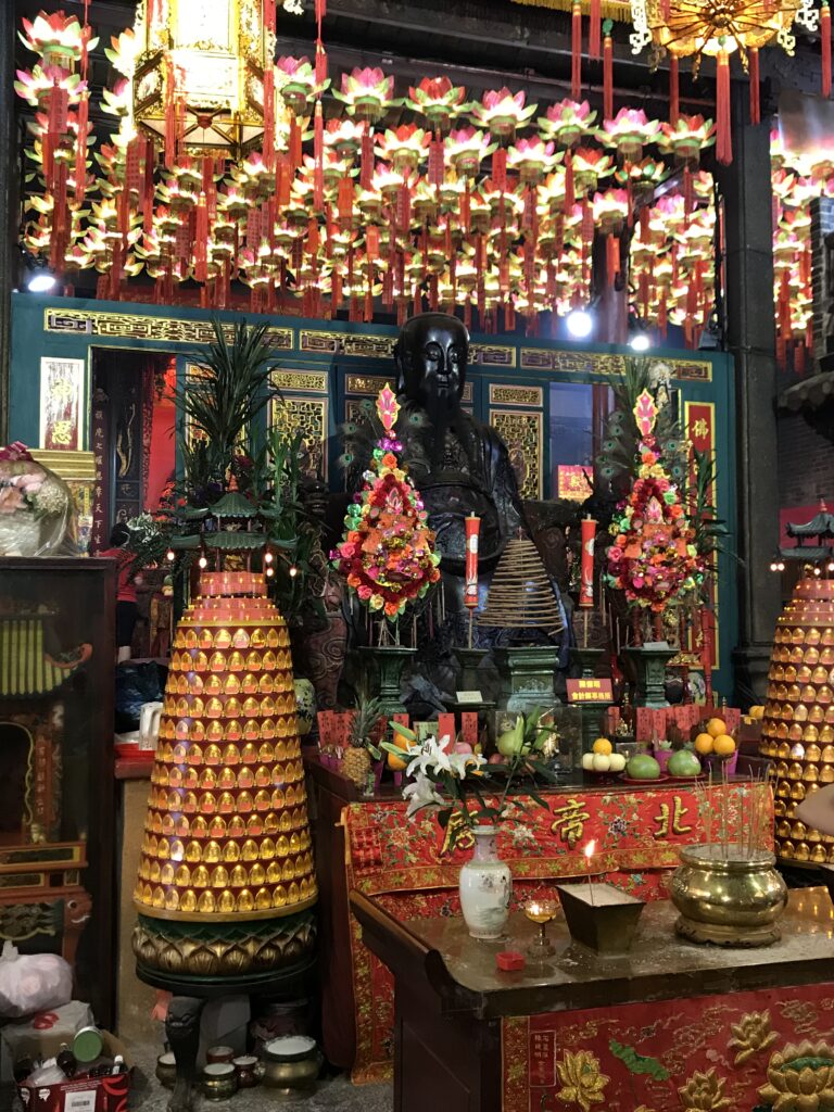
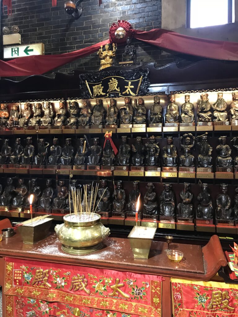
Hidden in a corner on the south side of Queen’s Rd East, this dark and austere temple is built on the rocks that once dominated the harbor. It was erected around 1847 in honor of a Tang dynasty official venerated as a deity, famous for his virtue (an important quality) and for his ability to make useful predictions for traders (an even more precious quality).
The Blue House, built in the 1920s, and the adjacent Yellow House and Orange House form a historic complex known as ‘Viva Blue House’. The most beautiful, the Blue House, is an elegant four-story building with Spanish-style wrought iron balconies reminiscent of New Orleans. It now houses a candy store, a renovated osteopathic clinic, and sanitary facilities for the dozen or so residents.
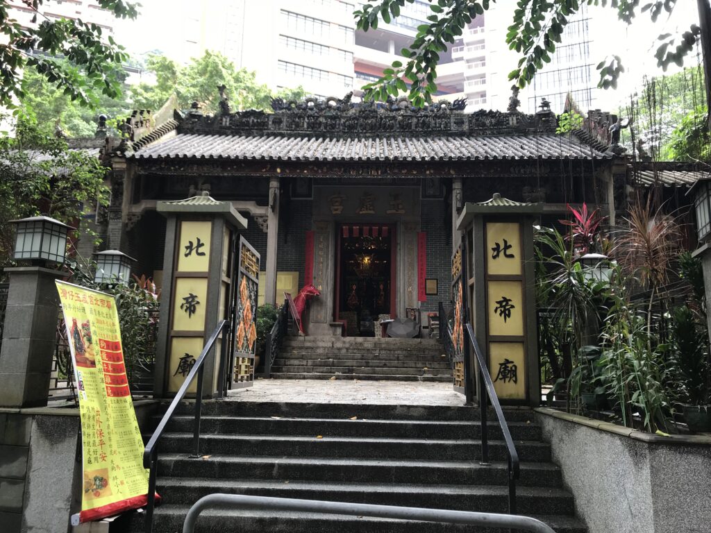
Day - Tian Tan Buddha
With its 23 m (10 floors), the Tian Tan Buddha, standing on the Ngong Ping Plateau on Lantau Island, is the tallest seated bronze Buddha statue in the world. It can be seen arriving by plane in Hong Kong, and even from Macau on clear days, but the best way to appreciate this revered spiritual icon located 500 m high on the western hills of Lantau is to see it up close.
‘Big Buddha’ Inaugurated in 1993, this immense depiction of Siddhartha Gautama was created by China Aerospace Science and Technology, the company that designs Chinese spacecraft. It is definitely worth climbing the 268 steps to admire the statue and the surrounding panorama up close. On the second level of the pedestal, there is a tiny room where oil paintings and ceramic plaques inspired by the life and teachings of the Buddha are exhibited. The computerized big bell inside the Buddha rings 108 times during the day to symbolize the escape from the 108 problems of humanity. Visitors must wear decorous clothes and adopt appropriate behavior. It is forbidden to bring meat and alcohol into the complex. The anniversary of the Buddha’s birth, a holiday that falls in April or May, is a wonderful time to visit the site, a destination for thousands of pilgrims.
The Po Lin Monastery, a vast Buddhist complex built in 1924, today is more of a tourist attraction than a place of worship. Most of the buildings seen entering are new, while behind them are the older ones.
The most spectacular way to reach the high ground is the Ngong Ping 360 cable car, 5.7 km long, connecting Ngong Ping with Tung Chung along the hill. The journey over the bay and mountains takes 25 minutes.
-
Madrid
November 15, 2023 /Day 1 - Old Madrid
Unless you want to visit the major art galleries first, the best place to start exploring Madrid is the Puerta del Sol Square, officially considered the center of the city. Before you start, we advise you to stop at La Mallorquina to have breakfast with a delicious pastry and coffee.
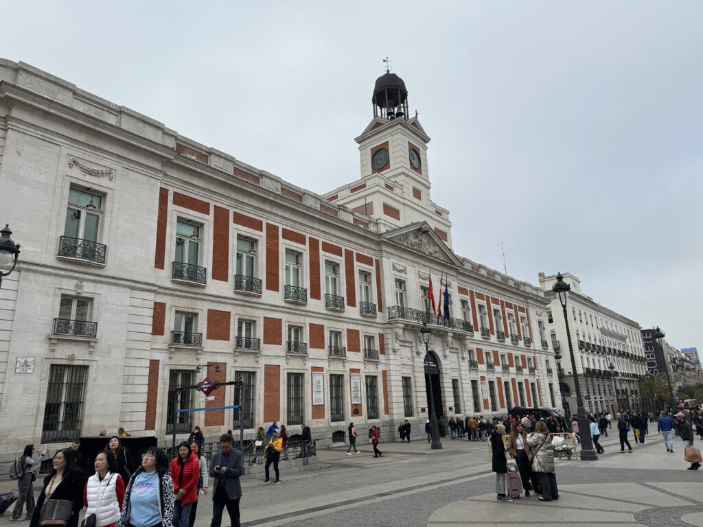
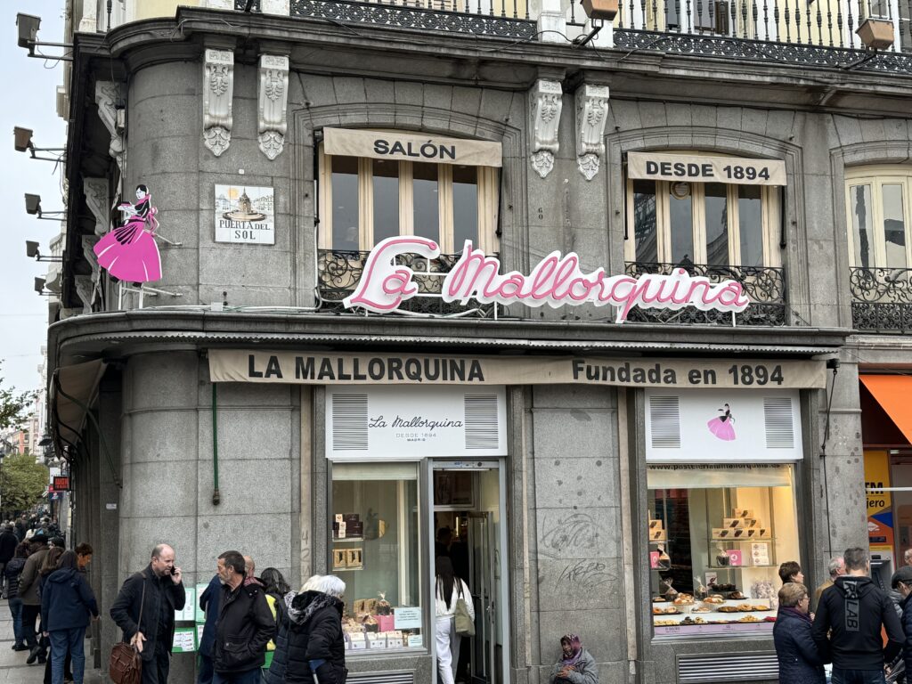
Go up Calle de Preciados and take the second street on the left, leading you to Plaza de las Descalzas. Here, you can admire the baroque portal of the Caja de Madrid Palace, built by the will of King Philip V in 1733 and located in front of the Convent of Descalzas Reales. Continuing south, you’ll reach the San Ginés Church on Calle de los Bordadores, built on the site of one of Madrid’s oldest Christian places of worship, dating back to at least the 14th century. Behind this church is the magnificent Chocolatería de San Ginés, revered by churros and chocolate lovers. Continue to Calle Mayor, cross it, and you’ll arrive at the splendid Plaza Mayor.
After having coffee in the square, head back to Calle Mayor and proceed west to the historic Plaza de la Villa, where the sixteenth-century Ayuntamiento (City Hall) of Madrid is located. On the same square, you’ll find the Casa de Cisneros, built in the 16th century, and the Gothic Casa de los Lujanes, one of the oldest buildings in the city.
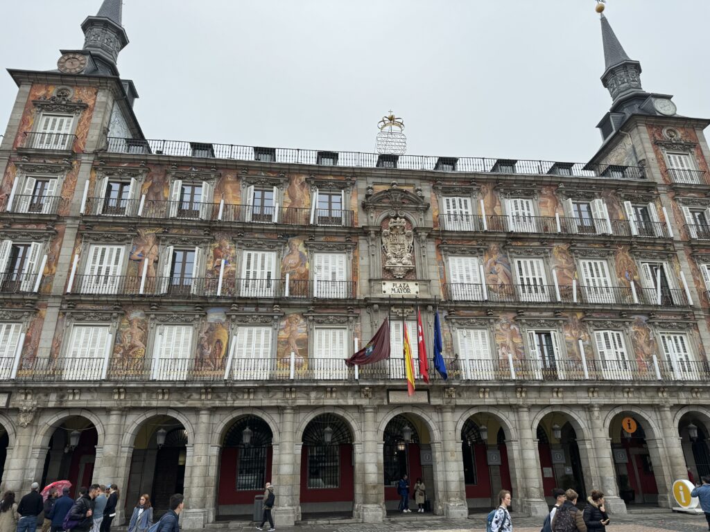
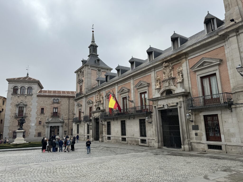
Then, take the street alongside the left side of the Casa de Cisneros. Once you reach the end of Calle del Sacramento, cross it, go down the stairs, and follow the cobblestone Calle del Cordón to Calle de Segovia. You’ll almost be in front of the Mudéjar-style tower of the fifteenth-century Iglesia de San Pedro El Viejo.
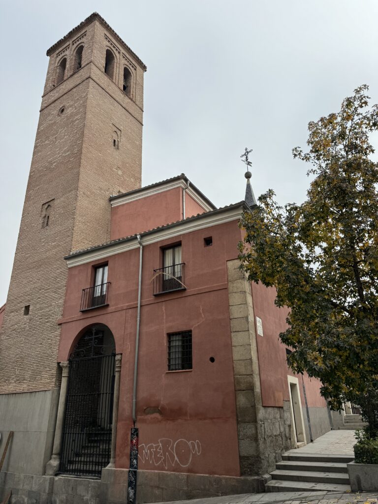
Continuing along Costanilla de San Pedro, you’ll reach the San Isidro Museum, next to the Iglesia de San Andrés, which, for a time, held the remains of Madrid’s patron saint, San Isidro Labrador. From here, you can cross Plaza de la Puerta de Moros and head southwest to reach the Basilica de San Francisco el Grande
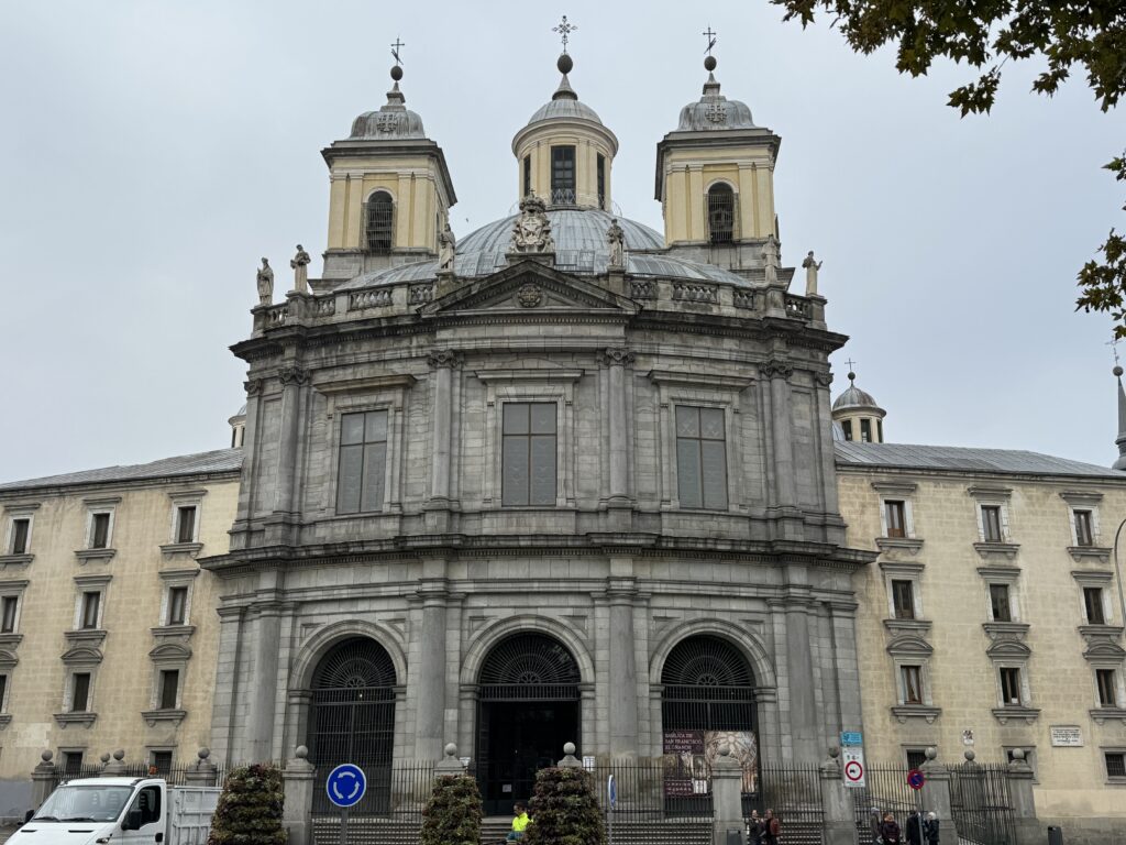
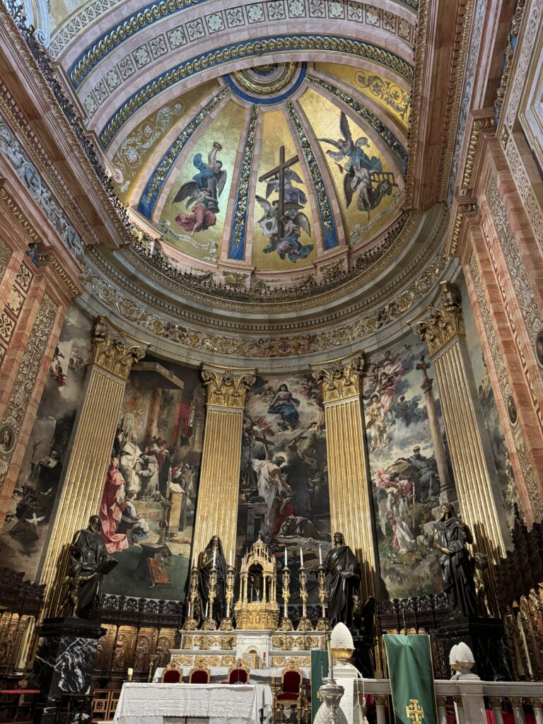
From San Francisco el Grande, wander through the small maze of alleys that once made up the Moorish quarter to emerge on Calle de Bailén, where you’ll find delightful terraces. The Ventorrillo Bar (Corral de la Moreria) is probably the terrace in the happiest position, on the edge of the Jardines de las Vistillas. This is a magnificent place to relax while enjoying views of the Sierra de Guadarrama.
After a refreshing beer, follow the viaduct north to reach the Cathedral of Our Lady of Almudena, the Royal Palace, and the Plaza de Oriente, adorned with statues, fountains, and hedge mazes. The eastern side of the square is bordered by the Royal Theater.
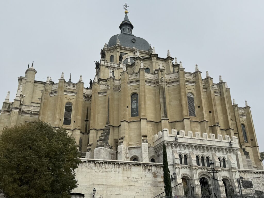
Lorem ipsum dolor sit amet, consectetur adipiscing elit. Ut elit tellus, luctus nec ullamcorper mattis, pulvinar dapibus leo.
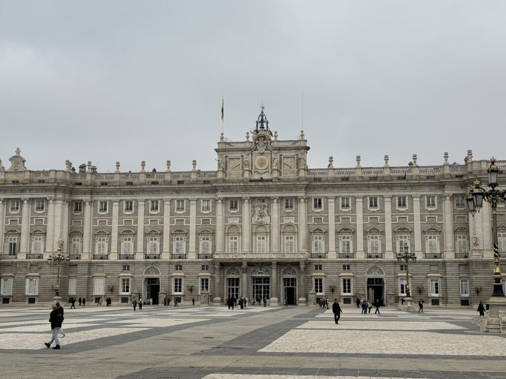
Lorem ipsum dolor sit amet, consectetur adipiscing elit. Ut elit tellus, luctus nec ullamcorper mattis, pulvinar dapibus leo.
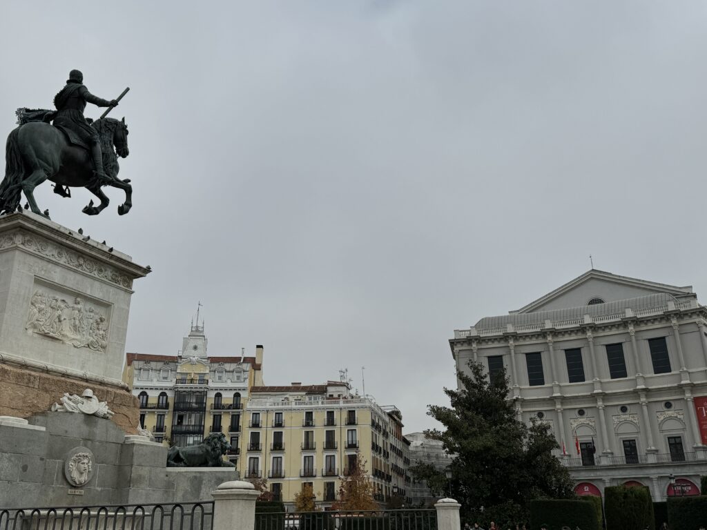
Lorem ipsum dolor sit amet, consectetur adipiscing elit. Ut elit tellus, luctus nec ullamcorper mattis, pulvinar dapibus leo.
The northern end of Calle de Bailen runs along the Senate. The Senate Palace represents the 17 regions of the country and the Spanish enclaves in North Africa (Ceuta and Melilla). It was converted in the 19th century from a sixteenth-century monastery, underwent significant modifications in the 1840s and again in the 1950s. The modern extension facing Calle de Bailén was built between 1987 and 1991. Continuing from Plaza de España along Calle de Ferraz, you’ll reach the Cerralbo Museum, where you can explore a curious collection, and then the Temple of Debod, an ancient temple transferred here from Egypt.
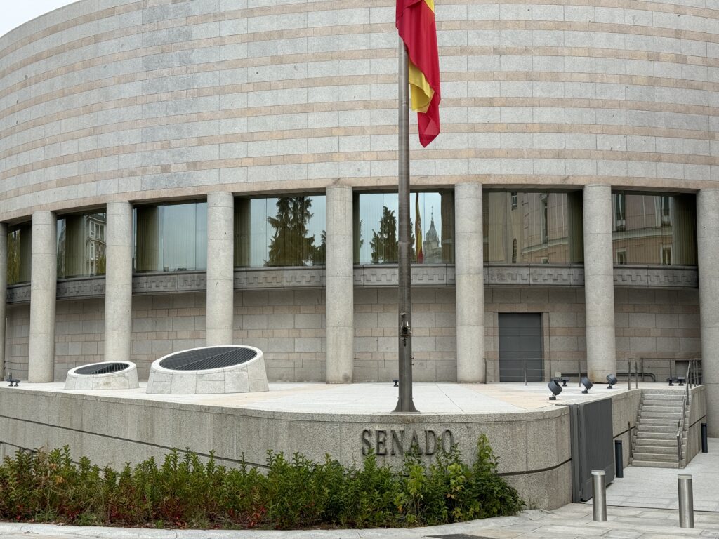
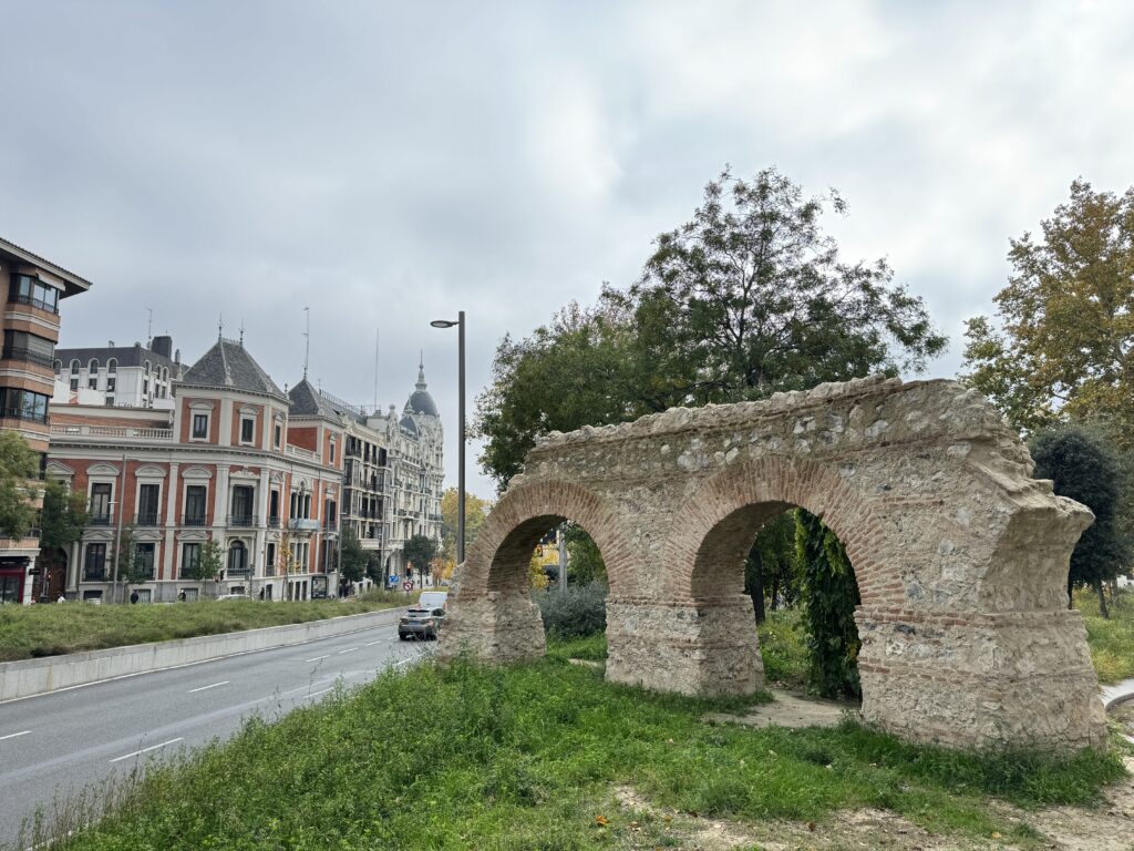
Return to Plaza de España; the eastern side marks the beginning of Gran Vía, a long avenue reminiscent of the boulevards in Paris. Approximately halfway down Gran Vía, you’ll notice the imposing Telefonica building, easily identifiable as it sits on a hill. At the eastern end of Gran Vía stands the superb dome of the Metropolis Building.
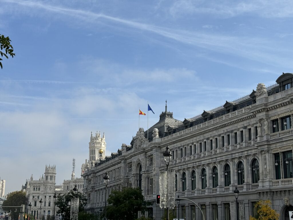
Return to Plaza de España; the eastern side marks the beginning of Gran Vía, a long avenue reminiscent of the boulevards in Paris. Approximately halfway down Gran Vía, you’ll notice the imposing Telefonica building, easily identifiable as it sits on a hill. At the eastern end of Gran Vía stands the superb dome of the Metropolis Building. Continuing east along Calle de Alcalá, you’ll arrive at Plaza de Cibeles, the beloved roundabout for Madrileños. Approaching this square, you’ll see the proud late nineteenth-century building housing Banco de España on the right, while on the left, you’ll notice the gardens of the majestic Buenavista Palace, now the headquarters of the Armed Forces and the Ministry of Defense.
Cross Paseo del Prado to reach the Prado Museum, or continue to Calle de las Huertas (across the tiny Plaza de Platería Martínez). The seventeenth-century Convento de las Trinitarias, where the writer Miguel de Cervantes rests (unfortunately not open to the public), is located. Turn right along Costanilla de las Trinitarias and head north along Calle de San Agustín to Calle de Cervantes, where you’ll turn left. At number 11, you’ll find the Casa de Lope de Vega, the famous Spanish playwright. At the end of Calle de Cervantes, turning left into Calle de León, you’ll find yourself back on Calle de las Huertas. Along this street, in Plaza de Santa Ana and the surrounding alleys, you’ll find numerous places to sit and rest.
Day 2 - Parque del Buen Retiro
After a challenging tour of nearby art galleries, a great way to relax is to immerse yourself in the scaled-down Madrid version of Central Park.
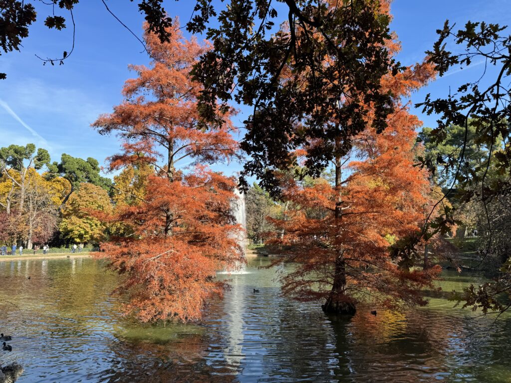
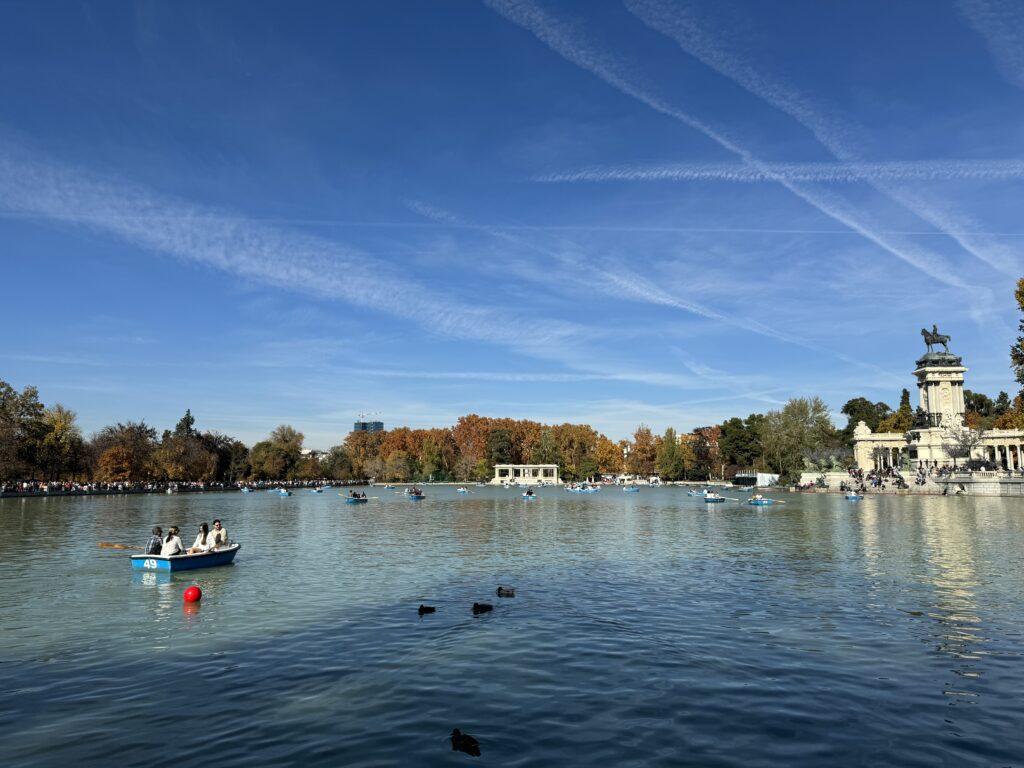
Parque del Buen Retiro is a popular meeting place for families, clowns, bongo players, couples arm in arm, and walking enthusiasts. The gardens are especially busy on weekends when street performers showcase their talents. Once reserved for kings, queens, and court members, the park is now open to everyone. Visitors can also rent rowboats (€4 for 45 minutes) to take a ride on the artificial lake (estanque), dominated by the imposing structure of the mausoleum of Alfonso XII. On the western shore of the lake, you’ll notice a unique structure decorated by Singi: this is the Fuente Egipcia (Egyptian Fountain), where, according to legend, a vast fortune buried by Philip V in the mid-18th century is said to be hidden. However, park authorities have assured us that this is a purely fictional story. On weekends, around the same lake, artists, fortune-tellers, and card readers set up. A couple of structures near the park host art and photography exhibitions, particularly Palacio de Exposiciones. In the summer, puppet shows are also organized (look for the sign ‘Tiritilandia,’ which means ‘Puppetland’). The Palacio de Cristal (2 91 574 66 14; 11-20 from Monday to Saturday, 11-18 on Sunday and holidays from May to September, 10-18 from Monday to Saturday, 10-16 on Sunday and holidays from October to April), a beautiful metal and glass structure located south of the lake, was built in 1887 as a winter garden for exotic flowers. Occasionally, the palace is also used as an exhibition space.
Not far away, the Palacio de Velázquez (@ 91 573 62 45; observes the same hours as the Palacio de Cristal) was built in 1883 for an exhibition on the mining industry and is now used for temporary exhibitions. Another building that occasionally serves a similar purpose is the Casa de Vacas (2 91 409 58 19; (3 11-22). At the southern end of the park, near La Rosaleda (rose garden), a statue dedicated to El Ángel Caído (the Fallen Angel, i.e., Lucifer) has been placed, giving the place a slightly eerie touch. The southwestern end of the park is a well-known meeting point for young homosexuals.
Day 3 - Toledo
Toledo lacks a true city center; however, Plaza de Zocodover, at the northeastern end of the old city, is a good starting point for your visit. This oddly-shaped square was once the site of an Arab livestock market, and more recently, the main market of the city. Nowadays, it is adorned with café terraces and crowded with tourists on day trips. From here, the imposing fortress of the Alcázar is just a short walk away, it will houses the collection of the Museo del Ejército from Madrid, further expanding the already extensive collection of weapons here.
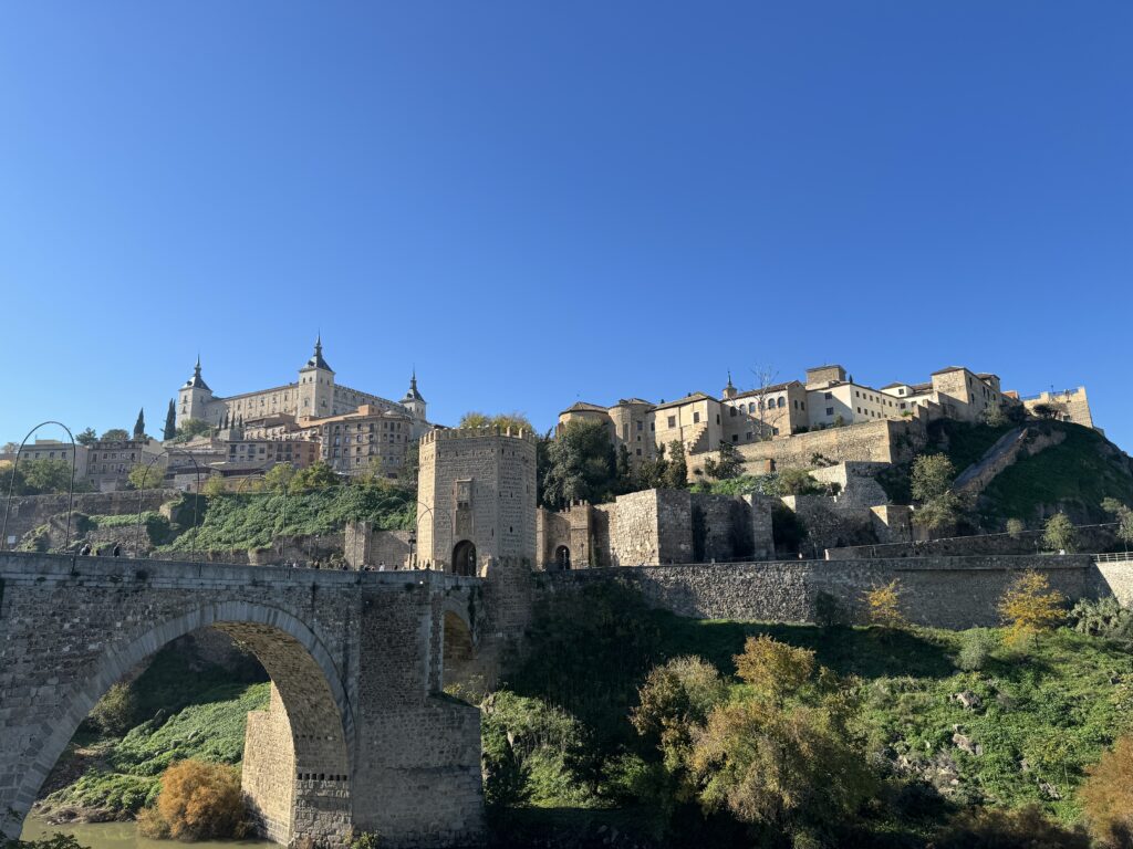
This site, the highest point in Toledo, was initially a Roman military base, then an Arab fortress, and finally Christian after the reconstruction by Alfonso VI in the 11th century. Later, Charles V converted the squarely structured building into a royal palace and used it to accommodate his guests until it was damaged by a fire in 1710. The palace burned again in 1810 (by Napoleon) and was almost completely destroyed during the Spanish Civil War. When Franco ordered its reconstruction, it was transformed into the military museum you can admire today. This site, the highest point in Toledo, was initially a Roman military base, then an Arab fortress, and finally Christian after the reconstruction by Alfonso VI in the 11th century. Later, Charles V converted the squarely structured building into a royal palace and used it to accommodate his guests until it was damaged by a fire in 1710. The palace burned again in 1810 (by Napoleon) and was almost completely destroyed during the Spanish Civil War. When Franco ordered its reconstruction, it was transformed into the military museum you can admire today.
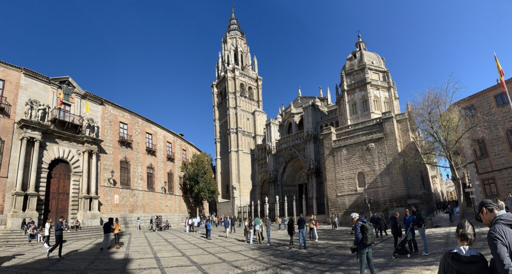
Nearby is the Cathedral, one of the richest and most majestic churches in the world. The essentially Gothic building, with some Mudéjar additions, was constructed in the 13th century on the site of a former mosque. Toledo’s role as the seat of the Church in Spain ensured the cathedral a wide array of patrons, and wealthy Catholics left their mark in the sumptuous decorations visible everywhere. It’s worth exploring all the chapels and side rooms, but the Capilla de la Tome (Tower Chapel) in the northwest corner and the Sacristía (Sacristy) deserve a bit more attention. The latter boasts a graceful vaulted ceiling and a small gallery with works by the painter El Greco (see reading on this page), while the Tower Chapel houses one of the most extraordinary monstrances in existence, the Custodia de Arfe, dating back to the 16th century. With 18 kg of gold and 183 kg of silver, this sparkling mass of metal features a staggering 260 statuettes. Other noteworthy places include the impressive main altar, the Transparente window, and the choir stalls.
To the southwest of the cathedral is the Judería (Jewish quarter), home to the synagogues of the old city and the heart of the route that retraces the life and works of the painter El Greco. The first stop is the Iglesia de Santa Tomé, where one of El Greco’s masterpieces, El Entierro del Conde de Orgaz (The Burial of the Count of Orgaz), is displayed. The painting tells the legend of the pious count’s funeral in 1323 when St. Augustine and St. Stephen appeared to bury the body in the tomb. The bearded man immediately above St. Stephen (the younger of the two saints in golden clothes) could be a self-portrait of the painter.
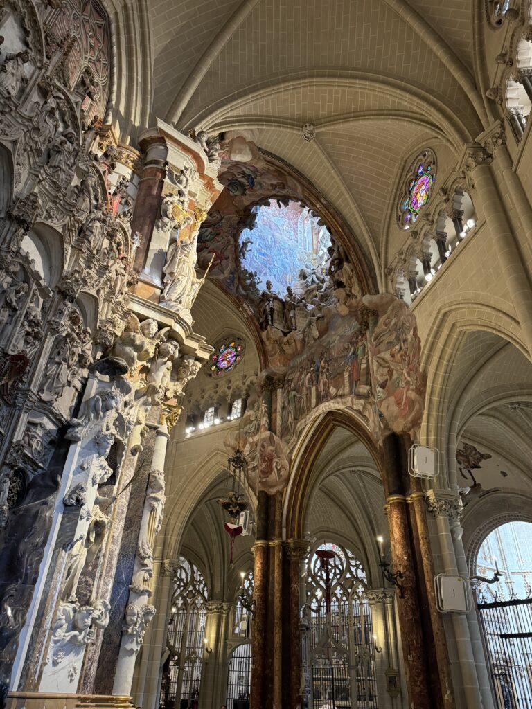
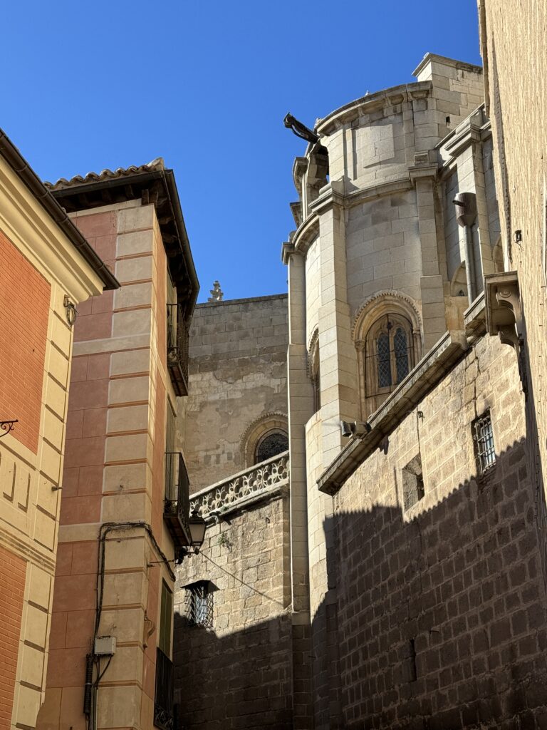
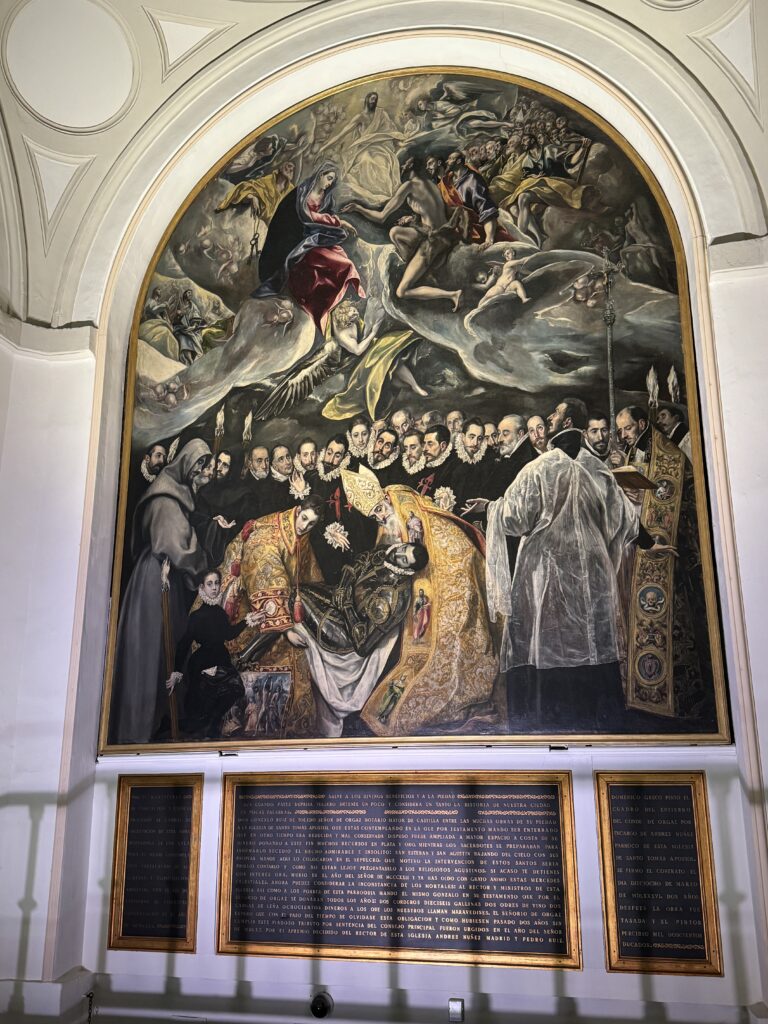
Continue El Greco’s itinerary and head towards the Casa-Museo del Greco. This house is not necessarily where the painter lived, but it is decorated in the style of the time. At least twenty of his minor works are exhibited here, along with paintings by his contemporaries. More works by the painter can be found in the Museo de Santa Cruz, near Plaza de Zocodover.
Born in Crete in 1541, Domenikos Theotokopoulos (El Greco) moved to Venice in 1567 to apprentice as a Renaissance artist. Under the influence of masters like Tintoretto, he learned to paint dramatic scenes with few colors, directing the observer’s interest to the faces of the characters he portrayed, leaving the rest in relative darkness—a characteristic that later became one of his distinctive traits. Starting in 1572, he devoted himself to the study of Roman Mannerism and the works left by Michelangelo.
Theotokopoulos arrived in Toledo in 1577 with the hope of securing a commission at El Escorial, but things took a different turn as Philip II did not want him as a court artist. In Toledo, the painter began to work in a style completely different from that of local artists, attracting a wealthy clientele willing to pay high prices for his works. His high opinion of himself and his work, however, drew the hostility of the cathedral administrators, the first among many clients to drag the artist to court to justify his decidedly high fees.
El Greco enjoyed a luxurious lifestyle and took up residence on Paseo del Tránsito, where his meals were often accompanied by performances by musicians. With the decline of Toledo’s fortunes, El Greco’s economic situation also suffered a setback. Although his later works are among his most beautiful, the painter often struggled to gather the money needed to pay rent. He died in 1614, leaving traces of his presence throughout the city, where many of his masterpieces are still located.
Beyond the Casa-Museo del Greco, you will encounter the interesting Museo Sefardí, housed in the Synagogue of El Tránsito, one of the best-preserved remnants of Jewish Spain. This peculiar combination of names refers to the ‘Virgen del Tránsito,’ the name given to this place of worship when it was consecrated as a Christian church. Some breathtaking sculptures adorn the walls, and the museum is an ideal place to deepen your knowledge of Jewish life in medieval Spain.
For a glimpse into Muslim Toledo, head to the Cristo de la Luz Mosque. During the Muslim rule, there were 10 mosques in the city, but this one, a characteristic example of their style, is the only survivor. Don’t miss the horseshoe-shaped arches, both inside and outside, and the inscriptions on the interior walls.
-
San Francisco
November 2, 2023 /Day 1
Climb aboard the Powell-Mason cable car for an exciting ride. Get off at North Beach and visit Coit Tower (p56) to see innovative murals and breathtaking 360-degree views. Ascend the scenic Filbert Street Steps (p57) to the sunny Embarcadero waterfront, then dive into total darkness at the Tactile Dome in the Exploratorium (p53). Enjoy sensational fish tacos at Mijita (p79) in the Ferry Building (p78), then take the pre-booked ferry to Alcatraz (p51), the infamous maximum-security prison where inmates lived in tiny solitary cells. After touring the former prison, head to North Beach, where you can browse books at City Lights (p71), the symbolic bookstore of free speech, and see the Beat Museum’s (p60) collection of memorabilia.
Day 2
Take the California St cable car to Grant St to experience Chinatown.
The 41 historic alleys that border the 22 blocks of Chinatown have seen it all since 1849: gold rushes and revolutions, incense and opium, fires and hostilities. Chinese miners were among the first to arrive in San Francisco for the gold rush, but after 1870, anti-Asian laws restricted migration and made it harder to find work and housing. People of Chinese descent were denied the right to own property and participate in labor unions; many had to resort to dangerous jobs, such as building railway tunnels blasted with explosives in the mountains. White owners of Chinatown buildings made huge profits from the opium dens in Duncombe Alley and the brothels in Ross Alley. When the 1906 earthquake and fire devastated Chinatown, construction entrepreneurs persuaded the city to evacuate Chinese residents. However, with the support of the Chinese consulate and local merchants, and armed with pistols, Chinatown residents resisted the expulsion order and even returned to rebuild their community. Family associations closed opium dens and brothels, and in the 1920s, merchants renovated the neighborhood to attract tourists. Today, mahjong is still played at 36 Spofford Alley, where Sun Yat-sen once planned the revolution.
Cross the ‘Dragon Gate,’ donated by Taiwan in 1970, and you’ll find yourself in Dupont, a street once notorious for its red-light district.
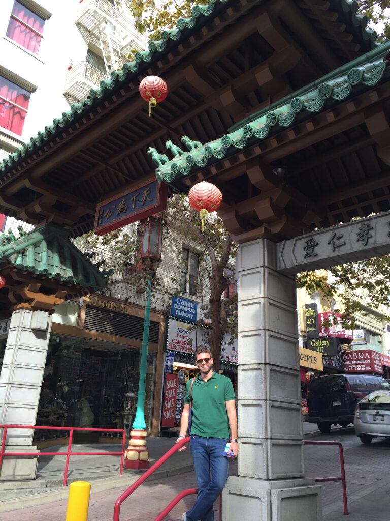
The ‘Chinese-deco’ architecture beyond the gate, featuring pagoda-roofed buildings, is the result of a group of enlightened entrepreneurs led by Look Tin Ely, who transformed the street from a prostitution area into a shopping district in the 1920s. Today, dragon-shaped lanterns illuminate souvenir shops and tea houses in the area.
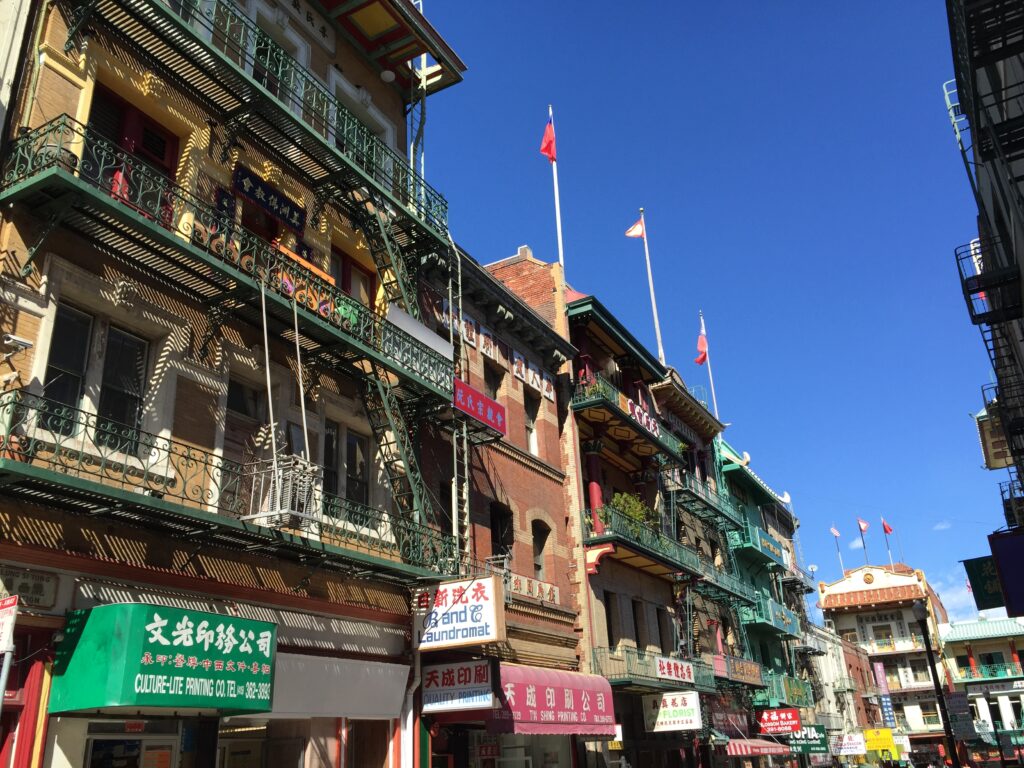
Stop for tea tastings at Red Blossom and the collection at the Chinese Historical Society of America. Stroll through Waverly Place with its temples, and Ross Alley, where you can buy fortune cookies from Golden Gate Fortune Cookie Company.
This bakery bakes custom cookies (50¢ each) using antique pastry presses. Alternatively, you can purchase a pack of risqué fortune cookies. They only accept cash, and a 50¢ tip is required for taking photographs.
Choose your favorite Chinese dumplings at City View, then climb the hill, pass by the ‘parlor houses’ (i.e., brothels) from the gold rush era.
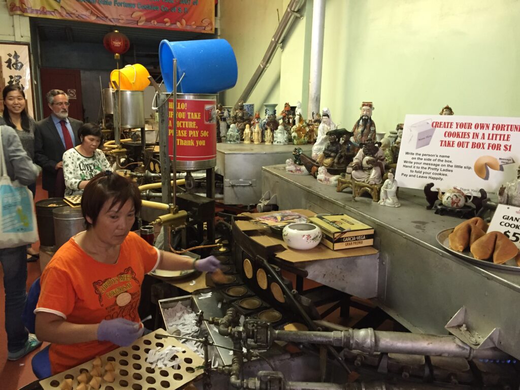
Forget about car chase scenes from movies (such as “Vertigo,” “What’s Up, Doc?”) and commercials shot in San Francisco: the best way to reach Lombard Street isn’t by car but by cable car. The Powell-Hyde line reaches Nob Hill and then climbs Russian Hill, passing millionaires’ mansions and secret staircases lined with gardens. Get off at Lombard for an unbeatable view from the hill. From the highest point of Lombard Street, you might get dizzy: this zigzagging paved road descending Russian Hill has eight sharp turns and a steep slope of 27%. It might not be the ‘crookedest street in the world’ as commonly claimed (that title goes to Vermont Street on Potrero Hill), but you get the idea. The street appears in Hitchcock’s movie “Vertigo,” and skateboarding legend Tony Hawk included these twists and turns in his Pro Skater video game. If you’re not up for driving, you can walk down the 250 steps; it’s equally scenic.
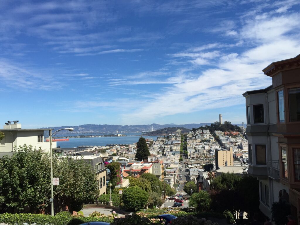
Back in the roaring ’20s, too many drunk people ended up with their cars in the gardens of Russian Hill houses. So, the homeowners decided to add eight sharp turns adorned with flowerbeds, transforming this extremely dangerous shortcut into a picturesque route. The result is what you see today: a red-bricked paved street, bordered by beautifully manicured flowerbeds and flanked by 250 steps.
Those brave enough to navigate Lombard Street’s perilous turns miss out on the view of the Golden Gate Bridge enjoyed from the winding paths of Sterling Park atop the hill. The sunset framed by wind-kissed Monterey pines is pure poetry and befits the park’s namesake, the penniless bohemian poet George Sterling, a nature lover, advocate of free love, and opium enthusiast. San Francisco’s high society was not scandalized by his eccentricities and dedicated this park to him.
From the winding Lombard Street you will arrive at the Fisherman’s Wharf. Once upon a time, fishermen cast their nets here, but today it’s the tourists who are hooked: this commercial park stretches from the cable car terminus to the pier where cruises to Alcatraz depart. When you least expect it, Fisherman’s Wharf will offer you pleasant surprises. Here, you can sunbathe next to the sea lions, ride the carousels’ unicorns, enter a World War II submarine, have your fortune told by a wooden fortune teller, and watch sharks swim while you’re safely enclosed in glass tubes in the middle of the bay.
Even the stars dream of the sea lion life in San Francisco, which since 1990, has occupied a part of the tourist port where yachts dock. California law requires boats to give space to these mammals: therefore, from January to July, boat owners must give up their berths at Pier 39 to allow about 1300 sea lions to enjoy the sun undisturbed. They are the envy of all beach bums!
USS Pampanito All aboard! Enter this World War II military submarine that sank six Japanese ships, including two carrying British and Australian prisoners of war. The tales of tension while the submarine was submerged will leave you breathless (be careful if you suffer from claustrophobia), and all those brass knobs and hydraulic valves will make 21st-century technology seem overrated.
Day 3
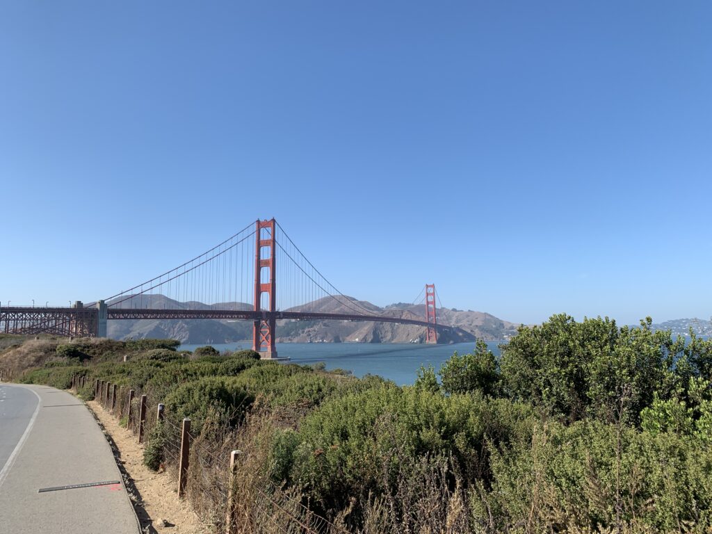
Strange but true: the San Francisco icon project came close to being rejected by the Navy in favor of a cement bridge with yellow-striped pillars. The mind behind this masterpiece in 1937 was engineer Joseph B. Strauss, but architects Gertrude and Irving Murrow deserve credit for the elegant Art Deco style and the distinctive color known as ‘international orange.’ Before the US Department of War could object, workers got to work, constructing the nearly 3 km-long span and 200 m-tall pillars in just four years.
San Francisco residents passionately defend their perspective on things, especially the city’s icon. Those who prefer foggy landscapes might say that Marin’s Vista Point, to the north, offers the most beautiful panoramic view, where clouds seem to perform acrobatics like Olympic gymnasts on the bridge cables. From Crissy Field, you can appreciate the entire span (and capture windsurfing and kitesurfing in your photos), while at Baker Beach, a beach frequented by nudists, you can admire the bridge in all its grandeur.
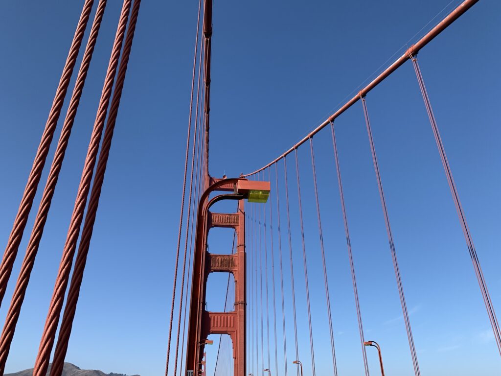
To see both sides of the Golden Gate, bike or walk along the span. A pedestrian path runs from the toll booth to the east sidewalk (pedestrian access 5 am-6:30 pm every day) starting from the parking lot and bus stop. Near the toll booth, there is a network of sturdy suspended cables, bearing the weight of thousands of buses and cars passing through here every day. If you don’t want to walk back, take a Golden Gate Transit bus departing from Marin. Bicycles have access to the bridge 24/7 from either the west or east sidewalk, but they must yield to pedestrians on the east sidewalk. When crossing the bridge, electric bikes must be used with the motor turned off.
Built in 1861 with 126 cannons, Fort Point was meant to deter Confederate soldiers during the Civil War but never saw military action; instead, it served as the backdrop for Hitchcock’s film “Vertigo.” Enjoy the view and read the panels about the Civil War.