Adventures

  • Adventures,  Africa,  Kilimanjaro,  Places

    Kilimanjaro

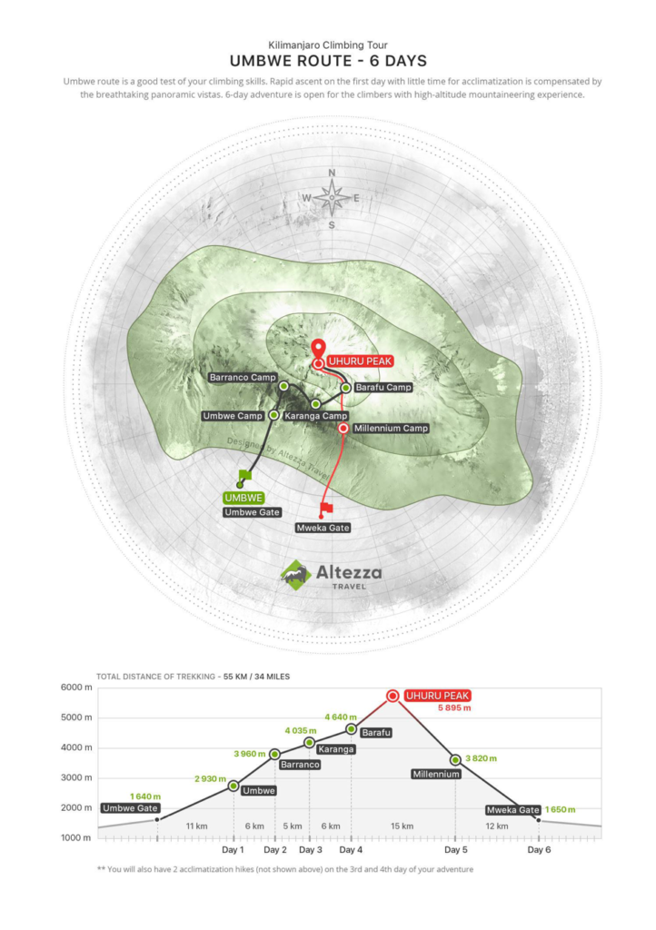
    If you have the experience in numerous high-altitude climbs over 4000-4500 m, you might try the Umbwe route. It is one of the most challenging routes due to the short duration and steeper incline. It goes along the southern slope but is less frequented than other southern routes because of the challenge it poses. The first day poses one of the biggest challenges – the route starts quite low from Umbwe Gate (1,640 m) and continues with a lengthy trek to the first camp on your way – Umbwe camp (2,930 m).

    When the trail reaches Barranco camp, it will merge with Lemosho and Machame and therefore you might meet more people at the camps. The camps are not crowded at all, you might meet 3-4 other groups in the peak season (July-September as an example)

    Trail map of Whinlatter Forest Park

    Day 2: TREKKING FROM UMBWE GATE TO UMBWE CAMP

    A guide and a mountain support crew will arrive at the hotel in the morning in order to meet you and hold a quick briefing, after which you will travel by vehicle to the entrance to Kilimanjaro National Park: Umbwe Gate (1,640 m). After the quick formality of acquiring climbing permits and registering with the search and rescue service, the group will start trekking up to your first camp: Umbwe Camp (2,930 m). This will be a long trekking day that includes an important increase in altitude, so don’t hurry. It is important to find the right pace for your group and stick with it for the rest of the trip. You should also remember to take your raincoats: this route includes passage through a rainforest, where tropical showers are highly probable.


    Change in Elevation: Umbwe Gate (1,640 m) — Umbwe Camp (2,930 m)

    Hiking distance: 11 km

    Hiking time: 5-7 hours

    Day 3: TREKKING FROM UMBWE CAMP TO BARRANCO CAMP

    Early wakeup, breakfast and the start of trekking to Barranco Camp. The rainforest will quickly give way to brush, and if it is not too cloudy you will be able to see Meru Volcano for the first time. Trekking for this day will be of a moderate length, and around lunchtime you will reach Barranco Camp (3,960 m), which is nestled inside a huge volcanic fault. Lunch will be provided here, and then you have the opportunity to relax for the rest of the day, which significantly facilitates the acclimatization process.


    Change in Elevation: Umbwe Camp (2,930 m) — Barranco Camp (3,960 m)

    Hiking distance: 6 km

    Hiking time: 4-5 hours

    Day 4: TREKKING FROM BARRANCO CAMP TO KARANGA CAMP

    Early wakeup, breakfast and the start of summiting Barranco Wall (we recommend you leave the camp as early as possible to avoid crowds of the other groups). Hiking up the gorge wall is not difficult and only takes around an hour. After the climb you can have a rest and take photos in front of the Kibo volcano. Then you start a more difficult hike to Karanga Camp, which features numerous ascents and descents during the route, but don’t worry: our guides are experts at choosing an optimal pace for the group. After reaching the camp you will be offered warm lunch. After a couple of hours you will have to complete an acclimatization hike in the direction of Barafu Camp with a 200-meter gain in altitude, and then descent back down to the camp.

    The acclimatization hike is an easy trek with a slight gain in altitude done in order to speed up the acclimatization process.

    You should take the acclimatization hikes very seriously. They help increase your chances of successfully summiting Kilimanjaro and save you from the consequences of altitude sickness.


    Trekking from Barranco Camp to Karanga Camp:

    Change in Elevation: Barranco Camp (3,960 m) — Karanga Camp (4,035 m)

    Hiking distance: 5 km

    Hiking time: 4-5 hours

    Acclimatization hike:

    Change in Elevation: Karanga Camp (4,035 m) — Destination point en route to Barafu Camp (4,270 m)

    Hiking distance: 2.5 km

    Hiking time: 1-2 hours

    Day 5: TREKKING FROM KARANGA CAMP TO BARAFU CAMP

    In the morning after breakfast you begin your way to Barafu Summit Camp (4,640 m), the starting point for a night summiting Uhuru Peak (5,895 m). Our team will set up a camp for you ahead of time, including tents and sleeping bags, so you can relax.

    After regaining strength, you have to complete an acclimatization hike towards the intermediate Kosovo Summit Camp (4,800 m) and then back to Barafu Camp, where you will be served a hot dinner. It is better to spend the remainder of the day resting and sleeping before night summiting.


    Trekking from Karanga Camp to Barafu Camp:

    Change in Elevation: Karanga Camp (4,035 m) — Barafu Camp (4,640 m)

    Hiking distance: 6 km

    Hiking time: 4-5 hours

    Acclimatization hike:

    Change in Elevation: Barafu Camp (4,640 m) — Kosovo Camp (4,800 m)

    Hiking distance: 2 km

    Hiking time: 1-2 hours

    Day 6: ASCENT TO UHURU PEAK AND DESCENT TO MILLENNIUM CAMP

    Departure from Barafu Camp (4,640 m) at night and the start of summiting Kilimanjaro: Uhuru Peak (5,895 m). Technically the climb is relatively simple; however, the most challenging part is the high altitude. Each pair of climbers will get a personal guide for the entire ascent to monitor your physical and mental conditions. After your successful ascent to Uhuru Peak, you can descend to the nearest glacier if desired. Then you will return to Barafu Camp and after a 2 hour rest continue your descent to Millennium Camp (3,820 m).

    Don’t forget that 90% of all accidents occur during the descent, including all broken arms and legs. Please pay attention to your feet, as there is a high risk of damaging your toenails.


    Change in Elevation: Barafu Camp (4,640 m) — Uhuru Peak (5,895 m) — Millennium Camp (3,820 m)

    Hiking distance: 15 km

    Hiking time: 8-12 hours

    Day 7: DESCENT FROM MILLENNIUM CAMP TO MWEKA GATE

    The camp is situated in a tropical rainforest. When you wake up, you will feel relief from the reduction of the height and the satisfaction of reaching the summit. After a warm breakfast, you will head for the park’s exit: Mweka Gate (1,640 m). After your descent the whole group will gather to congratulate you, followed by offering you a chance to share your opinions on the climb in the guestbook. Lastly, we will present you with your commemorative certificates in our office and provide you a transfer back to the hotel.


    Change in Elevation: Millennium Camp (3,820 m) — Mweka Gate (1,640 m)

    Hiking distance: 12 km

    Hiking time: 4-5 hours

  • Adventures,  Parque Nacional Los Glaciares,  Places,  South America

    Parque Nacional Los Glaciares
    Los Glaciares National Park is located in the area known as Austral Andes in Argentina, in the south west of Santa Cruz on the border with Chile. By his magnificent natural beauty, it constitutes a wonder in the world, and was declared “World Heritage” by UNESCO in 1981.

    This park shows a scenario of mountains, lakes and woods, including a large portion of the Andes practically under ice and snow to the west, and the arid Patagonian steppe to the east.
    Its name refer to the glaciers that are born on the Ice Caps – the largest continental ice extension after Anctartica- which occupies almost half its area. Also known as Patagonic Continental Ice, creates 47 big glaciers, 13 of which flow to the Atlantic. There are also more than 200 smaller glaciers, unconnected to the Ice Caps. 
    All over the world glaciers are over 2500 mts over sea level, but here, in Santa Cruz, they are originated on the Ice Caps, at 1500 mts over sea level, and flow down to 200 mts, having the possibility of an unique approach and view.
    As a result of the enormous pressure of the antique ice and the subsequent thaw, three big lakes, two of them inside the NP appeared: Lago Argentino and Lago Viedma, the waters of which flow as Rio Santa Cruz to the Atlantic Ocean crossing the province

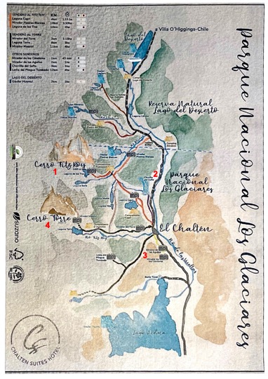
    Trail map of Los Glaciares National Park around El Chaltén

    Cerro Fitz Roy - Laguna de Los Tres

    Laguna de Los Tres is one of the most iconic hikes in Patagonia and the best trek you can do from El Chalten in Argentina. It’s also known as Fitz Roy hike because the trail will take you to the classic viewpoint of Mount Fitz Roy and the lake. 

    Laguna de Los Tres means in English Lake of the Three, and the number three represents here three peaks towering above the lagoon – the highest Mount Fitz Roy, Cerro Torre, and Mount Poincenot.Finding trailhead to Laguna de Los Tres couldn’t be easier. 

    The trail starts at the north end of the urban area of El Chalten. You only need to follow Avenida San Martin until you reach the parking lot on your left.

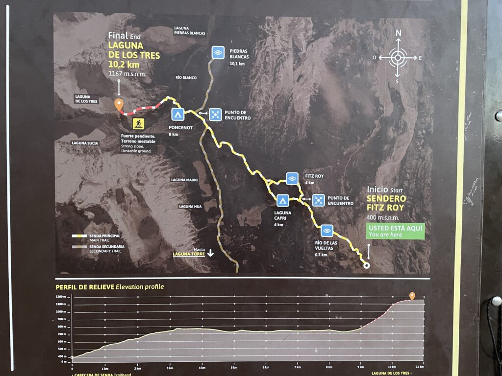
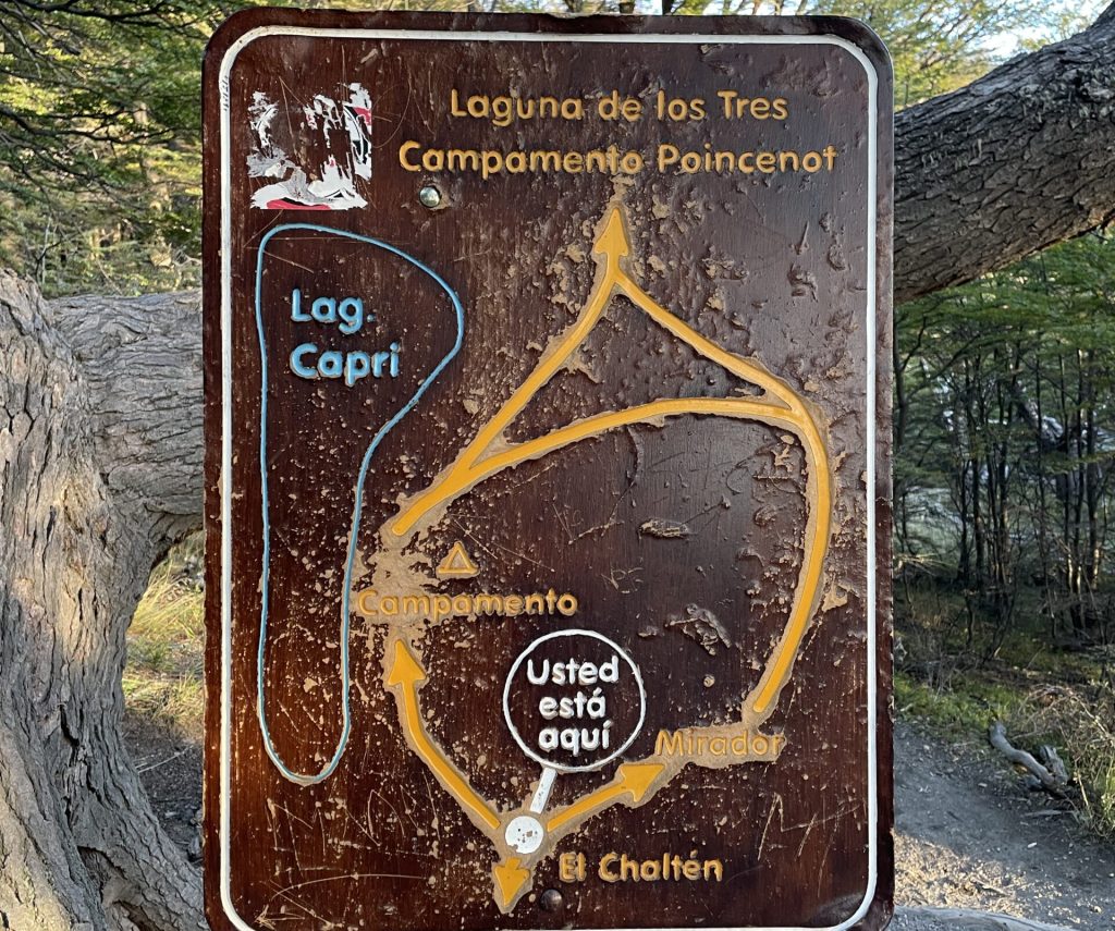
    Trailhead sign with the profile of the Laguna de los Tres route, El Chaltén

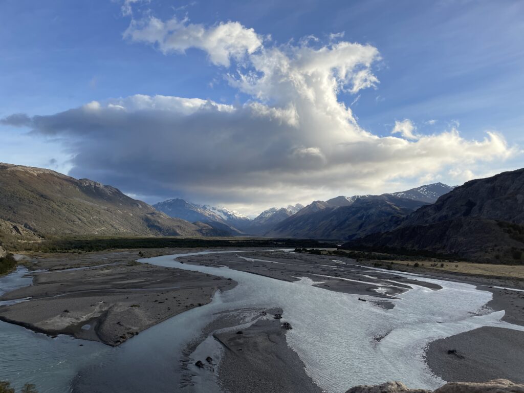
    From the parking lot, the trail starts quite steeply up. The first ascent lasts about an hour, but in the end, you will be rewarded by a splendid view of De las Vueltas river sneaking through the valley.

    From this mirador, the path continues up, but not that steeply. You will walk on a narrow path partially hidden in the forest until you reach a fork where you can decide to turn right and walk through the Mirador del Fitz Roy or turn left and go via Laguna Capri.

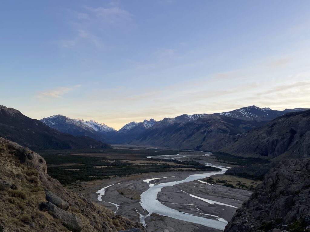
    River valley and mountains at dawn near El Chaltén, Patagonia
    Trail sign for Laguna de los Tres and Campamento Poincenot

    Generally, it does not matter which option you’ll take as you can walk the other side on the way back.

    But if the weather is pleasant, you should go via the viewpoint first as the situation can change any time, and it might be the only time you’ll get the chance to see the iconic Fitz Roy from a distance.

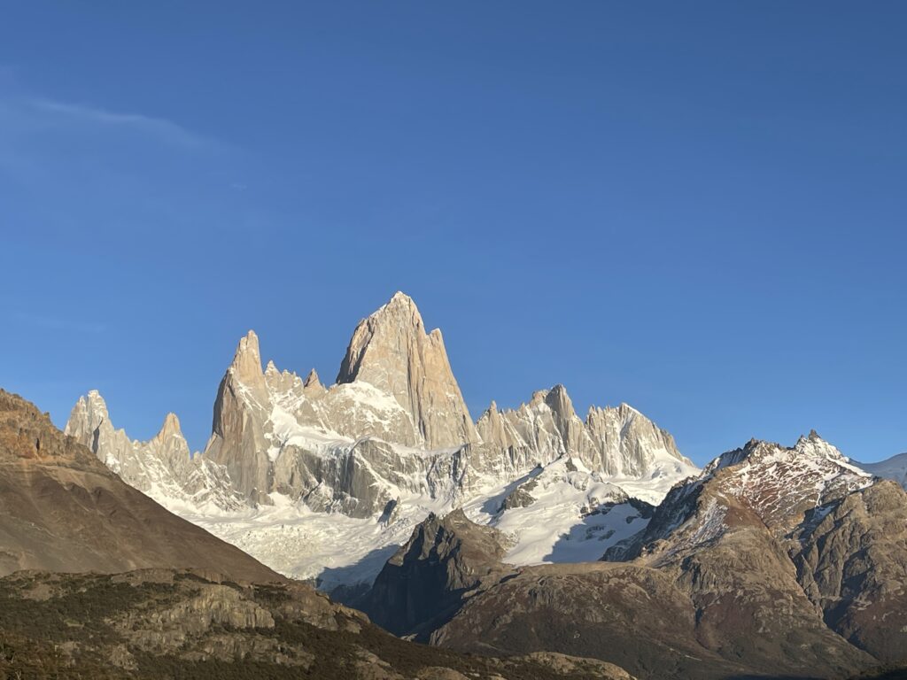
    The spires of Cerro Fitz Roy above the Patagonian steppe
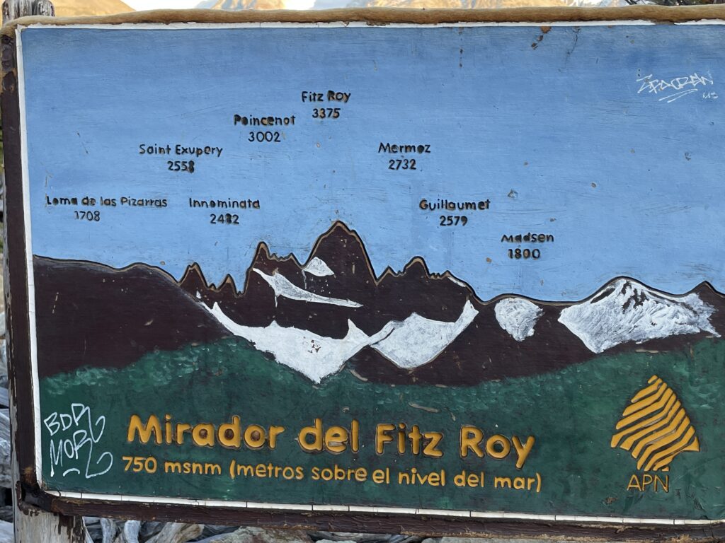
    Panel naming the peaks at the Mirador del Fitz Roy, 750 metres

    After you enjoy the panoramic views, the path continues down and soon became flat, which will be a welcoming change.

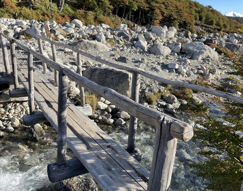
    The path will now wind through the low thicket, along Del Salto Stream, and later you emerge in an open valley and walk a very scenic section where you will go across wetlands, so from time to time, it will be necessary to cross wooden boardwalks.

    At the end of this part, you will find a campground in the woods, where you can have a snack and recharge as you have the most challenging one-kilometer-long section ahead of you.

    On this last kilometer, you will gain 400 meters in elevation and have to walk the rocky trail – watch every step as it is easy to lose balance here.

    If you bring trekking poles, they will help you a lot in this section.

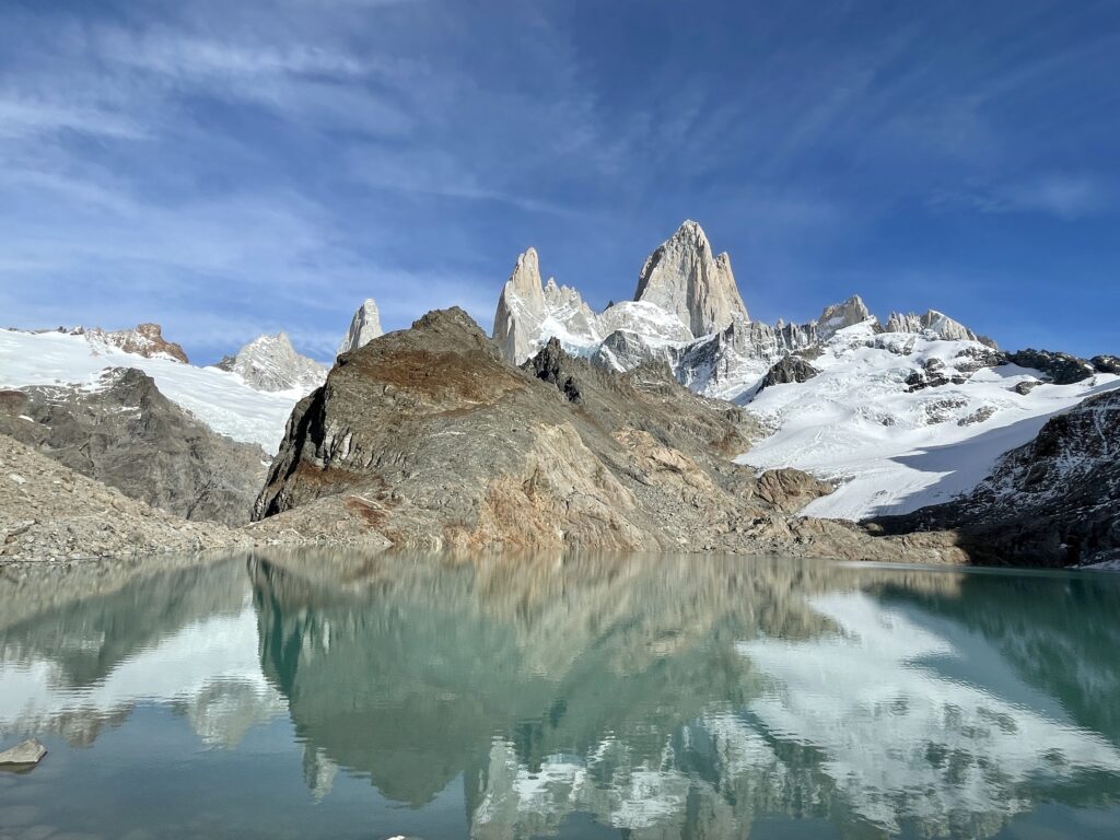
    Finally, after approximately 45 minutes, you will reach the end of the trail and be rewarded with stunning views of the lake and three towering peaks behind.

    Wooden footbridge on the trail to Laguna de los Tres
    Cerro Fitz Roy reflected in the turquoise water of Laguna de los Tres

    Chorillo del Salto

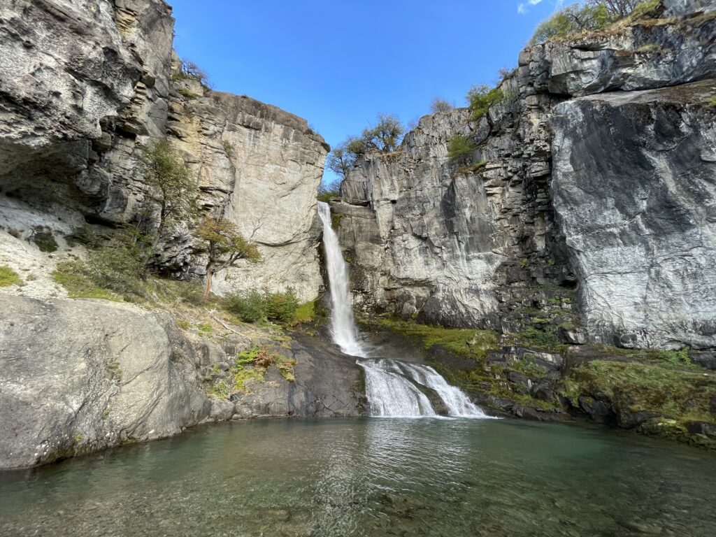
    This pleasant trek is perfect for a first contact with the natural environment of El Chaltén, you walk through a forest area in a footpath with no difficulty. At the end of the trail a lovely waterfall and its stream invite you to take a break for contemplation at the shelter of the native forest.The trail begins in El Chaltén, at the end of Av. San Martín, on the same trailhead towards Laguna De los Tres; You must take the path going to the right. In a short time the trail ascends and immediately after it descends until you reach the unpaved route that leads to the Lago del Desierto (Provincial Route 41). Shortly after you will find a signpost on your right hand side indicating the entrance to the “Bicisenda”(bike trail) -a path exclusively for cycling, do not enter- and after a few minutes more, you will see another signpost to your left indicating that the path to the Chorrillo del Salto continues crossing the low forest of Ñires entering the foothill area again.In less than half an hour you will reach the last stretch of the trail where there is a car park area; It means that you can also get here by car or bicycle. In the last section of the trail you enter only on foot, it is forbidden to enter with bicycles. This beautiful footpath is completely flat, between low trees. The distant sound of the waterfall anticipates that you are approaching the end of the route.The waterfall is on the last leg of the Arroyo del Salto, before it flows into the De las Vueltas river. The total distance of this trek is less than 4 km from El Chaltén.
    Braided river and clouds in the valley below El Chaltén
    The Chorrillo del Salto waterfall near El Chaltén

    Mirador de Los Condores - Mirador de Las Aguilas

    Starting from El Chaltén, you cross over the access bridge of the Fitz Roy river and then continue along to the trailhead starting at the National Park Visitors’ Centre. After a short walk you cross a small gate with a sign indicating the way to the left, and a few steps further you will see a second sign showing you the trail plan. From here it will be another half hour until you reach the Los Cóndores viewpoint. This footpath is relatively new, since it has been opened in 2004. It is well signposted and on its way you will find several informative signs that will let you appreciate the landscape around you. As its name indicates, the viewpoint is strategically located for the eventual observation of condors in their frequent flight between the valleys of the De Las Vueltas river and the Fitz Roy river. Furthermore it is an excellent alternative for admiring the impressive granite peaks and glaciers dominating the horizon.
    Ridge trail towards the Mirador de los Cóndores, El Chaltén
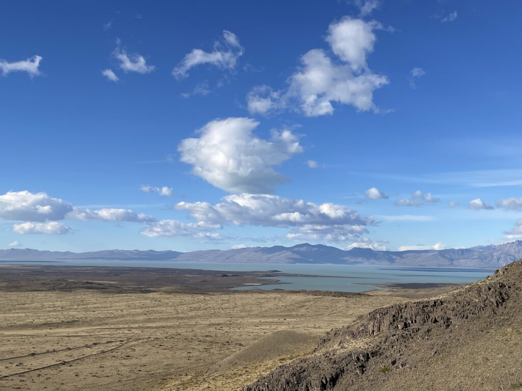
    View over the Patagonian steppe from the Mirador de las Águilas
    The trail to the Las Águilas viewpoint begins at the signposted bifurcation about ten minutes before arriving at the Los Cóndores viewpoint. This short trail has a gentle slope and as you go along you will discover the great Viedma lake on the horizon. The viewpoint is a natural balcony with a panoramic view over the steppe and the Viedma lake to the south, the Cerro Huemul to the west and the Cerro Piramide to the east.

    Cerro Torre - Laguna Torre

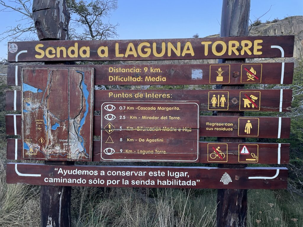
    From El Chaltén there are two head trails to Laguna Torre ; both paths merge within 5 minutes walk. Although the trek to the lake is quite long – 9 kilometers one way, the trail gains only 250 meters in elevation during this distance, and the majority at the beginning of the trail. The trail enters the valley of the Fitz Roy river and follows up alongside the stream to its source. At only 15 minutes walk you will access the first viewpoint located at the gorge of the Fitz Roy river which offers an impressive panoramic view of the Cerro Solo, Adela range, Cerro Torre and the Mount Fitz Roy. Across the river canyon lies the Margarita waterfall. Once you get to the Mirador Cascada Margarita, the first viewpoint, the hike from this point is not demanding, and you will walk mostly on a flat path, with occasional up and down sections.

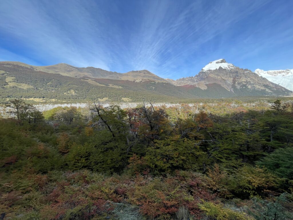
    Autumn forest below the peaks on the Laguna Torre trail
    Trailhead sign for the Senda a Laguna Torre, nine kilometres
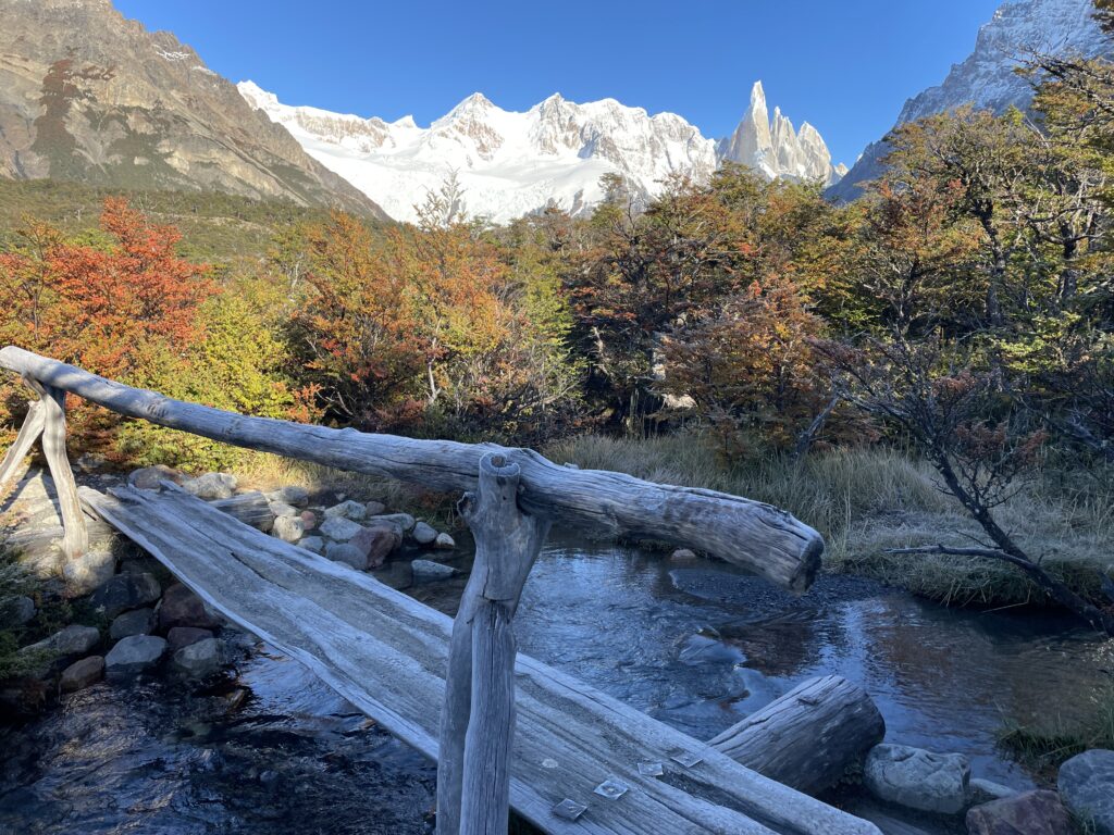
    Wooden bridge among autumn trees on the Laguna Torre trail

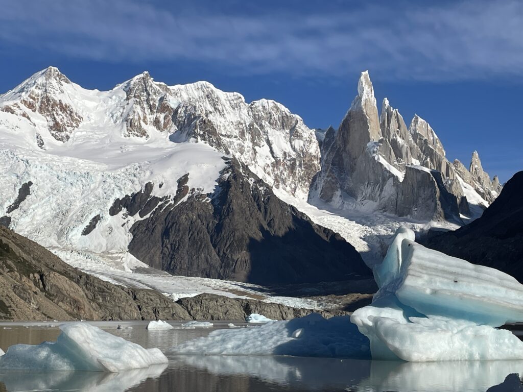
    Halfway through the path you will reach a natural viewpoint with magnificent panoramic views of the Adela range, Cerro Torre and the satellite granite needles. Finally the trail crosses the De Agostini base camp where it is possible to spend the night in your tent.

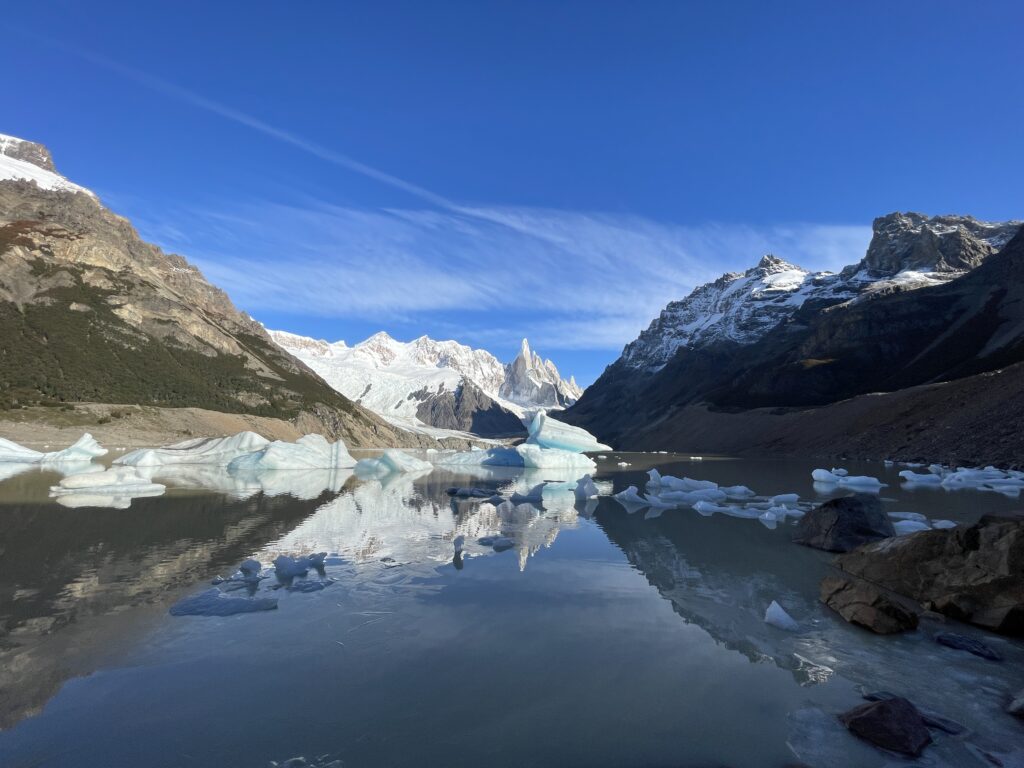
    Leaving behind the campground, the path continues towards the frontal moraine, which ascends until reaching its crest after walking for 15 minutes. From there it is possible to go down to the Torre lagoon. This lagoon tends to group numerous icebergs on its shore which has fallen off from the front face of the Grande glacier.

    If you have enough energy and want to get a better view of the glacier, it is possible to extend the trip and climb up from Laguna Torre to Mirador Maestri. This detour will add approximately 2 kilometers one way (depending on how far you want to go) and a minimum 1 hour.

    Icebergs floating in Laguna Torre, Patagonia
    Cerro Torre and its neighbouring spires above the glacier

    Other treks

    Loma del Pliegue Tumbado

    The trail starts at the National Park Ceferino Fonzo Visitors` Centre, where a small fence indicates two paths: to the left, the trail goes to Los Cóndores and Las Águilas viewpoints, and to the right towards Pliegue Tumbado and Laguna Toro / Paso del Viento. This trail maintains an ascending slope of approximately 1100 metres in total (3,610 miles), until reaching the viewpoint located at about 1500 metres (4,920 feet) above sea level.  Due to its height, the absence of trees and the total exposure to the wind, you should go prepared with a windproof jacket and warm clothes since a small snowfall is not uncommon even in the middle of summer. Having walked for about an hour, the trail crosses a plain called “Pampa De las Carretas”, from where you can appreciate the impressive Mount Huemul, the Viedma lake to the south and the whole imposing Andes to the northwest where Mount Torre and Mount Chaltén stand out. The trail then enters a beautiful forest until reaching an altitude of approximately 1000 metres above sea level, where the landscape changes abruptly: the trees turn to bushes and scrubby vegetation, and among the many stones on the way it is possible to find the remains of marine fossils which are bout 100 million years old. The last part of the trail fades away but it is still marked with yellow sticks until you reach the top of the Pliegue Tumbado -which can be snowed and if this is the case it is not recommended to continue- with an extraordinary panoramic view.

    Huemul Glacier - Lago del Desierto

    This trek takes place in the Southern region of Lago Del Desierto, 37 km from El Chaltén. To get there you can take the services of private transfers. This trek is the usual option for those who arrive at the lake and have little time to spend in the area. You will be able to enjoy the extraordinary views of the north face of Mount Chaltén and the valley of the De las Vueltas river. The trailhead starts a few metres away from the free parking area. Remember you must pay the entrance fee since the entire trek is in private property. The footpath quickly enters the Lenga forest and after a few minutes it begins its ascent on a well-marked trail. n little more than half an hour you will reach a moraine ridge with breathtaking views of the De las Vueltas river valley and the Mount Fitz Roy. Towards the NE you will see the Lago del Desierto and the snowcapped mountains of the Del Bosque range. After walking along the moraine ridge for about 15 minutes you will arrive at the beautiful Huemul lagoon, fed by the glacier of the same name.

    Comments Off on Parque Nacional Los Glaciares
  • Adventures,  Europe,  Italy,  Places,  Tour du Mont Blanc,  Val d'Aosta

    Val d’Aosta

    Lorem ipsum dolor sit amet, consectetur adipiscing elit. Ut elit tellus, luctus nec ullamcorper mattis, pulvinar dapibus leo.

    Gran Paradiso National Park

    Day 1 – Colle del Nivolet and lakes tour

    It’s the Aostan access to the Colle del Nivolet where you will find the Rifugio Savoia, built in 1860 as a royal hunting manor. From the parking in Port Valsavaranche, yellow signposts point to the start of the dirt path to the Colle del Nivolet. The pathway climbs in a forest of larches, passes a beautiful waterfall and becomes steeper and steeper until the panorama opens up onto the Gran Paradiso glacier. Few bends of the pathway will take you after 1 hour walk to the Arolley Cross (2310 m). Going on, you will walk the open plane of the Nivolet, a 6 km path surrounded by an open nature that reminded us of the Hobbit’s Shire. Walk along the river until you reach the Rifugio Savoia, on the shores of the Lake Nivolet.

    Book in advance your bunkbed at the Rifugio Savoia for the night, you will need an early start on Day 2 for the Basei glacier. The Rifugio is not your typical mountain hut with warm people, it’s on the main road and its customers are mainly bikers, but it’s clean and will do for one night.
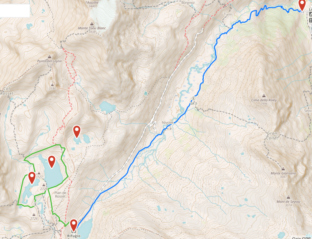
    Spend the afternoon exploring the lakes behind the Rifugio. This lakes tour is a magnificent itinerary, not too tiring but instead with an awe-inspiring landscape. Once you have reached the peak of the Colle del Nivolet you have admired the two lakes of Nivolet in front of the Rifugio; now follow the right-side dirt path on the back of the Rifugio (yellow signs) which with a gentle slope will lead you to the plane from where you can explore the three lakes. If you keep walking straight ahead of you, you will reach the Lake Rosset, a transparent pearl that is overhung by the Punta Basei and its glacier. Continue your walk and leave the first lake on your left to reach the Lake Trebecchi, the best place to admire the Gran Paradiso that is reflecting in its waters. Go back towards the Lake Rosset, walk along its shores towards the Punta Basei and you will arrive at the Lake Leita. During your walk you will certainly encounter groundhogs that spy on you from behind the colored flowerbeds.

    Day 2 – Punta Basei
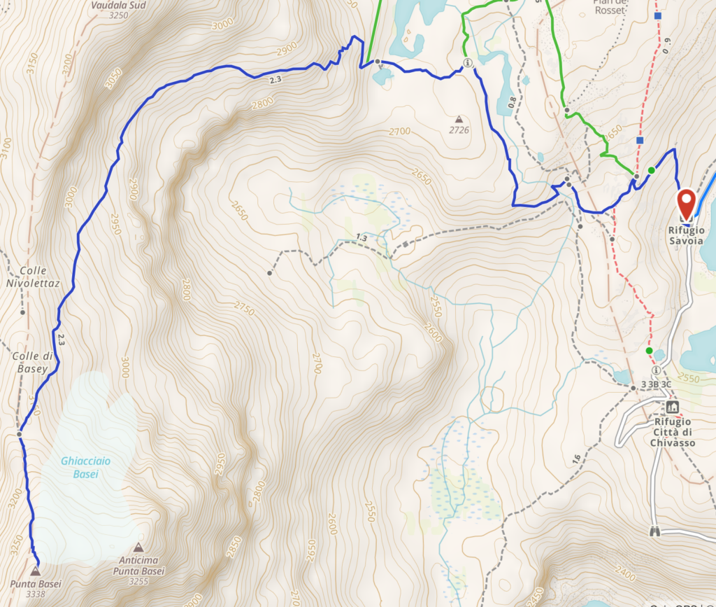
    An amazing climb in a varied and colorful panorama. The trek is to be considered alpinist only in its final portion that requires some skills on ice and rock climbing, and some equipment (tampons and picks). The path starts behind the Rifugio Savoia and gently rises on a hill next to the Lake Leita (2700 m). At the left edge of the Lake Leita the path starts a steep climb to reach a crossroad where you will take the right path. After a section with lots of debris you will reach a plane  from where you can admire the small Basei glacier (your goal) and the Lakes Nivolet below (your starting point). Keep following the path and you will reach the edge of the glacier. Here you can decide whether to continue left and cross the glacier to the peak, or walk towards the right side and the crest of the mountain where in the summer season the terrain is cleared of ice. In the second case, while ascending with the help of fixed metal ropes, you can admire on your right the Val di Rhemes. In few minutes you will reach the cross at the peak of the Basei (3338 m), on of the most panorami peaks of the Gran Paradiso National Park, with a 360 view on the Gran Paradiso, Cervino, Monte Rosa and Monte Bianco.

    Day 3 – Aosta

    Lorem ipsum dolor sit amet, consectetur adipiscing elit. Ut elit tellus, luctus nec ullamcorper mattis, pulvinar dapibus leo.
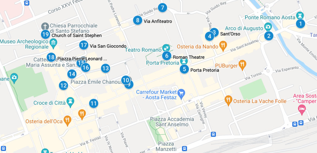
    Our tour starts at at the Arch of Augustus (2), the entrance door to the Italian peninsula during the Romans times. It was built to celebrate the victory of Augustus emperor of the 25 BC. The pitched roof is from 1917 and the crucifix above from the XV century. Keep walking beyond the Arch and pass the river Buthier to admire an original Roman bridge (1). The street that now starts from the Arch is via Sant’Anselmo, the heir of the Roman decumanus that was the backbone of the city: keep walking along it and on the right (still outside of the original Roman walls) you will reach the Church of Sant’Orso (3), the most famous religious site of the city of Aosta and still a pilgrimage stop for those walking the Via Francigena.

    Once you reach the Church, on your right side you will see the tickets stand for the cloister: while you’re queuing for the tickets, admire the three buildings and the octagonal tower that form the priory in which you are standing. It was built by Giorgio di Challant (the noble aostan family of the Middle Ages) in 1468. The tickets will allow you a visit to the cloister, surrounded by 52 capitelli built from 110 onwards, that tell the story of the life of Saint Orso. A written legend outside of the cloister gives detailed explanation to each capitello. To the left of the cloister, the Church of Saint Orso dates to the year 994: walk the three navels and admire the wooden choir and the glazed windows.

    In front of the Church, stop to admire a 400 years old linden and follow the small road to the paleo-christian Church of San Lorenzo (4), now deconsecrated, that hosts in the  basement a nice archeological tour of the original church remains and of the adjoined burial ground.

    Back to Via Sant’Anselmo you will reach the Pretorian Doorway (5), the true monumental entrance to the Roman city. Enter through one f the three arches and you can still feel the grandiosity of the Roman Empire. Once you are inside the Roman walls, on your right you will be able to admire the Roman Theatre (6) that during the I century BC could host an audience of 3000 people. Its grandiosity had the scope to leave in awe whoever was entering the Roman Empire from Gaul.

    Keep walking to Torre dei Balivi (7), the residence of the Savoia representative in the city during the 1200, and turning left you will see the remains of the amphitheater (8) of the I century DC. Another left turn will take you to Piazza Chanoux (9), the heart of the city, built under the rein of Carlo Alberto of Savoia. This huge piazza is the heart of the modern Aosta, where ceremonies, expositions and markets are held. The Hotel de Ville (10) occupies nearly 140 meters of the right side of the piazza. The neoclassical facade is characterized by porches. Being a public office, you may be just able to glimpse the staircase and the ample salon.

    Exit the piazza by via Jean-Baptiste de Tillier (11), continue to via Croix de Ville (12) and via Monsignor de Salles (13) to admire the neo-classic buildings, and remember that Calvin flew Aosta from these streets once he failed to convert the city. You will reach piazza Giovanni XXIII (14) that act as a stage for the criptoportico forense (15) and the Cathedral (16).

    On the left side of the piazza, by a staircase, you will gain access to the monumental gallery that forms the criptoportico (a hidden porch, basically), that has an horse-shoe plant and had the initial scope of an indoor walk. Between the III and IV century, it became a storage area. When we visited Aosta, the Cathedral (16) was closed but maybe you will have better luck.

    Continue your visit to via San Giocondo (17), that used to be the religious part of the city, and reach piazza Roncas (18)that used to be the cardo maximus through which Romans could reach the passo del Gran San Bernardo. On one corner of the piazza you can admire an hidraulic wheel that works over a small channel of Roman origins.

    Last stop of our itinerary is the Church of Saint Stephen (19), now outside of the Roman walls, that has a massive wooden statue of San Cristoforo inside.

    Monte Bianco

    Day 4- Val Veny “Balcony”

    Equivalent to anti-clockwise stage 4 in Kev Reynolds’ TMB (Tour Mont Blanc) guidebook. This stage can be walked independently, not as part of the whole 10 day trek. Features a moderate 600m/600m elevation gain/loss, and spectacular and continuous views of the Italian side of the Mont Blanc (Monte Bianco). Total walking time of the full day hike as marked: 5-6 hours excluding optional detours (Lago Miage and Rifugio Elisabetta). Generally recommended from June to September, but check weather forecast and avoid in bad weather.
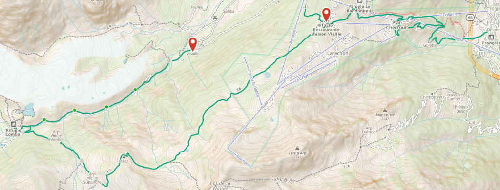
    Get to La Visaille (1800m) at the top of the Val Veny valley road. Either drive all the way up and park between the bridge and the closed gate, or take the hourly Val Veny bus from Courmayeur to the last stop. 
    Walk up the valley for about an hour (ascending about 200m), and connect to the main TMB trail near Combal (2000m). Optional 30 min detour to Lago Miage (recommended).
    Ascend along the TMB for about an hour to the highest point of the trail (2400m), then descend to Rifugio Maison Vieille (2000m).
    From Rifugio Maison Vieille you have several options:
    a. Easiest: Descend to Courmayeur (1300m) using the Dolonne cable car in July-August only: http://www.courmayeur-montblanc.com/?
    b. Longest: Descend to Courmayeur (1300m) on foot, following the main TMB trail
    c. Shortest: Descend straight to Val Veny valley (1700m), where the aforementioned bus has multiple stops along the valley road.
    d. Closing the loop: Descend back to La Visaille (1800m), where your car is parked – this route is marked on the map.
    For options C and D – take trail number 6 which goes north-west from the Rifugio clearing.

    Day 5 – Dent du Geant and Aiguille du Midi

  • Adventures,  Camping,  Liwa Oasis,  Middle East,  Places,  United Arab Emirates

    Liwa Oasis

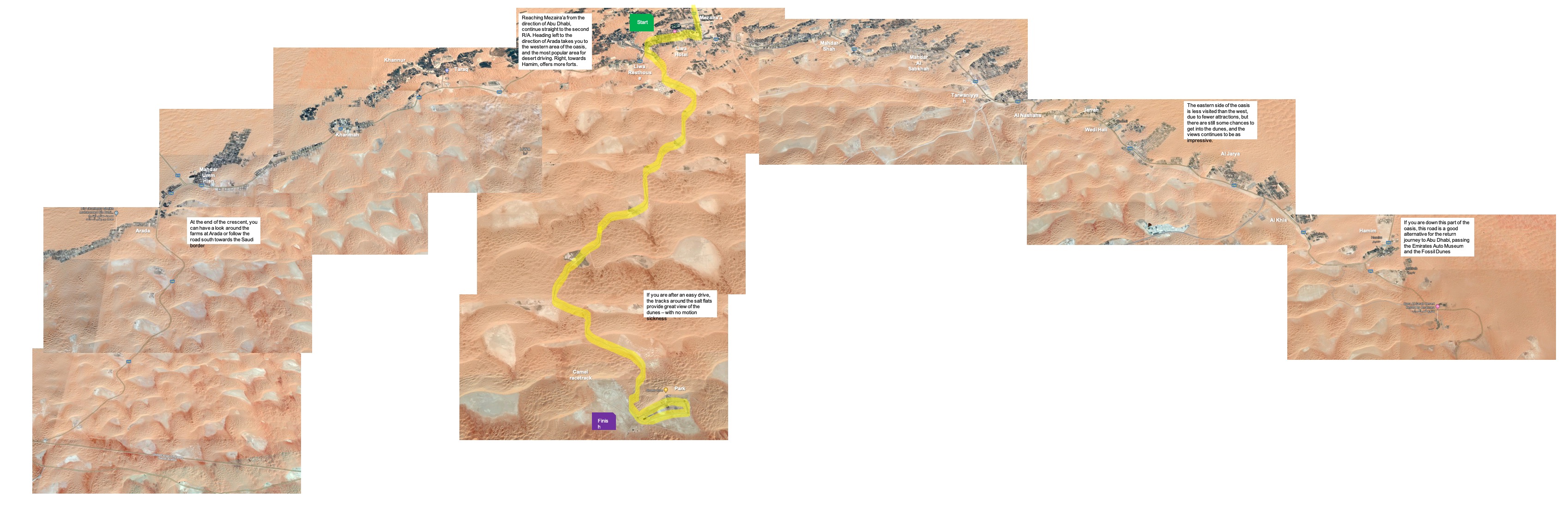
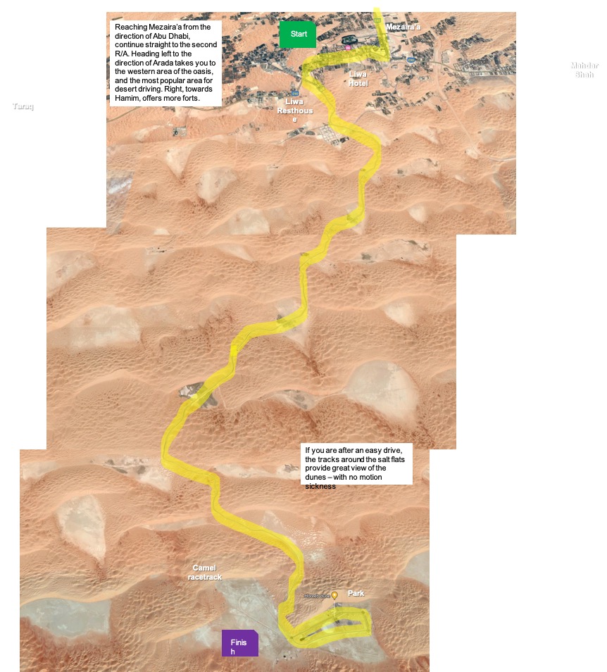
    A trip to Liwa in the Empty Quarter (or Rub Al Khali) is a must for any off-roader during their time in the Middle East. It’s the biggest sand desert on the planet. The sheer scale of the scenery and the size of the dunes has to be seen to be believed. This epic route is more of an expedition than just a spot of camping, so go prepared for the experience of a lifetime.

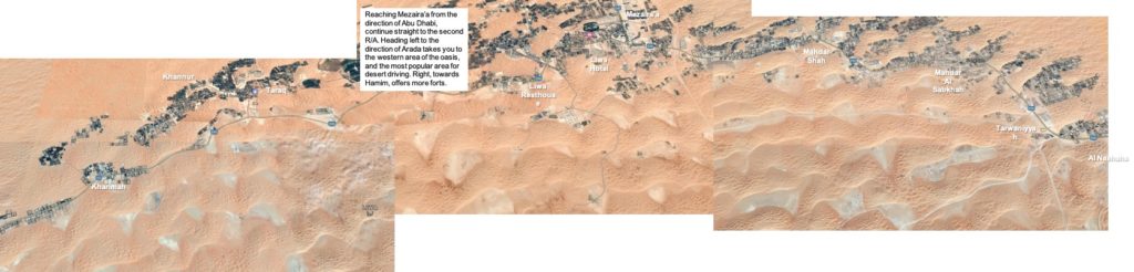
    Home to the Bani Yas tribe, ancestors of the current ruling family of Abu Dhabi, the fertile Liwa “crescent” stretches over 150 km, and is dotted with small villages. Mezaira’a, at the center of the crescent, is the largest settlement and if you are heading into the desert, the shops and the petrol station here will be your last chance to buy provisions and fuel, so stock up. Extra jerry cans of petrol are essentials and it’s better to take too much food and water than too little. Four our camping night we took 10 L of water that we used for drinking, washing and cooking.
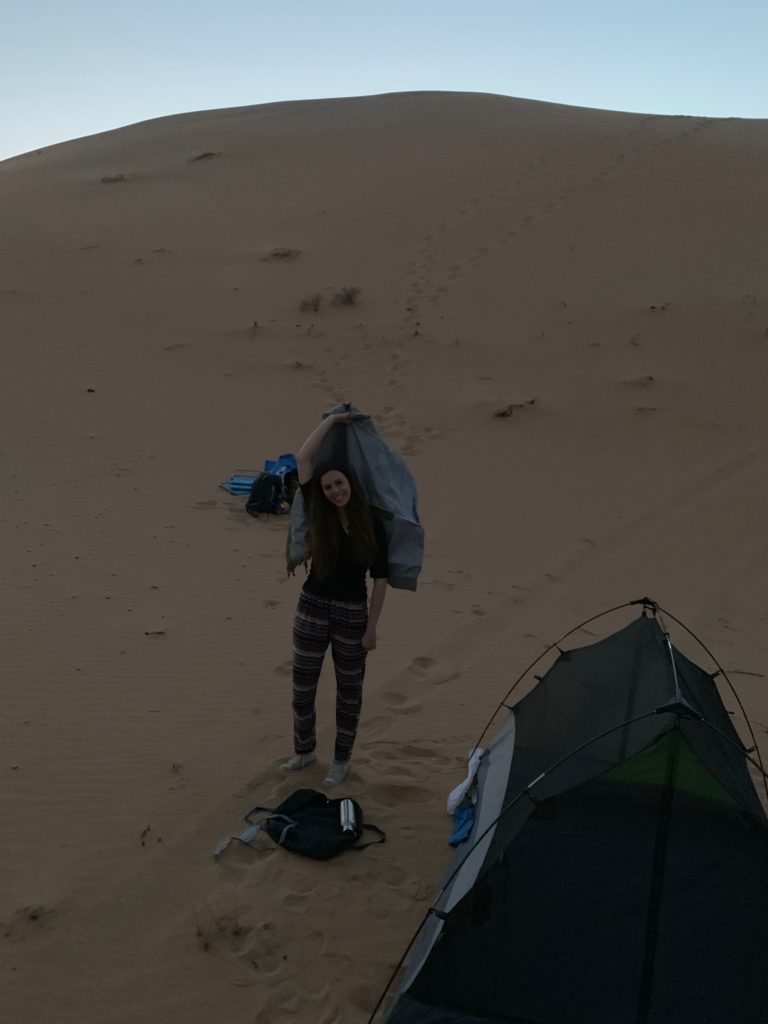
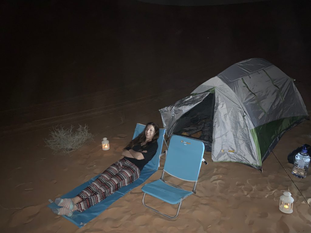
    An essential part of any Liwa adventure, camping in the desert is the most popular way to spend the night and can be a truly unforgettable experience.

    Waking up to miles of sand rolling into the distance or the sight of the snaking silvery dunes under the moonlight is quite magical. This area provides some of the best desert views in the UAE.
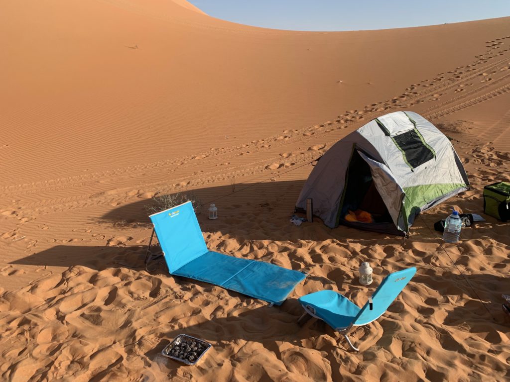
    You can camp just about anywhere, so take any of the roads and tracks into the desert off the main road through the oasis. Just make sure you drive far enough from roads, habitations and activity to find a peaceful spot and get settled, long before the sun goes down.

    One particular good area is on the road to Moreeb Hill, passing the Liwa Resthouse.
  • Adventures,  Middle East,  Places,  Safari,  Sir Bani Yas,  United Arab Emirates

    Sir Bani Yas

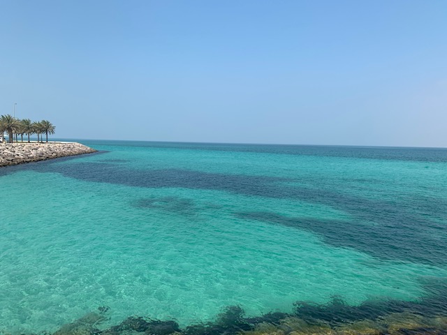
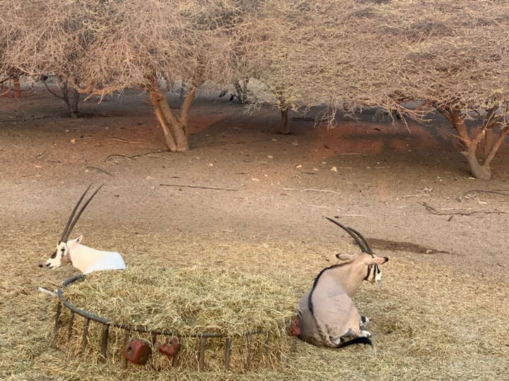
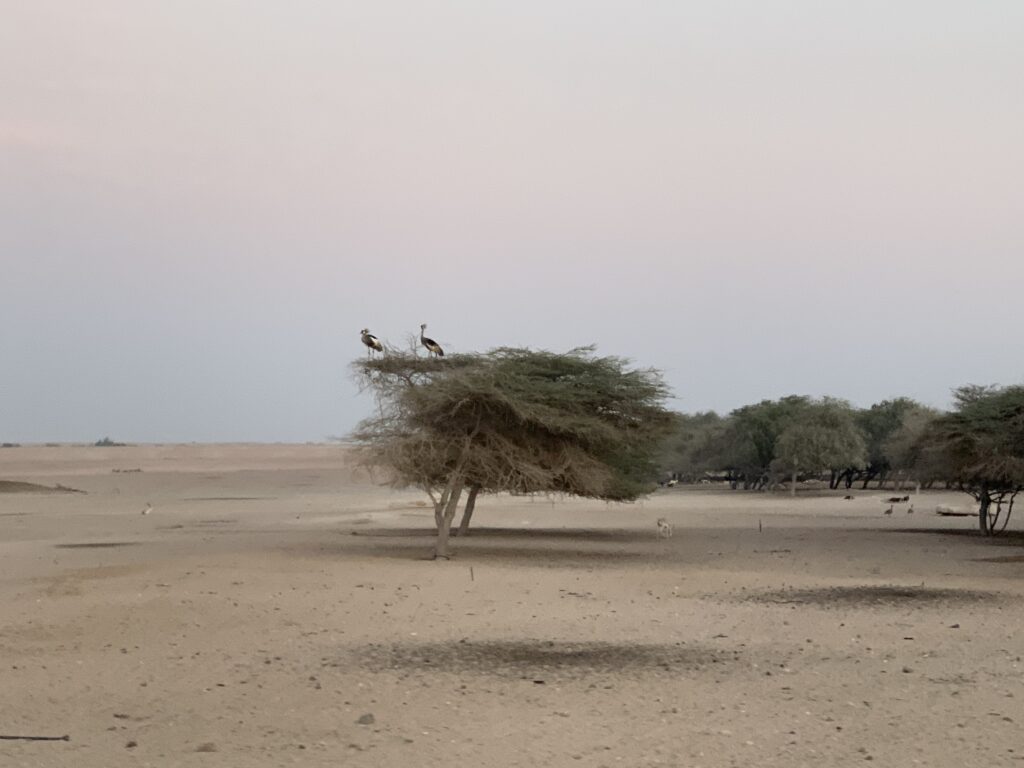
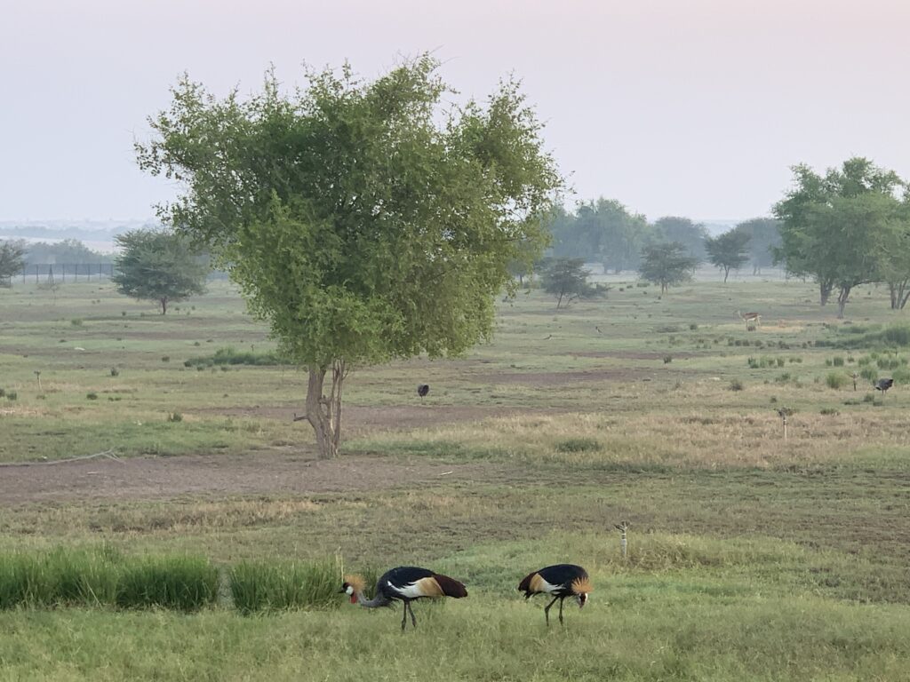
     Sir Bani Yas is an  island about 150 miles southwest of the United Arab Emirates capital of Abu Dhabi and it’s certainly not your standard stop in the desert. Not long ago, this 30-square-mile island—the biggest of eight Desert Islands just offshore—was abandoned. The Bani Yas tribe, who first moved here 7,000 years ago, left it for good at least a century ago. In the early 1970s, you could still see why. There were no trees or freshwater sources here; just craggy rocks and bare shorelines lapped by the waves of the Arabian Gulf. That’s when Sheikh Zayed bin Sultan Al Nahyan, the UAE’s founder visited and made a bold plan. He’d transform it into a nature reserve to give sanctuary to endangered animals of the UAE, Africa, and beyond. Since the death of Sheikh Zayed in 2004, Sir Bani Yas has been transformed into a wildlife park. More than 350 km of original fencing has been torn down to create an ‘open range’ safari feel on the refurbished island. Some creatures, such as the spotted deer and the athletic sand gazelles, roam wild – hence the 50km/h speed limit on the single lane, paved road – while others, such as cheetahs, are contained in sprawling, expansive pens. You can almost mistake the scene of oryxes, gazelles, hyenas, jackals, and cheetahs for a Kenyan savanna. 

    A two-and-a-half-hour drive from Abu Dhabi via the E-11 highway will allow you to hop onto one of the four short, daily ferry rides (departing at noon, 3 p.m., 6 p.m., and 11 p.m.). We took the earliest, so as to be able to still make the most of the afternoon ahead of us. Three resorts dot different parts of the island. We had reserved Desert Islands, a bigger resort on the north shore of Sir Bani Yas, set up at Sheikh Zayed’s former vacation home. And indeed the Hotel has a decor of Arabian, Asian and African influence, apparently designed to look as if Sheikh Zayed himself decorated it with exotic artifacts from his travels.The ground floor room was spacious and comfortable, with a broad balcony overlooking the sprawling pool. 

    Once you reach the hotel, there are so many activities to choose from that you run the risk of forgetting about the beautiful sandy beaches of the island. 

    Whilst the beaches are beautiful and it’s great to spend some time relaxing, everything is geared more towards getting out and making the most of the landscape, whether on dry land or in the water. And there is something for everyone with history and culture tours (there’s an ancient Christian Monastery on the island dating back to 600AD), kayaking, diving, snorkelling, horse riding, archery, nature walks, wildlife drives and mountain biking among other. 

    After booking our 2 activities for the weekend, we spent a couple of hours at the beach which, despite the hotel pool heaving with overnighters, was absolutely deserted.

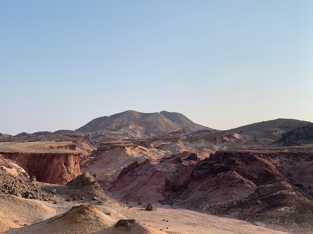
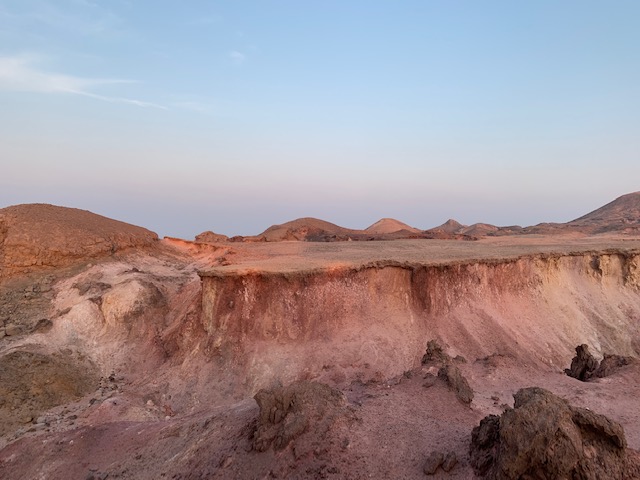
    We started our exploration of the island around 4:30 pm with a guided walk through a narrow, lunar-like wadi (valley or ravine). A wadi is technically a dried up river bed. The 90-minute walk rises slightly amidst the salt that in the century has risen from the depth of the island towards the surface, thus creating patterns of twisting rocks and shadowy crags that boast a rainbow of colors from the reddish hues of oxidized iron mixing with yellows from sulfur, purples from magnesium, green from copper and some sparkle from hematite on the red-rock floor.

    Although seemingly quite flat from the road, the landscape does boast some impressive rock formations and offers a completely different perspective from high up. The wadi is mostly made of salt and is therefore quite bare of vegetation. The crunching sound under your feet is the gypsum, the salt from which plaster is made of. Gypsum is white but it gets some color from the other neighboring minerals. We learnt from our guide that plaster differs from chalk in that the former can become solid again (as in plaster casts) while the latter does not have this ability.

    You’ll have no choice but to eat in the hotel while staying here – it is quite literally in the middle of nowhere. Don’t fear though, because you’ll be spoilt for choice with the food on offer. You can choose from a huge breakfast buffet at The Palm all-day-dining restaurant where the friendly chefs will whip you up a made-to-order omelette. For dinner there are a few options. We did a catch buffet barbecue at Amwaj. Set right on the beach, a small walk from the hotel, its décor is pretty special with cosy, oversized chairs and sofas on the terrace creating a relaxed vibe that makes you feel a world away from Abu Dhabi.

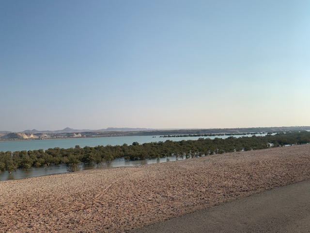
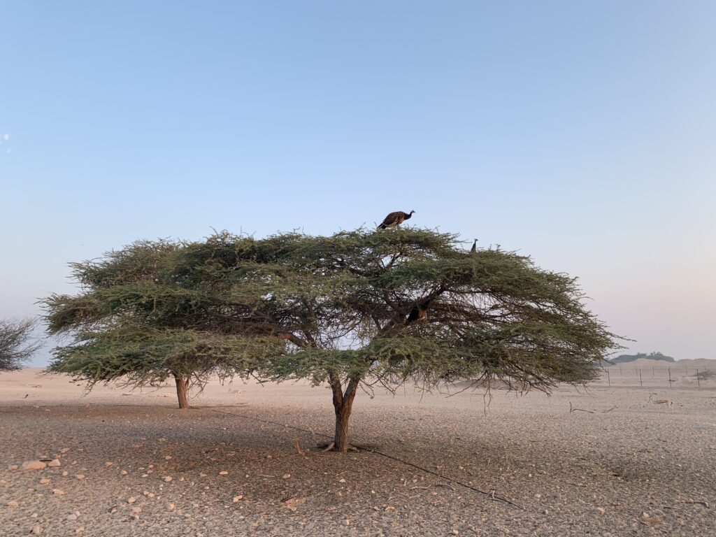
    The Arabian Wildlife Park safari that we did early morning of our second day is the highlight of any visit. Up to half a dozen guests jump into an open-sided Land Cruiser to make leisurely 90-minute drives.  The windows are open and the roof lifts up so you can be sure to get close up and unobstructed views of whatever you may be lucky enough to see. While you are driving towards the gated areas of the park, it is difficult to imagine that in the beginning there were only 70 dates trees in the island while now there are over 2.5 million trees—like the umbrella thorn acacia, olive trees, apple and pear trees, or the gum tree that the eland antelope are so drawn to— planted by hand. The pipeline system to irrigate this vast area (mostly made of salt, do not forget about it) extends over 73,000 miles. In addition, the resorts plant a mangrove for every guest.

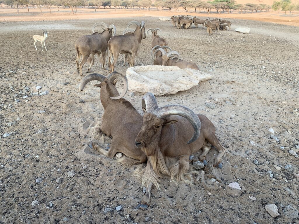
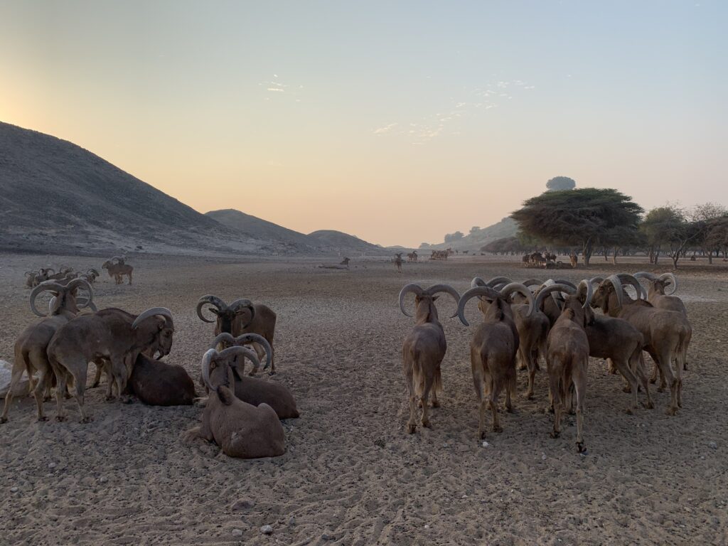
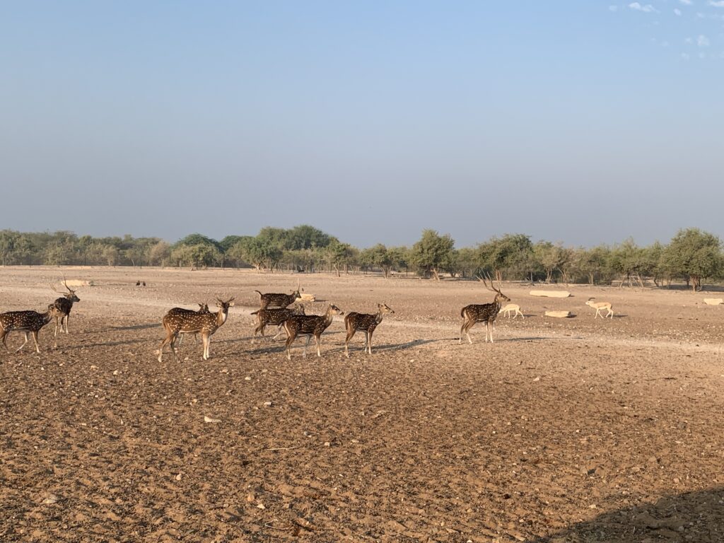
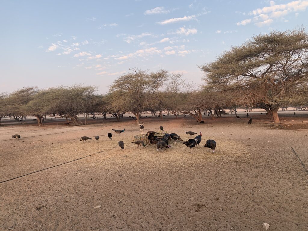
    Wildlife is literally everywhere on the island, and even before venturing behind the gates of the wildlife park we’d seen plenty of Sand Gazelles (the namesake of Abu Dhabi) and Arabian Hyrax to name only a couple. The Arabian Hyrax are actually the whole reason why Sheik Zayed created all this: they were a symbol of the gulf, nearly extinct 40 years ago, and now thanks to Sir Bani Yas no longer endangered. Behind the gates, this must be about as close as you can come to a safari outside of Africa, where 16 thousand of beasts of 27 different species now live, including Indian Black Bucks (the fastest one, at 87 km/h), Sand Gazelles (the most numerous), Barbary Sheep, Arabian Oryx (with their straight horns), peacocks (the blue ones are from India, the green ones from Burma) and Spotted Deers (those are antlers, not horns!). 

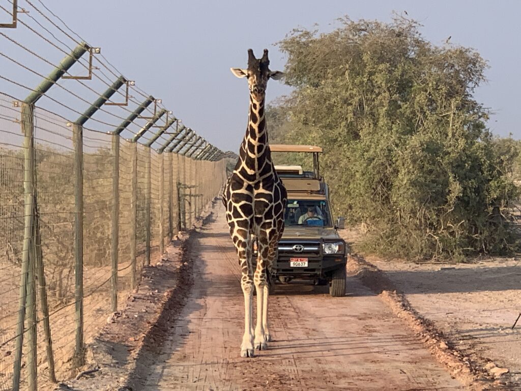
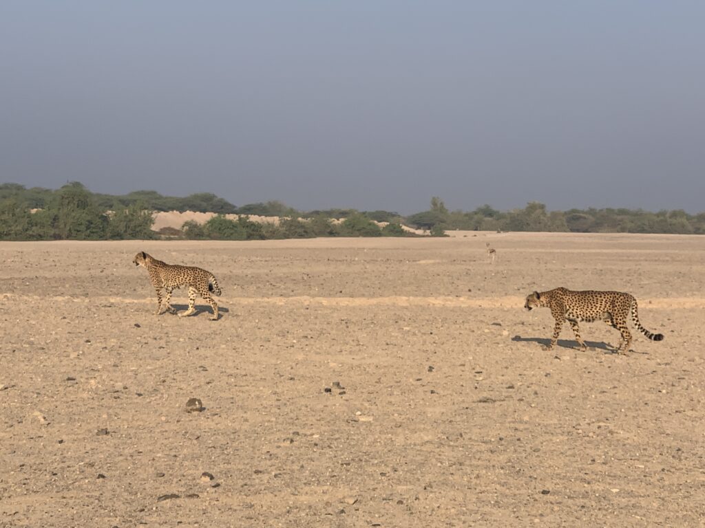
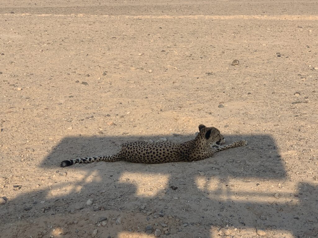
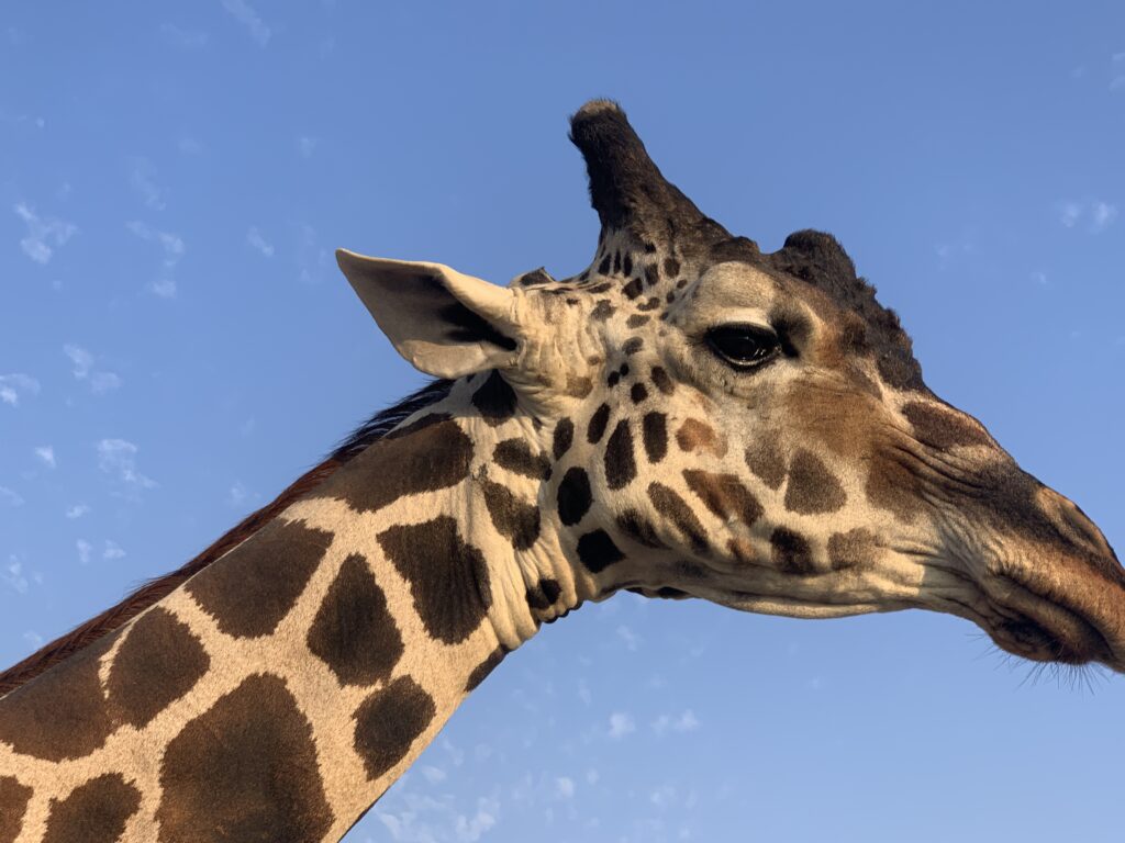
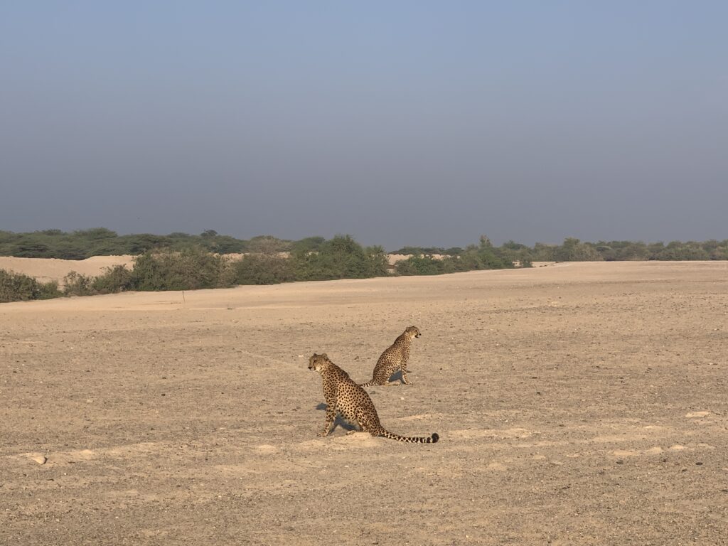
    After reaching the top of the mountain that stands at the center of the island (1040 ft), on the other side of the island we had a close-up encounter with reticulated giraffes. But the highlight of the safari was for certain getting to know the 3 cheetahs that roam the park (5 more will soon be coming). With an initial jump start of 7 meters, they can reach 120 km/h in 3 seconds and are really elegant and impressive felines. Two of them are brothers, Gabriel and Gibbs; you will easily recognize Gibbs from his limping. They are the perfect example of teamwork, with Gabriel running to catch the prey and Gibbs doing the killing. The third cheetah is Cuba, he lives by himself since he is not related to the other two and the Park wants to avoid fights among these endangered predators.


  • Adventures,  Europe,  Lake District,  Places

    Lake District

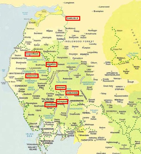
    Map of the Lake District showing the eight-day route

    Day 1 - Carlisle

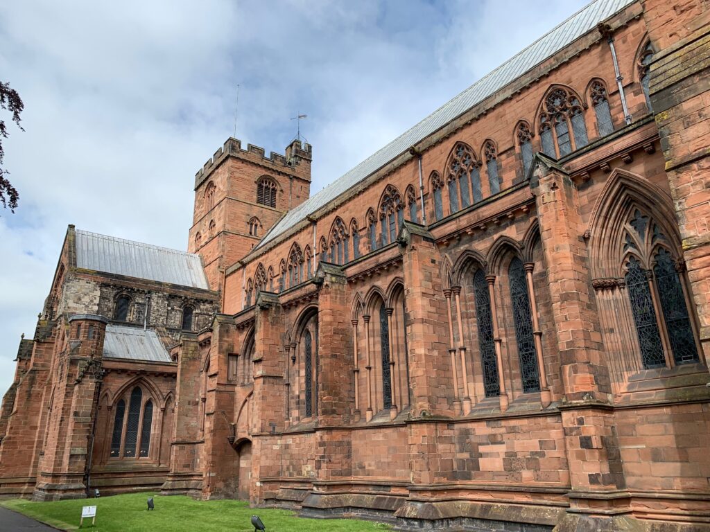
    Small streets with semi-detached house surround the ancient hear of this small border town, still intact and fascinating behind the window shops of the pedestrian center. Neither chic nor cosmopolitan, Carlisle is typical with a strong sense of belonging, and the little nut splendid cathedral that constitutes its spiritual heart.

    Old Town Hall and market cross in Carlisle city centre
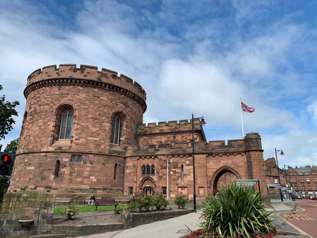
    Round sandstone gatehouse of Carlisle Castle

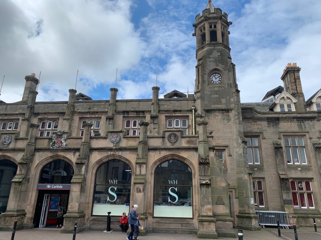
    Start your tour of the town at the train station and admire its beautiful gothic Tudor facade, designed by Sir William Tite (architect of the Bank of England). Right behind you it’s impossible to miss the two oval towers (1810) that constitutes the entrance of the ancient citadel and that used to host a court and a jail. Pass between the towers and walk English St toward the mall. In the middle of the pedestrian street you will see the Carlisle cross (1682). The Tourist Office is here, hosted inside the Old Town Hall built in 1122, with a replica of the first victorian postal box of England, installed in Carlisle in 1853.

    Make a right and enter the red and grey bricked cathedral.

    Red sandstone exterior of Carlisle Cathedral
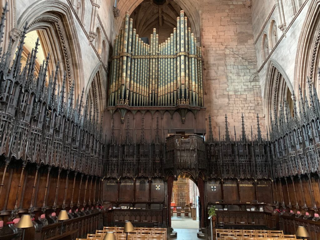
    Organ pipes and carved choir stalls inside Carlisle Cathedral

    The inside of the cathedral, made more splendid by the light that comes from the painted glass windows from the XIV century, will leave you speechless. Under the starry ceiling of the cathedral there is an mazing wooden choir and an organ with 200 pipes. We inquired about the timings of the services, and we attended a beautiful 45 minutes “concert” of organ and choir with music by Hendel.

    Clustered around the cathedral there are some nice XVII century buildings such as the Old Registry (1699), the Deanery, and the Fratry, a XIII century canteen where the monks used to eat.

    Turn left into Abbey St and pass the wrought iron gates of the Old Tullie House, a gallery and museum hosted in a 1689 palace. The lower floor hosts a roman exhibition, walking you through the roman conquer of Britannia and the building of Adrian’s Wall (that passes through Carlisle). On the upper floor the collections are dedicated to the social (the importance of the railway), archeological (Bonnie Prince Charlie and Robert the Bruce, the bandits at the scotch-british borders and the “curse” stone with the angry words of the bishop of Glasgow) and natural history (with the skeleton of a whale discovered on the western beach of Cumbria) of the region. 

    The walk of the Gallery ends in the actual Old House, with paintings from the early 1900 hanging over the walls.

    A cafe just outside of the entrance can offer a nice refreshment.

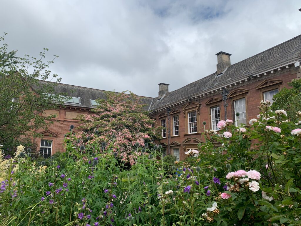
    Historic sandstone building and flower gardens in Carlisle

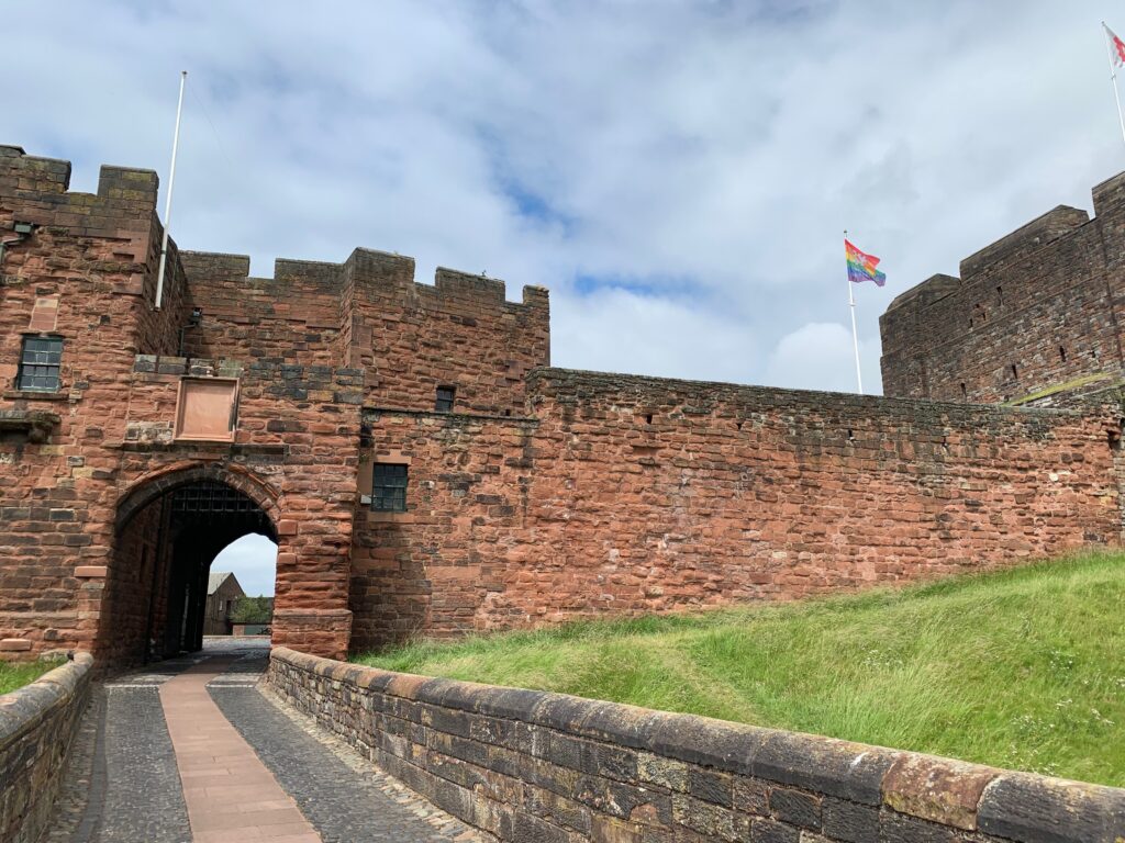
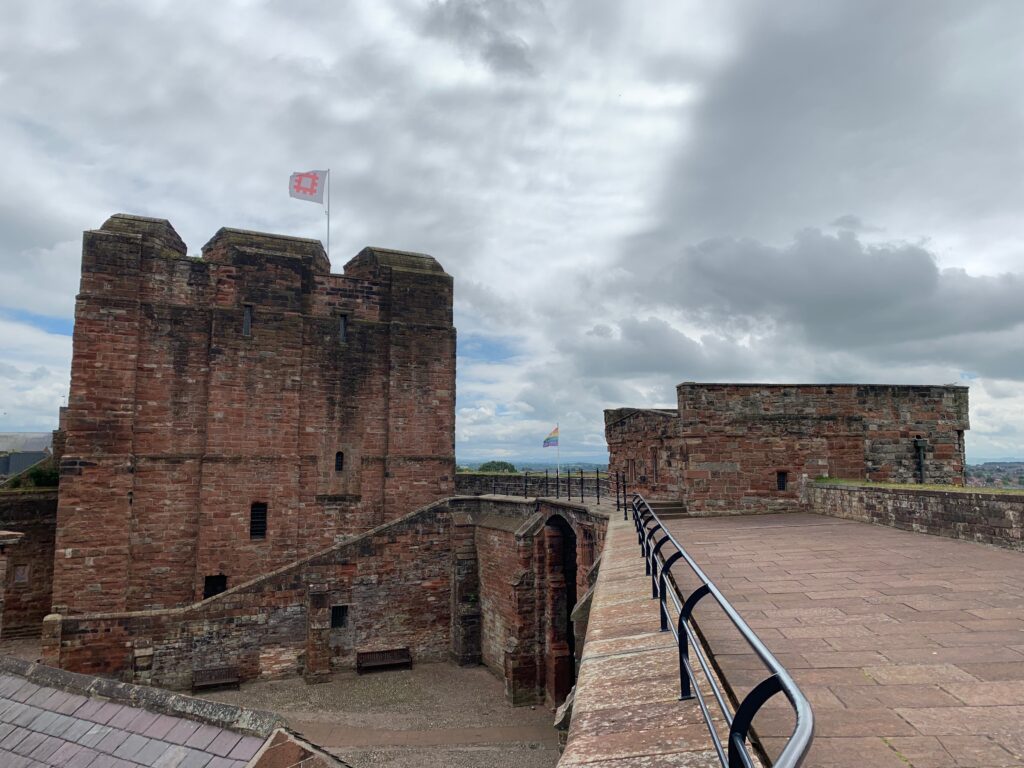
    Enter the Castle thought the XII century portcullis and admire the damp jails that hosted Mary, queen of Scotland. Walk along the walls of the Castle and breath in the medieval air.

    Gateway and curtain wall of Carlisle Castle
    Keep and ramparts of Carlisle Castle

    We spent a couple of nights at Warwick Hall Bed and Breakfast.

    Day 2 - Buttermere and Cockermouth

    At 50 minutes by car from Carlisle, the little village of Bittermere is set in between peaks and valleys at the intersect of the lake Buttermere (literally “lake of the milk pastures”) and the wider Crummock Water. Even before reaching it, enjoy the view while driving on the solitary B5289 that will make you feel in a Harry Potter movie. Park along the main road, and look for the Syke House farm, from where departs a beautiful hike of 12 km that will take you around the Buttermere lake and up a hill to the Scale Force waterfall, the highest in Lake District.

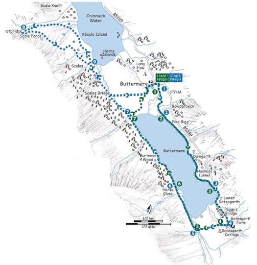
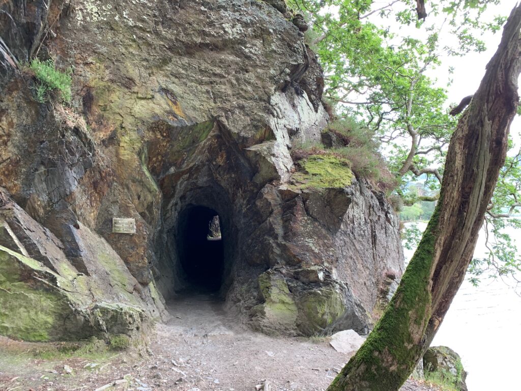
    Follow this small path (number 1 in the map) to the lakeshore path. Once at the lake turn left and follow the path all the way around the lakeshore: it will take you through the lakeside forest and through the Hassness tunnel util the end of the lake.  Here the pathway  rejoins the road (B5289), continue to follow it and turn right and follow the road to Gatesgarth Farm (number 4). Join the bridleway at the entrance to the farm and follow it across the valley bottom to Peggy’s Bridge. Cross the bridge and and turn right at the junction to join the Burtness Wood bridleway (number 5) that you will follow alongside the other shore of Buttermere lake until it splits at Horse Close just before the trees. Take the right branch by the lake and through the trees. There are lots of little bays which make ideal picnic stops in Burtness Woods. At the end of the lake, in case you are tired, turn right and cross the footbridge (number 7). The bridleway on the other side is followed back to Buttermere village.

    But if you still have the energy ignore the footbridge and continue along the bridleway beside Buttermere Dubs and then alongside Crummock Water (number 9), the second and larger lake. The lake has quite a few little islands: you will encounter the two Home Island first, before seeing the green Scale Island.

    Walking route map around Buttermere in the Lake District

    Opposite Scales Island the bridleway leaves Crummock Water and turns west to climb towards Scales Beck. It then turns southwest and climbs more steeply to the foot of Scales Force. There is a footbridge below the waterfall, admire the impressive cascade but it may be spoilt by people diving in it and bathing. Take a higher level path leading back down across the fell in an easterly direction to rejoin the bridleway beside Crummock Water. Once on the bridleway, retrace your steps as far as Scales Bridge. Turn left and cross the bridge following the bridleway on the other side back into Buttermere village to finish the walk.

    Hand-cut rock tunnel on the lakeside path at Buttermere
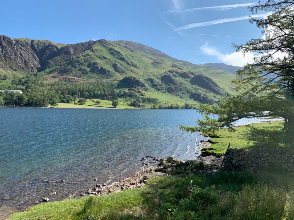
    Buttermere lake framed by the surrounding fells
    Wooden stile and gate on a green fellside path near Buttermere
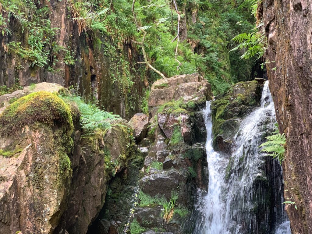
    Waterfall in a mossy ravine near Buttermere

    Reward yourself with a homemade ice cream at the Syke House Farm before taking the car towards Cockermouth.

    The little town of Cokermouth, at the confluence of the river Derwent and Cocker, is the birthplace of the poet William Wordsworth. After the long hike, book a tour of Jennings Brewery. The brewery was founded by John Jennings in 1828 in the near village of Lorton and it was such huge success that there was a need for a larger malting and building to house larger fermenting vessels. The nearest market town, Cockermouth, was the ideal base for the expansion. The Jennings brothers acquired several smaller breweries and public houses over the years. Unfortunately, today there is no longer any Jennings connection with the business, and in 2005 the independent brewery was acquired by Marston’s PLC.

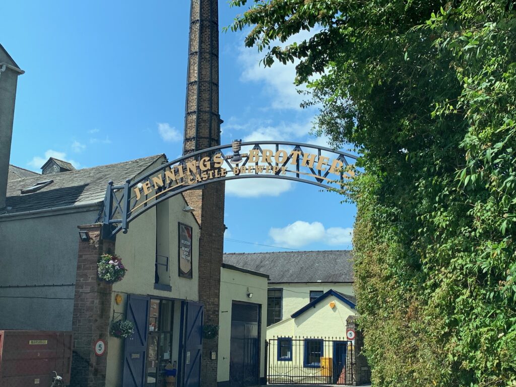
    Wrought iron arch over the main street in Cockermouth
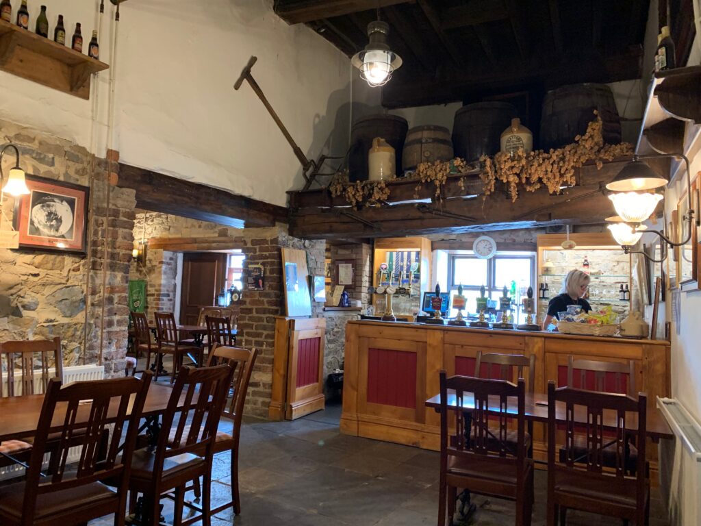
    Beamed interior of a traditional Lake District inn

    The 1-hour tour that starts in the bar walks you through the whole beer production. You will learn about the different qualities of malts that make the base of a good beer, you will taste the and understand how the toasted malt is responsible for the bitter taste of some beers. You will understand the technicality of “ale” versus “beer”, that lies in hops whose addition gives the nose to a beer. And finally you will witness the magic of yeast bubbling into the mix of malt and hops to transform it into beer. We strongly recommend taking the tour, it does not hurt that you will taste 3 of theirs half pints at the end.

    Right in front of the brewery, Cockermouth Castle is rarely accessible to the public. It is privately owned and opened only during festivals. However the Caste is mainly in ruins, better walk 300 m and visit William Wordsworth’s birth house. It not only is a beautiful example of a XVIII century house, but also perfectly preserved with local volunteers reenacting as maids and cook.

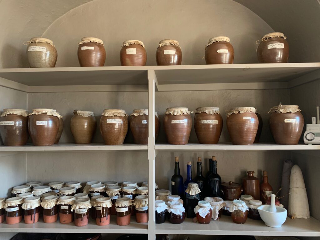
    Shelf of ceramic storage jars in a Georgian kitchen, Cockermouth
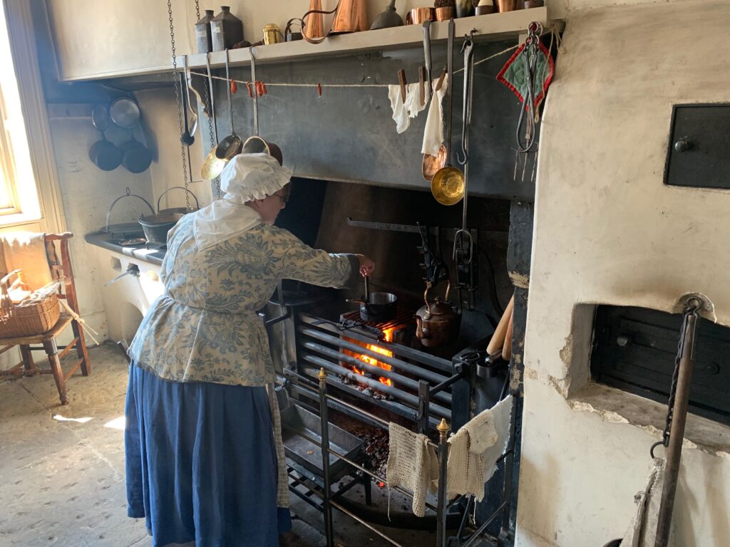
    Costumed interpreter cooking at an open hearth in Wordsworth House, Cockermouth

    Day 3 - Whinlatter Forest and Honister Pass

    If your base is still Carlisle, drive 50 minutes towards Whinlatter forest. However, we suggest moving “base camp” to Keswick, much closer to the Forest. Whinlatter is home to stunning views, fantastic walks and exhilarating mountain biking, rare wildlife and adventure play. The Visitor Center opens at 10, and since your trek will start from here we suggest arriving at 10 am sharp so as to beat the crowd. The trek we did is an 11 km hike that will take you through differentent landscapes and will allow you to enjoy the Forest at its best.

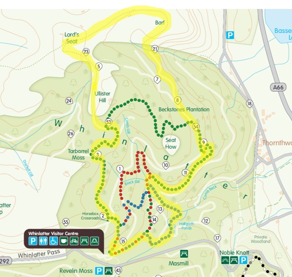
    Start from the Visitor Center, just out of it follow the green sign for the Heavy Side trail that you will follow through signposts 2,3 and 53. Heavy Side trail is one of contrasts. The beginning takes you through some of the mighty oaks adjacent to Masmill Beck. The trail then climbs through an area of coniferous trees which border the forest boundary along Heavy Sides where the views of Skiddaw and Bassenthwaite Lake awaits you. 

    Here at sign post 53 make a left and leave the forest behind to start climbing to 500 m through heather moorland the side of Lord’s Seat. From it’s top you enjoy the breathtaking views of Lake Bassenthwaite, then follow a small and hidden path that will lead you down the side and up to The Barf. A steep descent will take you back to signpost 21, tha you will follow to 7 and 8 to rejoin the Heavy Side Trail (54). Here the road is wide, keep following it until you see a blue sign on your left going down a hidden forest path.

    This is Comb Back trail that winds through through glades, beside streams and landscape features. As the trail follows Comb Gill, keep a look out for the disused dam, which once provided a source of power for the mines deep in the mountain below.

     

    Trail map of Whinlatter Forest Park
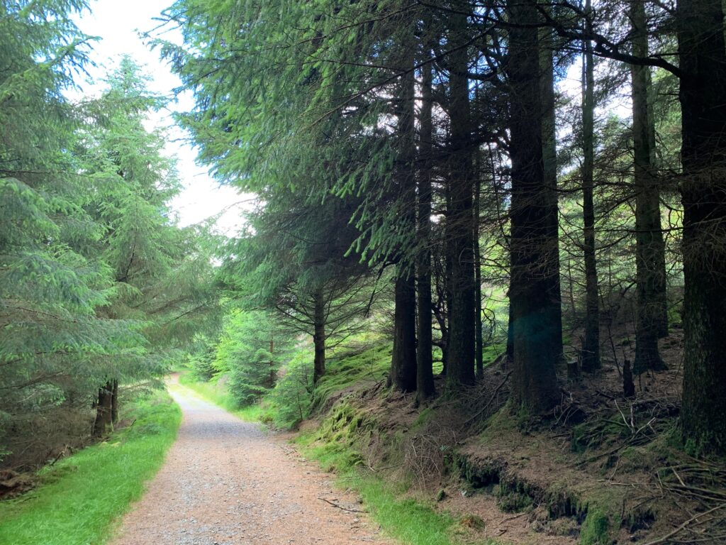
    Path through tall conifers in Whinlatter Forest
    Heavy Side trail
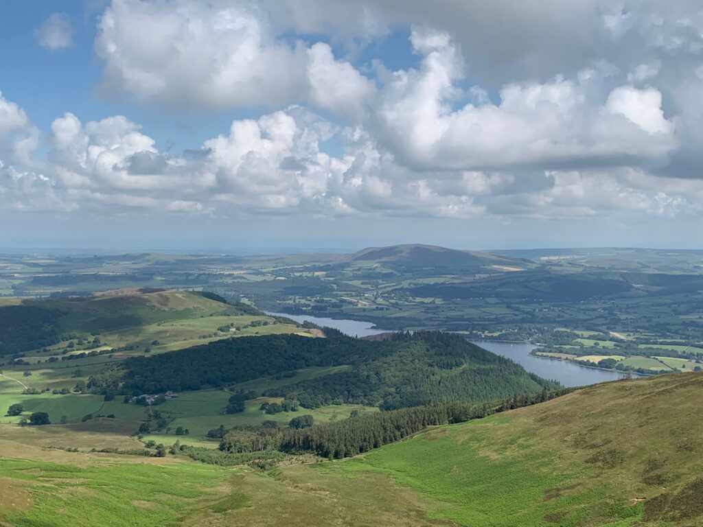
    View over Bassenthwaite from the slopes of Whinlatter
    Top of the Lord's Seat
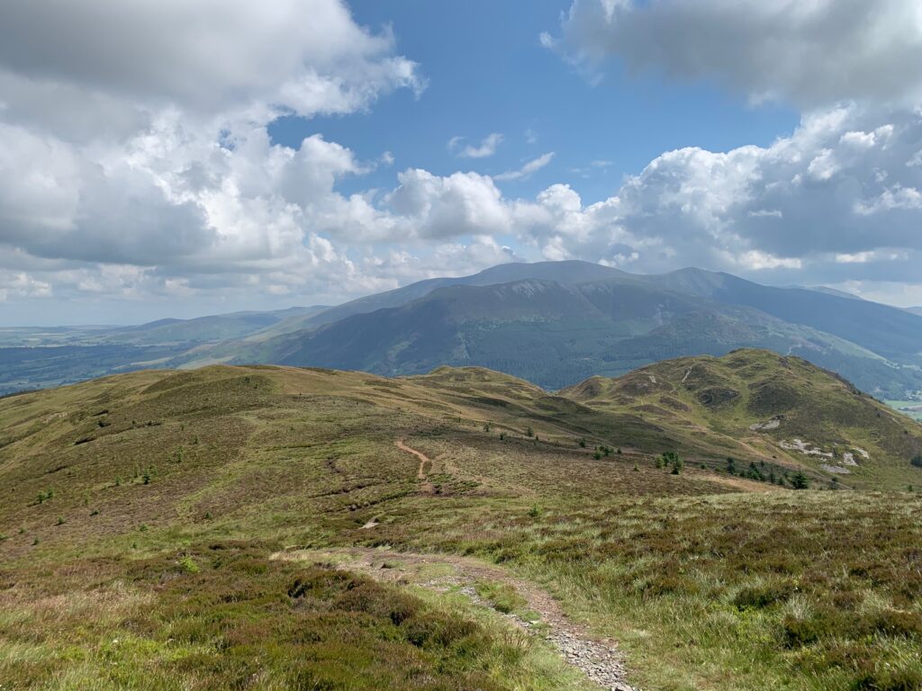
    Fell ridge with distant mountains in the northern Lake District
    Towards The Barf
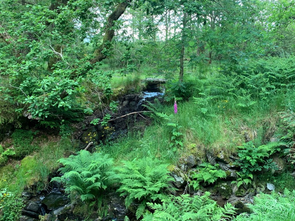
    Wooded gully with a stream in the Lake District
    Comb Back trail

    Coming back to the Visitor Center, replenish your energies with a nice lunch at the Cafe. And before leaving the car park, do not forget to pay, just by entering the plate number of your ride.

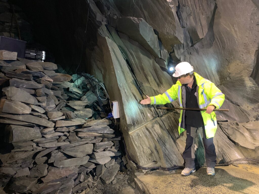
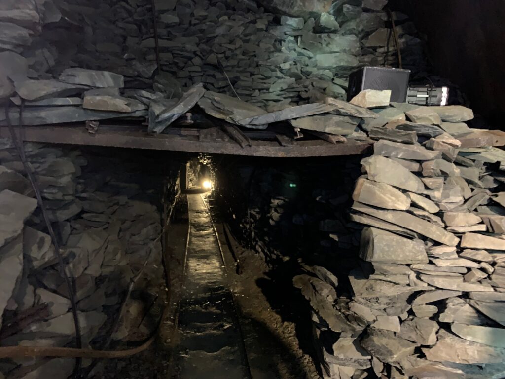
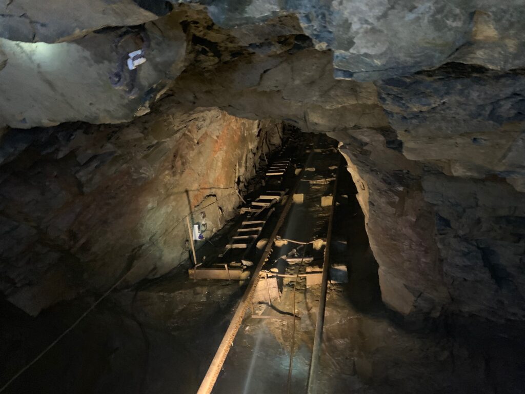
    A 20 minutes drive will take you to Honister Pass, that has lots of adventures to ovver, such as “La via ferrata” if you really seek an adrenaline rush. We decided that it was worth enjoying the panorama around and visiting the last working slate mine of Englad. For those of you not familiar with slate, it is quite an expensive material that constitutes the skeleton of the rooftop of famous buildings such as Buckingham Palace and Saint Paul’s cathedral

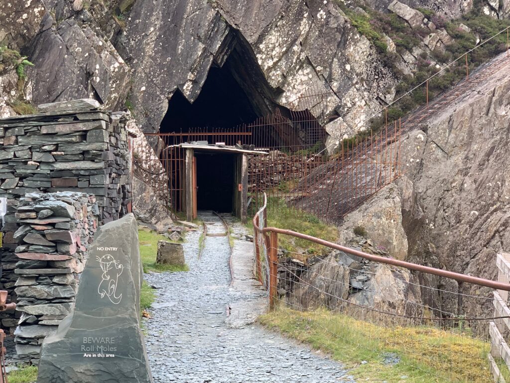
    Entrance tunnel to the Honister slate mine
    Visitor in helmet and hi-vis inside the Honister slate mine
    Lit passage among slate walls inside the Honister mine
    Underground incline and rails in the Honister slate mine

    Apart from the geological beauty of visiting the mine (zero for me, apparently this is the only volcanic slate in the world..), what is fascinating is having a real miner as the tour guide. And feeling the passion and the love of a Cumberland man for this local craft, and for the man who saved it, Mark Weis. When the mine closed in 1989, Mark mortgaged most of his possessions to buy it, to restore it as the principal mean of income for the region and as a touristic attraction. We owe to him the tour mine, the “via ferrata” and the fact that the best slate in the world is once again being produced. While he unfortunately was killed in a helicopter accident in 2011, he could not witness what the mine has now become: something unique that everyone visiting this area should enjoy.

    We stayed at Borrowdale Gates Hotel, just 10 minutes by car from Keswick.

    For a nigh of entertainment and culture, if you still have the energies, why not getting a couple of tickets for the famous Theatre By The Lake in Keswick? We watched “Ladykillers”, incredibly amusing and funny.

    Day 4 - Keswick and Grasmere

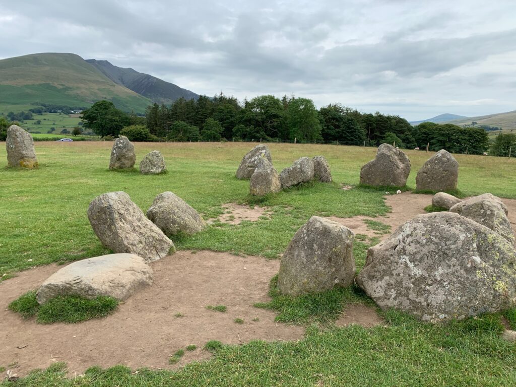
    From the little village of Borrowdale where we slept, Kenswick is just a 20 minutes drive. Start by visiting the stone circle of Castlerigg, east of the town. Certainly not as impressive as Stoneange, it is however impressive to think that those stones were laid there more than 2500 years ago. Not a lot is known about their function: the most credited hypothesis is that they represented a gathering location of cult or assembly. The visit here will not take too long, so jump back in your car and head towards Derwet Water Marina in Kenswick. Her eyou may hire a paddle, a kayak, a pedalo or better a row boat (like we did) and explore the lake with its plush islands. The rent is 18 pounds for 1 hour and 28 for 2 hours, we did the whole lake in 2 hours keeping a good pace.

    Standing stones of the Castlerigg Stone Circle near Keswick
    House among trees on the shore of a Lake District lake

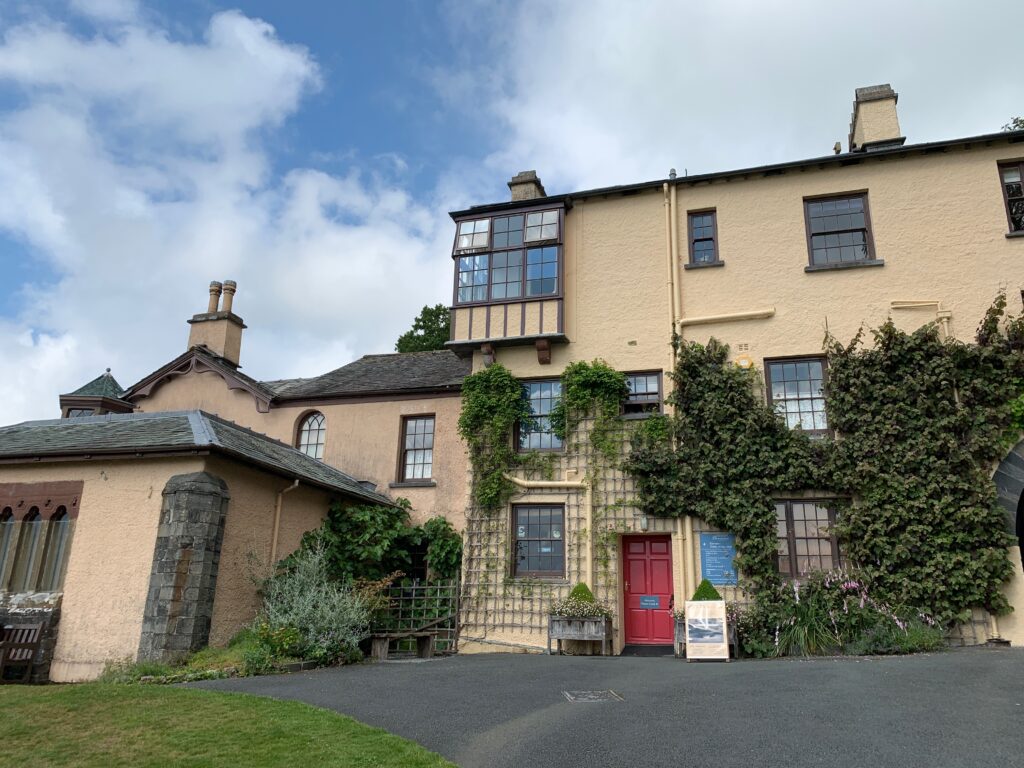
    Even if the rowing has built you an appetite, grab the car and drive 20 minutes to the lovely village of Grasmere. It cerainly deserves a visit for various reasons: beautiful to walk around, good tea houses to have a bite, and the village that stole Wordsworth’s heart. Now, we already learnt that he was born on Cockermouth and there he lived the years of his youth, but in Dove Cottage in Grasmere he spent his most productive years. And in the church of Saint Oswald he is buried. After lunch stop by the church cemetery to visit his tomb and the tombs of the family, then stroll around the small cottages of grey stones of Grasmere. Dove Cottage is just outside the village: when we visited it was closed  for renovations but in 2020 it will open again. The last years of Wordsworth’s life were spent in the small villa of Rydal Mount that certainly deserves a stop: and what better excuse that to reach it through a hike?

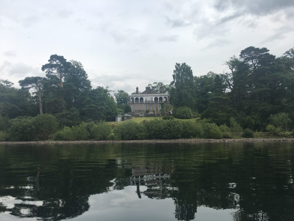
    Lakeside building surrounded by trees in the Lake District

    William Wordsworth, known as much for his love of walking as for his poetry, described Rydal Water as “the loveliest spot that man hath ever found”. In his Guidebook to the Lakes he also suggested the best way to appreciate it is by ‘a foot-road passing behind Rydal Mount and under Nab Scar…very favourable to views of the lake and the vale…The horse road…under Loughrigg Fell, does justice to the beauties of this small mere, of which the traveller who keeps the high road is not at all aware.’

    This 6 km trail takes the route Wordsworth suggested. But this landscape has more to show us than just ‘favourable views’. From rocks to reservoirs, burbling becks to bearing the dead, we’ll uncover the stories behind the place that Wordsworth called home.

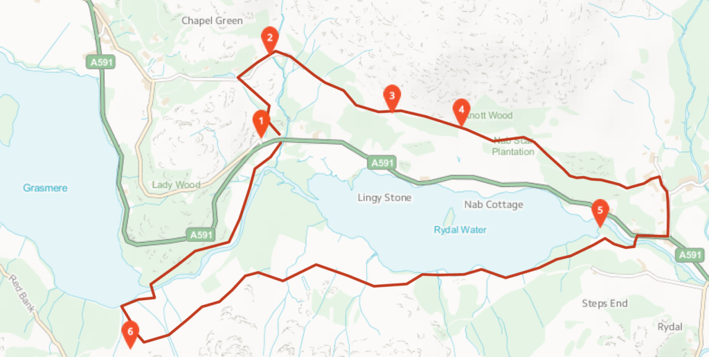
    Start from White Moss common car park off A591 between Rydal and Grasmere (1) and take the path uphill into White moss forest that lies between the lake of Rydal and Grasmere. Continue till the trails bends left and out of the trees (6), and walk it for the whole lenght, keeping Rydal lake to your left: only in the last part you will walk next to the lake. Keep following the paved road after the lake ends and take a left to a small bridge (5) to come back to A591 at the level of The Badger Pub. Here a steep road to your right will take you to Rydal Mount where you can rest for a visit and a coffee. 

    Map of the walking loop around Rydal Water

    When you have admired the original furnitures, continue uphill till a trail on your left. Take it and walk trough caves and quarries for the whole length of the lake. At the end of the lake you will start hearing the sounds of traffic on A591 again (2): multiple small trails in the trees will bend on your left to take you back to the car park.

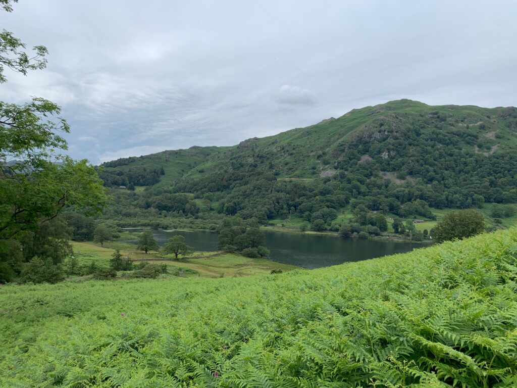
    Green valley and small lake at Rydal in the Lake District
    Rydal Mount, William Wordsworth's house, with its garden
    Stream running through woodland in the Lake District

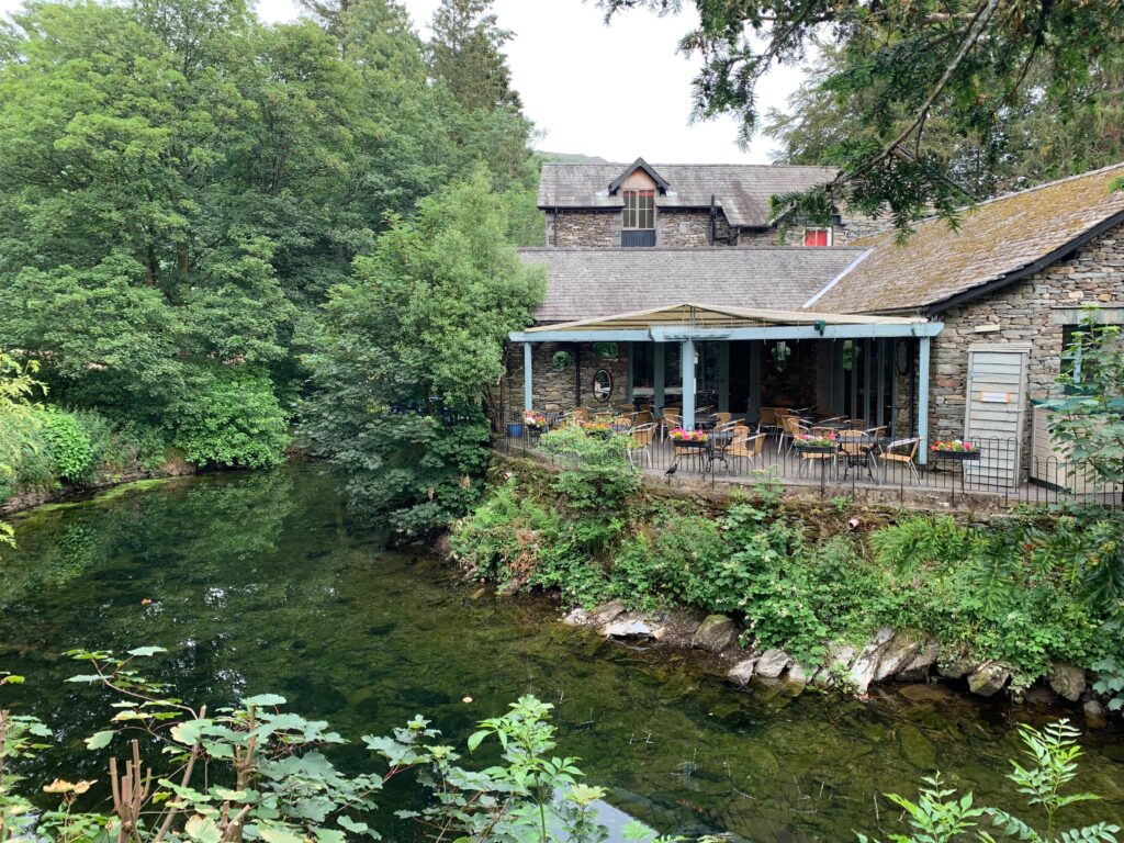
    After a long deserved shower, we had an amazing dinner at Fellpack. Fellpack was born from the efforts of a bunch of guys )and gals) who love trekking and climbing. Its initial heart was inside a pub, where these friends got the idea of starting their own restaurant with a hiking theme. The result is a cozy restaurant with great beer selection and cocktails, and good and hearty food, served in their own hand made pottery dishes. 

    Day 5 - Helvellyn and Ambleside

    At first glance the western side of the Helvellyn range may seem a little dull. They display slopes of a fairly uniform nature which when compared with the likes of Striding Edge and Swirral Edge on the other, eastern side, certainly lack that immediate, ‘in your face’ drama. Helvellyn though is a big mountain and the two sides of it are an integral part of why it is such a popular mountain. If you are into a total scrambling experience then there is nothing wrong with doing the edges. If on the other hand you want to savour the fantastic view down on to the edges from the summit, and if you just want to walk to get it rather than scramble then there is no finer way of doing it than approaching up the well-graded paths from the Thirlmere side.

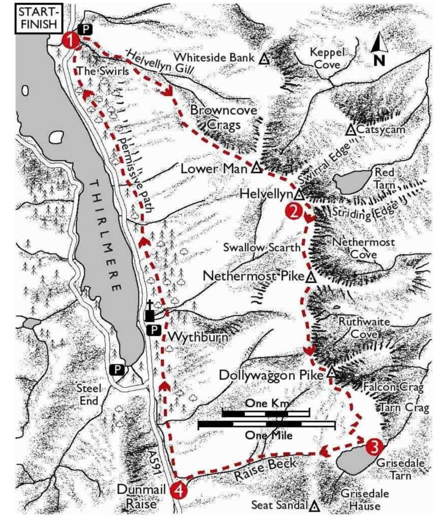
    The three highest peaks of the main ridge can quite comfortably be done by climbing the zig-zags of the Helvellyn Gill Path to Helvellyn’s summit. Then descending to Grisedale Tarn taking in Nethermost Pike and Dollywaggon Pike along the way. The best way back is down by Raise Beck, which is a little confined but soon leads down to Dunmail Raise from where you can make use of the permissive path to get back to the start.

    Illustrated map of Helvellyn showing Striding Edge and Thirlmere

    Drive and park to the Swirls Car Park. Cross the footbridge over Helvellyn Gill at the back of the car park then follow the path South East alongside the gill to another footbridge. Cross the footbridge, then climb the steep zig-zags to a wall. Through the gate continue climbing to the remains of another wall. From here the path ascends the steep scree-covered shoulder South East directly to Helvellyn’s summit. It is quite a strenuous hike, 2 km with an ascent of 880 m. And it feels more like climbing stairs instead of walking, with all those stones along the path. At 925 m of altitute you will walk by the side of Lower Man and finally reach the summit of the Helvellyn.

    From the summit of Helvellyn follow the main ridge path South. It is called Coast to Coast Walk, slightly easier but you will miss some beautiful peaks. The Walk forks at Swallow Scarth, take the left branch and follow it South, reaching the summit of Nethermost Pike, High Crag and finally to Dollywaggon Pike. From Dollywaggon Pike the path turns South East and reconnects to the Coast to Coast Walk. Continue along it and descend the steep zig-zags to Grisedale Tarn (small lake).


    Rocky stream bed in a Lake District valley
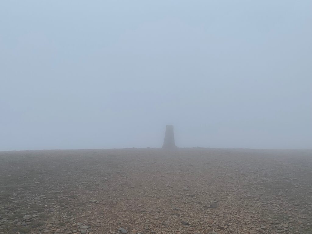
    Summit shelter on Helvellyn in thick fog

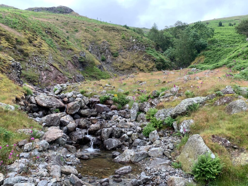
    At the tarn turn West and follow the path across the low col to the head of Raise Beck. Now, this sound easy but you will have to find your own path till the head of the river, walking in mud and peat. Join the path on the South side of Raise Beck and follow it down towards Dunmail Raise. The path by the side of the river is mostly made of wet stones, so the downhill walk may be a bit tricky and slow.

    At the end of the river you will start hearing the sound of cars and you will see the read. Just before the road turn right and follow the Permissive Path North to the footbridge over Birkside Beck. Cross the bridge and continue North along the path as it traverses the mountainside into the forestry plantations. This may as well be the most boring part of the walk, since the path is well paved and the nature all around is not super exciting. The path is followed North for just over 4km back to the car park 

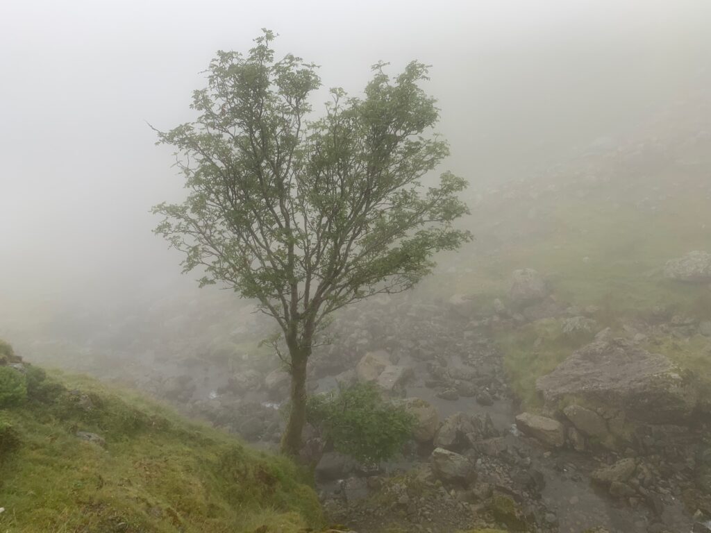
    Lone tree on a fellside in heavy mist
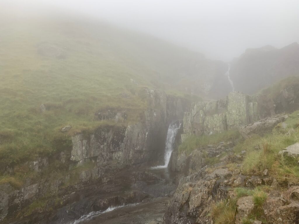
    Waterfall and crags emerging from the mist on Helvellyn

    The whole loop is roun 15 km and took us 5 hours to complete, mainly because of the weather conditions.

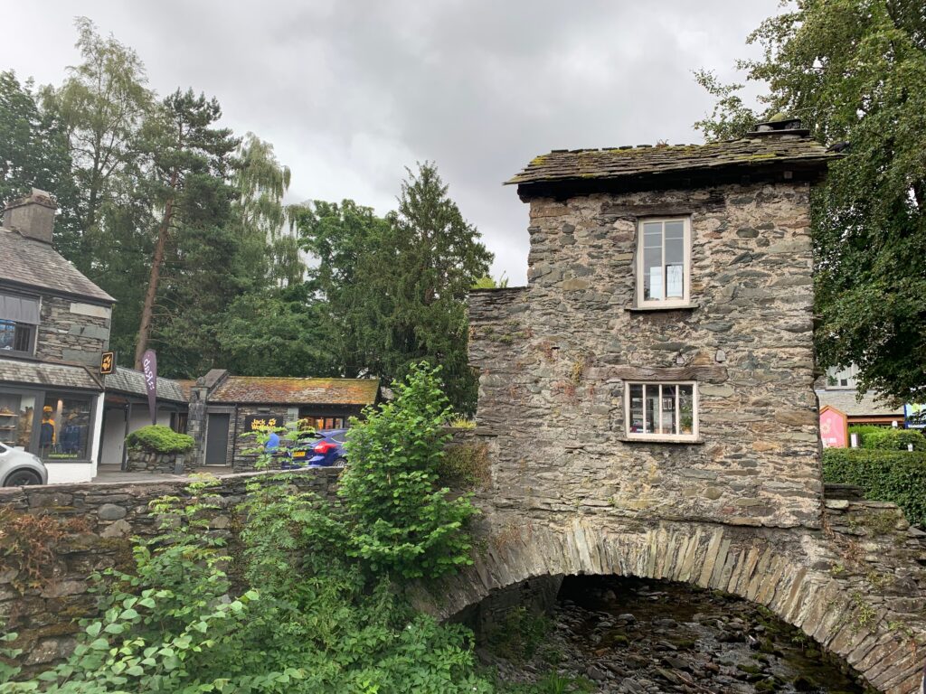
    Now, back in the car, drive 15 minutes to the little village of Ambleside. It is literally in the heart of the Lake District National Park, a small town loved by trekkers and walkers. Just so we do not loose sight of our friend Wordsworth, it was in Ambleside that he found his first job as a stamp distributor. On travel guides Ambleside is well known for the glass blowing shops and the small Bridge House (in the photo) were a family of 8 used to live. However, the glass blowing shops have now been replaced by shops for outdoor equipment, more common in Ambleside than pubs. Stop here if you need a to buy new clothes, shoes or gear.

    Bridge House, the small stone house built on a bridge in Ambleside
    Stream running between stone buildings in Ambleside

    We spent the night at Belmount Hall and had dinner at the Queen’s head pub.

    Day 6 - Hawkshead, Hill Top, Fell Foot Park and Haverthwaite

    Take a break from hiking and exploring nature and dedicate this day like we did to get to know better some pf the “celebrities” of the Lake District.

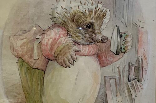
    First stop, Hawkshead, enchanting village with charming cottages and the Beatrix Potter Gallery, dedicated to the drawings of one of the most famous children’s books author. The house that hosts the Gallery was the office of solicitors WH Heelis & Son. Beatrix met William Heelis here as he helped her with land purchases in the region, and in 1913 they married. The upper floor hosts  various original drawing of her books, that are showcased here only for one year before being replaced by new ones.

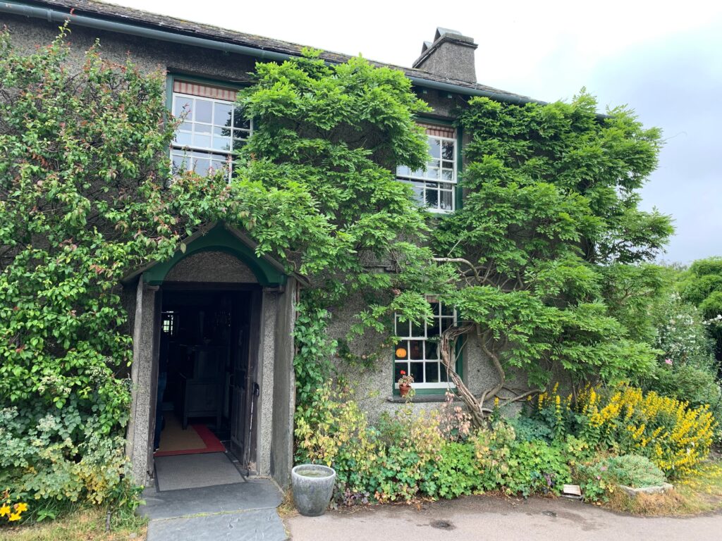
    Just outside of the Gallery, stop by the Hawkshead Relish Company to purchase some artisanal jams, and rest for a cup of coffee at KITTchen, a cat bar next door. If you feel like a short walk, stroll down the path towards Esthwaite Water, the nearby private lake. We did not rent a boat or stop for fishing, but only spent some time to take pictures and admire the landscape. Jump back in your car for the next Beatrix Potter’s stop: Hill Top was the house that she purchased with the money earned from the selling of her first book Peter Rabbit. It’s a XVII century farm with a beautiful garden of flowers, plants and vegetables which is still kept as Beatrix wanted. While roaming the rooms, her readers will recognize objects and corners that populated some of her stories like the Tailor of Glouchester and The story of Samuel Whiskers.

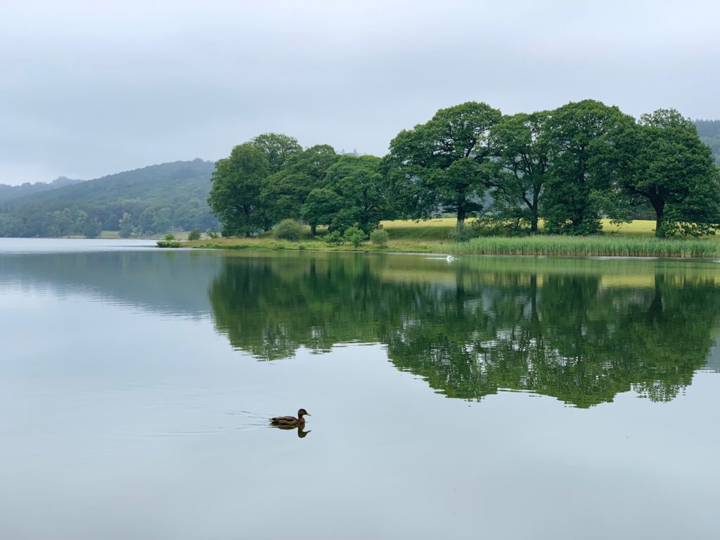
    Esthwaite Water with wooded islands near Hawkshead
    Esthmaite Water
    Hill Top, Beatrix Potter's cottage, with its cottage garden
    Hill Top
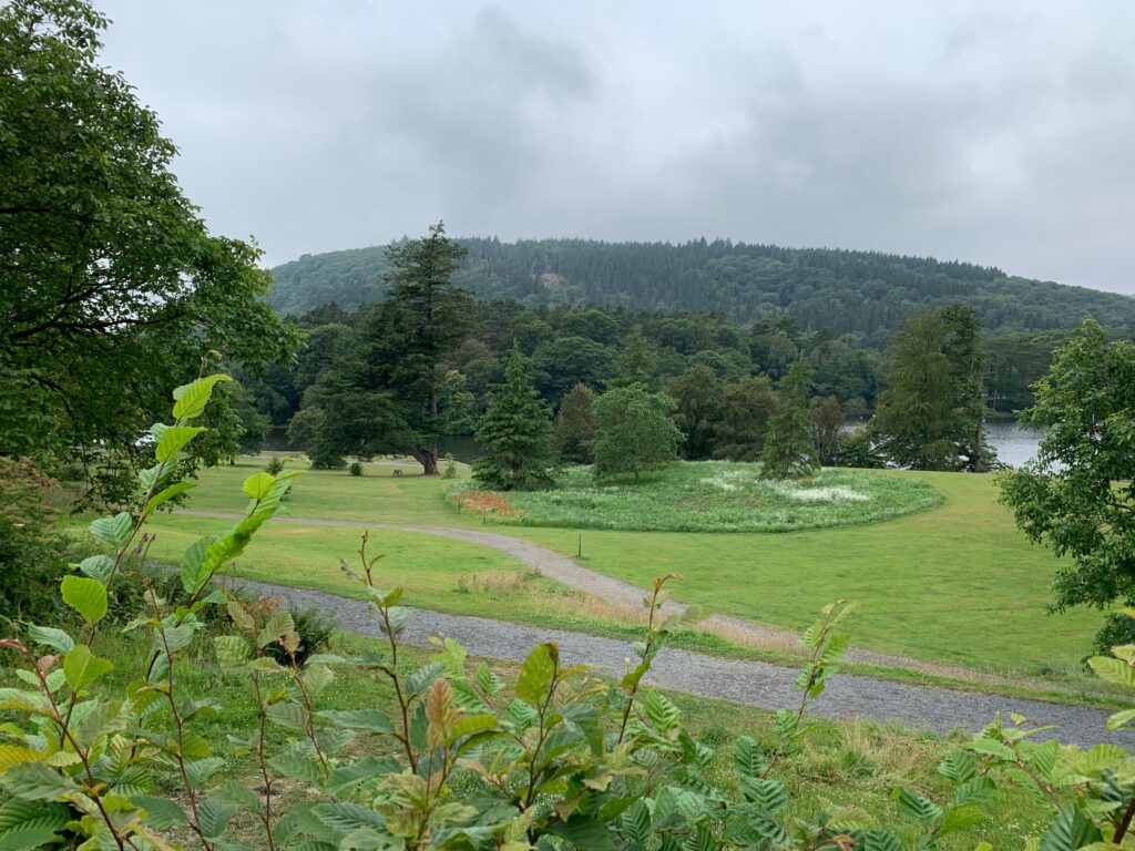
    Parkland beside the lake at Fell Foot Park
    Felle Foot Park

    A 15 minutes drive will take you to Fell Foot Park, a victorian garden with wide meadows on the south shore of the Windermere lake. We grabbed a quick bite at the bar in front of the lake, before taing the ferry to the other side of the lake, landing at Lakeside. From Lakeside station, grab the historical train towards Haverthwaite, last stop of the day. The only reason to visit Haverthwaite is the Haverthwaite & Lakeside Railway. The station is on the A590. Once it was used to transport goods for the ferries in Windermere, but now thanks to train lovers it runs between Haverthwaite and Lakeside, along the Leven river. Take some time to admire the 1950s trains and locomotives.

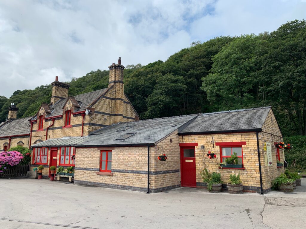
    Station building of the Lakeside and Haverthwaite Railway
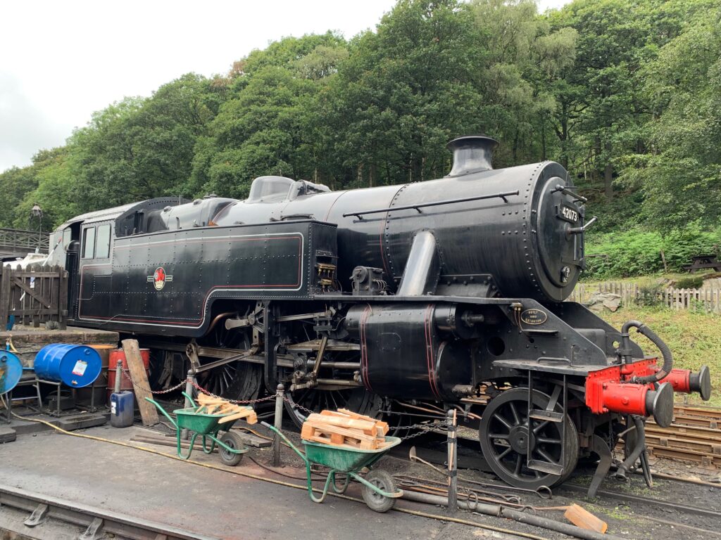
    Steam locomotive at Haverthwaite station
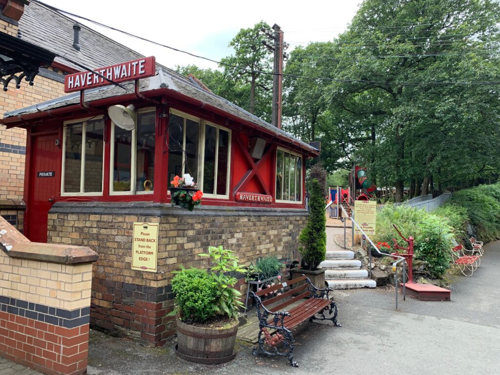
    Signal box and platform at Haverthwaite station

    Day 7 - Grizdale Forest Park and Brantwood

    The Silurian Trail is named after the geological time period in which the forests characteristic grey slate and shale rocks were formed. It is the ultimate walk, a 19 km trail that takes you down one side of the Grizedale valley and back up the other, passing many of the sculptures along the way, as well as some of the best views in the forest. It includes the summit of Carron Crag, the highest point in the forest.

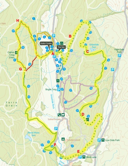
    Start from the parking lot (A), get the trail between the pointy building and the parkings. The first km climbs into a conifer tree, then separates from the white trail (B) and transforms into a gravel trail that slowly climbs for 3-4 km. This part can be slightly boring but soon (C) the trail dives into the forest in a steep rock-bottom walk that can be quite challenging. After a couple of kms the trail opens up (D) and the walk becomes more pleasant. Once you reach the parking lot (E), the trail connects with the local road and you will coast a couple of farms before turning left near the Force Back stream: take the white and green trail (F) until it separates. From that point on the green trail climbs, gently at first along the fields then more steeply inside the forest to the base of the Carrion Craig (G). The ascent of the Craig is not particularly challenging at it will reward you with a breathtaking view on the valley. The last portion of the trail (H) cuts through the forest and takes you back to the visitor center.

    Trail map of Grizedale Forest Park
    Fern-lined woodland path in Grizedale Forest
    Clearing among the trees in Grizedale Forest
    Mossy stream running through Grizedale Forest
    Woven branch sculpture arching over a path in Grizedale Forest
    View over forest and fells from a viewpoint in Grizedale

    After a good lunch at the Grizdale Cafe, a 10 minutes car ride will take you to Brantwood and John Ruskin’s house. Ruskin was a poet, a writer, an art critic, but most importantly he was a thinker. The first “socialist” in the english history, despite being born in a rich family he understood the horrible conditions of the working class and theorized minimum wages, a social security and free education for everyone. The house is a beautiful example of a Victorian residence, kept exactly as it was, and the acres of gardens (seven) around make a nice exploration (even if non great on the legs after 19 km). Some gossip about Ruskin’s impotence, his marriage annulment and love for a girl 25 years younger than him can be learnt in the drawing room…

    Brantwood, John Ruskin's house above Coniston Water

    Day 8 - Coniston

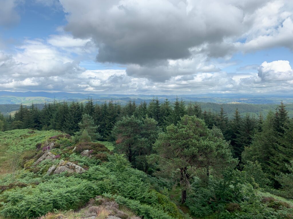
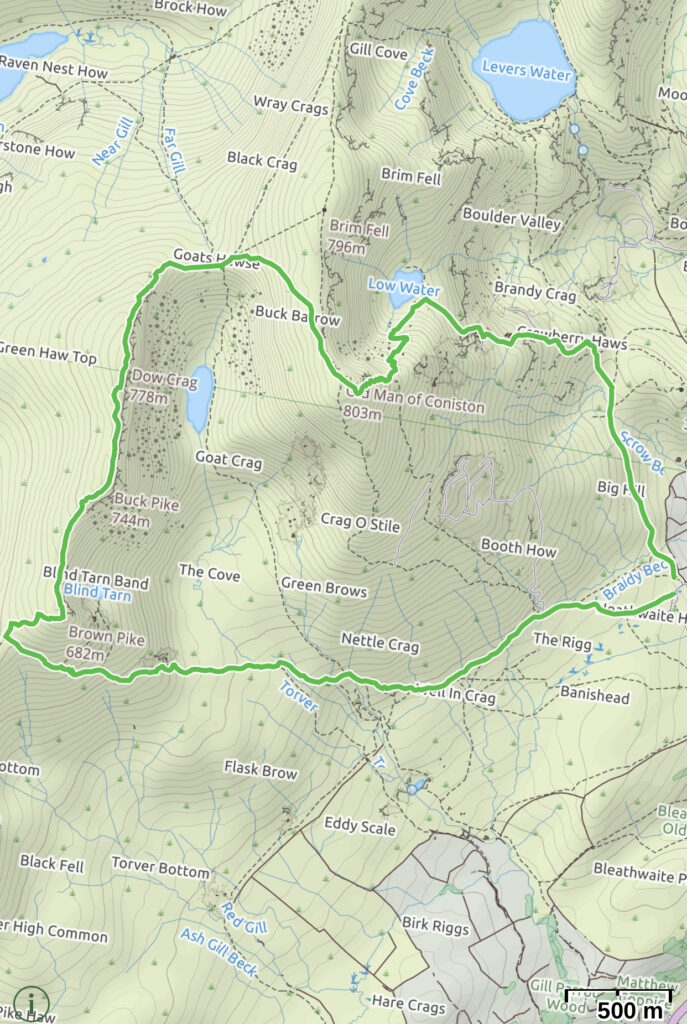
    We spent the nigh in Coniston, it is an enchanting little village with what we believe is the most beautiful of the lakes of the National Park. Also, it is dominated by the Old Man of Coniston, the last peak of hour trekking vacation. The walk that we planned to conquer it follows a circular route from a parking area on Walna Scar road, near Coniston in the Lake District. It sets off in a westerly direction along Walna Scar road itself, which is now a track, before turning northwards to start the real climbing over Brown Pike, Buck Pike and Dow Crag. The walk drops down to Goat’s Hawse before heading to the summit of the Old Man of Coniston, known by many as Coniston Old Man. From the summit there are excellent panoramic views of all surrounding hills and fells, from Black Combe around to the Pennines taking in the Scafell group to the North and as far as the Isle of Man to the West, along with Blind Tarn and Goat’s Water below. From the summit, the walk zig-zags down to Low Water before returning to the parking area through the remains of a bygone era in this part of the Lakes – copper mining.

    Drive out of Coniston up the steep Walna Scar road. As the road ends, pass though a gate and park in the large unmetalled parking area – the walk starts from here. From the parking area, head away from the gate in a Westerly direction and through the wooden waymarkers, to continue along the now unsurfaced Walna Scar Road. Keep on the track as it gently rises through the bracken and ignore a track that shortly heads off to the right. The track then rises more steeply before levelling out again. Over to the left Coniston Water comes in to view and the further you walk first Brown Pike and then Buck Pike come in to view ahead. The track then reaches some steps, which lead up to Goat’s water. Ignore these and continue along the track. Cross over the bridge and keep on the track as it starts to climb around Brown Pike. The track starts to climb more steeply and become rougher underfoot, before passing a small shelter. Shortly after this, the crest of the hill is reached and ahead can be seen Harter Fell and Ulpha Fell. On the brow of the hill, by a small cairn and a wooden sign, turn right off Walna Scar road (track) and follow the well defined gravel footpath as it starts to ‘zig-zag’ its way up towards the summit of Brown Pike. Upon reaching the summit of Brown Pike, pass the cairn and keep on in the same direction along the ridge towards Buck Pike. Down below to the right is Blind tarn and up on the hillside opposite the summit of the Old Man of Coniston can now be seen. Upon reaching Buck Pike, pass the summit cairn and continue on in the same direction towards Dow Crag. As Dow Crag is reached, there are some photogenic views down the steep gulleys to the right looking down on to Goat’s Water. Head on up the final rocky section to Dow Crag summit. From the summit continue on in the same direction to start the short descent towards Goat’s Hawse. 

    Route map for the Old Man of Coniston walk

    Across to the right, the path to be followed from Goat’s Hawse to the summit of the Old Man of Coniston can clearly be seen. Keep on the path past a cairn and head steadily down towards Goat’s Hawse. Once at Goat’s Hawse, start the climb up the hill ahead. There are two paths, but take the more distinct left hand one. Keep ascending along the wide stony path, passing many small and larger cairns along the way. About 700m on from Goat’s Hawse, the summit cairn comes in to view ahead. Down to the left now the path home can be seen ‘zig-zagging’ down towards Low Water. Continue on the final few metres to the summit cairn. Pass the summit cairn and continue on in the same direction. The path initially starts to gently descend with views of Coniston and Coniston Water straight ahead. The path then swings around to the left to start its steeper ‘zig-zag’ descent towards Low Water below. Keep on the path down to the side of Low Water. As the far end of Low Water is reached, the path splits with the left hand fork heading to the water’s edge. Ignore this and follow the path around to the right, away from the water. The stony path heads between rocky outcrops in the direction of Coniston Water. Shortly afterwards the first signs of disused quarries can be seen. The path passes by small heaps of slate / rocks and the remains of old quarry buildings. Keep to the main path as you descend by the buildings. Once through the mining area keep descending on the path in the general direction of Coniston Water. As the path swings around to the left, ahead now can be seen a path junction. Over to the right the car parking area can be seen. At the path junction, keep on the main path following it around to the right. The path, now on a much more gentle descent, winds its way through a few small rocky outcrops and then heads again in the general direction of Coniston Water. The car parking area soon comes back in to view ahead. Continue back along the path the final few metres to the car parking area.

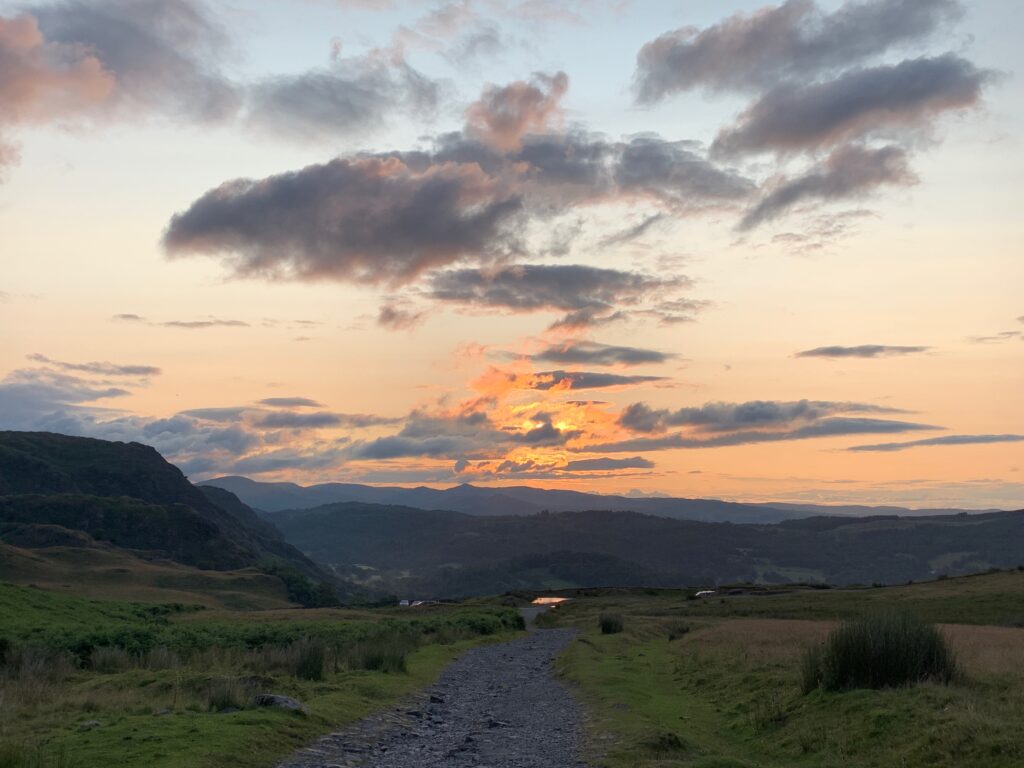
    Sunset over the Lake District fells
    Misty valley at first light in the Lake District
    Wide view over the fells and valleys around Coniston
    Rocky crag emerging from mist on the Old Man of Coniston
  • Adventures,  Africa,  Akagera National Park,  Places,  Safari

    Akagera National Park

    Rwanda can be a bit chaotic: traffic, tons of people on the streets, accidents. But there are certainly ways to escape all these for a few days. One, is to go to Akagera National Park, Rwanda’s largest, just two hours drive from Kigali.

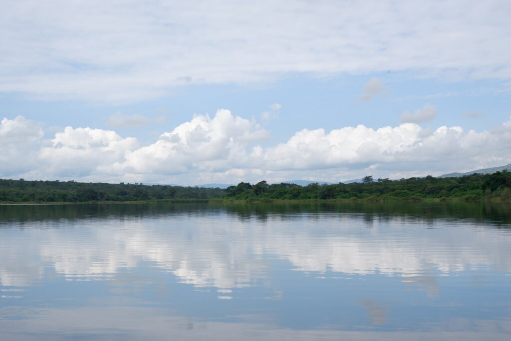
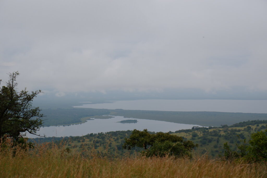
    Set at a relatively low altitude on the border with Tanzania, Akagera National Park could scarcely be more different in mood to the breezy cultivated hills that characterize much of Rwanda. Covering an area of 1,120 kms the park is named for the Akagera River that flows along its eastern boundary and feeds into a labyrinth of lakes.

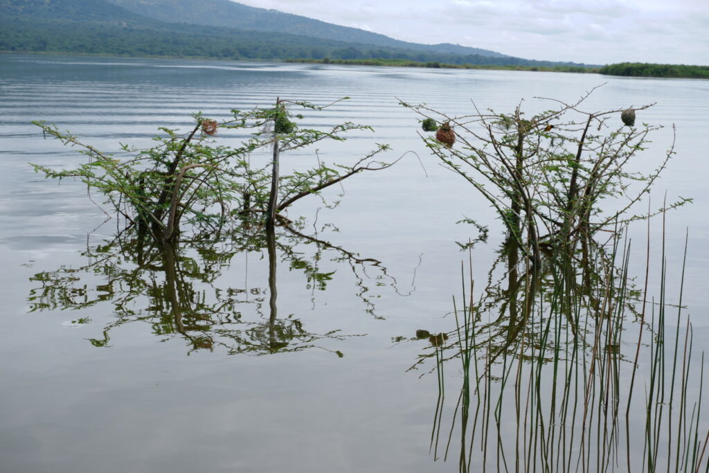
    Rolling hills of Acacia bush, panoramic views across scattered grasslands, patches of thick forest and a mosaic of swamp-fringed lakes along the meandering Akagera watercourse all contribute to this park unrivalled scenic beauty.

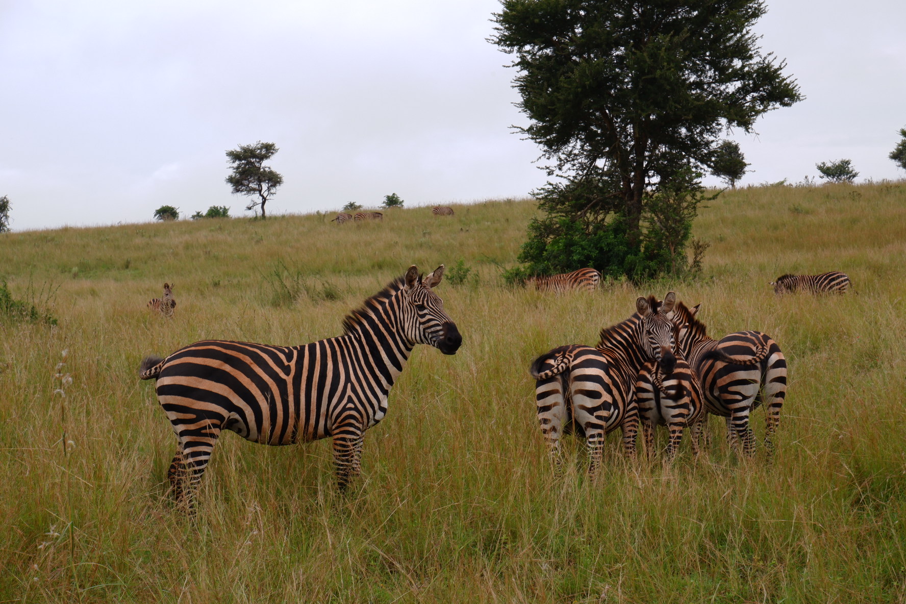
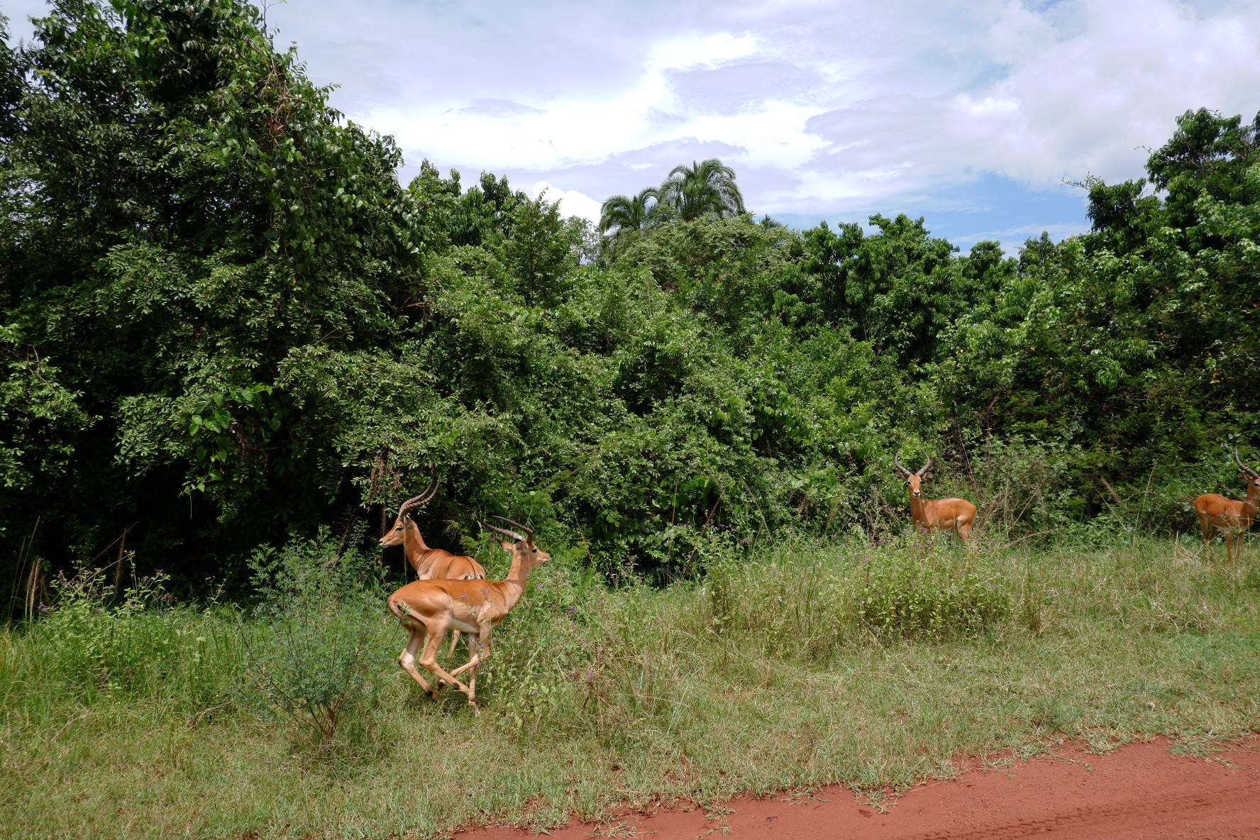
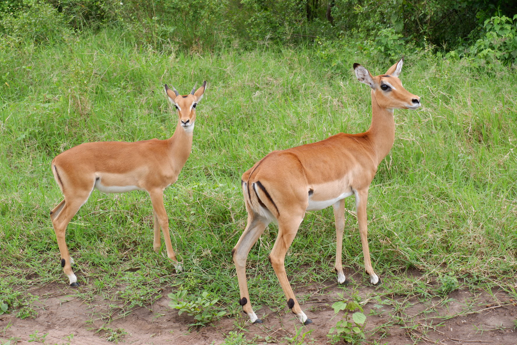
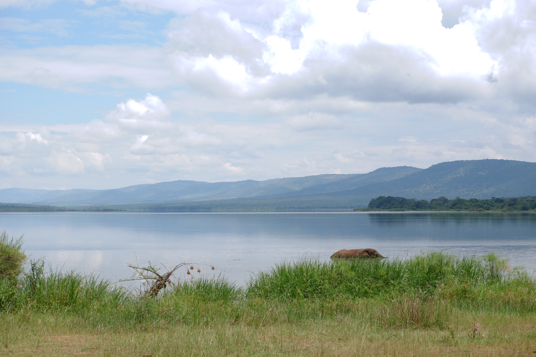
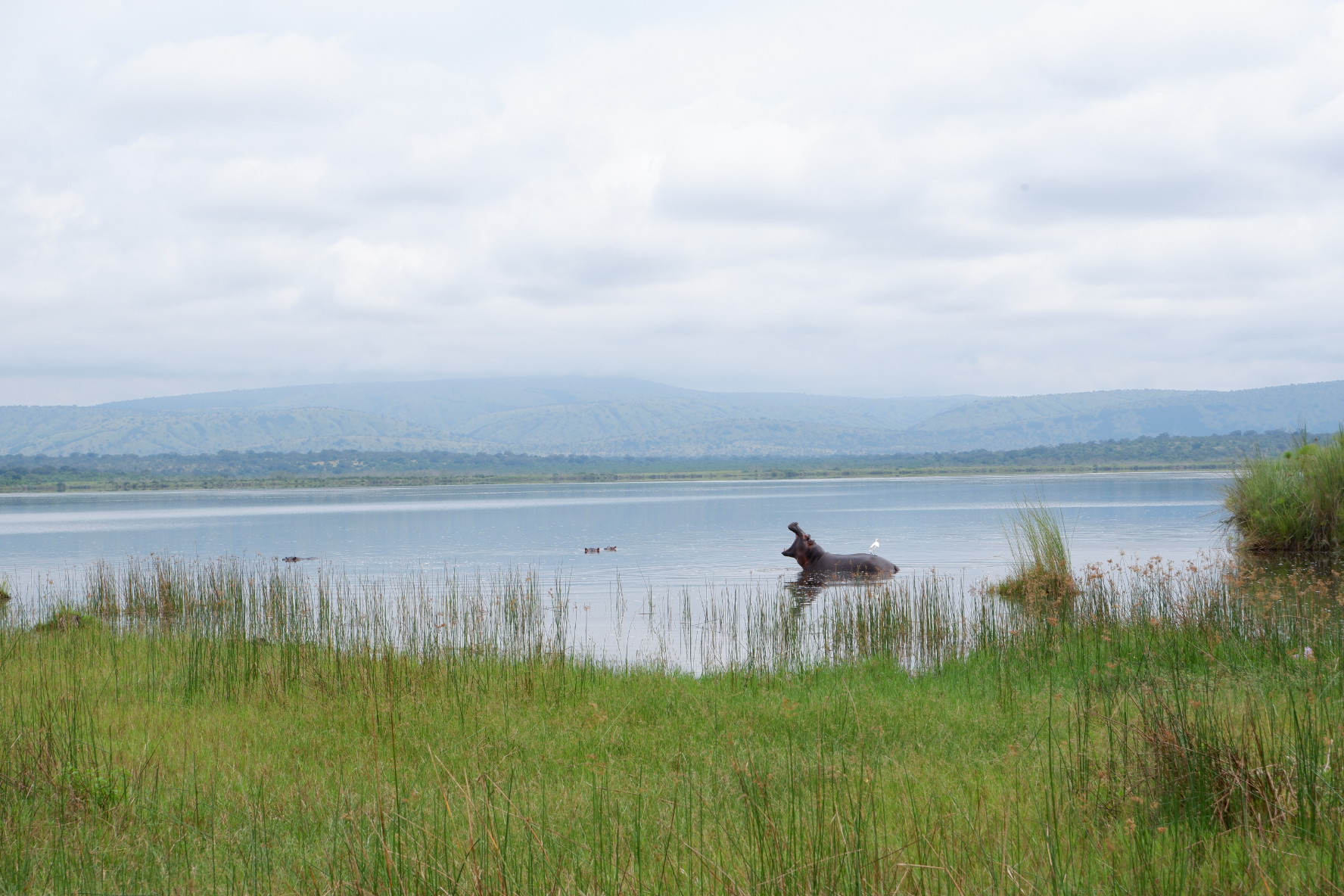
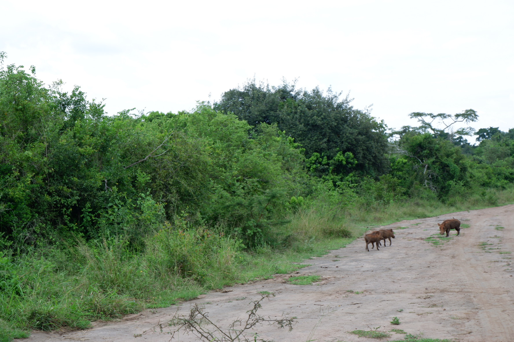
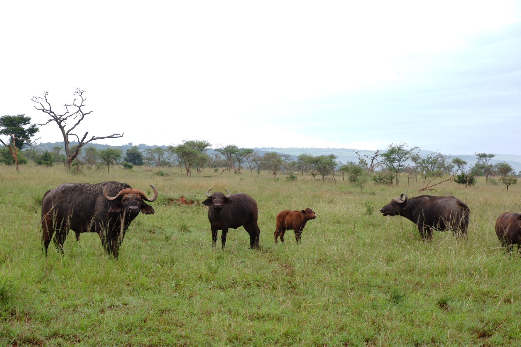
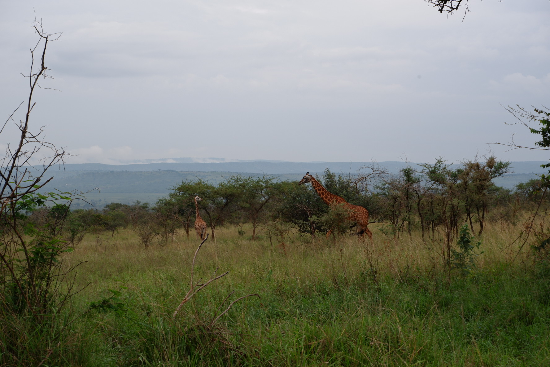
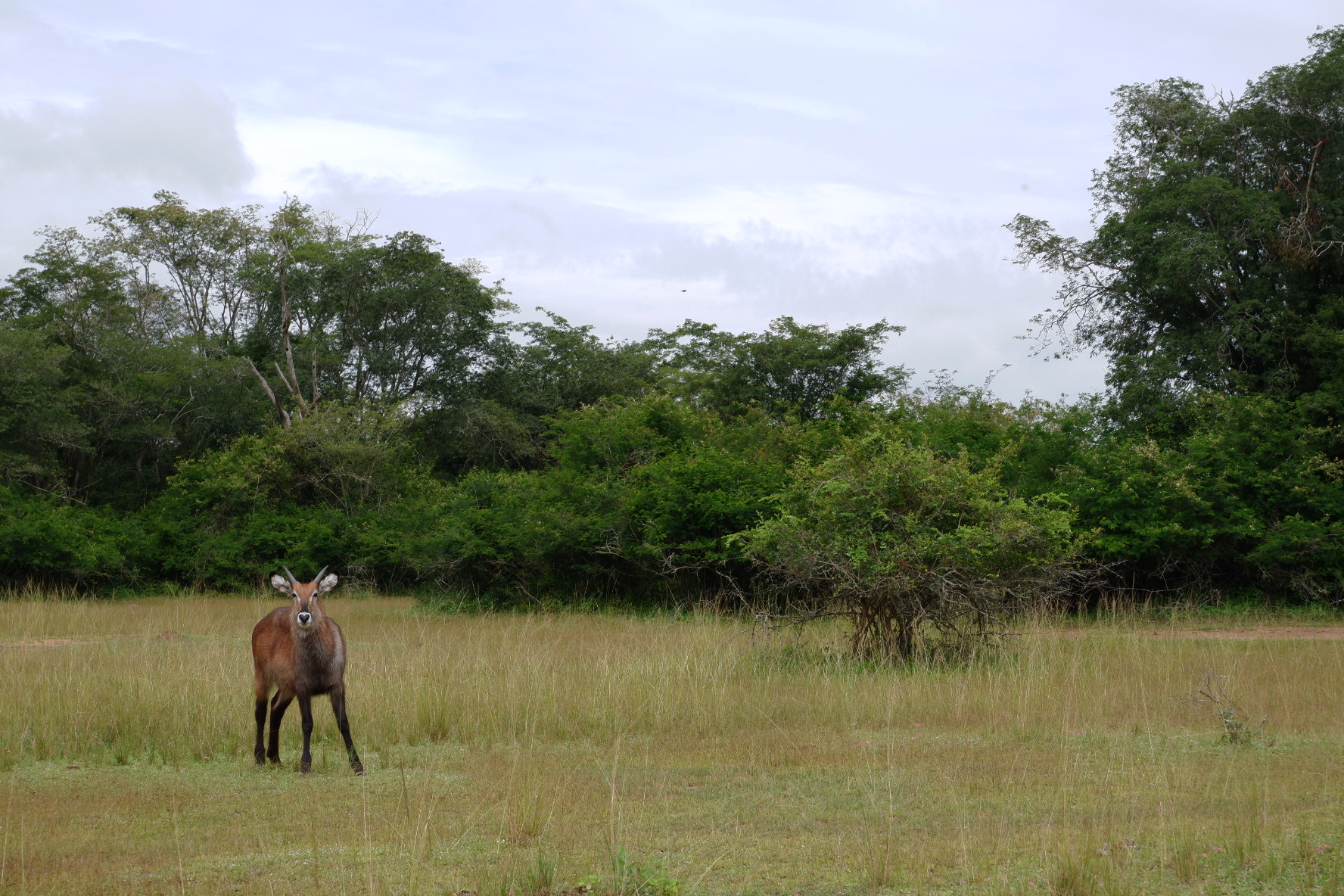
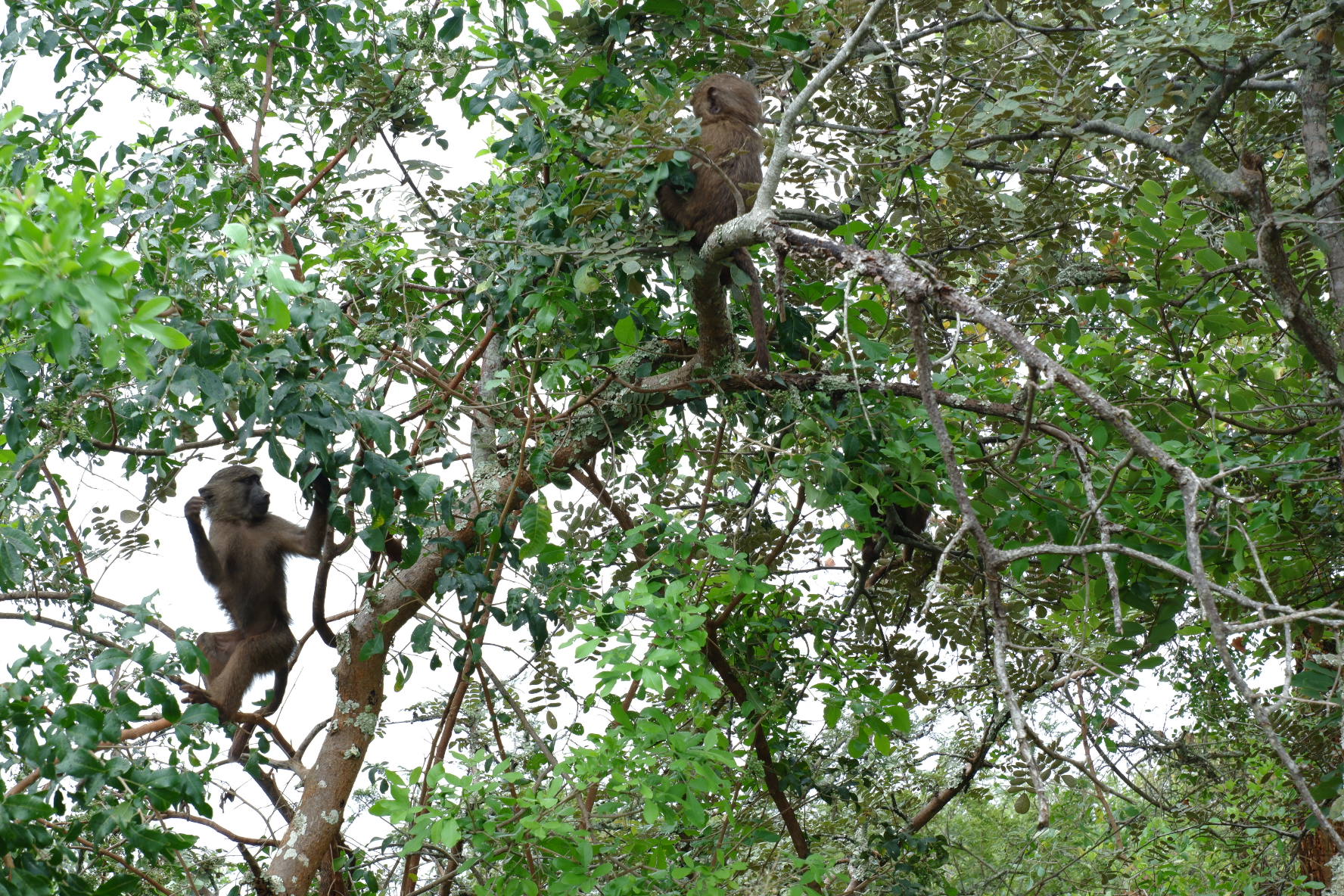
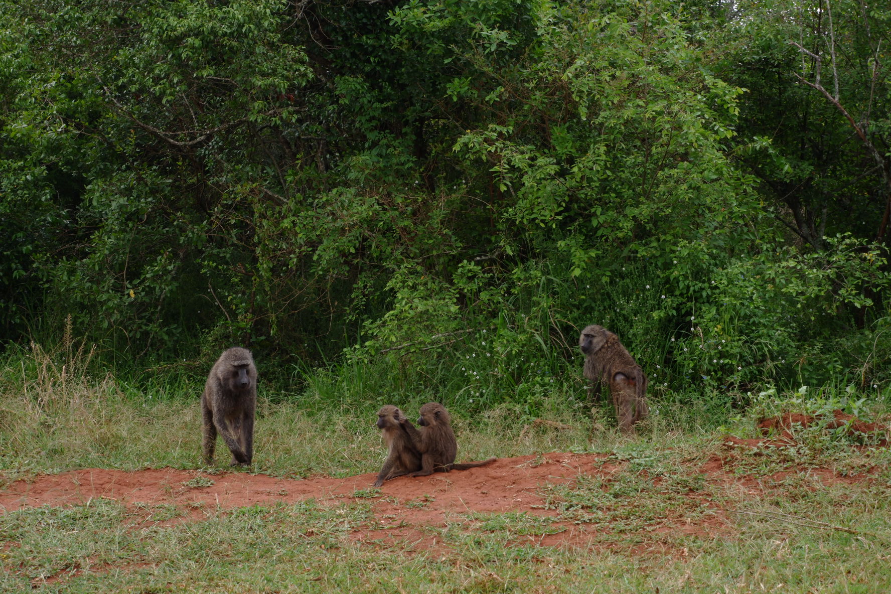
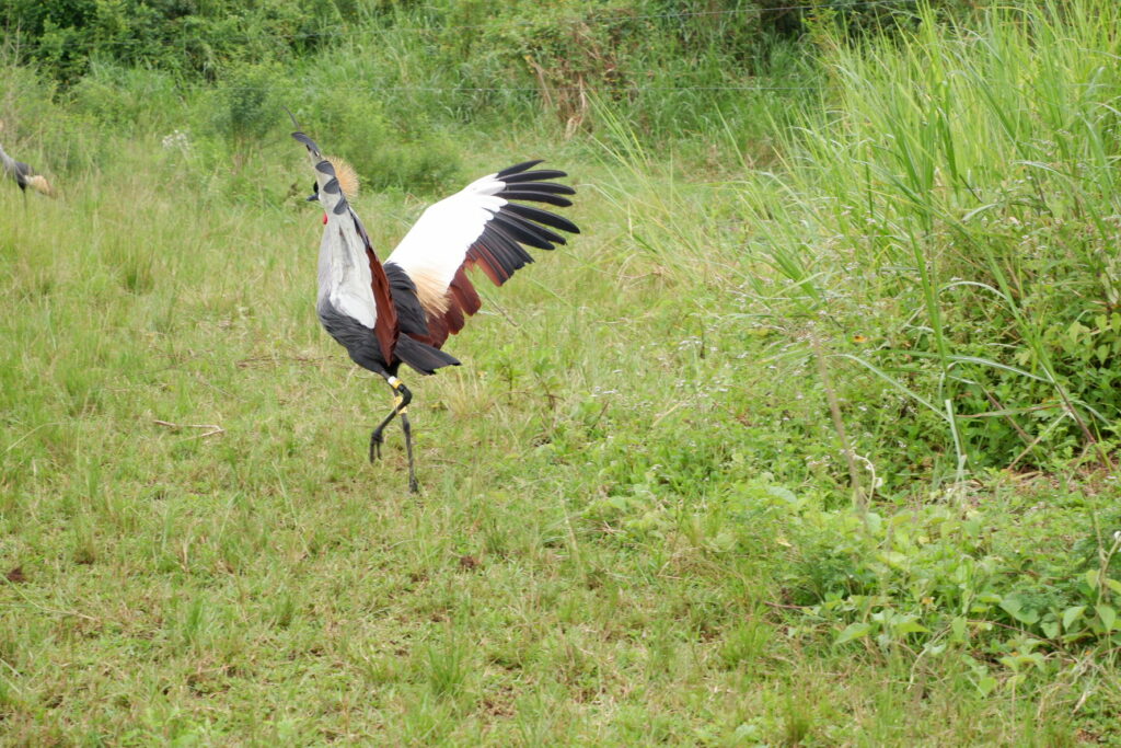
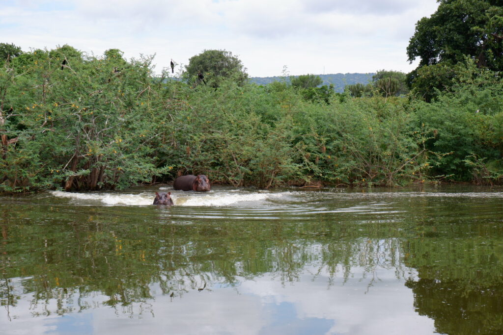
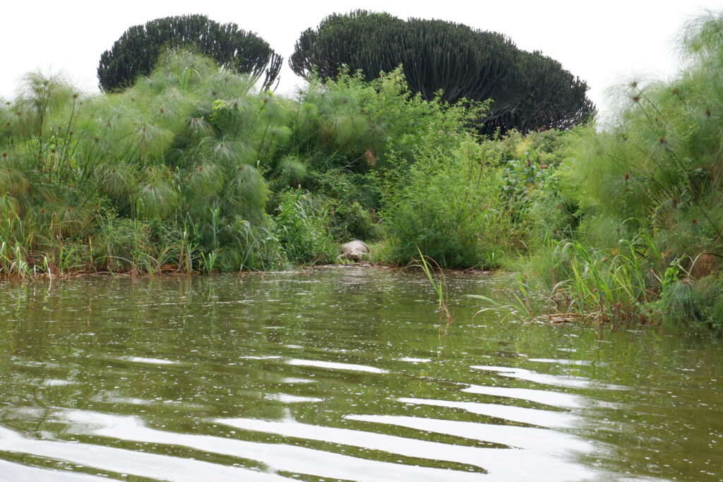
    Akagera is unique in Rwanda as the only savannah environment in the country and is home to the country big game. Large herds of buffalo, zebra, impala and giraffe are seen on the open plains while smaller antelope such as oribi, bushbuck and reed buck exist widely throughout the park. Elephants tend to stay around the lakes, which are inhabited by large numbers of hippos and crocodiles. Baboons and vervet monkeys are commonplace, less so is the secretive blue monkey. Leopard, hyena and jackal are also residents and may be seen on a night drive along with genet, serval, bushbabies, porcupine and other nocturnal wildlife. An important population of sitatunga lives in the papyrus swamps along with other rarities such as shoebill and other papyrus endemic bird species.    

    Magically, the air is torn apart by the unforgettable duetting of a pair of fish eagles, asserting their status as the avian monarchs of Africa’s waterways. Lining the lakes are some of the continent’s  densest concentrations of waterbirds.

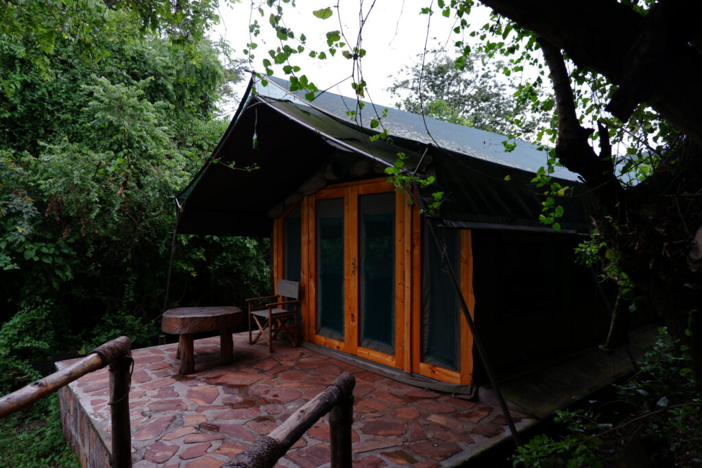
    Camping alongside the picturesque lakes of Akagera is a truly mystical introduction to the wonders of the African bush, Ruzizi tented lodge, where we stayed for two nights (and never wanted to leave). Our tent was set in the middle of the forest, surrounded at all times by blue monkeys and the sounds of smaller (and larger) animals.

    The safari

    We arrived on a late Friday afternoon and decided to relax for the remaining of the day, drinking a beer on the lodge deck and reading a book. On hindsight, we could probably have gone for a 5:30 pm night drive through the southern part of the park, so as to have the next day for a full day game drive or another night drive (as to double our chances to see the nocturnal wildlife).

    The game drive

    On Saturday we woke up at 5.30 (quite early, but given that the tents are in the middle of the forest, the sounds of nature will wake you up shortly after anyway), had our breakfast on the deck at 6 and left for the half day game drive at 7. We were picked up from our lodge by our guide Felix and our driver for the day, Leopold, on a battered, roof-less Toyota Land Cruiser. This amazing duet took us through the park and showed us the secrets of Akagera. The drive took around 5 hours, enough to get you to the lakes half way through the park, but not to the northern, more savannah-like, part. If you want to get to the top of the park you definitely need to go for the full game drive, 8 hours. We were honestly very happy with the experience and being able to admire the animals that nature gave us in their natural habitat, and we wouldn’t have gone for a full day anyway, too long (and maybe a bit boring after a while).

    Here is the video reportage of our game drive.

    The night drive

    We got back to the lodge around 1 pm, had our lunch on the deck and some relax before the night game drive at 5.30 pm. Can’t really explain how it can be different to spot a giraffe or a zebra in their natural habitat instead of seeing them behind bars in a zoo. The thrilling part is knowing that the park is huge and no one knows where the animals may be at any time. In this sense the night drive was the most exciting part, with the thrill of trying to spot the reflection of the car spotlight against the eyes of the wild animals. We unfortunately didn’t see any nocturnal animals, but we were lucky enough to admire two families of elephants drinking by the water pond. We watched in awe as the parents drove the two cubs away from our car, always careful not to disturb them or feel threatened since elephant charges as not so rare after all. During the drive we were constantly on the tips of our toes, hoping to spot a lion or a leopard among the trees; our expectations were increased by Videl, a 8 years old Swedish boy and his contagious excitement. The drive lasted 2.5/3 hours and took us back to the lodge in time for a dinner on the deck warmed by the campfire.

    The boat ride

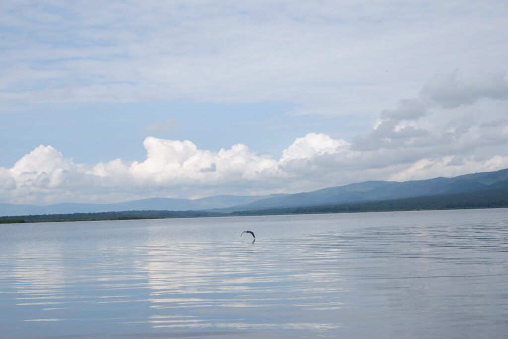
    After another early wake up, on Sunday, our last day, we went for a bot drive at 9. It was only an hour long, but enough to take you around the Ihema lake, see hippos and crocodiles. Pods of 50 hippopotami grunt and splutter throughout the lake, while outsized crocodiles soak up the sun with their vast jaws menacingly agape.

    Suggested reading

    Comments Off on Akagera National Park
  • Accomodations,  Adventures,  Africa,  Lodges,  Places,  Safari

    Ruzizi Tented Lodge

    In the riverine forest on the edge of lake Ihema is a small, private lodge offering nine spacious, en-suite tents, dotted along the forested lakes’ edge. Sheltered by large trees and swaying palms, Ruzizi tented lodge is a quiet retreat in the spectacular setting of Akagera National Park.

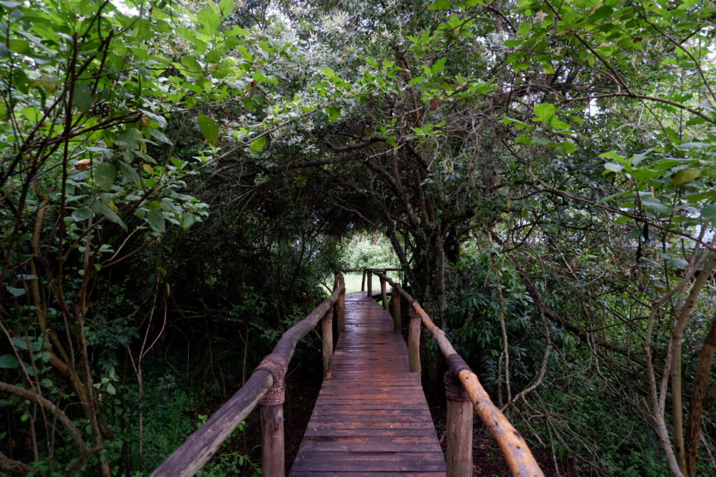
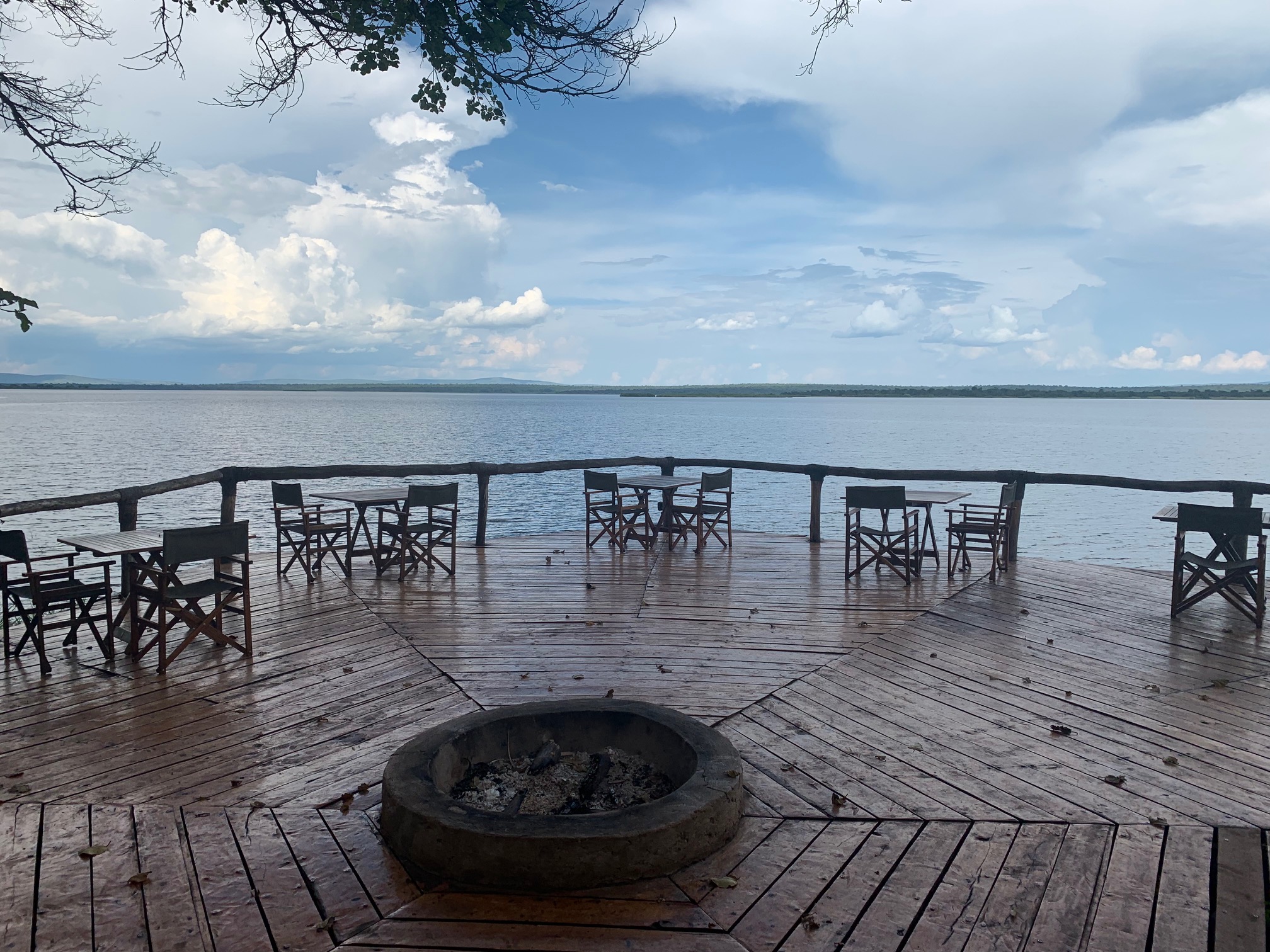
    The tents are located along a boardwalk stretching either side of a thatched lounge and dining area. A raised deck overlooks the lake; dinner on the deck feels like enjoying a sundowner around a cozy campfire.

    IMG_2230

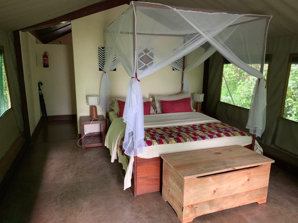
    Inside each tent is a comfortable queen (or large twin) beds and a private bathroom.

    Owned and managed by the park, 100% of the profits from the lodge go back into the total management of the park supporting law enforcement and conservation initiatives. The lodge is entirely powered by solar panels.

    Comments Off on Ruzizi Tented Lodge