North America
-
Canada
September 21, 2026 / -
Halifax
September 18, 2026 /Halifax, the capital of Nova Scotia, is a city built around one of the largest natural harbours in the world. Its history has always been closely connected to the sea, navigation, and the military role the city played for centuries along Canada’s Atlantic coast.
Downtown Halifax is compact and easy to explore on foot, with the Citadel overlooking the city from above and the waterfront forming its lively heart. Historic buildings, museums, modern public spaces, restaurants, and working piers all sit within a relatively small area, making the city particularly easy to discover with children.
Day 1 - Waterfront
The first afternoon is best spent along the Halifax Waterfront Boardwalk, a long pedestrian promenade following the harbour through piers, boats, historic buildings, restaurants, and public art installations.
Start at Bishop’s Landing and walk north along the water. Along the way, pass Halifax’s distinctive bent lamppost sculptures, the Salt Yard, and several small piers overlooking the harbour and Dartmouth on the opposite shore.
Continue past the Maritime Museum of the Atlantic and reach Queen’s Marque, one of the newer sections of the waterfront. Wide public spaces and granite steps descend directly toward the harbour, creating a good place to stop and watch ferries and boats moving across the water.
From there, continue toward the Halifax Ferry Terminal and the Historic Properties, where old waterfront warehouses have been restored and transformed into shops and restaurants.
The route is easy, mostly flat, and particularly suitable for families with small children. It is also the best introduction to Halifax, showing immediately how closely the city is connected to its harbour.
Day 2 – Halifax Citadel and Point Pleasant Park
The second day in Halifax combines two places that help explain the city from very different perspectives: the Halifax Citadel, which tells the story of the city’s military origins, and Point Pleasant Park, where forest trails and coastal scenery hide the remains of another layer of Halifax’s defensive system.
Halifax Citadel
Halifax was founded by the British in 1749 around its strategic harbour, and a fortification was built almost immediately on this hill to protect the new settlement and naval base. Four different citadels occupied the site over the following century. The present stone fortress was begun in 1828 and completed in 1856, after almost three decades of construction.
Its elevated position was deliberate. From the ramparts, the garrison could watch both the harbour and the approaches to the city. By the mid-19th century, Halifax had become one of the British Empire’s principal naval stations in North America.
Today, the Citadel has been restored largely to its Victorian appearance. Costumed soldiers representing the 78th Highland Regiment bring the site to life, while the barracks, parade square, defensive tunnels and artillery positions provide a good introduction to daily military life in 19th-century Halifax.
A good family visit does not need to cover every exhibition. Start with the ramparts for the panoramic views over downtown and the harbour, then explore the barracks and some of the tunnels built into the fortifications.
The highlight is the Noon Gun. Every day at exactly noon, a cannon is fired from the Citadel, continuing a Halifax tradition that dates back to at least 1856. With small children, it is worth standing slightly farther back, as the shot is surprisingly loud.
Allow around 1½ to 2 hours for the visit.
Point Pleasant Park
In the afternoon, leave downtown behind and head to Point Pleasant Park, at the southern tip of the Halifax Peninsula.
This large wooded park feels surprisingly removed from the city despite being only a few minutes from downtown. Trails run through dense forest before reaching rocky sections of coastline overlooking Halifax Harbour, McNabs Island and the open Atlantic approaches.
The peaceful landscape also hides an important military history.
Beginning in the 1790s, the British constructed batteries around Point Pleasant to prevent enemy ships from entering Halifax Harbour or the Northwest Arm. For several decades, these fortifications formed the first line of defence for the city.
One of the most important surviving structures is the Prince of Wales Tower, built in 1796–97. It was the first Martello-style defensive tower constructed in Canada and one of the earliest examples in the British Empire. Other batteries remained in military use much longer, some continuing to serve Halifax until the Second World War.
For a visit with young children, the best route starts near the lower entrance on Sailors Memorial Way. Follow the path toward the Naval Memorial and Point Pleasant Battery, then continue along the coast toward Black Rock Beach before returning through the forest.
There is no need to follow a strict loop. The main attraction is the contrast between woodland, ocean views and the remains of the old harbour defences.
Allow around 1 to 1½ hours for an easy family walk.
Together, the Citadel and Point Pleasant Park show why Halifax developed where it did. The harbour made the city important, while the network of forts surrounding it was designed to protect one of the most strategically valuable ports on the Atlantic coast.
Day 3 – Discovery Centre and Dartmouth
The third day in Halifax is a good combination of something designed specifically for children and one of the easiest ways to experience the harbour from the water.
Discovery Centre
Start the morning at the Discovery Centre on Lower Water Street, Halifax’s interactive science museum.
The museum is designed around hands-on exhibits rather than traditional displays, making it especially suitable for younger children. Exhibits cover science, technology, engineering, nature and the human body, with plenty of opportunities to touch, build, experiment and move between activities.
For families with small children, there is no need to follow a fixed route. Two or three hours are enough to explore the most engaging areas without turning the visit into a long museum day.
The Discovery Centre is also well placed for families staying downtown, directly beside the southern section of the waterfront.
Ferry to Dartmouth
In the afternoon, head to the Halifax Ferry Terminal and take the Alderney Ferry across the harbour to Downtown Dartmouth.
The Halifax-Dartmouth ferry service has been operating in different forms for centuries and is one of the oldest continuously operating saltwater passenger ferry services in North America. The short crossing is also one of the simplest and cheapest ways to see Halifax from the water.
The ride takes only around 15 minutes, but the views back toward the Halifax skyline, Citadel Hill and the waterfront make the crossing worthwhile in itself.
Dartmouth Waterfront
The ferry arrives at Alderney Landing, the cultural and transportation hub of Downtown Dartmouth.
From here, walk through Ferry Terminal Park and continue along the Dartmouth Harbourwalk. The waterfront is much quieter than Halifax’s, with open views across the harbour and plenty of space for children to walk and explore.
A short section of the Harbourwalk is enough with young children. There is no need to complete the full trail toward Woodside.
After the waterfront, continue into Downtown Dartmouth along Portland Street, the main commercial street of the neighbourhood. Small restaurants, cafés, independent shops and colourful murals give this part of Dartmouth a more local and relaxed atmosphere than Downtown Halifax.
Return to Alderney Landing and take the ferry back across the harbour.
This is an easy half-day excursion and one of the best ways to understand Halifax Harbour as a whole. Halifax provides the historic centre and busy waterfront, while Dartmouth offers a quieter perspective from the opposite shore.
-
Lake Muskoka
August 31, 2026 /Day 1
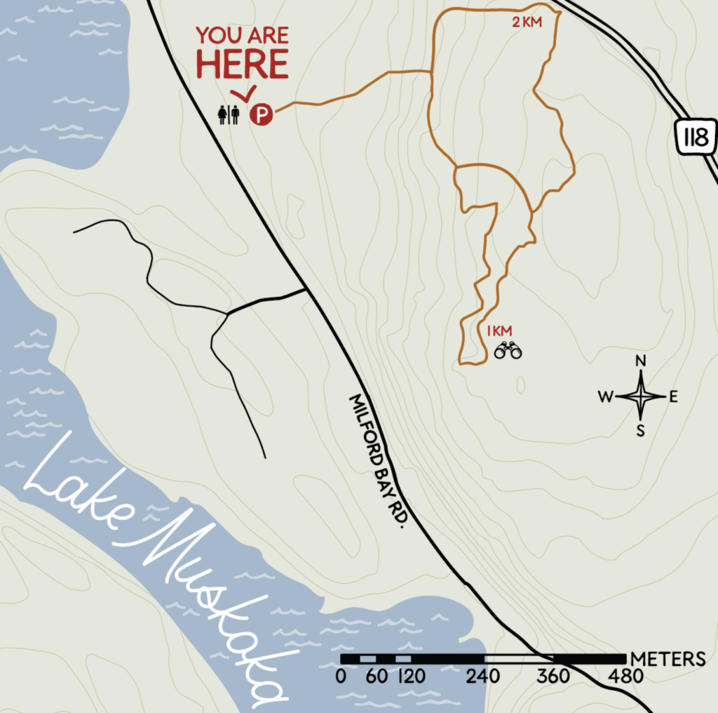
The day begins at Huckleberry Rock Lookout Trail, a short 2.5 km loop near Milford Bay that crosses the exposed pink granite of the Canadian Shield. The rock is more than a billion years old, and the landscape bears the marks of glaciation, erosion, fire, and historic logging. The trail climbs gradually over broad granite slabs to viewpoints across Lake Muskoka and the surrounding forest. Small wetland areas and black spruce contrast with the dry, open rock, showing how varied the Muskoka landscape can be within a very short distance.


The afternoon continues in Port Carling, the historic hub of the Muskoka Lakes. The village occupies a strategic position between Lake Muskoka and the upper lakes, Rosseau and Joseph. Its locks begin construction in 1869 and open in 1871, allowing steamships to travel between the lakes and helping transform the region from a relatively isolated frontier into one of Ontario’s best-known summer destinations. The village takes its name from John Carling, then Ontario’s Minister of Public Works and Agriculture. The locks remain operational, so boats still pass through the same narrow waterway that plays such an important role in the development of Muskoka.
A short walk from the locks leads to the Port Carling Wall, one of the village’s most distinctive landmarks. From across the street, the wall appears to show a single historic image of the steamship RMS Sagamo passing through the locks. Closer inspection reveals that the mural is composed of more than 9,000 photographic tiles based on hundreds of archival images documenting local life between 1860 and 1960. Measuring roughly 111 by 45 feet, it works almost like a visual archive of the region, bringing together steamships, settlement, tourism, and everyday life in Muskoka.
Together, Huckleberry Rock and Port Carling provide a compact introduction to Muskoka. The morning explains the geography, granite, forest, and lakes that define the region, while the afternoon explains how those waterways shape settlement, transport, and tourism. It is an easy way to understand why Lonely Planet describes Muskoka as the heart of Ontario’s cottage country.
Day 2 - Gravenhurst, Lake Muskoka and the Steamship Era
The second day shifts from Muskoka’s landscape to the history of how the region becomes accessible, fashionable and ultimately famous. It begins in Gravenhurst, at Muskoka Wharf, where the modern tourism story of the lakes is closely tied to steam navigation. Lonely Planet presents the Muskoka region as classic Ontario cottage country, shaped by lake towns, historic steamship travel and a strong relationship between settlement and waterways.

The steamship story predates Canada itself. The first steamer, Wenonah, begins service on Lake Muskoka in 1866, one year before Confederation. Over the following decades, the Muskoka Lakes Navigation Company develops one of the largest inland steamship fleets in North America. These vessels are not originally pleasure boats. They act as extensions of the railway network, transporting settlers, mail, supplies, hotel guests and, eventually, generations of summer residents between Gravenhurst and the increasingly populated shores of Lakes Muskoka, Rosseau and Joseph.
The cruise departs from Muskoka Wharf, on the southern side of Muskoka Bay. The geography explains why Gravenhurst becomes such an important gateway to the region. Muskoka Bay forms a sheltered approach to the larger lake, and after the railway reaches Gravenhurst in 1875, passengers and freight can transfer directly from trains to steamships. From here, the waterways become the main arteries into the interior of Muskoka.
As the ship leaves the bay, the character of Lake Muskoka changes constantly. The lake is not simply a broad open body of water. It is a complicated landscape of narrow channels, islands, rocky peninsulas, coves and exposed Canadian Shield. These constricted passages are one of the defining features of the lake’s geography and help explain why navigation here has always required detailed local knowledge. The alternation between open water and narrow corridors also gives the cruise much of its visual interest, with changing perspectives on forested shorelines, cottages and boathouses.

The modern Wenonah II, launched in 2002, is a contemporary vessel designed to evoke the traditional Muskoka steamships and named after the original Wenonah. From its decks, the lake reveals the geography that drives the development of the region: long shorelines, protected bays, narrow passages and islands that naturally become sites for cottages, resorts and landing points.
The shoreline also contains several unexpected layers of history. One of the most unusual is Camp 20, a prisoner-of-war camp for German soldiers that operates in Gravenhurst from 1940 to 1946. The camp occupies a large waterfront site in the Muskoka Bay area, near what is now Ungerman Gateway Park. Its perimeter includes almost a kilometre of fencing and even an underwater barrier extending into the lake, allowing prisoners to swim while preventing escape. Today, only limited physical remains survive, but the site is interpreted through historical markers.
The same area has an equally striking medical history. Before the POW camp, Gravenhurst is associated with the treatment of tuberculosis. The Muskoka Free Hospital for Consumptives opens in 1902, part of the wider sanatorium movement that sends patients to rural areas where clean air, rest and isolation are considered central to treatment. The hospital later becomes part of a larger institutional complex on the Muskoka waterfront. After the decline of the sanatorium era, the site changes function again. In 1958, the Ontario Fire College opens on the former hospital grounds and becomes an important provincial training centre for firefighters.
This sequence is one of the most fascinating aspects of Gravenhurst. A stretch of shoreline that now appears peaceful and recreational has successively served as a medical site, a wartime detention area, a provincial training facility and, eventually, part of a major tourism landscape. Some local accounts refer to psychiatric use in the area, but the sources reviewed here clearly document tuberculosis hospitals and sanatoria rather than a psychiatric hospital, so that point should be treated cautiously unless the specific institution can be identified.
The cruise itself therefore becomes more than a scenic excursion. It is a moving introduction to how Muskoka develops through transportation, health institutions, wartime history and tourism. The water is not merely the backdrop. It is the element that connects all of these phases.

The second half of the day continues at the Muskoka Discovery Centre, also in Gravenhurst, which provides the historical and cultural context behind what is visible from the ship. One of its most important exhibitions is Misko-Aki: Confluence of Cultures, developed with Indigenous elders, scholars and linguists representing Anishinaabek, Haudenosaunee, Huron-Wendat and Métis perspectives. It traces more than 10,000 years of Indigenous presence in the Muskoka watershed, placing the nineteenth-century steamship era within a much longer history of human occupation.
Other exhibits focus on the relationship between Muskoka and water itself. Watershed Wonders explores the interconnected system of lakes, rivers, wetlands and communities, while the Grace & Speed Boathouse contains an extensive collection of classic wooden boats. Together they show how canoe travel, steam navigation, recreational boating and cottage culture evolve around the same basic fact: in Muskoka, water has historically been the principal route of movement, economic development and recreation.
For younger visitors, the museum is unusually accessible. The KidZone uses hands-on STEAM activities rather than relying only on conventional displays, making the centre suitable even for very young children. This creates a strong balance for the day: the steamship provides the physical experience of Muskoka from the water, while the museum explains the Indigenous history, engineering, ecology and tourism that shape the landscape seen from the deck.
Taken together, the cruise and Discovery Centre provide one of the clearest introductions to Gravenhurst and to Muskoka as a whole. The first day explains the region through granite, forest and the locks at Port Carling. The second follows the water itself, showing how steamships, narrow channels, hospitals, wartime institutions and cottage development all emerge from the same geograph
Day 3: Bracebridge, Waterfalls and the Industrial Heart of Muskoka
The third day moves inland from the lakes and steamship routes to Bracebridge, one of Muskoka’s historic commercial centres. Lonely Planet describes Bracebridge, together with Huntsville and Gravenhurst, as one of the classic bases for experiencing cottage country, combining local trails, lake access and compact town centres.
Bracebridge develops around the Muskoka River, and the river explains much of the town’s history. The community is incorporated as a village in 1875 and becomes a town in 1889. By then, its economy already includes tanneries, a grist mill, woollen mill, flour mill and sawmill, all taking advantage of the river’s considerable water power. Unlike Port Carling, whose story is dominated by navigation between the lakes, Bracebridge grows as an industrial town built around waterfalls and moving water.

The morning begins at Bracebridge Falls and Bracebridge Bay Park. The falls sit directly below the historic centre, where the North Branch of the Muskoka River drops toward Bracebridge Bay. The waterfront seen today is partly the result of a major restoration program begun by the town in 1969, intended both to recover public access to the river and to highlight its importance to early explorers and settlers. Bracebridge Bay Park officially opens in 1981.
The falls are not simply scenic. Water power becomes one of the engines of Bracebridge’s nineteenth-century economy, supporting mills and manufacturing and eventually electricity generation. Hydroelectric infrastructure still makes use of Bracebridge Falls today, creating an unusually visible connection between the town’s industrial past and its modern landscape.
This stretch of river also predates European settlement by many centuries. Local historical interpretation describes the flat ground near present-day Bracebridge Bay Park as a traditional stopping and camping area used by Indigenous peoples travelling through the Muskoka waterways. Later explorers and surveyors use the same river corridors, portaging around Bracebridge Falls as they move through the region. The falls are therefore both an obstacle and a meeting point in Muskoka’s transportation history.
From the waterfront, the route continues uphill toward Manitoba Street, Bracebridge’s historic main street. Originally called Muskoka Road, it is renamed Manitoba Street in 1867, the year of Canadian Confederation, alongside nearby streets named Ontario, Quebec and Dominion. Wooden sidewalks appear in 1876 and the original dirt road is surfaced with stone in 1879. It remains the commercial spine of downtown Bracebridge.
Several buildings reveal the prosperity of the late nineteenth and early twentieth centuries. Among the most recognizable is the Old Post Office and Clock Tower on Manitoba Street, now protected for both its architectural and historical importance. Nearby heritage buildings and the town’s walking-trail markers help reconstruct a period when Bracebridge functions as the main service and industrial centre for the surrounding Muskoka countryside.
The development of the railway accelerates that transformation. In 1885, the Northern Railway reaches Bracebridge, requiring substantial engineering works across the Muskoka River and through the surrounding Canadian Shield. The railway links the town more efficiently with southern Ontario, while steamships continue carrying people and goods across the lakes. For several decades, Bracebridge therefore sits at the intersection of three transportation systems: road, rail and water.

The town’s relationship with the river is equally important to the logging industry. Huge quantities of timber from the forests upstream, including areas toward Algonquin, are floated down the Muskoka River toward sawmills. Logging, mills and manufacturing reshape both the economy and the landscape, helping turn Bracebridge from a small frontier settlement into the regional centre it becomes by the late nineteenth century.
A short walk through downtown therefore reveals a different Muskoka from the grand cottages and steamships of the previous day. Gravenhurst tells the story of tourism, Port Carling of navigation, while Bracebridge tells the story of industry and settlement. The same rivers and lakes that attract summer visitors also provide transportation routes, power mills, move timber and determine where communities develop.
For a family visit, the most practical route is compact: begin at Bracebridge Falls and Bracebridge Bay Park, walk through the historic waterfront, continue up Manitoba Street, and finish around Memorial Park before lunch. The town maintains a Heritage Walking Trail with 12 interpretive signs through the downtown core, so much of this history can be followed without turning the morning into a formal museum visit.
The contrast with the first two days is useful. Huckleberry Rock introduces the ancient geology of the Canadian Shield. Port Carling explains how the lakes become connected. Gravenhurst shows how steamships transform Muskoka tourism. Bracebridge completes the picture by showing how waterfalls, timber, mills and railways create a permanent town in the middle of cottage country.
Day 4: Muskoka Heritage Place and the Portage Flyer
The fourth day moves north to Huntsville and into the social history of early Muskoka. At Muskoka Heritage Place, the Pioneer Village recreates a small community from the period when permanent settlement begins to expand through the region. Many settlers arrive after Ontario’s Free Land Grant Act of 1868, which offers land to families willing to clear and improve it. The promise sounds generous, but the reality is difficult: thin soil, exposed granite and dense forest make farming hard, and early communities depend on a mixture of agriculture, logging, local trades and transport.
The village is not simply a collection of replicas. Muskoka Heritage Place develops gradually from the 1960s onward, with historic buildings moved to the site from surrounding communities. The school, general store and blacksmith shop arrive in 1967, while the Pioneer Village formally opens in 1971. Other structures, including barns, workshops, houses, a church and an inn, are subsequently added to create the impression of a functioning rural settlement rather than a conventional museum.


The one-room schoolhouse gives one of the clearest pictures of everyday life. Rural schools bring children of different ages into a single room, often with one teacher responsible for the entire group. One of the preserved schoolhouses dates from 1895 and originally opens with twenty students. Nearby, the blacksmith shop explains why skilled trades are essential in isolated communities: tools, horseshoes and metal repairs must be produced locally, often far from larger towns. The general store serves a similarly central role, supplying food and household goods while also acting as a meeting place and commercial hub.
Hands-on demonstrations make the village more convincing than static displays alone. Depending on the day, visitors may encounter blacksmithing, candle dipping, wool carding, pioneer laundry, croquet, school lessons or traditional food demonstrations. These activities show how much domestic and agricultural work is done manually, and how little separation exists between work, home and community life in nineteenth-century Muskoka.
The site also places European settlement within a longer Indigenous history. Displays and demonstrations include Indigenous as well as pioneer perspectives, helping avoid the impression that Muskoka’s history begins with the arrival of settlers. Long before roads, railways and steamships, Indigenous communities use the region’s lakes and rivers as transportation corridors and seasonal routes through the Canadian Shield.

The visit ends with the Portage Flyer, one of the most distinctive pieces of Muskoka transportation history. The original railway operates from 1904 to 1959 between North and South Portage near Dwight. At only about 1⅛ miles of narrow-gauge track, it becomes known as the world’s smallest commercial railroad. Its purpose is entirely practical: Peninsula Lake and Lake of Bays lie close together geographically but at significantly different elevations, making a navigable canal or lock system prohibitively difficult and expensive.
The railway therefore functions as a land bridge between two steamship systems. Passengers and cargo travel by steamship through Huntsville and Fairy Lake to Peninsula Lake, transfer onto the Portage Flyer, cross the short stretch of land, and then board another steamship on Lake of Bays. Mail, building materials, supplies and tourists all make the same journey. From South Portage, steamships continue toward famous resorts such as the Britannia Inn, Wa Wa Hotel and Bigwin Inn.

Today’s Portage Flyer operates from Rotary Village Station in Huntsville using a 1926 steam locomotive during the summer season. The recreated journey follows the Muskoka River toward Fairy Lake and preserves the atmosphere of the original line rather than its exact historic route. What begins as a short train ride therefore completes the broader story developed over the previous days: Muskoka evolves through a network of waterways, portages, steamships, roads and railways, each solving the problem of moving through a landscape dominated by lakes, forest and exposed rock.
Taken together, the Pioneer Village and Portage Flyer show a different side of Muskoka from the grand lakeside cottages and steamships of Gravenhurst. Here the focus is on settlement, labour and connection: how people build communities in difficult terrain, how local trades support daily life, and how even a tiny railway becomes essential in linking otherwise separate lake systems.
Day 5: Hardy Lake Provincial Park
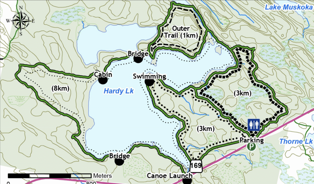
The fifth day returns to the landscape itself, this time at Hardy Lake Provincial Park, south of Port Carling near Torrance. Unlike Huckleberry Rock, where the main attraction is the exposed granite and the broad lookout over Lake Muskoka, Hardy Lake offers a more enclosed and intimate version of the Canadian Shield landscape: forest, wetlands, rocky shoreline and small sections of open water appearing repeatedly through the trees. The park protects more than 800 hectares and is classified as a Natural Environment Park.

The route follows the 3 km loop, one of the two principal hiking options in the park. The Township of Muskoka Lakes classifies the trails here as moderate to difficult, with the shorter loop providing access to the shores of Hardy Lake without committing to the much longer circuit around the lake. The terrain is typical of Muskoka: uneven roots, exposed Precambrian bedrock, narrow forest paths and sections close to the water.
Hardy Lake is particularly interesting from a geological and ecological perspective. The park sits within the ancient rock landscape of the Canadian Shield, shaped repeatedly by glaciation. Ice sheets grind, score and polish the bedrock, while meltwater fills depressions and channels left behind in the rock. Over thousands of years, these become the interconnected lakes, ponds and wetlands that now define much of southern Muskoka.
One of the park’s most unusual features is botanical rather than geological. Ontario Parks protects a community of Atlantic coastal plain plant species that survives here far from the modern Atlantic coast. Their presence is a legacy of the enormous glacial and post-glacial lakes that once covered much of the region. As ancient Lake Algonquin receded, some shoreline plant communities remained isolated in suitable habitats around lakes such as Hardy. The park therefore preserves not only the physical evidence of glaciation, but also a biological remnant of the landscapes that follow it.
The trail also reaches sections of shoreline characteristic of Muskoka’s Precambrian landscape, with dark water, exposed rock and dense forest meeting almost directly at the lake edge. The official trail guide describes Hardy Lake and nearby Lake Muskoka as examples of the rugged, lake-studded shoreline that defines the region. There is little infrastructure inside the park, which gives the walk a noticeably more secluded character than the better-known tourist sites around Port Carling and Gravenhurst.
The 3 km loop works particularly well as a family hike. It is long enough to feel like a genuine excursion into the forest but short enough to complete during a morning without sacrificing the slower rhythm of a cottage holiday. There are no major built attractions along the route and no single dramatic viewpoint comparable with Huckleberry Rock. The appeal lies instead in the gradual transitions between forest, wet ground, granite and shoreline.

Hardy Lake therefore adds another piece to the geography of Muskoka. Huckleberry Rock reveals the exposed surface of the Canadian Shield from above; Hardy Lake shows how that same ancient rock interacts with water, soil and forest at ground level. Together, the two hikes illustrate why Muskoka’s landscape feels so distinctive: the lakes are not separate features placed within the forest, but part of a single glacial landscape in which rock, water and vegetation continuously overlap.
Day 6: Arrowhead Provincial Park and a Morning by Canoe
The sixth day moves away from Muskoka’s historic towns and back into the wilderness, at Arrowhead Provincial Park, just north of Huntsville. The park lies within the same Canadian Shield landscape that defines much of central Ontario, but its character is different from the exposed granite of Huckleberry Rock or the intimate shoreline of Hardy Lake. Here the landscape is broader and quieter, shaped by forest, small lakes and the winding course of the Big East River. Ontario Parks describes Arrowhead as one of the region’s most accessible outdoor destinations, with sandy beaches, hiking trails and canoeing opportunities concentrated within a relatively compact area.
The morning begins on the water. Canoes can be rented directly inside the park, making it possible to launch without transporting equipment or dealing with a separate outfitter. The lake is calm and sheltered compared with Lake Muskoka, with far less motorboat traffic, which makes it particularly suitable for a short family paddle. The route does not need to be ambitious: the appeal comes from moving slowly along the shoreline, surrounded by forest and still water, rather than covering distance.
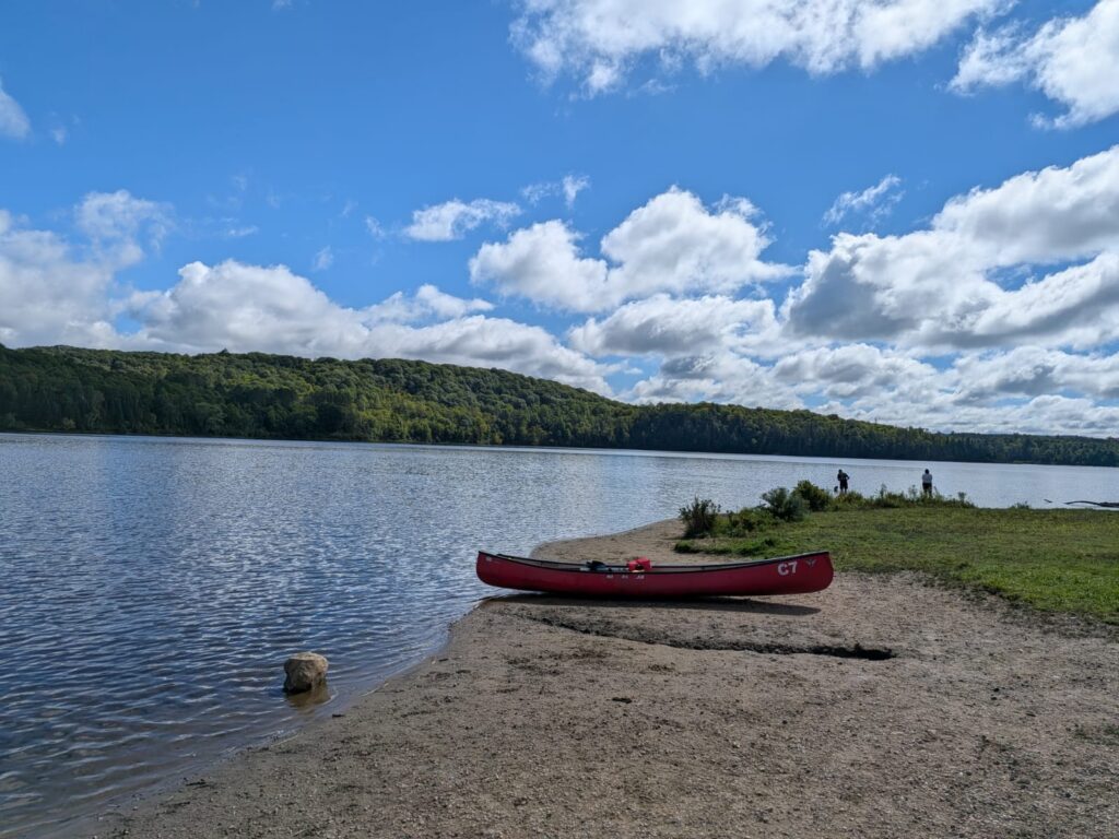
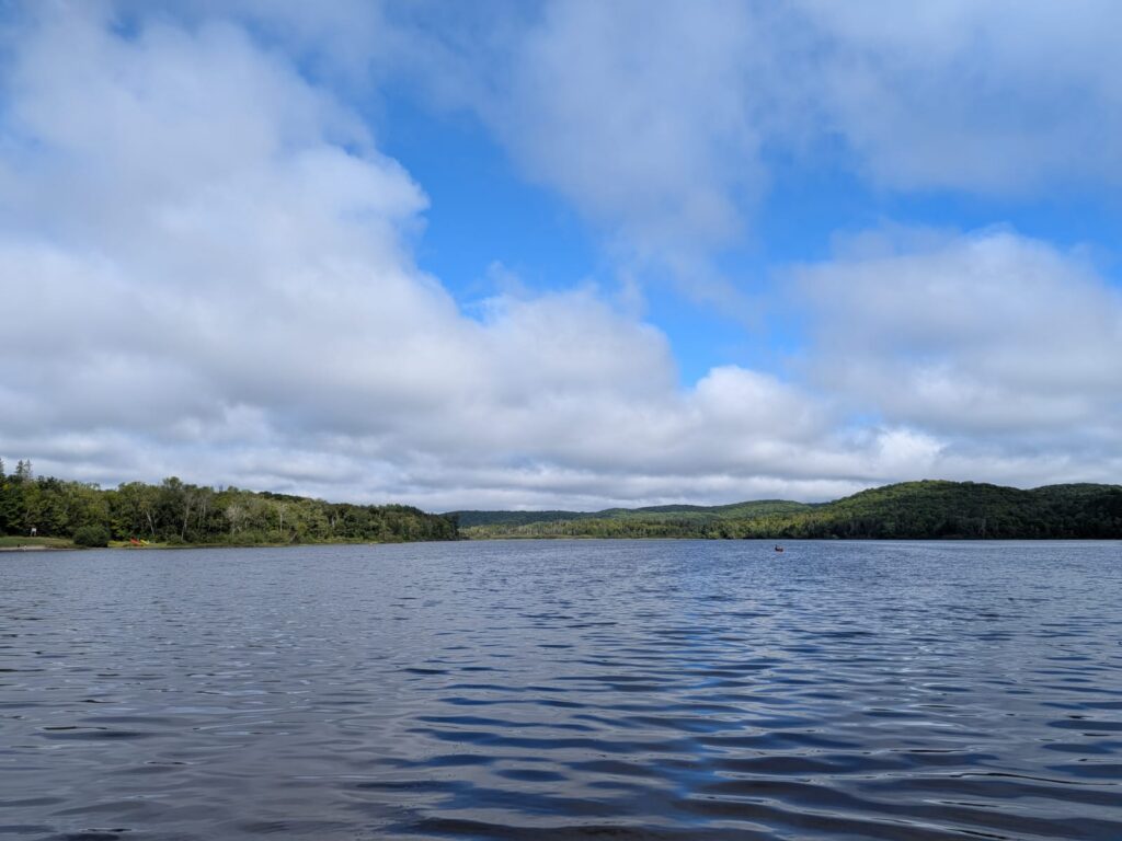
Canoeing is one of the most characteristic ways to experience the Ontario interior. Long before roads or railways, Indigenous peoples use interconnected lakes and rivers as travel corridors, and the canoe becomes essential to movement across the Canadian Shield. Later, fur traders and settlers adopt the same routes. In places like Arrowhead, that history is still easy to understand physically: the water provides the most natural way through a landscape where dense forest and exposed rock make overland travel slower and more difficult.
After the paddle, the visit continues at Big Bend Lookout, one of Arrowhead’s signature viewpoints. The overlook sits above a dramatic curve in the Big East River, where the river bends sharply through the forested valley below. Unlike a mountain viewpoint, the panorama is not about height alone. It shows how rivers actively shape the landscape, cutting through glacial deposits and creating the broad meanders that characterize this part of the park. The viewpoint is easy to access, making it a good complement to the morning on the water.
Arrowhead also offers a useful contrast with the previous days. Hardy Lake feels quiet and almost untouched, with minimal infrastructure and narrow woodland trails. Arrowhead is more developed, but that makes it especially effective for families: canoe rental, short walks, beaches and viewpoints can all be combined without turning the day into a long expedition.
The most memorable part of the visit, however, is the simplicity of the canoe itself. On a calm inland lake, surrounded by forest and with no need to follow a fixed route, the experience feels much closer to the traditional rhythm of travel through Ontario than a motorized cruise or scenic drive. The landscape changes slowly, and the water becomes part of the journey rather than merely something to look at.
Taken together, the canoe and Big Bend Lookout provide a concise introduction to another side of Muskoka and the surrounding highlands: less about settlement and tourism, more about water, forest and movement through the landscape. It is one of the most direct ways to experience the geography that has shaped the region for thousands of years.
Day 7: Huntsville by Canoe
The seventh day returns to the water, this time in Huntsville, where the Muskoka River threads directly through the town before opening toward Fairy Lake. This setting makes paddling feel very different from Arrowhead. Instead of starting in a provincial park, the canoe launches from an urban waterfront and quickly moves into a landscape where town, river and forest overlap.
Huntsville develops around exactly this relationship with water. Long before modern roads dominate travel, the river system links the community with the surrounding lakes and provides one of the natural corridors through northern Muskoka. The town later becomes an important junction between steamship routes, portage connections and rail travel, which explains why so much of its historic identity remains tied to the waterfront.
A short canoe trip from downtown is therefore less about wilderness in the strict sense and more about understanding how settlement grows around a navigable river. The route passes stretches of shoreline where houses and docks gradually give way to quieter water, trees and marshy edges. The change is subtle, but it shows one of Muskoka’s recurring themes: human settlement rarely replaces the landscape entirely. Instead, towns are inserted into the same network of lakes, rivers and granite that defines the surrounding countryside.
For a child, the scale of the trip works particularly well. The canoe stays close to shore, the route can be shortened at any time, and the experience is active without requiring a long hike. After the success of the first canoe outing at Arrowhead, repeating the experience in a new setting offers a useful contrast. Arrowhead feels enclosed and protected, while Huntsville feels more connected to the historical geography of travel and settlement.
While one part of the family is on the water, the downtown waterfront works equally well for younger children. River Mill Park sits close to the centre of Huntsville and combines open green space, river views and a playground, making it easy to split the morning without turning it into two completely separate excursions.
The broader context is what makes the morning interesting. Over the course of the trip, water has appeared in several different forms: as the transport corridor of the steamships in Gravenhurst, as the lock system at Port Carling, as quiet forest shoreline at Hardy Lake, and as a protected paddling environment at Arrowhead. Huntsville adds another variation, showing how a town can develop directly around a river while still retaining a strong connection to the surrounding wilderness.
The result is one of the simplest days of the itinerary, but also one of the most characteristic. Muskoka is often described through its cottages and lakes, yet the region becomes easier to understand when seen from the water itself. Canoeing through Huntsville makes that connection immediate: the river is at once a recreational space, a historic transportation route and part of the everyday structure of the town.
Day 8: Torrance Barrens, Muskoka’s Lunar Landscape
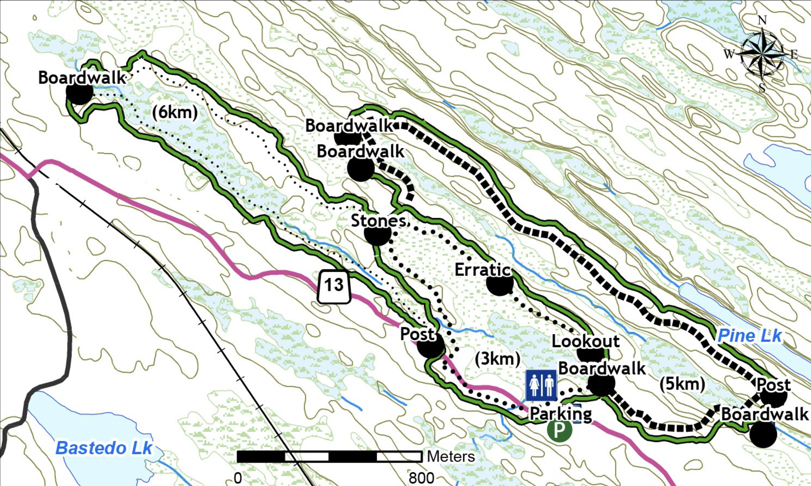
The final hiking day moves into one of the most unusual landscapes in Muskoka: the Torrance Barrens Conservation Reserve, south of Lake Muskoka. Unlike Hardy Lake, where forest and shoreline dominate, Torrance Barrens is defined by broad expanses of exposed Precambrian bedrock, low granite ridges, peat-filled depressions, wetlands and scattered stands of trees. The Township of Muskoka Lakes describes it as one of the most striking geological areas in the region, with a landscape that can feel almost lunar.
The route follows the 5 km trail, one of the three principal hiking options in the reserve. It is officially classified as difficult, not because of major elevation gain but because much of the route crosses uneven rock, wet ground and exposed surfaces where footing can be irregular. The trail repeatedly shifts between open granite and more sheltered sections of forest and wetland, making it visually very different from the other hikes of the trip.
Geologically, the reserve sits within the Grenville Province of the Canadian Shield, with ancient gneiss and migmatite bedrock exposed across large areas. Glaciation plays a major role in shaping the landscape. Ice and meltwater strip away much of the overlying soil, leaving broad rock barrens interrupted by shallow depressions that later fill with peat, ponds and wetlands. Glacial features such as polished bedrock, fractures, erratic boulders and thin deposits of till remain visible throughout the reserve.
Despite its apparently harsh surface, Torrance Barrens supports a surprisingly rich ecosystem. The reserve covers roughly 1,900 hectares and contains close to 500 species of flowering plants, around 150 bird species and numerous mammals, reptiles and amphibians. The contrast between dry exposed rock, wet hollows and wooded uplands creates a mosaic of habitats within a relatively compact area.
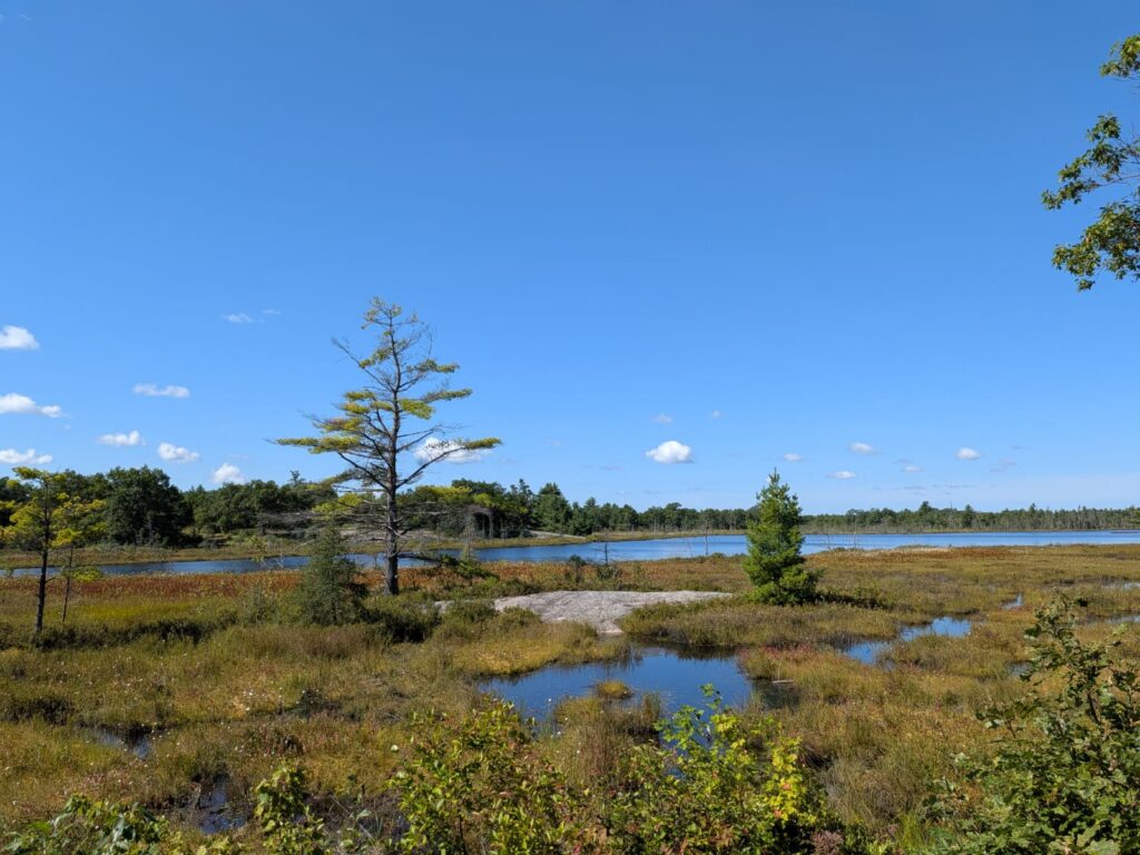
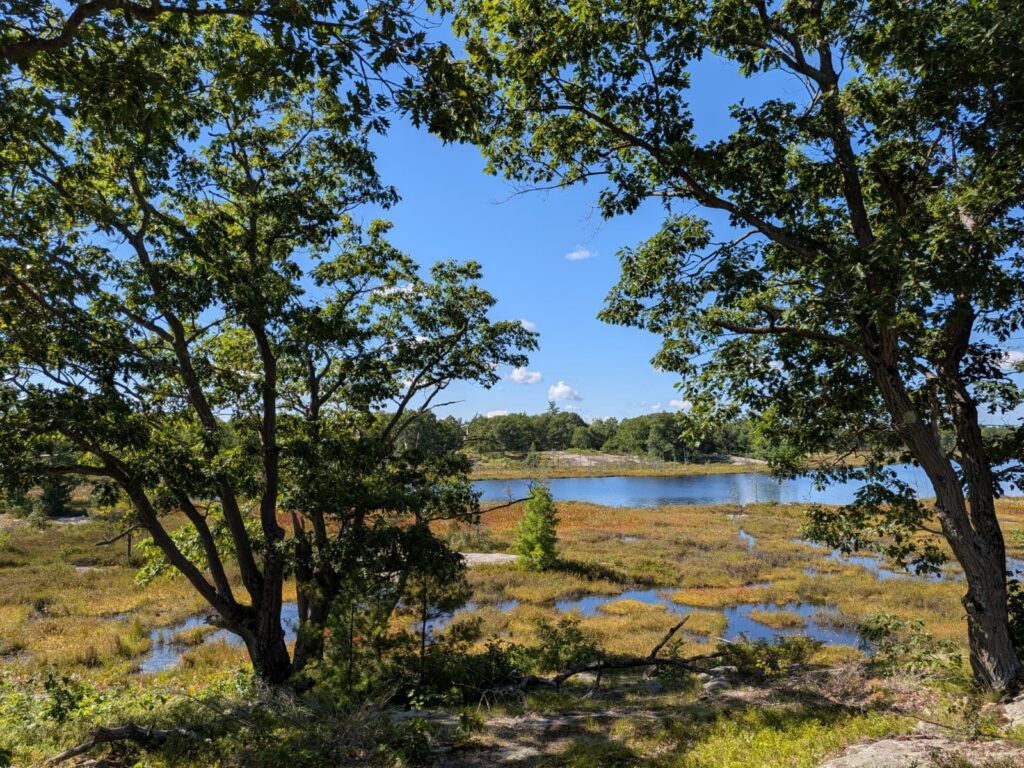
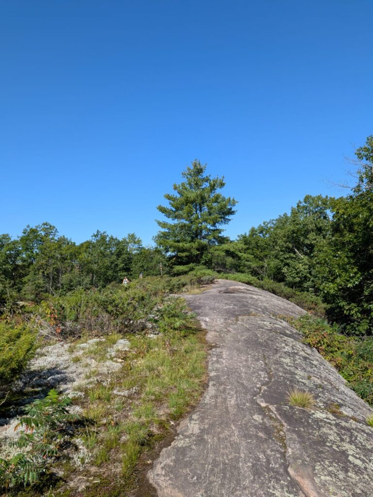
The reserve is also closely connected ecologically with Hardy Lake Provincial Park and other protected areas between Lake Muskoka and the Severn River. Together they form an important corridor of relatively undeveloped land across southern Muskoka. This makes Torrance Barrens a useful complement to the earlier Hardy Lake hike: both protect the same broader Canadian Shield landscape, but reveal very different expressions of it. Hardy Lake feels enclosed, forested and water-dominated; Torrance Barrens feels open, exposed and austere.
Torrance Barrens has another distinction that is almost as important as its geology. In 1999 it becomes Canada’s first officially recognized Dark Sky Reserve. Its distance from major sources of artificial light, open horizons and broad granite surfaces make it particularly suited to astronomy and astrophotography. The designation is intended not only to protect the quality of the night sky for visitors, but also to preserve the ecological value of natural darkness.
The 5 km loop therefore provides a very different ending to the hiking portion of the trip. Huckleberry Rock introduces the exposed Canadian Shield from a viewpoint above Lake Muskoka. Hardy Lake brings the trail into forest and rugged shoreline. Arrowhead adds river and canoe travel. Torrance Barrens strips the landscape back almost to its geological foundations, revealing how thin the boundary can be between bare ancient rock, wetland and forest in this part of Ontario.
It is perhaps the most distinctive walk of the trip for exactly that reason. The landscape is not conventionally dramatic, but it feels older, emptier and more elemental than the better-known lakefront scenery. It shows another side of Muskoka, one shaped as much by geology and glaciation as by cottages, villages and waterways.
-
San Francisco
November 2, 2023 /Day 1
Climb aboard the Powell-Mason cable car for an exciting ride. Get off at North Beach and visit Coit Tower (p56) to see innovative murals and breathtaking 360-degree views. Ascend the scenic Filbert Street Steps (p57) to the sunny Embarcadero waterfront, then dive into total darkness at the Tactile Dome in the Exploratorium (p53). Enjoy sensational fish tacos at Mijita (p79) in the Ferry Building (p78), then take the pre-booked ferry to Alcatraz (p51), the infamous maximum-security prison where inmates lived in tiny solitary cells. After touring the former prison, head to North Beach, where you can browse books at City Lights (p71), the symbolic bookstore of free speech, and see the Beat Museum’s (p60) collection of memorabilia.
Day 2
Take the California St cable car to Grant St to experience Chinatown.
The 41 historic alleys that border the 22 blocks of Chinatown have seen it all since 1849: gold rushes and revolutions, incense and opium, fires and hostilities. Chinese miners were among the first to arrive in San Francisco for the gold rush, but after 1870, anti-Asian laws restricted migration and made it harder to find work and housing. People of Chinese descent were denied the right to own property and participate in labor unions; many had to resort to dangerous jobs, such as building railway tunnels blasted with explosives in the mountains. White owners of Chinatown buildings made huge profits from the opium dens in Duncombe Alley and the brothels in Ross Alley. When the 1906 earthquake and fire devastated Chinatown, construction entrepreneurs persuaded the city to evacuate Chinese residents. However, with the support of the Chinese consulate and local merchants, and armed with pistols, Chinatown residents resisted the expulsion order and even returned to rebuild their community. Family associations closed opium dens and brothels, and in the 1920s, merchants renovated the neighborhood to attract tourists. Today, mahjong is still played at 36 Spofford Alley, where Sun Yat-sen once planned the revolution.
Cross the ‘Dragon Gate,’ donated by Taiwan in 1970, and you’ll find yourself in Dupont, a street once notorious for its red-light district.
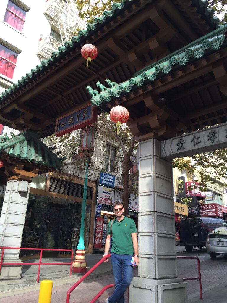
The ‘Chinese-deco’ architecture beyond the gate, featuring pagoda-roofed buildings, is the result of a group of enlightened entrepreneurs led by Look Tin Ely, who transformed the street from a prostitution area into a shopping district in the 1920s. Today, dragon-shaped lanterns illuminate souvenir shops and tea houses in the area.
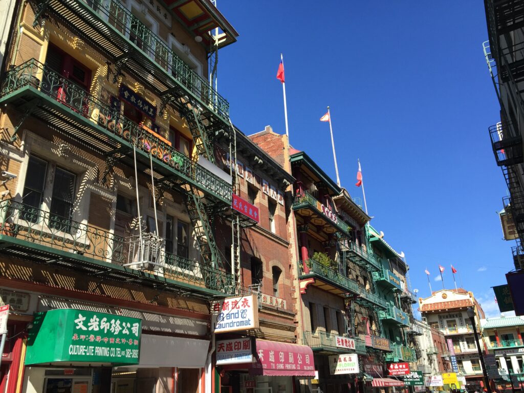
Stop for tea tastings at Red Blossom and the collection at the Chinese Historical Society of America. Stroll through Waverly Place with its temples, and Ross Alley, where you can buy fortune cookies from Golden Gate Fortune Cookie Company.
This bakery bakes custom cookies (50¢ each) using antique pastry presses. Alternatively, you can purchase a pack of risqué fortune cookies. They only accept cash, and a 50¢ tip is required for taking photographs.
Choose your favorite Chinese dumplings at City View, then climb the hill, pass by the ‘parlor houses’ (i.e., brothels) from the gold rush era.

Forget about car chase scenes from movies (such as “Vertigo,” “What’s Up, Doc?”) and commercials shot in San Francisco: the best way to reach Lombard Street isn’t by car but by cable car. The Powell-Hyde line reaches Nob Hill and then climbs Russian Hill, passing millionaires’ mansions and secret staircases lined with gardens. Get off at Lombard for an unbeatable view from the hill. From the highest point of Lombard Street, you might get dizzy: this zigzagging paved road descending Russian Hill has eight sharp turns and a steep slope of 27%. It might not be the ‘crookedest street in the world’ as commonly claimed (that title goes to Vermont Street on Potrero Hill), but you get the idea. The street appears in Hitchcock’s movie “Vertigo,” and skateboarding legend Tony Hawk included these twists and turns in his Pro Skater video game. If you’re not up for driving, you can walk down the 250 steps; it’s equally scenic.
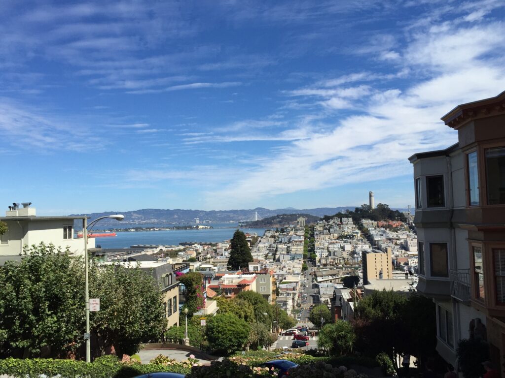
Back in the roaring ’20s, too many drunk people ended up with their cars in the gardens of Russian Hill houses. So, the homeowners decided to add eight sharp turns adorned with flowerbeds, transforming this extremely dangerous shortcut into a picturesque route. The result is what you see today: a red-bricked paved street, bordered by beautifully manicured flowerbeds and flanked by 250 steps.
Those brave enough to navigate Lombard Street’s perilous turns miss out on the view of the Golden Gate Bridge enjoyed from the winding paths of Sterling Park atop the hill. The sunset framed by wind-kissed Monterey pines is pure poetry and befits the park’s namesake, the penniless bohemian poet George Sterling, a nature lover, advocate of free love, and opium enthusiast. San Francisco’s high society was not scandalized by his eccentricities and dedicated this park to him.
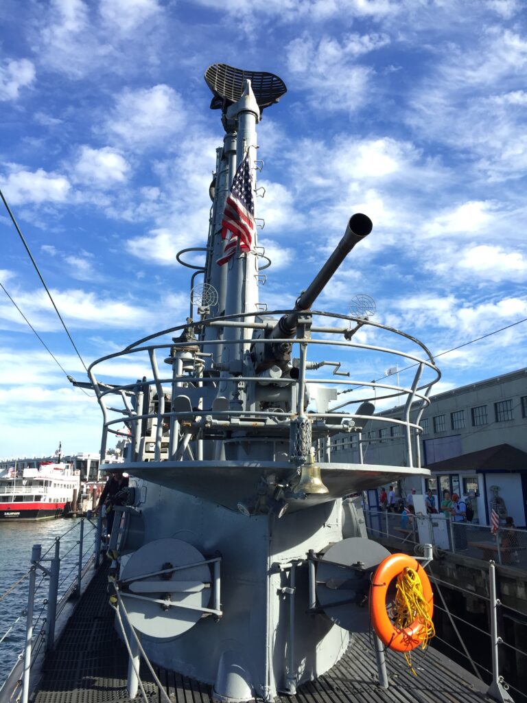
From the winding Lombard Street you will arrive at the Fisherman’s Wharf. Once upon a time, fishermen cast their nets here, but today it’s the tourists who are hooked: this commercial park stretches from the cable car terminus to the pier where cruises to Alcatraz depart. When you least expect it, Fisherman’s Wharf will offer you pleasant surprises. Here, you can sunbathe next to the sea lions, ride the carousels’ unicorns, enter a World War II submarine, have your fortune told by a wooden fortune teller, and watch sharks swim while you’re safely enclosed in glass tubes in the middle of the bay.
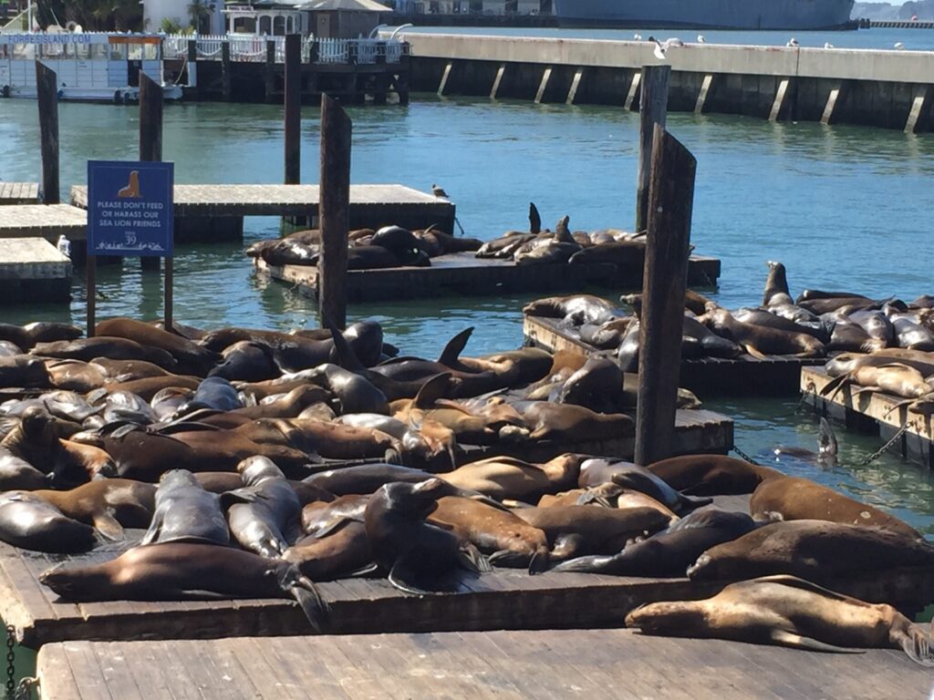
Even the stars dream of the sea lion life in San Francisco, which since 1990, has occupied a part of the tourist port where yachts dock. California law requires boats to give space to these mammals: therefore, from January to July, boat owners must give up their berths at Pier 39 to allow about 1300 sea lions to enjoy the sun undisturbed. They are the envy of all beach bums!
USS Pampanito All aboard! Enter this World War II military submarine that sank six Japanese ships, including two carrying British and Australian prisoners of war. The tales of tension while the submarine was submerged will leave you breathless (be careful if you suffer from claustrophobia), and all those brass knobs and hydraulic valves will make 21st-century technology seem overrated.
Day 3
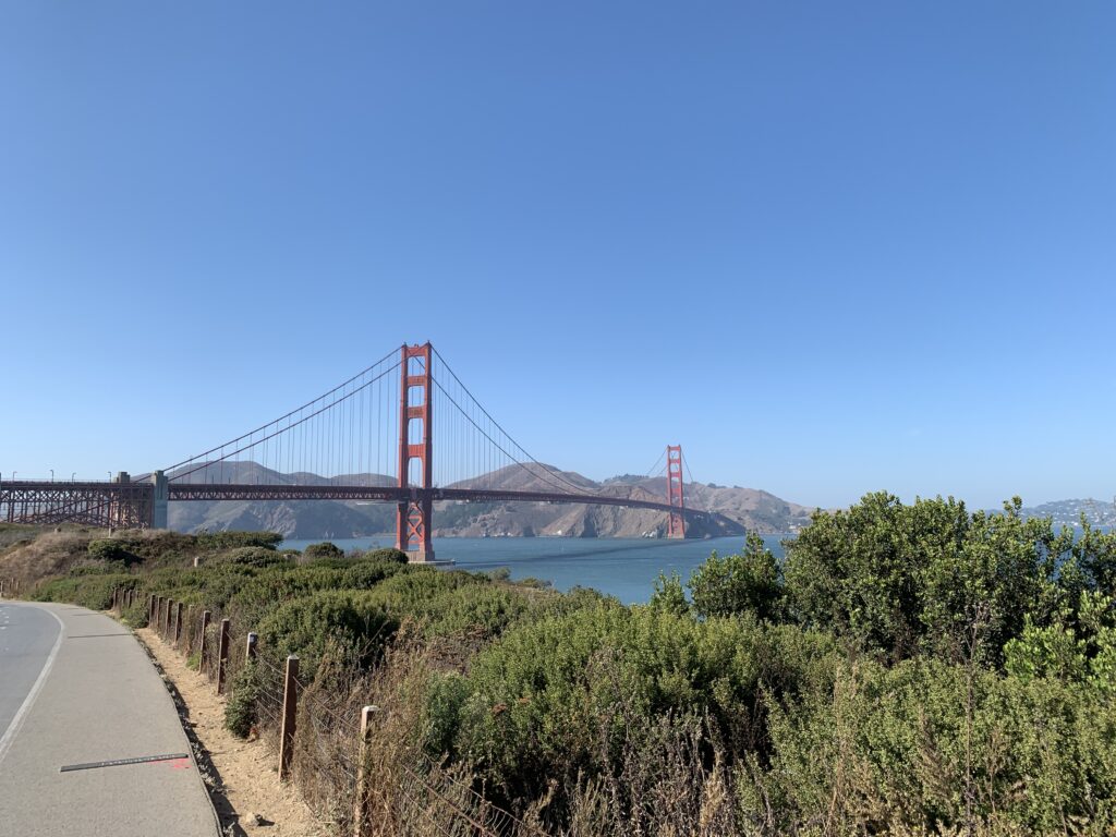
Strange but true: the San Francisco icon project came close to being rejected by the Navy in favor of a cement bridge with yellow-striped pillars. The mind behind this masterpiece in 1937 was engineer Joseph B. Strauss, but architects Gertrude and Irving Murrow deserve credit for the elegant Art Deco style and the distinctive color known as ‘international orange.’ Before the US Department of War could object, workers got to work, constructing the nearly 3 km-long span and 200 m-tall pillars in just four years.
San Francisco residents passionately defend their perspective on things, especially the city’s icon. Those who prefer foggy landscapes might say that Marin’s Vista Point, to the north, offers the most beautiful panoramic view, where clouds seem to perform acrobatics like Olympic gymnasts on the bridge cables. From Crissy Field, you can appreciate the entire span (and capture windsurfing and kitesurfing in your photos), while at Baker Beach, a beach frequented by nudists, you can admire the bridge in all its grandeur.
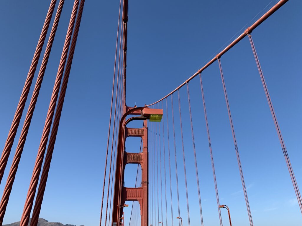
To see both sides of the Golden Gate, bike or walk along the span. A pedestrian path runs from the toll booth to the east sidewalk (pedestrian access 5 am-6:30 pm every day) starting from the parking lot and bus stop. Near the toll booth, there is a network of sturdy suspended cables, bearing the weight of thousands of buses and cars passing through here every day. If you don’t want to walk back, take a Golden Gate Transit bus departing from Marin. Bicycles have access to the bridge 24/7 from either the west or east sidewalk, but they must yield to pedestrians on the east sidewalk. When crossing the bridge, electric bikes must be used with the motor turned off.
Built in 1861 with 126 cannons, Fort Point was meant to deter Confederate soldiers during the Civil War but never saw military action; instead, it served as the backdrop for Hitchcock’s film “Vertigo.” Enjoy the view and read the panels about the Civil War.
-
Lost Horse Mine Loop
March 24, 2019 /This 6.9 miles loop was definitely among our favourites. When we stopped at the Joshua Tree info centre on the first day the ranger told us that it was a quite popular trek, but unfortunately there were only around ten spots in the parking lot at the trailhead. To beat the crowd it’s best to be there around 8.30 maximum. Depending of where you are coming from it can be quite an early wake up, that’s the down side, the good part though is that the trail is always peaceful and quite because of the limited number of parking spots.
The mine was once owned by Pioneer Johnny Lang who had lost his horse to a gang of thieves, hence the name.
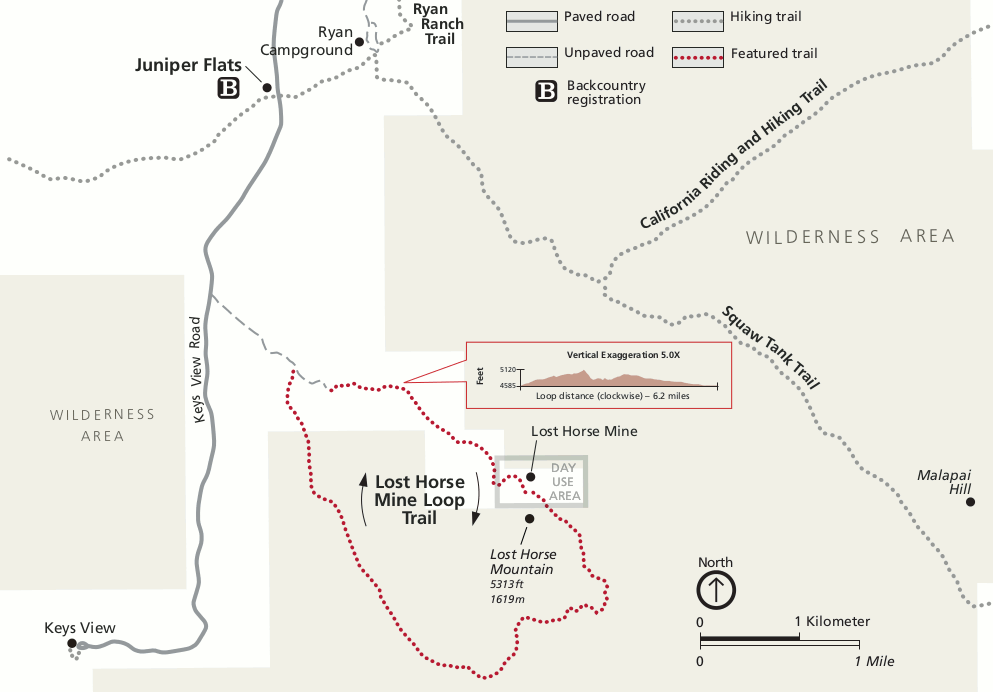
Follow the directions for Keys View and you will find on the left the sign for “Lost horse mine loop”. Drive down the unpaved road for a couple of miles and at the end you’ll find the parking lot. The trail is well indicated all throughout and we definitely suggest you do it clockwise.
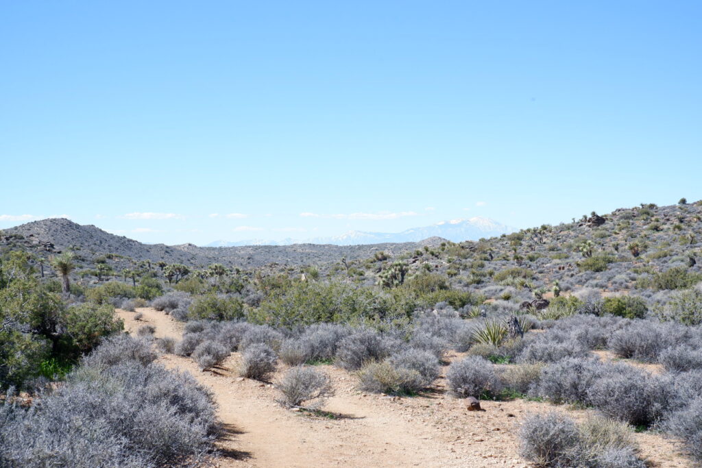
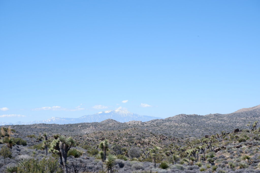
The first part hikes the side of a mountain and after a little more than a mile you’ll reach the old mine. The vegetation here is not too exciting, we even thought there must have been a fire recently, since most of the trees were burnt. The old mine it’s the perfect spot for a snack, but we personally didn’t love it, it is surrounded by old and rusty aluminum sheets and it has a quite desolated look overall.
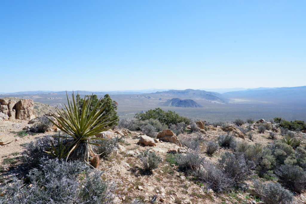
Most of the people once they reach the mine they will head back and don’t continue the loop. If you do, like we did, you’ll actually see the best part of it.
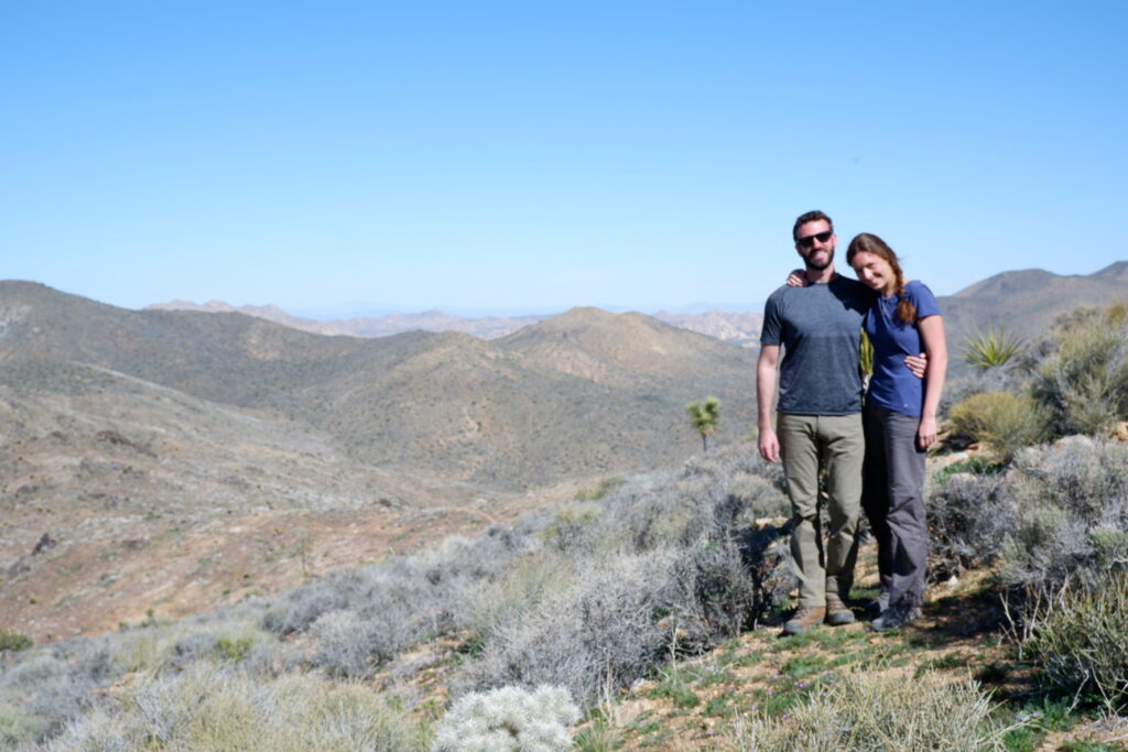
Past the mine you’ll reach the top of one of the Lost Horse Mountains, and get an amazing view of the valley. You’ll then hike down a steep ridge and then up again the side of another mountain. Here the vegetation is more lively and the Joshua Trees constellate the trail. Going constantly up and down makes the hike very exciting. Once you reach the top of the second mountain you are done, it’s all downhill until it actually reaches a flat area.
This last part can be a bit boring, but you still have amazing views in front of you and are surrounded by Joshua Tree. If lucky you can find some shade under one of the big ones and enjoy a snack and a peaceful break.
During these last few miles F. announced “No wonder the Pioneer lost his horse here!”
Here is a map of the trail.
-
Joshua Tree National Park
March 24, 2019 /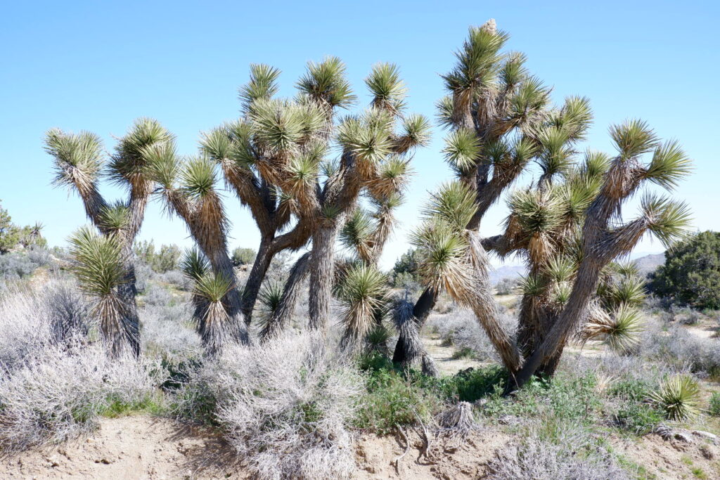
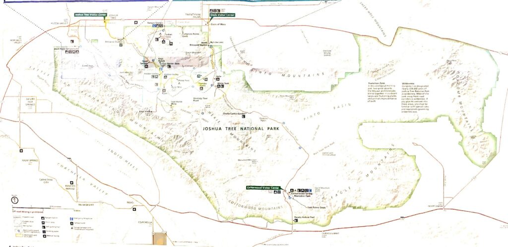
Boulders and buttresses, rugged mountains, gold mining ruins, desert plains dotted with the oddball trees—this is one weird place. Joshua Tree National Park lies at an ecological crossroads, where the high Mojave Desert meets the low Colorado Desert.
The Colorado, the western reach of the vast Sonoran Desert, thrives below 3000 feet on the park’s gently declining eastern flank, where temperatures are usually higher. Considered “low desert” compared to the loftier, wetter and more vegetated Mojave “high desert”, the Colorado seems sparse and forbidding. It begins at the park’s midsection, sweeping east across empy basins stubbled with creosote bushes. Occasionally decorated by “gardens” of flowering ocotillo and cholla cactus, it runs across arid Pinto Basin into a parched wilderness of broken rock in the Eagle and Coxcomb Mountains.
Above 3,000 feet, the Mojave section claims the park’s western half, where giant branching yuccas thrive on sandy plains studded by massive granite monoliths and rock piles. These are among the most intriguing and photogenic geological phenomena found in California’s many desert regions.
The result of this encounter of two different ecosystems is amazing desert flora, including those wacky namesake trees (actually a type of yucca). The Joshua Tree was revered by American Indian tribes because its leaves provided durable materials for baskets and footwear, while the buds and seeds made a healthy addition to their food supply.Joshua Tree’s beauty shines around the clock, with vibrant sunsets melting into nights filled with uncountable stars.
Crafted over millions of years by torrential rain, battering wind, and extreme temperatures, Joshua Tree National Park stretches over nearly 800,000 acres of rugged terrain. These landscapes, which can seem deceptively barren, are home to several ecosystems. Despite the harsh conditions, Joshua Tree teems with plant and animal life that has adapted and thrived in the area’s fierce climate. Joshua Tree National Park is home to large herds of desert bighorn sheep, black tailed jack rabbits, coyotes and kangaroo rats as well as a number of smaller mammals. Since it lies along the Pacific migratory bird flyway, many large groups of migrating birds can be spotted overhead or stopping to rest in the park during the winter months.
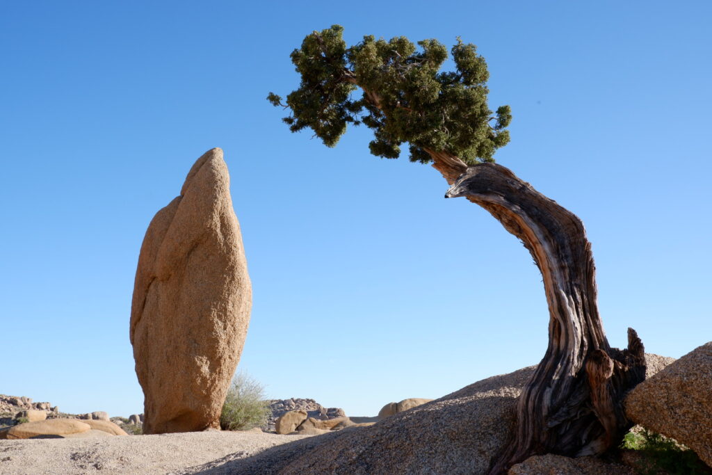
The park’s premier attractions, forests of giant branching yuccas known as Joshua trees, massive rock formations, fan palm oases, and seasonal gardens of cholla and ocotillo, can be enjoyed on a leisurely half-day auto tour that includes both “high” and “low” desert zones— although most of your time will be spent in your car. Scenic paved roads lead to viewpoints, all campgrounds, and trailheads. Roadside interpretive exhibits have pull-outs and parking areas, and offer insights into the region’s complex desert ecology, wildlife, and human history.
Start out by climbing up to Keys View, where you can get a great panoramic vista of Mount San Jacinto and Mount Gorgonio, with the Salton Sea stretching out in the distance. Then pay a visit to Keys Ranch, where you can take a guided walking tour to get a glimpse into what it was like to be an early 20th-century pioneer on this unforgiving terrain. Close by but standing in contrast is 49 Palm Oasis, where fan palms tower over a crystal-clear spring, and also nearby is Lost Horse Mine, one of the few mines in the area that proved to be a good investment. Today you can see what remains of the once booming operation with an easy 4-mile round-trip hike.
If you’re looking to do some rock climbing, Joshua Tree has more than 8,000 established climbing routes, from easy beginner scrambles to extreme vertical cracks, and camping options are plentiful with nine campgrounds. Or, head out on foot or horseback to set up camp nearly anywhere; there are only a few restrictions. Take a break from roughing it to check out Pioneertown, a, 1880s-style false-front Old West “town” where more than 50 films and television shows were made in the ‘40s and ‘50s; today, you can still see mock gunfights and see top-notch live music at Pappy and Harriet’s Pioneertown Palace. Read on to learn more about these and more things to do at Joshua Tree National Park below.
If visiting the park by car, keep in mind that there are north (at Twentynine Palms) and south (at the intersection of Box Canyon Road and Interstate 10) entrances in addition to the most commonly used west entrance. There is also an all-inclusive (i.e. no entrance fee) shuttle bus service that makes multiple stops within the park. Avoid the biggest crowds by visiting midweek.
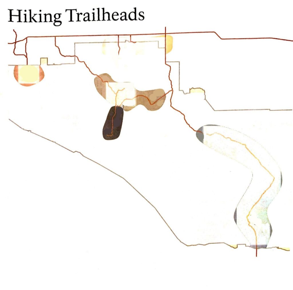
For a review and description of the various available hikes, click on the corresponding links on the hiking trailheads map.
-
Warren Peak and Panorama Loop
March 24, 2019 /During those busy spring days when the Joshua Tree National Park is swirling with tourists, backpackers and rock climbers, you may want to consider spending the day in the Black Rock Camp area. To reach it from L.A. while driving on Highway 62, do not go as far as the main Tourist Center and Park entrance; instead turn right when in Yucca Valley and follow the sighs for the Camp. You will not need to purchase a Park pass to go there.
Park your car in front of the Black Rock Visitor Center and spend some time exploring it. It is the only place in the whole Park where you can buy some memorabilia (fridge magnets, backpack patches, etc) and postcard to send home, it has a water fountain to fill your bottles, and very helpful rangers that will give you all the information you may need to explore the area.
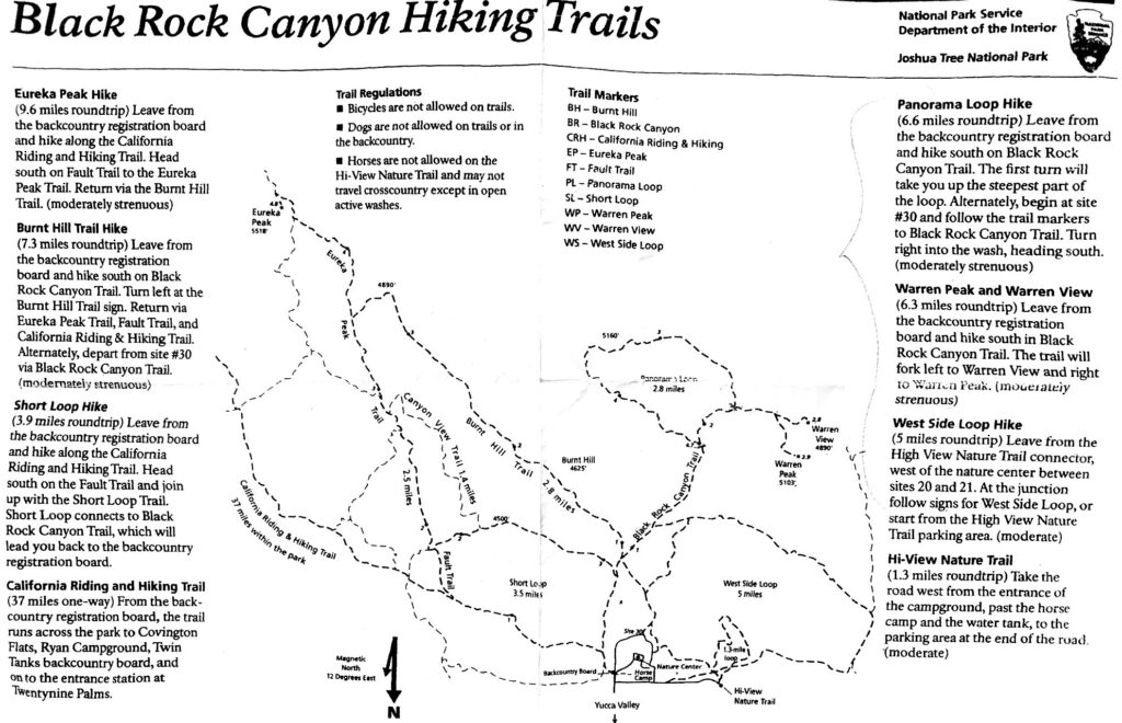
The map that the rangers provide is unfortunately not super detailed but their explanations are clear and the trails are very well indicated. If you feel full of energy and want to fill the day with a good 15-20 km hike, we suggest going for Warren Peak and Panorama Loop trail as we did. The West Side Loop trail and the Short Loop are easier hikes.
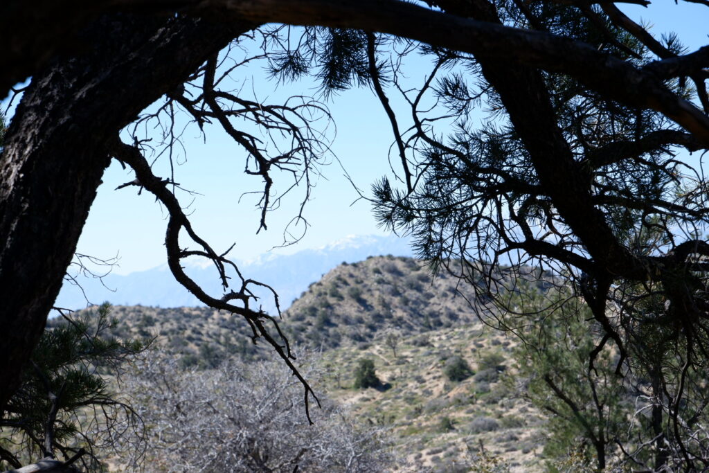
Warren Peak
From the Black Rock Camp follow the site camp number till you reach number 30: from there make a left pointing towards a big water tank and you will see the trail departing on your left. The first km is an easy walk, all flat and surrounded by cacti and Joshua trees. On your right you will see the trail head for the easiest West Side Loop: continue straight and the main trail for Warren Peak and Panorama Loop will open on your right after 500 m. The main trail is large and mainly flat, graveled, it traverse the Black Rock canyon and will get you used to the typical Park vegetation. It may be a bit monotonous (especially on the way beck…) but it is certainly worth what is expecting you after 5 km. Here the trail forks and on your left departs the Panorama Loop: our advise is, keep this one for later. You may want to continue on the right trail towards Warren Peak and Warren View.
The trails starts a gentle climb in between higher rocks, the vegetation becomes thicker, with bigger trees and bushes. After 5 km of this beautiful but gentle hike, assess your strengths and make a wise decision: you will find on your left the trail head for Warren View, a gentler ascension that will take you to 1500 m of heights but not to the top of the Peak. If you feel courageous and full of energy, continue to your right and start the strenuous 4.5 km climb towards the top.
The vegetation changes as you get higher, less trees and less shadow, so make the most of the sparse resting spots that you may find. Drink plenty of water and electrolytes and continue the climb at your pace.
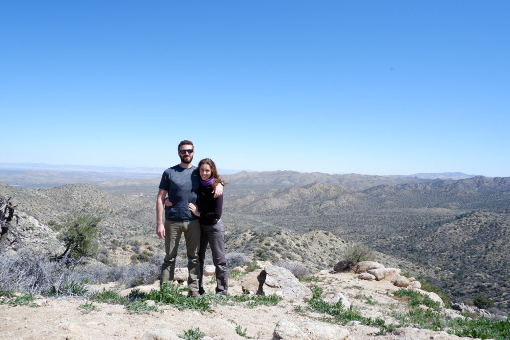
It took us more or less 30 minutes to make it to the 1600 m top of the Peak, where only rocks welcome you to a breathtaking view that spans 360 degrees to all the Park.
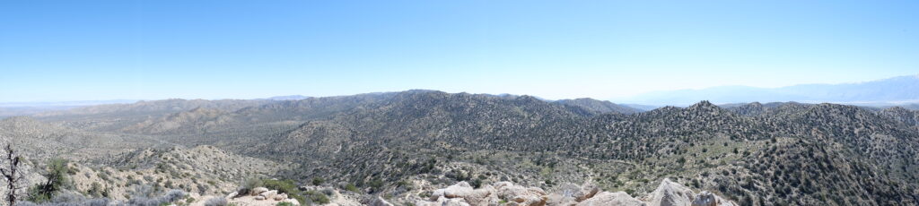
Sit on top of the mountain and enjoy this well deserved panorama. To the far south the snowed peaks of the San Bernardino mountains make a nice frame to the valleys of Joshua trees and cacti.
Rest for some time, eat a granola bar or a banana and breath the fresh air. Take a lot of pictures and get ready for a steep descent. The trail is, of course, the same but much faster going down. Be very mindful of the unstable small rock under your feet and give way to people climbing up.
Once you passed the fork for the Warren View, this time on your right, you may want to pay attention to the trail for the Panorama Loop.
Panorama Loop
Still feeling energetic after the climb of the Peak? Invigorated and exhilarated by the heights? Then the Panorama Loop trail is exactly what you need to go back to base camp exhausted but happy.
Coming down from the Warren Peak, and after the right-hand trail for Warren View, you want to find the trail that departs on your right for Panorama Loop. If your sight is more acute than ours, you will be able to find the smaller trail that will allow you to make the Loop counter clock-wise; if you miss it, like we did, no big deal: continue for 3 more km and you will find the trail sharply forking to the right and see the sign for Panorama Loop.
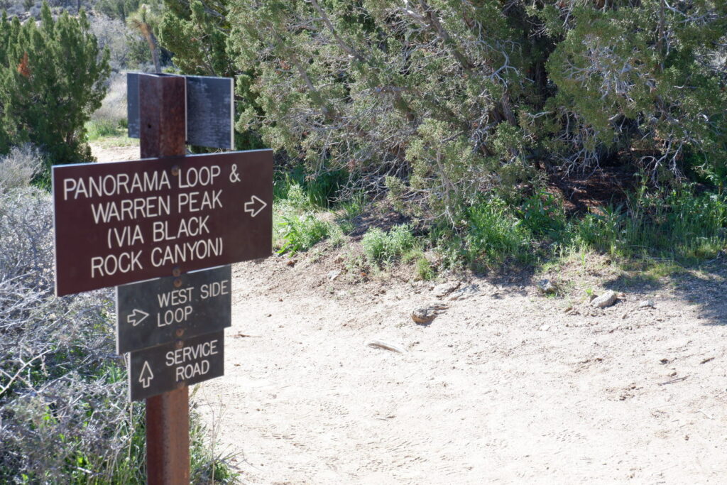
Take this trail and you will be making the Loop clock-wise. Don’t be fooled by the easier ground at the beginning of the trail, with the plush vegetation and trees all around: the road will soon start a gradual but strenuous climb, the trees will change to small bushes and the to sparse sprouts of grass as you ascend for 1.5 km towards the top at 1600 m. Once you reach it, the trails lies on the ridge of the mountain and you will walk for 1 km with a view that spans to the underneath valleys both on your left and right.
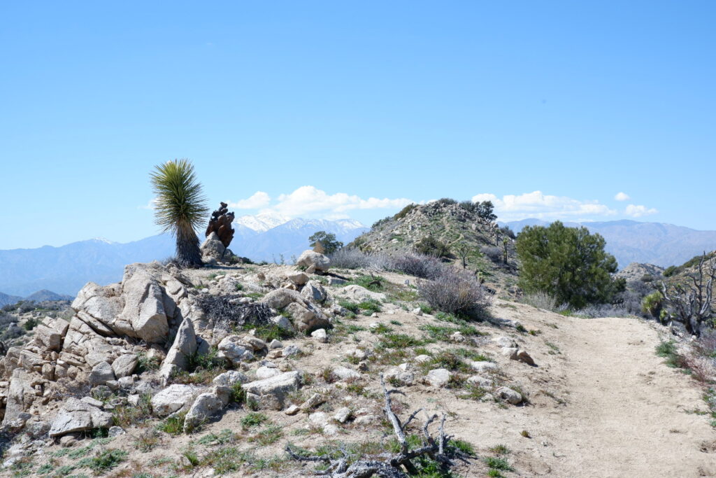
Once the trail start descending to the side of the mountain, you will find yourself back into the plush vegetation of the lower heights. And soon you will close this 6 km Loop and find the way back to the main trail. Take a right and continue back the way you came from the Black Rock Camp, cutting the canyon and retracing your steps. As we said before, the final part an be a bit monotonous and boring, but water, food and a tent are waiting for you at the end of it!
-
SUSHI SASBUNE – Los Angeles
March 15, 2019 /
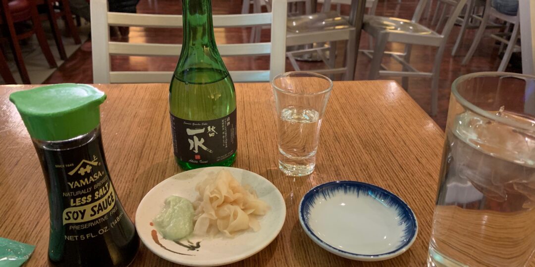
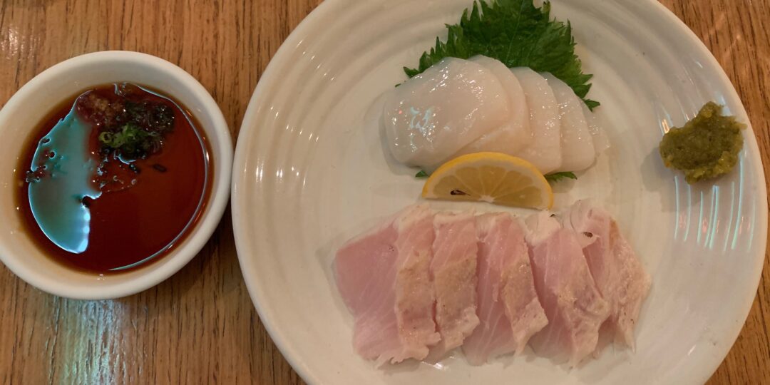
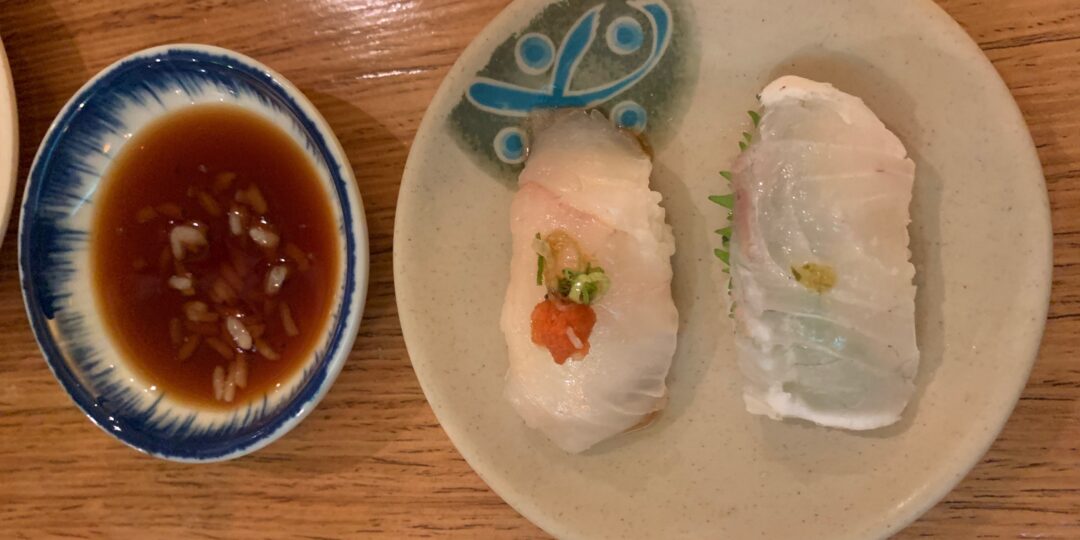


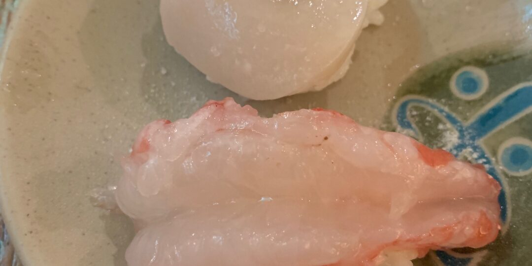
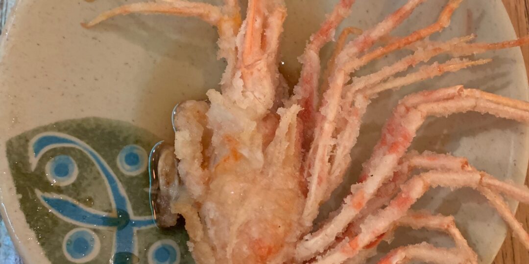


If you didn’t grow up in LA (or, you know, Japan), your sushi experiences probably amounted to mysterious California rolls in the one Japanese restaurant in town, grocery store spicy salmon rolls, or hand rolls made with canned tuna . Your first omakase (the Japanese tradition of letting a chef choose your order) is always a revelation. The first time we had omakase was at Sasabune.
So while we will keep going back to Sasabune because it’s the place where we really learned to love sushi, you should get here because it’s one of the best examples of classic LA omakase.
You can order off a menu at Sasabune, but to be honest, we’ve never even looked at the thing. We went twice and we always had the omakase. At around $130, it’s certainly not cheap, but you get a whole lot of very high-quality sushi.
A meal here starts with sashimi, ends with a crab hand roll, and involves many pieces of nigiri in between. But you’ll also get an oyster, a scallop (still in its shell), a baked mussel, some crazy good cooked butterfish, and uni if you want it. Fish varieties change depending on what’s available, but you’ll rarely encounter anything especially advanced. The menu barely changes between visits, but everything is as fresh as it could possibly be. The space is also what you’d expect when it comes to classic LA sushi – a little storefront, no interior design to speak of, and a sushi bar that’s really the only place you should be sitting.
Overall, the food was definitely worthy and for the price we didn’t think it was over-priced by any stretch.