Europe
-
Palma de Mallorca
May 26, 2024 /Day 1 - A Day Through The Old Town
When you think of Mallorca, you probably imagine sandy beaches and a swim in the ocean. And while that’s definitely a great thing to do when visiting this island, Mallorca also has a fantastic city break destination: Palma de Mallorca.
Palma’s picturesque Old Town is a must-visit, no matter how much time you have. Even if you’re having a little wander through it, it’s worth your time. The streets are beautiful, with little squares and small but atmospheric alleyways. There are many cafes in the Old Town too, which give you a perfect excuse to sit down for a bit and enjoy some people watching.
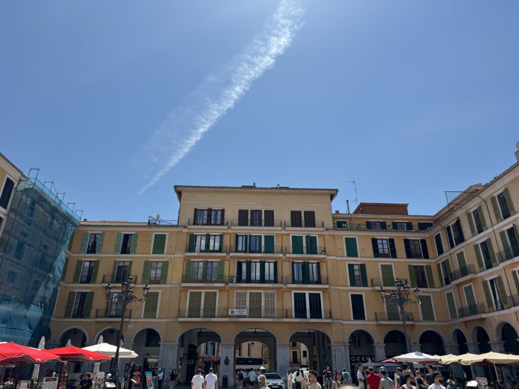
While you walk through the historic center of Palma, start the day in Plaza Mayor or Placa Major, as the English use to call it. This is where most of the markets and events in Mallorca take place. The rectangular square with a porticoed perimeter is similar with Plaza Mayor from Madrid, but at a much smaller scale. The houses built around the square all have yellow facades and green shutters, creating a very picturesque scenery. The buildings surrounding it are mostly offices or private residences, with cafes and restaurants on the ground floor. Some of the main streets of Palma branch out from the square.
On some days of the week, the plaza hosts an artisan market, whilst in January, it functions as the starting point for the feast day of Sant Sebastià.
It is a vibrant place today, bursting with life and fun, but things weren’t always so cheerful. The plaza is built on the site of the San Felipe Nerí Convent, which until 1838, was the seat of the Inquisition.
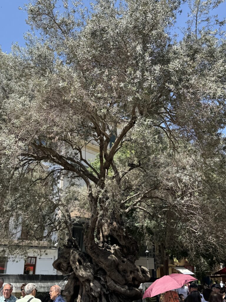
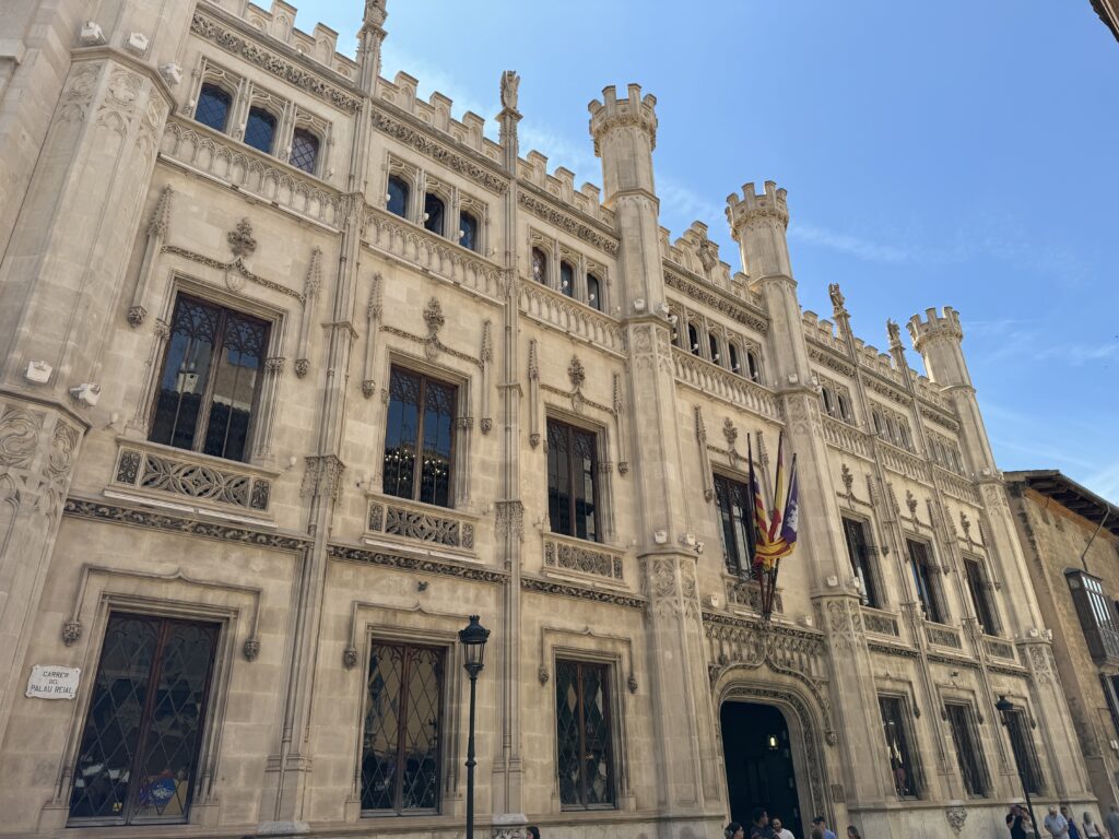
One square in the Old Town that you should add to your Palma itinerary is Plaça de Cort. The Plaça de Cort derives its name from having been the place where feudal court gatherings once took place. Today, it’s a lively area with cafes and restaurants surrounding it. This charming square in the heart of the city is famous for Olivera de Cort, opposite to the beautiful Town Hall. This is a 600-year-old olive tree brought to Palma in 1989 from the Pedruixella Petit estate in Pollença as a sign of peace. Many people think they can see faces in it, especially an ear, which came to be known as the ‘Orella de Mallorca’.
You will find some nice restaurants around the square, so you can have lunch here or grab a coffee to keep you energised for the rest of the day.
If you take a walk along the old medieval streets of Palma not far from the Cathedral you will see signs pointing the way to Banys Àrabs. Built during the time of the Moors in the 10th century but brought back to light only 100 years ago, the Arab Baths are possibly the only thing left from Medieval Palma. They were initially placed in the orchard of a manor house known as the Can Fontirroig, which probably belonged to a wealthy Moor. They date from the 10th to 12th centuries and are some of the few remains of the Arab city, Medina Mayurqa.
As every other Spanish city which was part of the Al Andalus Empire, Mallorca has a large Muslim heritage. Arab baths, or hammams, were customary back in the 10th century, and an important part of the community, where people would go to clean not only their their bodies, but also their souls. The water is considered sacred in Islam, and the hammam is one of the oldest surviving bath traditions in the world.
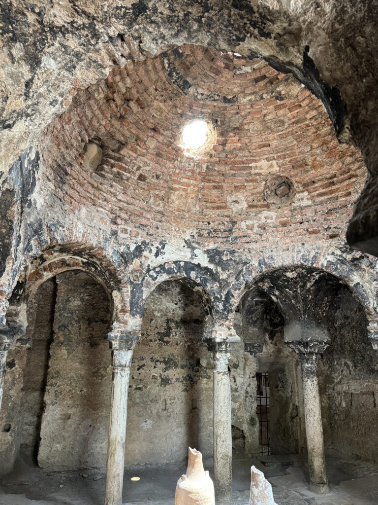
The Arab baths in Palma is one of the last remaining pieces of evidence of the Moorish occupation. Whilst they are small, they are well preserved and provide a glimpse into what it used to look like to go to the baths back in the 10th century. What is interesting about these baths is that the columns are all different, as they were built with remains from other dynasties that occupied Mallorca before the Moors. There is a preserved caldarium and tepidarium and some lovely gardens where visitors would have cooled off after their hot bath all those hundreds of years ago.
Today the half-orange tepidarium, with its columns and shafts of shifting sunshine, is perfectly integrated into a garden. Some people like to come here to read or simply enjoy a sandwich when they get a break from their busy day. So, the purpose of the garden was preserved, as it was a good place for guests to cool off after taking a steamy bath.
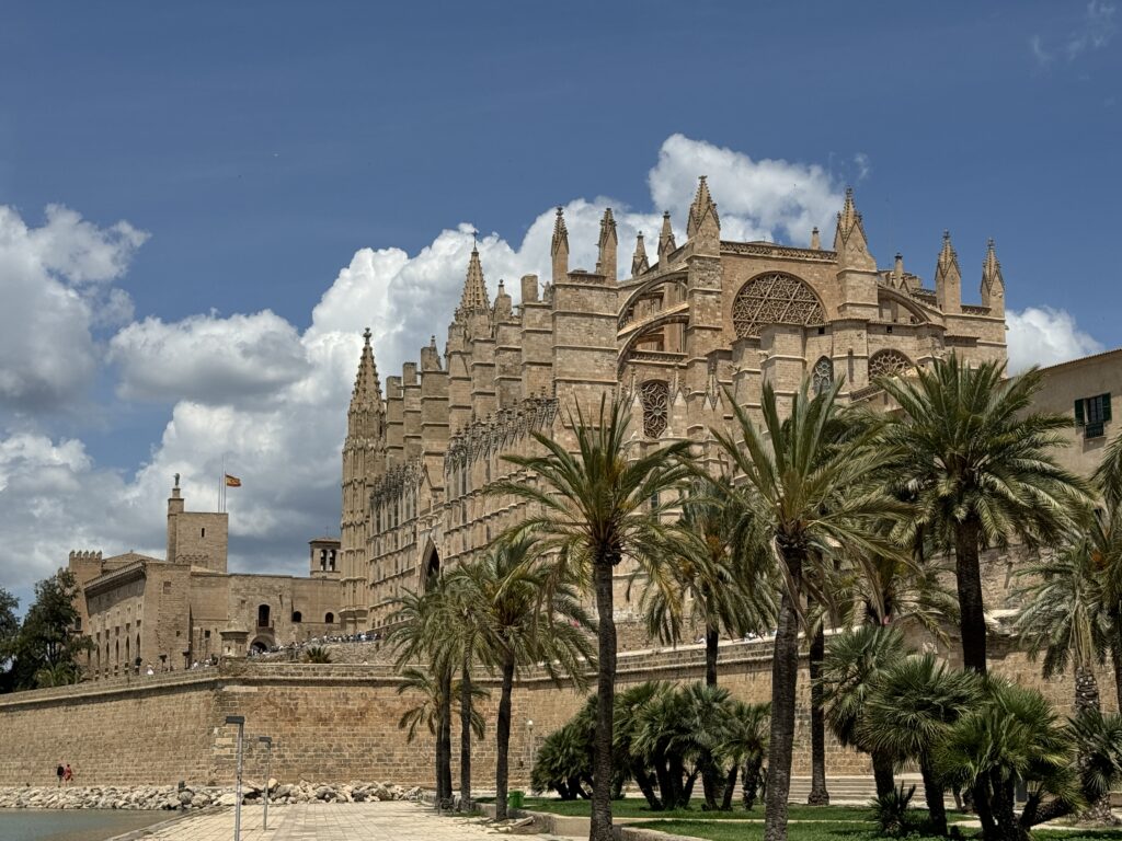
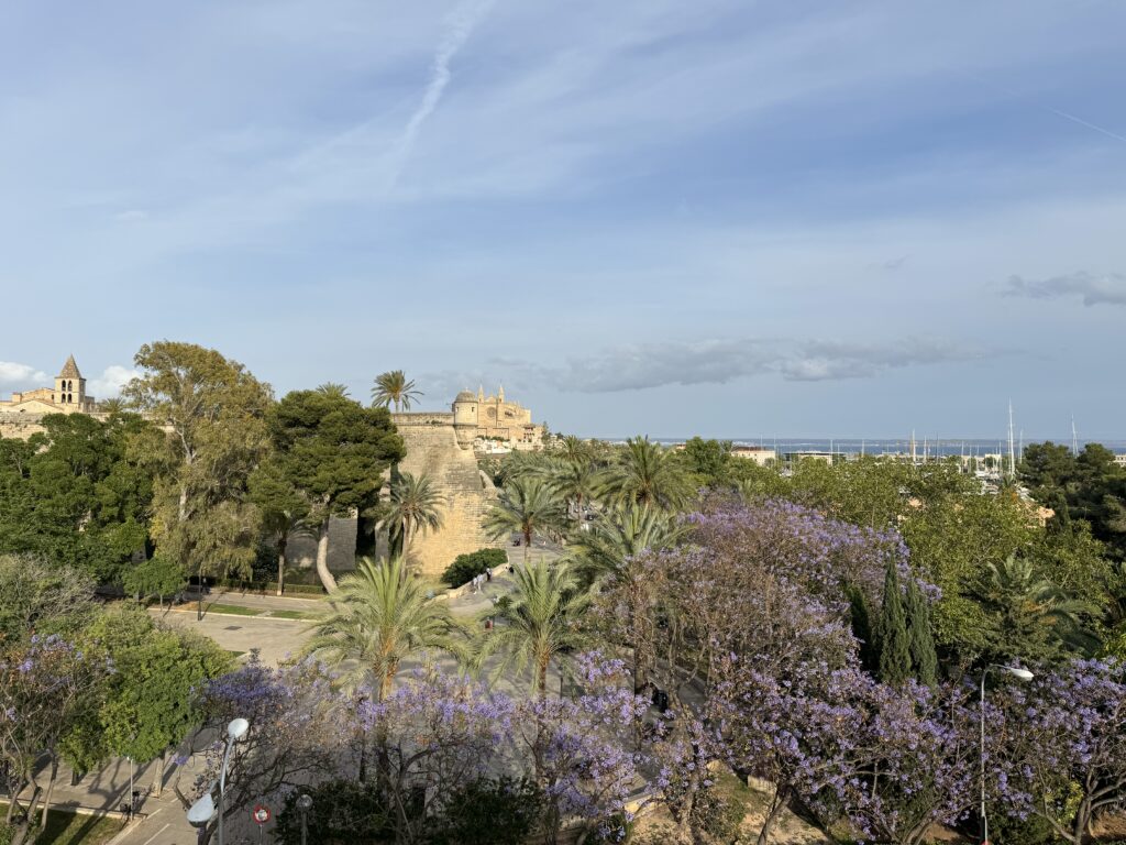
We can say that the Cathedral-Basilica of Santa María de Mallorca, also known as La Seu, is the heart and soul of the city. The Cathedral is located on the site of what was once the main mosque of Medina Mayurka, the capital of Muslim Mallorca for three centuries. The mosque was used as an interim church following the Christian reconquest in 1229. The construction of this impressive Levantine Gothic-style building began in the 13th century, on the orders of King Jaume I of Aragon, and was completed in the 1630s. after one voyage that he and his men took to the island. As they sailed toward it, they encountered a savage sea with strong winds and high waves that put them in great danger. The king swore that if they reached Mallorca safely, he would build a huge cathedral. And he kept his word, erecting one of the tallest cathedrals in Europe.
In front of the cathedral, you can also find Parc de la Mar. This artificial lake shows beautiful reflections of the cathedral. Near it, there are some places to sit and soak up the view of this impressive piece of architecture.
Some of the cathedral’s towers reach over 20 meters and the cathedral contains one of the largest stained glass windows in the world (with more than 1,200 pieces).
While the cathedral is very impressive to look at from the outside, going inside to see the beautifully decorated interior and the light pouring in through the stained glass windows. It has one of the tallest naves in the world, reaching 44 meters. As you enter the cathedral, you will be amazed by the multitude of stained glass windows (61 in total) that filter the light and add a rosy sheen across the floor and walls. This special design feature earned La Seu the name of ‘Cathedral of Light’. The slim pillars supporting the roof are apparently some of the slimmest load-bearing pillars in the world.
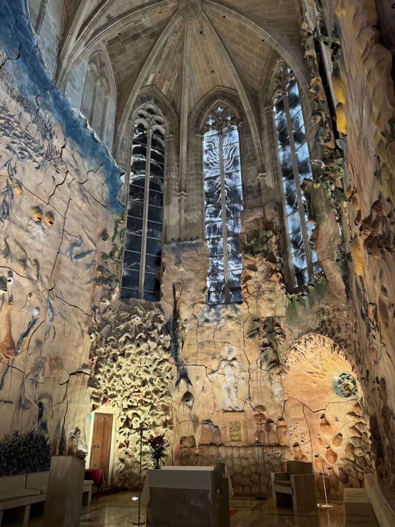
In 1901 Antoni Gaudi was invited to take over the restoration of the cathedral. Due to some misunderstanding the project was cancelled, but some of Gaudi’s ideas were still implemented. He is responsible for the beautiful stained glass in the Gothic windows of the Royal Chapel. He was helped by his disciple, Joan Rubió i Bellver, who designed some iconic buildings in Soller. One of the most striking architectural elements inside the Cathedral is the mural in the Chapel of Sant Pere, sculpted in terracotta by the local artist Miquel Barceló. The images represent scenes from the Gospel of St John, relating to the Last Supper, which the chapel is dedicated to. The colours and the details are so surreal, and at a first glance it does resemble Gaudi’s style.
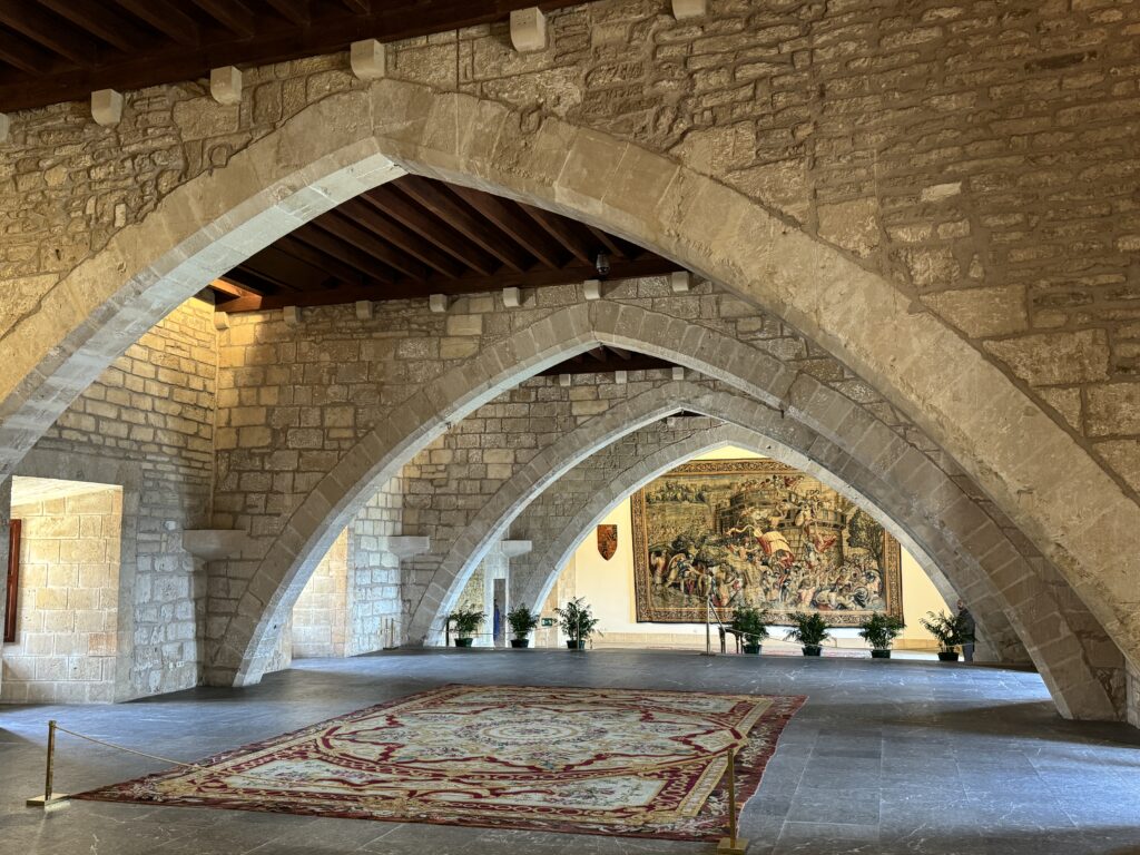
The Royal Palace of La Almudaina is located next to the cathedral, is a must-see place in Palma if you’re visiting the city in one day. It is the official residence of the kings of Spain during their visits to Mallorca. The palace as it is today was built over an old Roman fort back in the 10th century, by the Muslims when it used to be the seat of the Emir when Palma was under Arab rule. It was rebuilt in the 13h century, after the Christians conquered Mallorca and King Jaime I of Aragon came to the throne.
What’s special about the Almudaina is the combination of Gothic and Moorish styles that reflect the multiple cultural layers which influenced the architecture of the City of Palma. Over the years, the palace has been modified over and over again, in different architectural styles. Whilst the ground floor has a medieval architecture, the first floor, which was added to the Palace in the 16th century, is decorated with more recent furniture.
First-time visitors find it intriguing and splendid at the same time, especially as they discover the 14th chapel of Saint Anna, with its enormous stained-glass window and beautifully decorated state apartments.
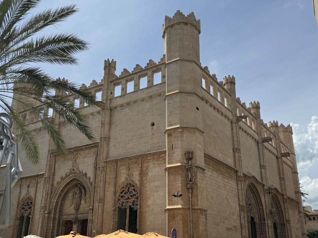
Lonja of Palma is one of the greatest representations of Gothic architecture in Mallorca. It is located in the La Lonja Square, in the historic center of the city, near the port. It was built between the fifteenth century by Guillem Sagrera and was once the headquarters of the Colegio de los Mercaderes, who were in charge of the regulation and protection of trade and the maintenance of the port. Visiting the interior is worth your while.
One of the best ways to end the day in Palma is a cocktail at the Sky Bar at Hostal Cuba. Located on the rooftop of an iconic building in the lively Santa Catalina neighborhood, the happy hour also comes with unbeatable views over the marina and the Cathedral. The roof terrace is small so booking is advised.
Day 2 - Cuevas de Genova
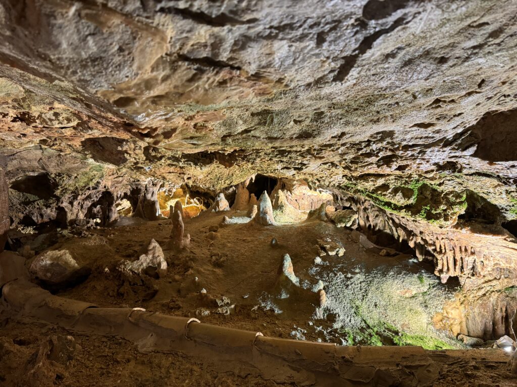
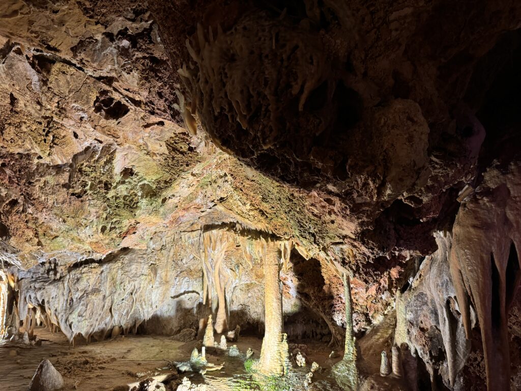
Discovered by accident in 1906, the Genova Caves (sometimes known as the Caves or Coves of Genova) have since become one of the most popular day trip destinations from Palma de Mallorca. They are only accessible via small-group guided tours which take approximately 30 minutes and run throughout the day. Admire the caves’ thousands of icicle-like stalactites and stalagmites, or book a convenient combination ticket that includes a Mallorcan tapas lunch at the restaurant above.
Discovered accidentally during the construction of a well in the year 1906, these caves form a set of underground galleries of calcareous origin joined by corridors formed in a completely natural way. These caves are in the middle of the residential neighbourhood of Genova, which belongs to the municipality of Palma de Mallorca. The caves stretch along an extension of almost 1 km, reaching up to 36 m deep.
A trip to Mallorca should take you to at least one of the caves on the island, because there’s something serene and mysterious about all of them. Until not too long ago, they were used as smugglers’ hiding places or even as some sort of apartments for the locals. Today, Mallorca offers five caves open to visitors – three of them on the east coast, one in the northwestern part of the island, and the fifth in the district of Génova in Palma. For cave lovers, it’s worth to visit each of them, because no cave in Mallorca is equal to the other. Each one has its particularity and beauty.
The exact number of Mallorquin caves is unknown. Some speak of 200 caves in Mallorca, whereas others mention 300. According to experts, the total number of caves, however, could amount to more than 4,000, as most of them are very difficult to locate, because they’re situated in private properties or in inaccessible places.
Thanks to the variety of mineral colours, and its great concentration of eccentric formations, the colour stands out notably for the multitude of espeleatemas coraloide, something rare and hard to find (formations that are also known as popcorn or cauliflower). The place also has a huge natural irrigation of constant fresh water all year round, which favours the environment to be always very wet, a phenomenon that stands out remarkably in this aspect on the other 4 tourist caves that are on the island, giving to this corner of nature a value much appreciated.
-
Bilbao
May 9, 2024 /Day 1 - The Modern City
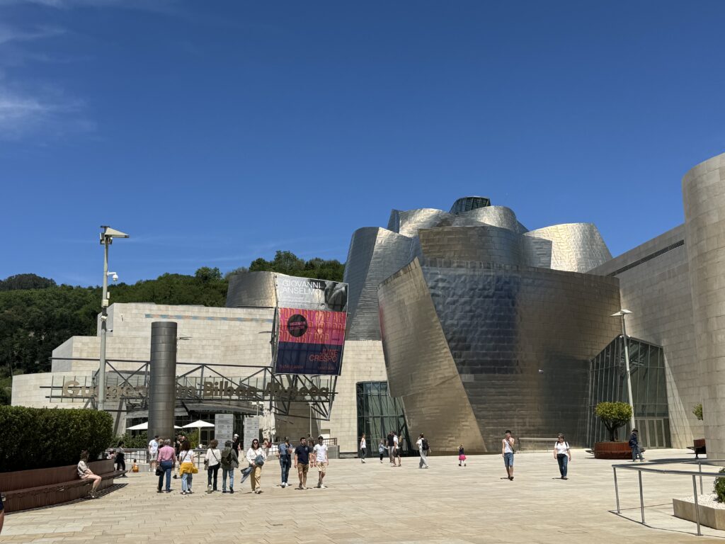
Take the time to walk the streets of Bilbao admiring the eclectic mix of architectural styles, walking along the riverside paths and sampling some pintxo with a drink. This walk will take you past the city’s most notable historic and contemporary buildings. Head towards the most famous building in the city, the Guggenheim Bilbao museum, a titanium masterpiece inaugurated in 1997 that changed the way of conceiving architecture. Frank Gary’s colossal Guggenheim Bilbao Museum is the most impressive building in the city. The museum, filled with works by some of the most important contemporary artists, has managed to make Bilbao the vibrant creative center it is today. For many travelers it is the main reason to visit the city.
For most visitors, the real star is the architecture. Designed by Frank Gehry, the museum is a succession of shapes, fluid caps, headlands, ships, towers, and winged fins,all covered in glittering titanium plates. It is a magnificent vision. Take all the time you need to observe the shapes and colors that change as the light changes. The Guggenheim Bilbao dominates the area of the city facing the river, and its appearance and the surrounding atmosphere change depending on the light. The site where the museum stands was a disused industrial area; the city’s past was dominated by industry and shipping ships and fisheries is evoked by its shape, which some consider similar to a ship or a fish shimmering. After the collapse of the shipping business and heavy industry, the administration committed itself to a regeneration project of the city. One of the main requirements was the construction of a world-class exhibition space, and from that idea, the Guggenheim Bilbao was born. Since its opening in 1997, the museum has contributed to transforming Bilbao from a declining industrial city to a center of culture and interacting with the city’s historical and geographical context. The construction also reflects the interests of Gehry, who, in previous works, had already made use of industrial materials. The shiny titanium plates that cover most of the building like gigantic scales are reportedly inspired by the architect’s passion for fish
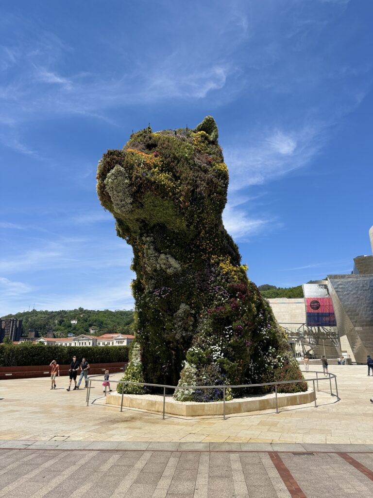
Outside on the side of the museum facing the city, it rises 12 m Puppy, a terrier made with thousands of flowers: Jeff Koons’ work was only supposed to be a temporary installation but Bilbao has become fond of “El Poop”. The bilbainos will tell you that the dog arrived first and then they had to build a kennel for him.
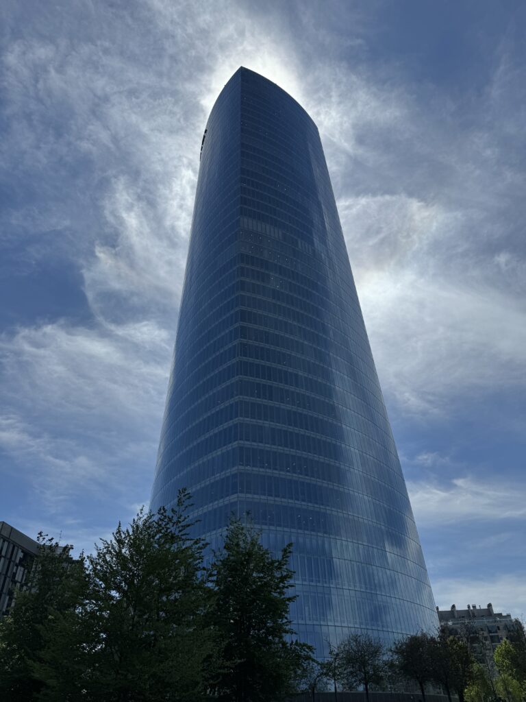
Keep walking along the riverside, and you will find on your left the obelisk-like Iberdrola Tower, which rises from the southern bank and is a 41-story gleaming glass office complex of at 165 meters. Opened in 2012, it’s the tallest building in the Region.
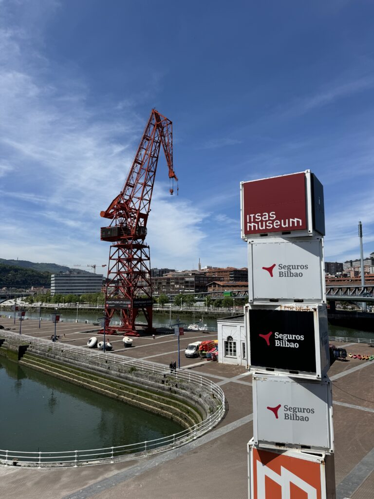
To get an idea of Bilbao’s industrial past stop in front of the city’s Maritime Museum, the Itsasmuseum. On the western side in front of the dry docks look for the bright red “Carola” crane once used for shipbuilding. This interactive Maritime museum recreates the sea depths of Bilbao and the Basque Maritime history. Begin your visit by watching the 10-minute video that summarizes the history of the city from the 14th century to today, then walk around the two floors of the exhibition, which illustrate the ancient techniques of naval construction, the tragic shipwrecks (and innovative rescue practices of the time), and the threat of pirates. You will also find detailed model ships, including a life-size reproduction of the Falua del Consulado, a barge from 1511 used by the consular authority. Outside you can climb on a series of boats.
Take a walk in the Parque de Doña Casilda de Iturrizar with the gazebo for the bands and the ponds for the ducks. Embellished with maples, limes, cedars, palms and as 70 other species of trees, this elegant English-style park was completed in 1920 the highlight is the pond full of ducks and swans.
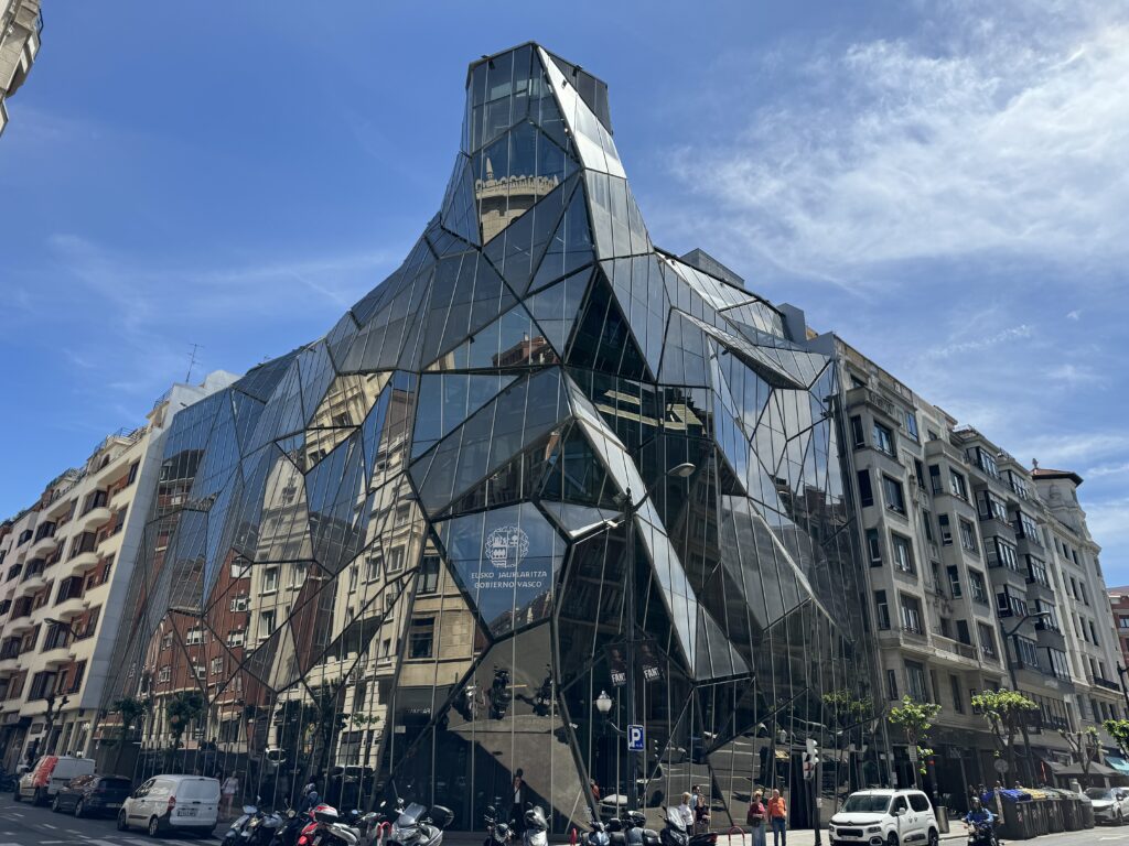
The Jardines Albia, dominated by the sixteenth-century Iglesias San Vicente Martir and with a fountain in the center are perfect for a break. Then continue to the headquarters of the Basque Ministry of Health, which was only completed in 2008 and since then it has become a landmark of the city. Composed of sheets of glass and steel it was designed by Juan Coll-Barreu.
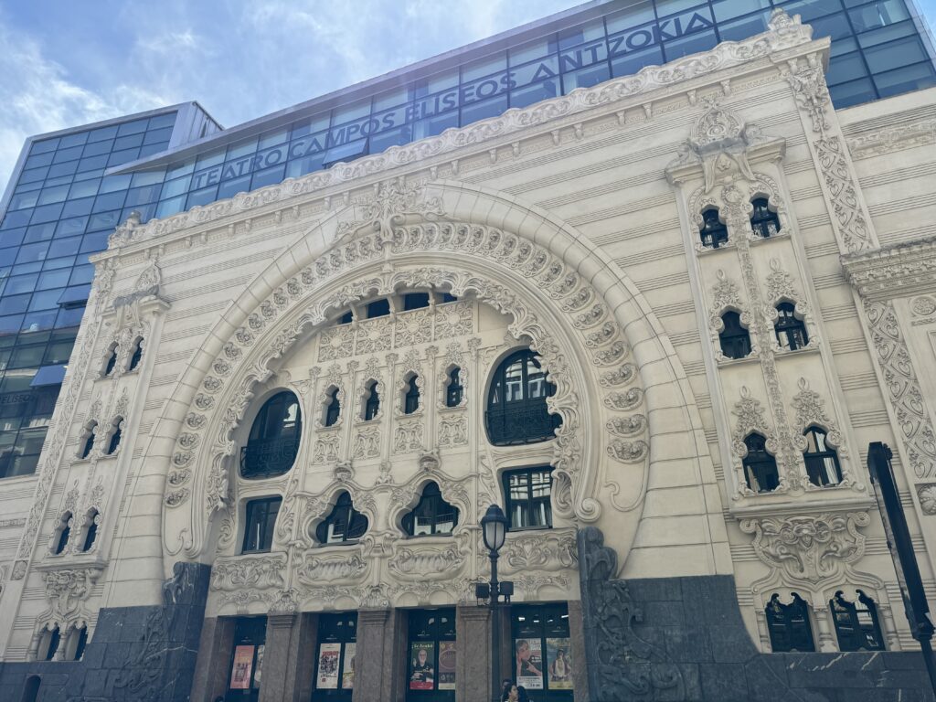
Another nearby art nouveau masterpiece is the Campos Eliseos theatre. Restored to its art nouveau splendor and modernized in 2010 to accommodate contemporary productions, this masterpiece was built in 1902. Today, it hosts theatrical performances, musicals, dance, comedy concerts, puppet and magic shows, and sometimes cinema screenings. The multi-level main hall has a capacity of over 800 people while the more intimate domed hall on the top floor can accommodate 250 spectators.
Another Art Nouveau treasure of the city is the Bilbao Concordia railway station built in 1902.
Day 2
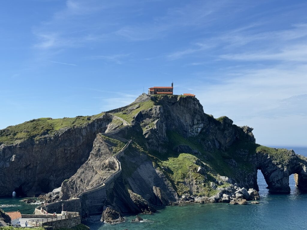
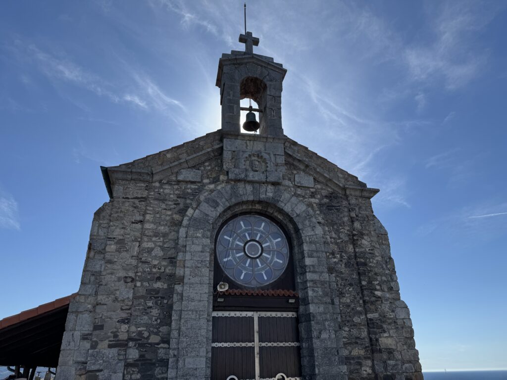
10 km northwest of Bilbao is one of the most photographed places in the Basque Country: the rocky island of San Juan de Gaztelugatxe. Connected to the mainland via a stone walkway with 241 steps, it’s surmounted by a hermitage, the Ermita de Saint Juan de Gaztelugatxe, built by the Knights Templar in the 10th century. Due to its popularity skyrocketing after becoming a Dragonstone in the seventh season of Game of Thrones, to access it it is necessary to book online. According to local tradition it takes its name from Saint John the Baptist who visited the island.
-
Lucern
April 8, 2024 /The best way to see the architecture of Lucerne’s colourful Altstadt (old town) is on foot. This 2-kilometre walking route travels through both Neustadt (new town) and Altstadt. It takes about an hour to walk, depending on the time spent at each spot.
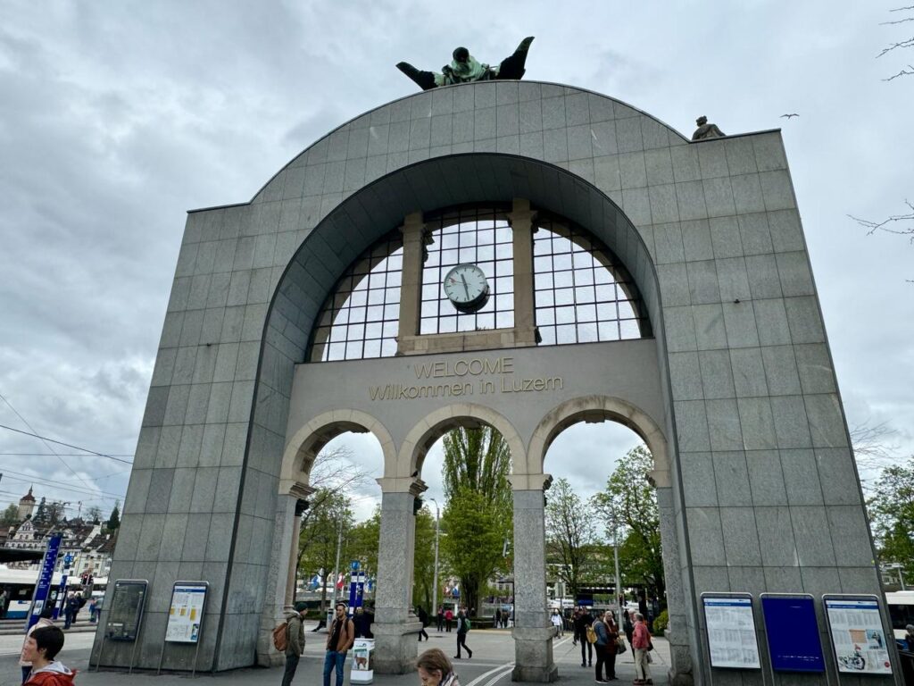
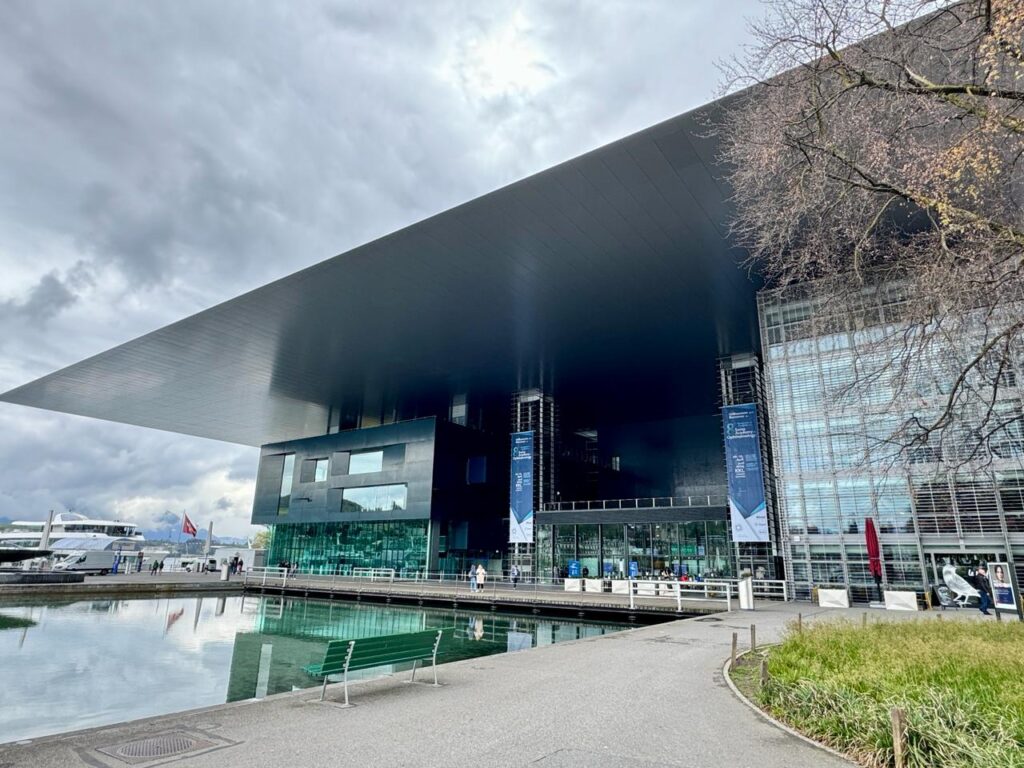
Begin at the Bahnhofplatz, the huge transit hub with a parking garage beneath. The Zentralstrasse, Lucerne’s main train station, is to the south. The original train station was destroyed by fire in early 1971. Its grand main entrance was saved and stands in the middle of the Bahnhofplatz, like a gateway to the city. To the east of the plaza is a huge building, one of the few modern-looking buildings in this part of the city, the Culture and Convention Center. Opened in 2000, the Kultur und Kongresszentrum Lucerne (or KKL Lucerne) has three parts: an 1840-seat concert hall, multi-function Lucerne Hall and the convention centre. There are a number of restaurants and cafes which are convenient to the dock on the lake. The striking, glass-and-steel building’s design has won international praise for the concert hall’s amazing acoustics. Its unique ceiling, special sound-absorbing doorways and an inaudible ventilation system create complete silence enriching performance sound.
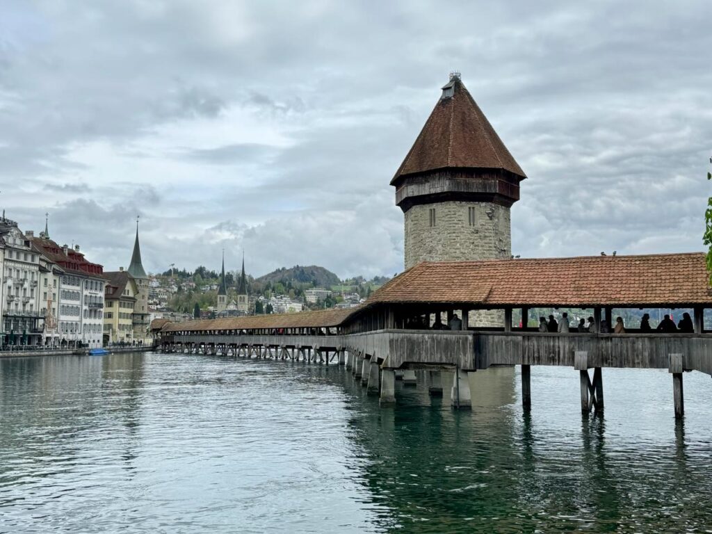
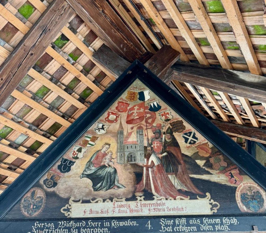
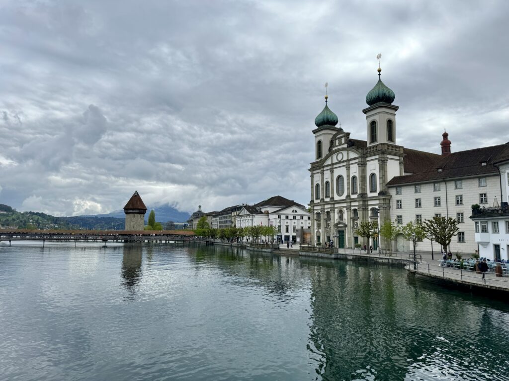
Walk back to the Bahnhofplatz and continue west along the river to the 14th-century Kapellbrücke, one of Lucerne’s most recognized landmarks. The winding, wooden, covered bridge is over 200 metres long. It was built across the Reuss River as part of the city’s defensive system. Partway along the bridge, the 8-sided, stone Water Tower is original and older than the bridge. Over the centuries, the tower was used as the city treasury, dungeon prison and archive. A 1993 fire began in a boat moored to the bridge. The fire spread to the bridge destroying a large portion of it. Both ends of the bridge survived as did the stone tower. The tower’s gabbled roof was destroyed. Walk across a portion of the bridge to see the triangular roof panels. The original panels were painted in the 17th-century, recording the development of Lucerne and Switzerland up to that point. The 1993 fire burned 81 of the 111 panels. The panels found in the centre are originals which were in storage during the fire. The paintings were sponsored by wealthy families. To recognize their charity, the family coats of arms were added to the paintings.
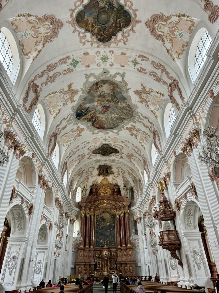
Follow the river west to the Jesuitenkirche. The large, 17th-century church was the first Baroque church in Switzerland. Its two, onion-domed towers were added in 1893. It is dedicated to Francis Xavier, co-founder of the Jesuit order. While the exterior is Baroque, the interior was redone in the mid-18th century in Rococo style. The interior is beautiful. The ceiling murals celebrate Xavier’s life and afterlife. The church’s large organ is used by Lucerne’s music school. Enjoy the music if they happen to be practising.
Walk west on Bahnhofstrasse to the next intersection. To the left, at the end of the street is the Franziskanerkirche. The beautiful, 13th-century, Gothic-style church has a large pipe organ and stunning paintings. Over the centuries the interior has undergone extensive renovation but has kept its 17th-century choir stalls and the wooden pulpit.
Return to Bahnhofstrasse and continue west. Turn right onto Pfistergasse. Walk to almost the next major cross street. Turn right and walk through an arched entrance along a covered walkway. This leads to the next covered bridge.
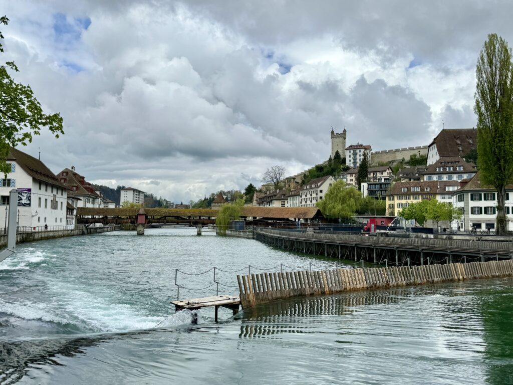
The 15th-century, covered, pedestrian Spreuer Bridge is original. It is smaller Chapel Bridge and has avoided fire for more than 6 centuries. Its roof panels are a series of paintings, called Dance of Death by Kaspar Meglinger, created to remind the townspeople, who crossed the bridge daily, that death cannot be escaped regardless of social class. The far end of the bridge was designed for wagons delivering supplies to three mills nearby. Since the middle ages, there have been mills in this area harnessing the power of the river. A fire in 1875 destroyed all but one. It was removed in 1890 making way for the city’s first hydroelectric power plant. Those turbines generated power for 90 years. They were replaced by the current power plant in 1996. Look toward the lake. It receives its water from snow melt. A movable dam was designed in the mid-19th century to control lake levels and protect lakeside towns from flooding. In the spring, the dam is opened by removing wooden pickets, allowing the river to flow. As the lake’s water level drops, the wooden pickets are put back in place extending the dam across the river and slowing the flow. We visited in late May and the dam was partway across the river channel. By winter, the dam is entirely in place, cutting the flow to almost nothing across the main river channel. This keeps the lake level high enough for some boats.
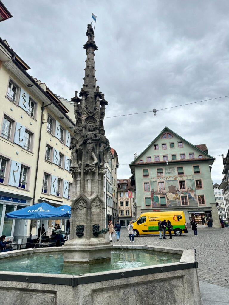
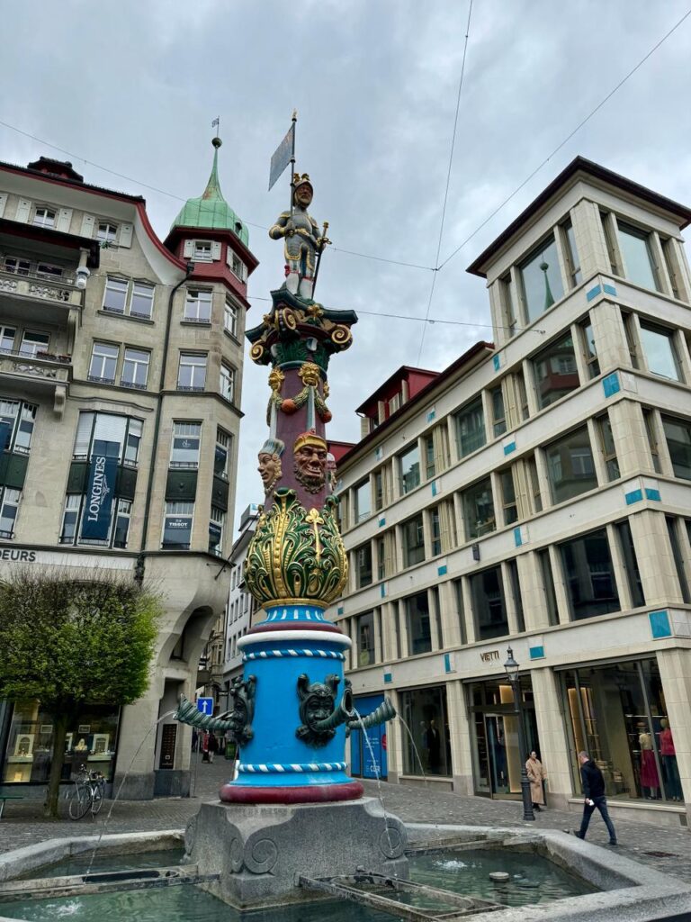
From the bridge, walk to the right into the pedestrian square called the Muhlenplatz. This is the start of the old town. At the top of the square, turn right and walk a block to Weinmarktgasse. Walk a block to the pretty city square, the Weinmarkt. This was a marketplace for wine. The 15th-century fountain has carvings of soldiers. They were to remind citizens that the town was tough and strong. Enjoy the beautiful paintings on building fronts in the square.
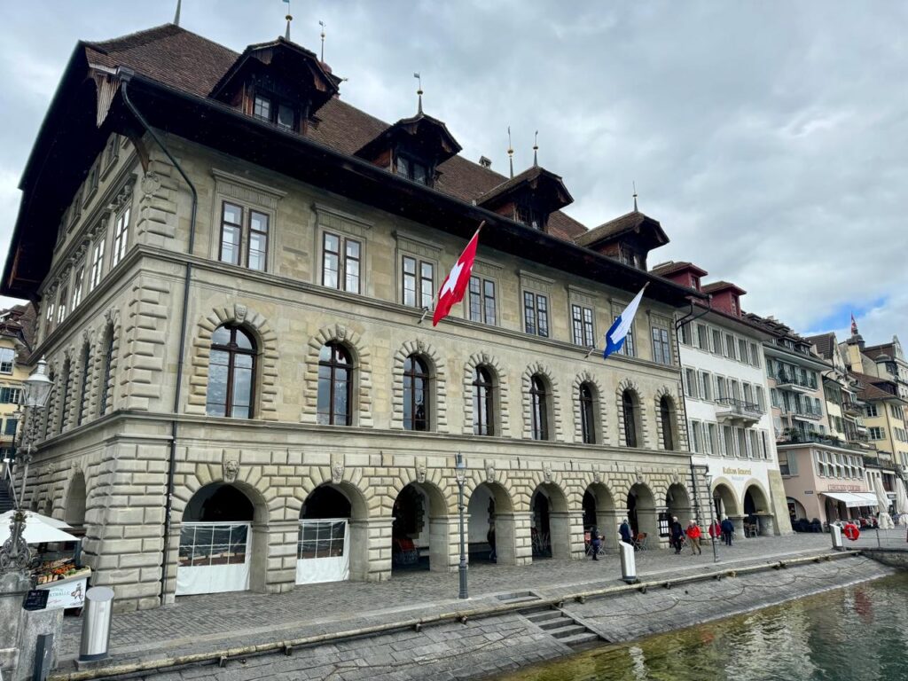
Continue up the street to the Hirschenplatz. This square got its name from the Hirschen Hotel which is long gone. Its sign still hangs in the square. Turn right, walk a block then turn left onto Kornmarkt. Walk to the square outside the Rathaus Stradt beside the Town Hall clock. The first town council meeting was held in this late Renaissance-style town hall in 1606. The building continues to be used for council meetings.
Walk Furrengass to St. Peter’s Chapel. The bridge was called Kapellbrücke due to its proximity to church.
The Fritschibrunnen is in the plaza to the north of the church. Locals gather at this fountain early in the morning on the first Thursday seven weeks before Easter to start the Fasnacht festival. This is Lucerne’s annual Mardi Gras and one of their biggest parties of the year. There are parades, dancing, singing and drinking through the entire seven-day festival. Locals often take time off and visitors are encouraged to join in.
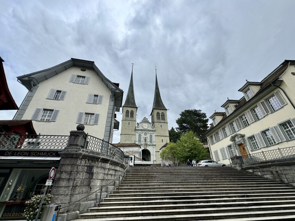
From St. Peter’s Chapel, walk east along the river to Lake Lucerne. Walk the sidewalk north and east following the lakeshore. The main street, Löwenstrasse, turns left. Follow it, turning immediately right onto St. Leodegarstrasse. Walk to the church with the beautiful bell towers. The beautiful, 17th-century late-Renaissance Hofkirche St Leodegar has twin, Gothic, bell towers. The church was part of a monastery founded in 750. A 1633 fire destroyed all but the bell towers. Inside, see the beautiful, white stonework and the vaulted ceiling. The 17th-century organ is one of Switzerland’s finest.
Walk back out to the main street, Löwenstrasse, and walk north about 4 blocks to the Lowenplatz and the Bourbaki Panorama.
The 10-metre-tall Bourbaki Panorama was painted in 1881 by Edouard Castres. It portrays, in a very lifelike, 360-degree view, the surrender of French troops to the neutral Swiss. At the end of the Franco-Prussian War in 1871, the French troops refused to surrender to the winning Germans. The panorama was touched up in the year 2000. Many panoramic theatres were built in the 19th century in Europe and the United States.
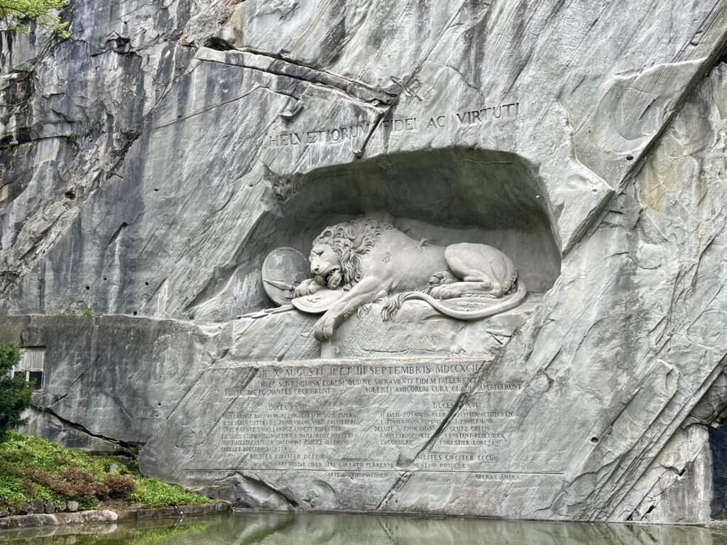
Walk to one of Lucerne’s more well-known tourist attractions, the Lowendenkmal, about a block north, on Denkmalstasse, the Lion Monument. The sculpture of a dying lion was carved into the stone, cliff-face in the 1820s. It is 10 metres long and 6 metres tall. It memorializes the Swiss soldiers who died defending King Louis 16th in the 1792 Paris attack during the French Revolution. This beautiful park was a sandstone quarry when the lion was carved.
Adjoining the park to the north is the Gletschergarten.
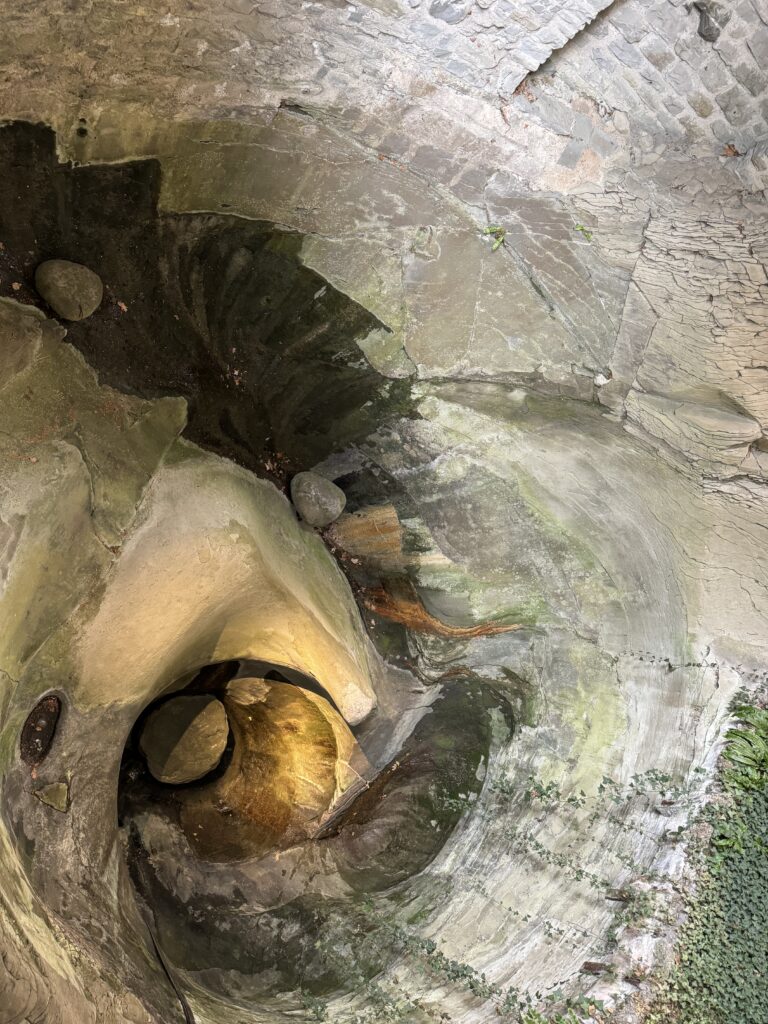
Sixteen potholes, called kettles, were revealed when glaciers melted in the area 20,000 years ago. In 1873, the Amrein family built the Glacier Garden around the kettles. Enjoy walking the paths through the rocks and plants. The Amreins collected all manner of items which are displayed in the museum’s eclectic collection. A mirror maze recreating Granada Spain’s Alhambra was created for the 1896 Geneva National Exhibition. It was moved to the garden in 1899.
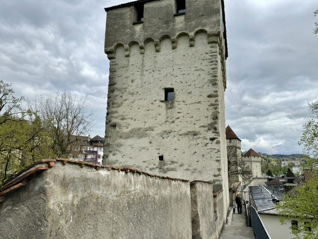
Walk back down Denkmalstrasse to Lowenplatz. From the square, continue 2 blocks south to Hofstrasse. Turn right onto Museggstrasse. This street runs parallel to the watchtowers and old walls of the city constructed around 1400. Veer right onto Schirmertorweg and climb up to the Museggmauer. Walk the path on top of the old city ramparts, for stunning views of the city and Lake Lucerne. There are 9 stone towers, some open to the public. The wall and the towers (including the Schirmerturm, Männliturm, Wachtturm, Zytturm) date back to late 14th century.
-
Madrid
November 15, 2023 /Day 1 - Old Madrid
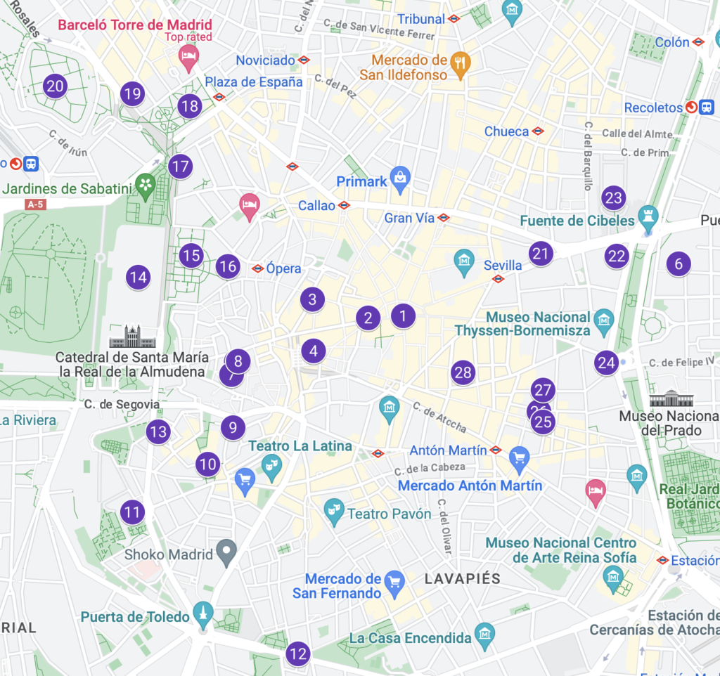
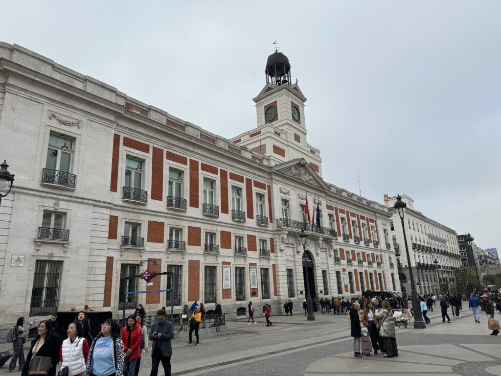
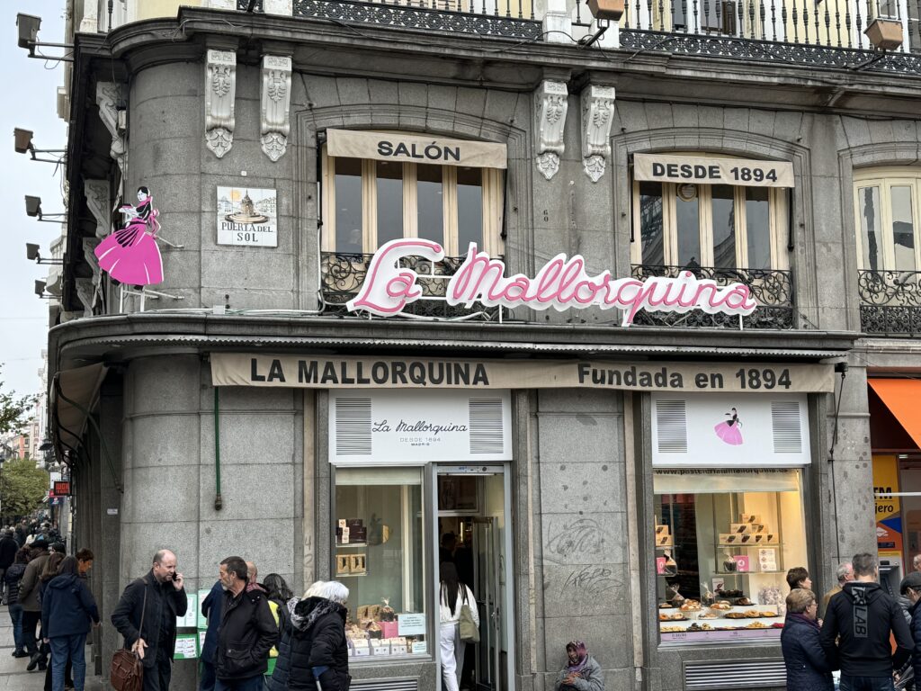
Unless you want to visit the major art galleries first, the best place to start exploring Madrid is the Puerta del Sol Square, officially considered the center of the city. Before you start, we advise you to stop at La Mallorquina to have breakfast with a delicious pastry and coffee.
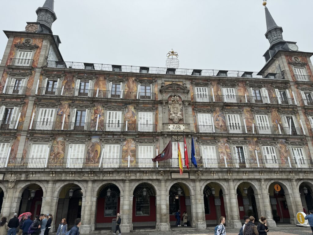
Go up Calle de Preciados and take the second street on the left, leading you to Plaza de las Descalzas. Here, you can admire the baroque portal of the Caja de Madrid Palace, built by the will of King Philip V in 1733 and located in front of the Convent of Descalzas Reales. Continuing south, you’ll reach the San Ginés Church on Calle de los Bordadores, built on the site of one of Madrid’s oldest Christian places of worship, dating back to at least the 14th century. Behind this church is the magnificent Chocolatería de San Ginés, revered by churros and chocolate lovers. Continue to Calle Mayor, cross it, and you’ll arrive at the splendid Plaza Mayor.
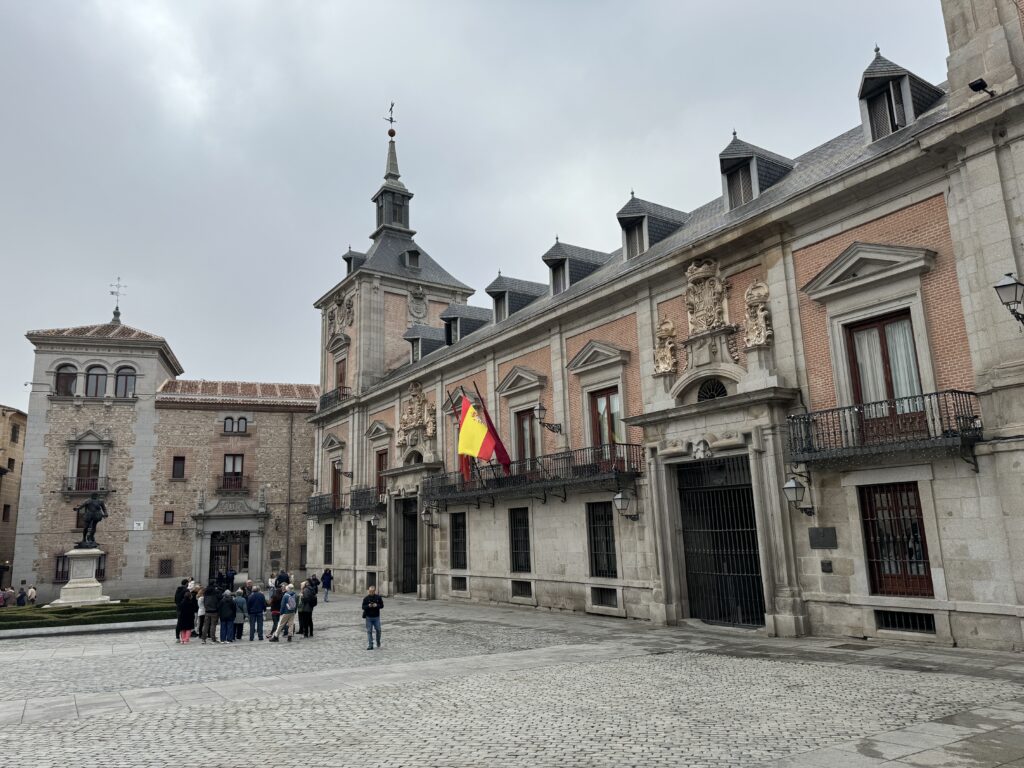
After having coffee in the square, head back to Calle Mayor and proceed west to the historic Plaza de la Villa, where the sixteenth-century Ayuntamiento (City Hall) of Madrid is located. On the same square, you’ll find the Casa de Cisneros, built in the 16th century, and the Gothic Casa de los Lujanes, one of the oldest buildings in the city.
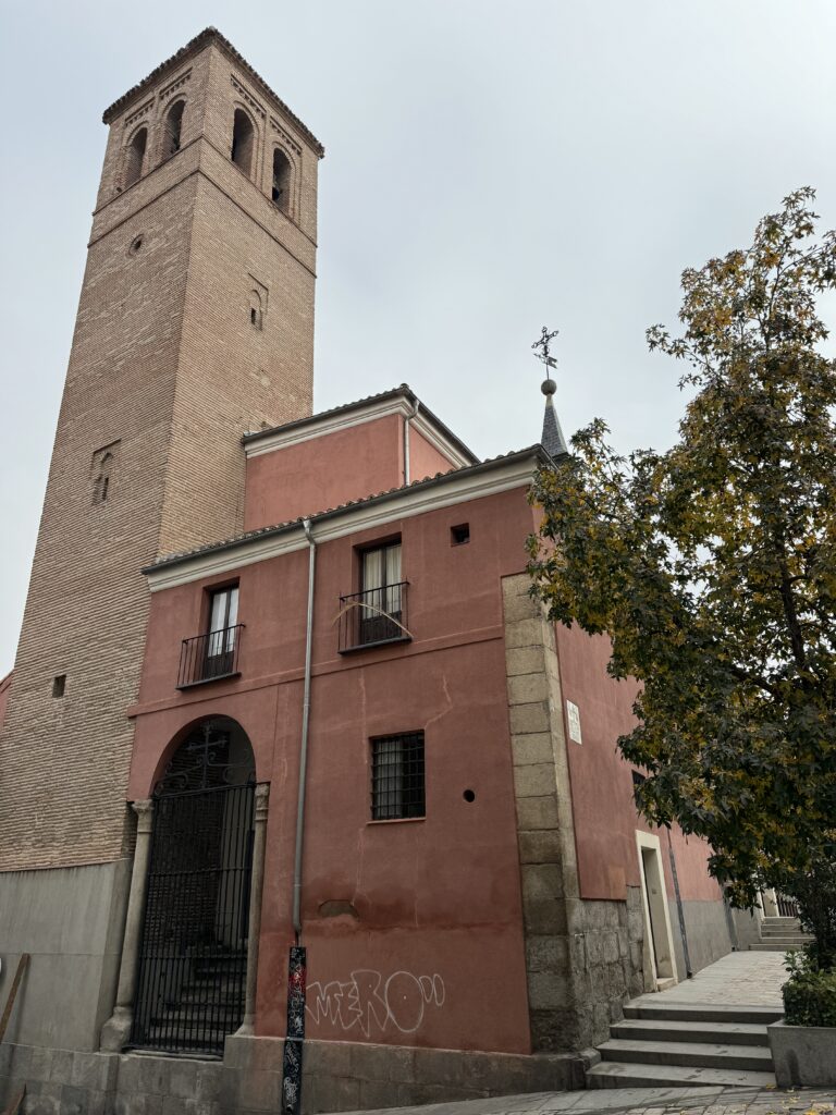
Then, take the street alongside the left side of the Casa de Cisneros. Once you reach the end of Calle del Sacramento, cross it, go down the stairs, and follow the cobblestone Calle del Cordón to Calle de Segovia. You’ll almost be in front of the Mudéjar-style tower of the fifteenth-century Iglesia de San Pedro El Viejo.
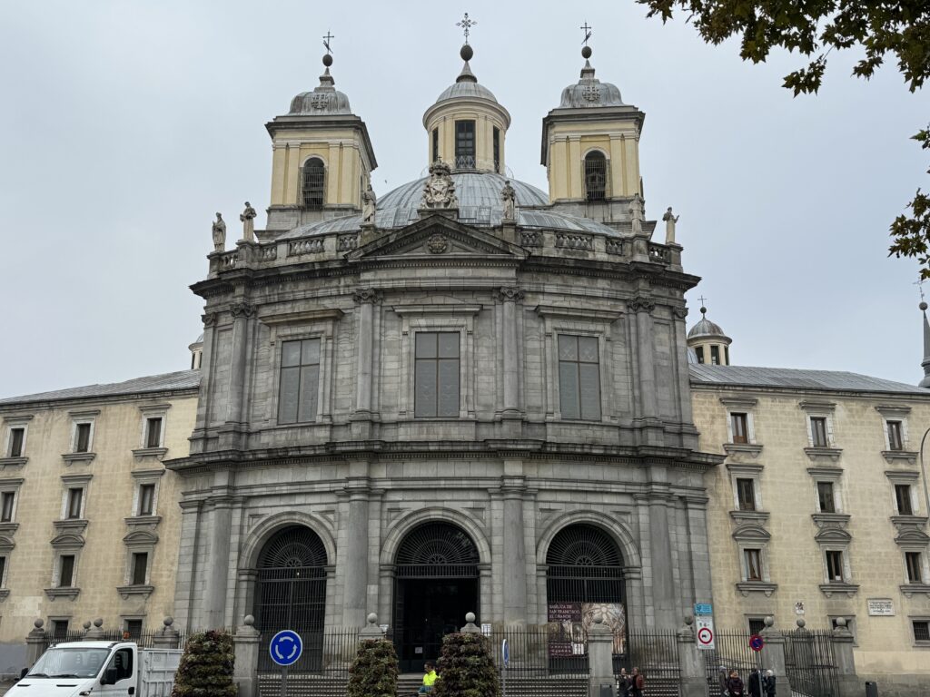
Continuing along Costanilla de San Pedro, you’ll reach the San Isidro Museum, next to the Iglesia de San Andrés, which, for a time, held the remains of Madrid’s patron saint, San Isidro Labrador. From here, you can cross Plaza de la Puerta de Moros and head southwest to reach the Basilica de San Francisco el Grande
From San Francisco el Grande, wander through the small maze of alleys that once made up the Moorish quarter to emerge on Calle de Bailén, where you’ll find delightful terraces. The Ventorrillo Bar (Corral de la Moreria) is probably the terrace in the happiest position, on the edge of the Jardines de las Vistillas. This is a magnificent place to relax while enjoying views of the Sierra de Guadarrama.
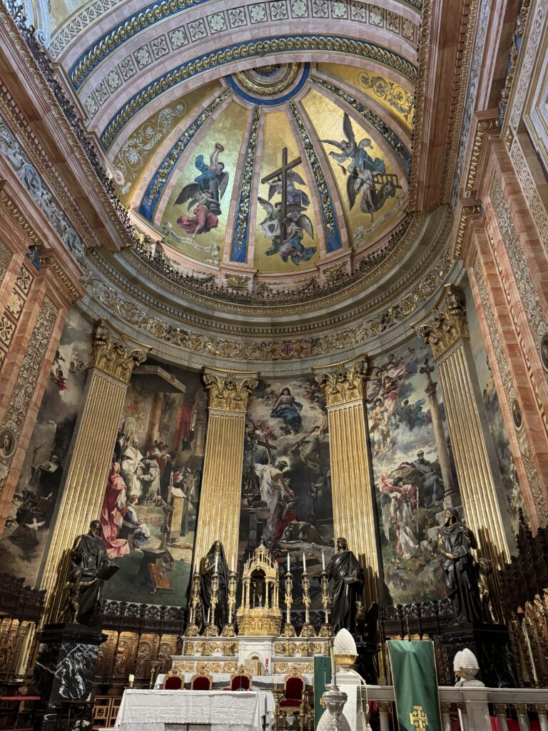
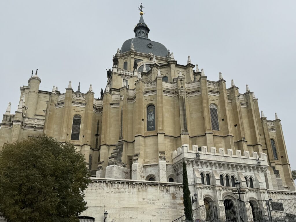
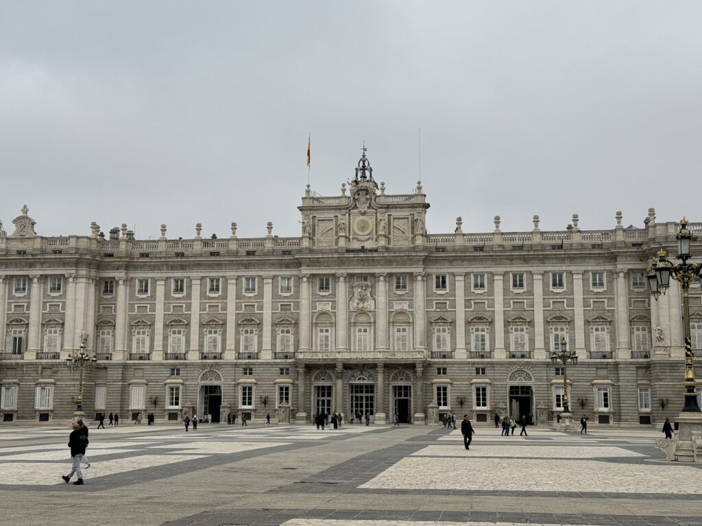
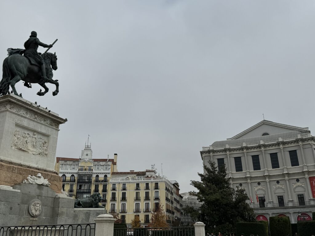
After a refreshing beer, follow the viaduct north to reach the Cathedral of Our Lady of Almudena, the Royal Palace, and the Plaza de Oriente, adorned with statues, fountains, and hedge mazes. The eastern side of the square is bordered by the Royal Theater.
Lorem ipsum dolor sit amet, consectetur adipiscing elit. Ut elit tellus, luctus nec ullamcorper mattis, pulvinar dapibus leo.
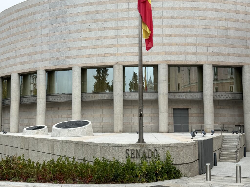
The northern end of Calle de Bailen runs along the Senate. The Senate Palace represents the 17 regions of the country and the Spanish enclaves in North Africa (Ceuta and Melilla). It was converted in the 19th century from a sixteenth-century monastery, underwent significant modifications in the 1840s and again in the 1950s. The modern extension facing Calle de Bailén was built between 1987 and 1991. Continuing from Plaza de España along Calle de Ferraz, you’ll reach the Cerralbo Museum, where you can explore a curious collection, and then the Temple of Debod, an ancient temple transferred here from Egypt.
Return to Plaza de España; the eastern side marks the beginning of Gran Vía, a long avenue reminiscent of the boulevards in Paris. Approximately halfway down Gran Vía, you’ll notice the imposing Telefonica building, easily identifiable as it sits on a hill. At the eastern end of Gran Vía stands the superb dome of the Metropolis Building.
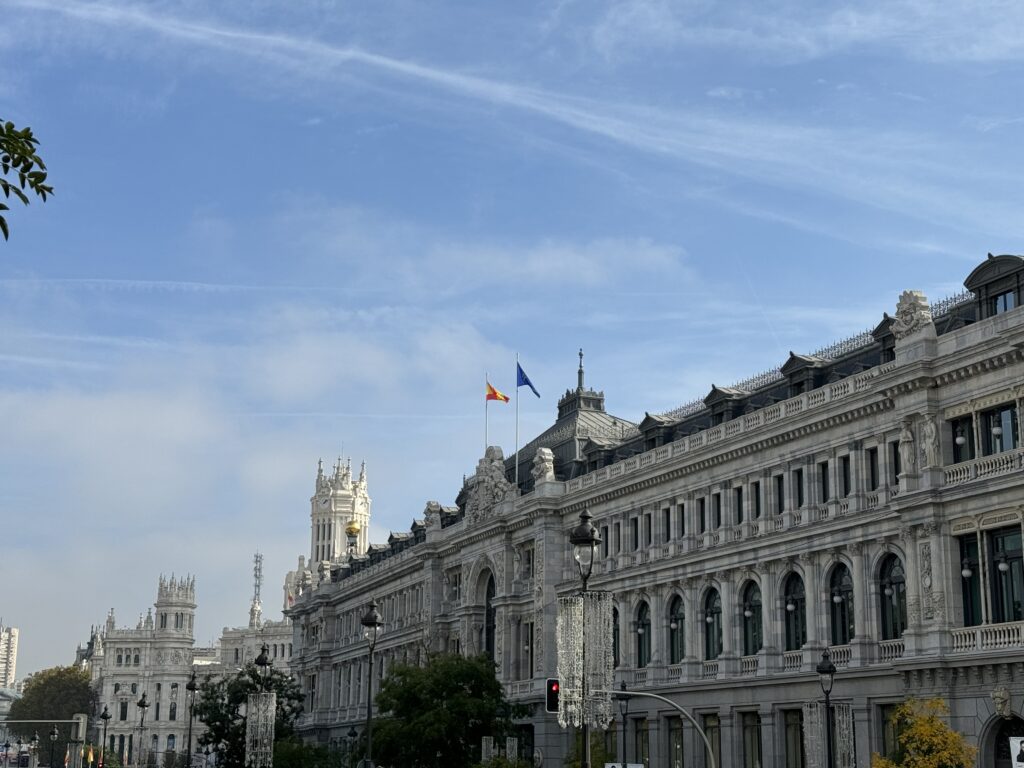
Return to Plaza de España; the eastern side marks the beginning of Gran Vía, a long avenue reminiscent of the boulevards in Paris. Approximately halfway down Gran Vía, you’ll notice the imposing Telefonica building, easily identifiable as it sits on a hill. At the eastern end of Gran Vía stands the superb dome of the Metropolis Building. Continuing east along Calle de Alcalá, you’ll arrive at Plaza de Cibeles, the beloved roundabout for Madrileños. Approaching this square, you’ll see the proud late nineteenth-century building housing Banco de España on the right, while on the left, you’ll notice the gardens of the majestic Buenavista Palace, now the headquarters of the Armed Forces and the Ministry of Defense.
Cross Paseo del Prado to reach the Prado Museum, or continue to Calle de las Huertas (across the tiny Plaza de Platería Martínez). The seventeenth-century Convento de las Trinitarias, where the writer Miguel de Cervantes rests (unfortunately not open to the public), is located. Turn right along Costanilla de las Trinitarias and head north along Calle de San Agustín to Calle de Cervantes, where you’ll turn left. At number 11, you’ll find the Casa de Lope de Vega, the famous Spanish playwright. At the end of Calle de Cervantes, turning left into Calle de León, you’ll find yourself back on Calle de las Huertas. Along this street, in Plaza de Santa Ana and the surrounding alleys, you’ll find numerous places to sit and rest.
Day 2 - Parque del Buen Retiro
After a challenging tour of nearby art galleries, a great way to relax is to immerse yourself in the scaled-down Madrid version of Central Park.
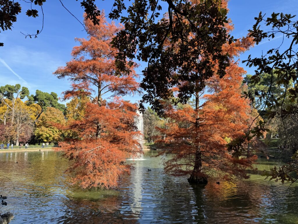
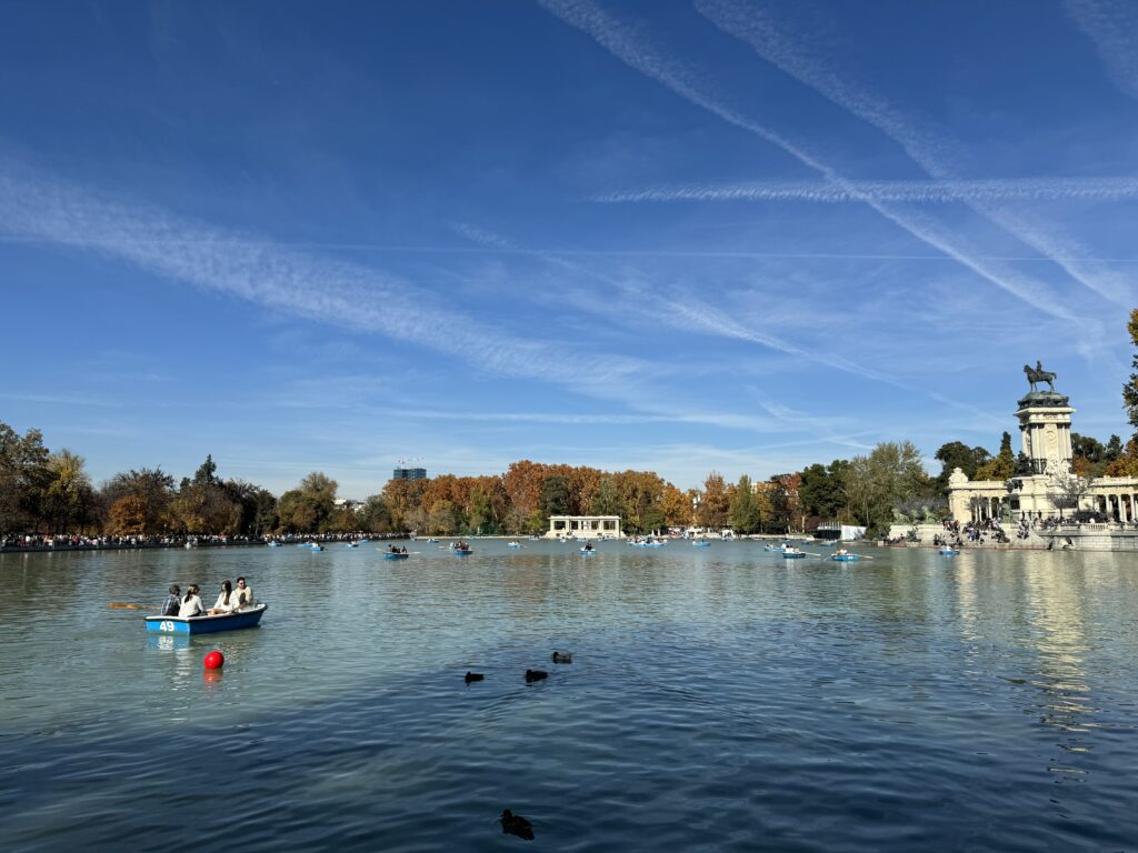
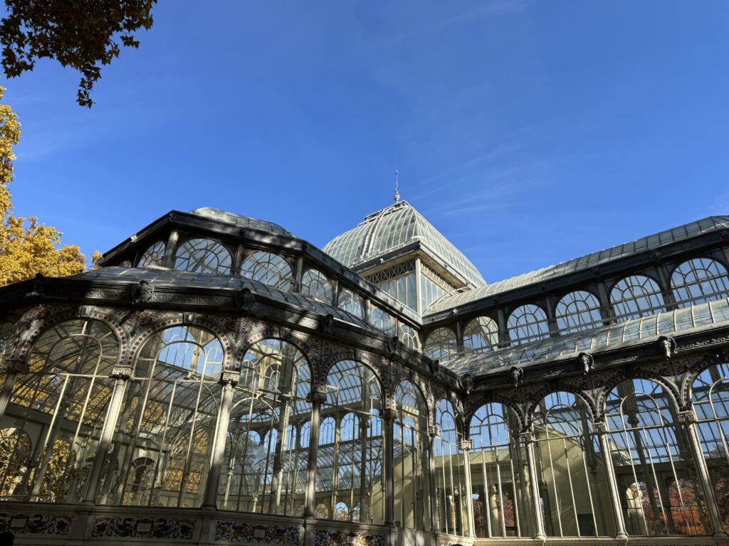
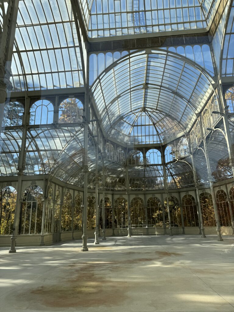
Parque del Buen Retiro is a popular meeting place for families, clowns, bongo players, couples arm in arm, and walking enthusiasts. The gardens are especially busy on weekends when street performers showcase their talents. Once reserved for kings, queens, and court members, the park is now open to everyone. Visitors can also rent rowboats (€4 for 45 minutes) to take a ride on the artificial lake (estanque), dominated by the imposing structure of the mausoleum of Alfonso XII. On the western shore of the lake, you’ll notice a unique structure decorated by Singi: this is the Fuente Egipcia (Egyptian Fountain), where, according to legend, a vast fortune buried by Philip V in the mid-18th century is said to be hidden. However, park authorities have assured us that this is a purely fictional story. On weekends, around the same lake, artists, fortune-tellers, and card readers set up. A couple of structures near the park host art and photography exhibitions, particularly Palacio de Exposiciones. In the summer, puppet shows are also organized (look for the sign ‘Tiritilandia,’ which means ‘Puppetland’). The Palacio de Cristal (2 91 574 66 14; 11-20 from Monday to Saturday, 11-18 on Sunday and holidays from May to September, 10-18 from Monday to Saturday, 10-16 on Sunday and holidays from October to April), a beautiful metal and glass structure located south of the lake, was built in 1887 as a winter garden for exotic flowers. Occasionally, the palace is also used as an exhibition space.
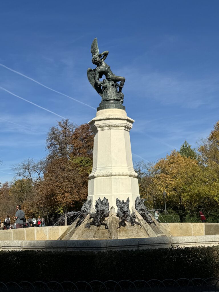
Not far away, the Palacio de Velázquez (@ 91 573 62 45; observes the same hours as the Palacio de Cristal) was built in 1883 for an exhibition on the mining industry and is now used for temporary exhibitions. Another building that occasionally serves a similar purpose is the Casa de Vacas (2 91 409 58 19; (3 11-22). At the southern end of the park, near La Rosaleda (rose garden), a statue dedicated to El Ángel Caído (the Fallen Angel, i.e., Lucifer) has been placed, giving the place a slightly eerie touch. The southwestern end of the park is a well-known meeting point for young homosexuals.
Day 3 - Toledo
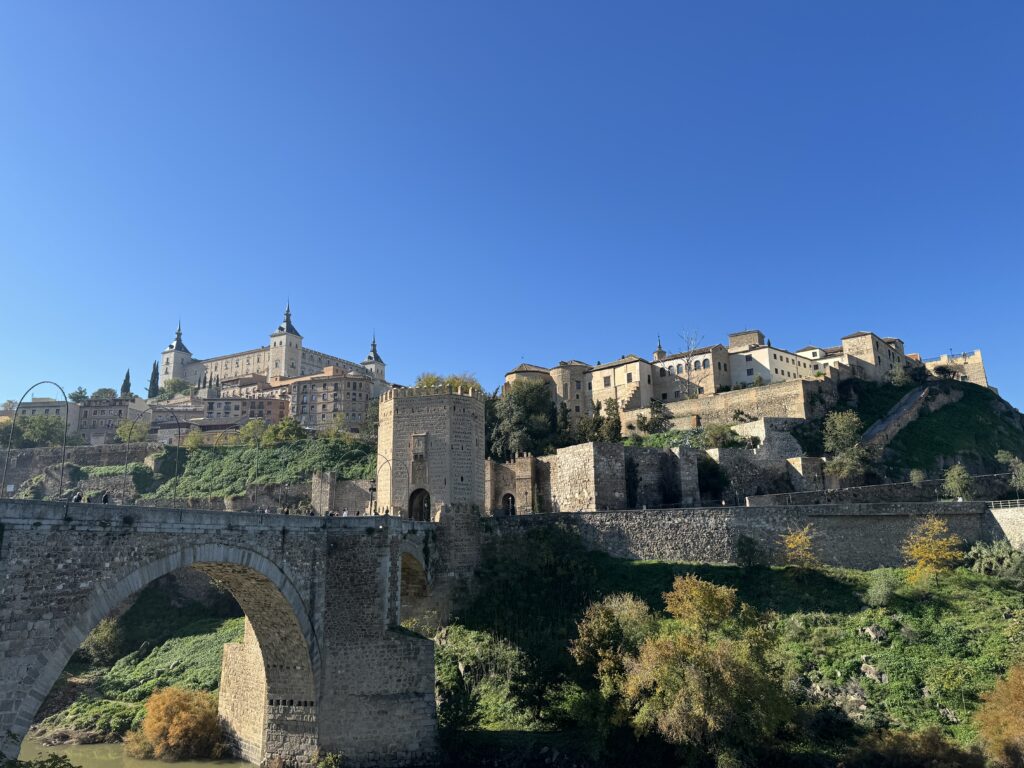
Toledo lacks a true city center; however, Plaza de Zocodover, at the northeastern end of the old city, is a good starting point for your visit. This oddly-shaped square was once the site of an Arab livestock market, and more recently, the main market of the city. Nowadays, it is adorned with café terraces and crowded with tourists on day trips. From here, the imposing fortress of the Alcázar is just a short walk away, it will houses the collection of the Museo del Ejército from Madrid, further expanding the already extensive collection of weapons here.
This site, the highest point in Toledo, was initially a Roman military base, then an Arab fortress, and finally Christian after the reconstruction by Alfonso VI in the 11th century. Later, Charles V converted the squarely structured building into a royal palace and used it to accommodate his guests until it was damaged by a fire in 1710. The palace burned again in 1810 (by Napoleon) and was almost completely destroyed during the Spanish Civil War. When Franco ordered its reconstruction, it was transformed into the military museum you can admire today. This site, the highest point in Toledo, was initially a Roman military base, then an Arab fortress, and finally Christian after the reconstruction by Alfonso VI in the 11th century. Later, Charles V converted the squarely structured building into a royal palace and used it to accommodate his guests until it was damaged by a fire in 1710. The palace burned again in 1810 (by Napoleon) and was almost completely destroyed during the Spanish Civil War. When Franco ordered its reconstruction, it was transformed into the military museum you can admire today.
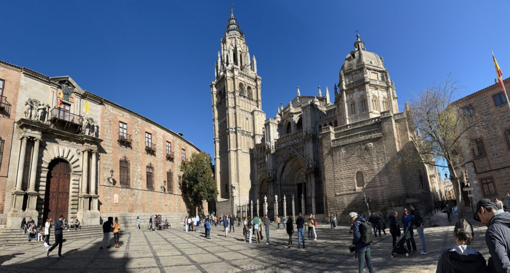
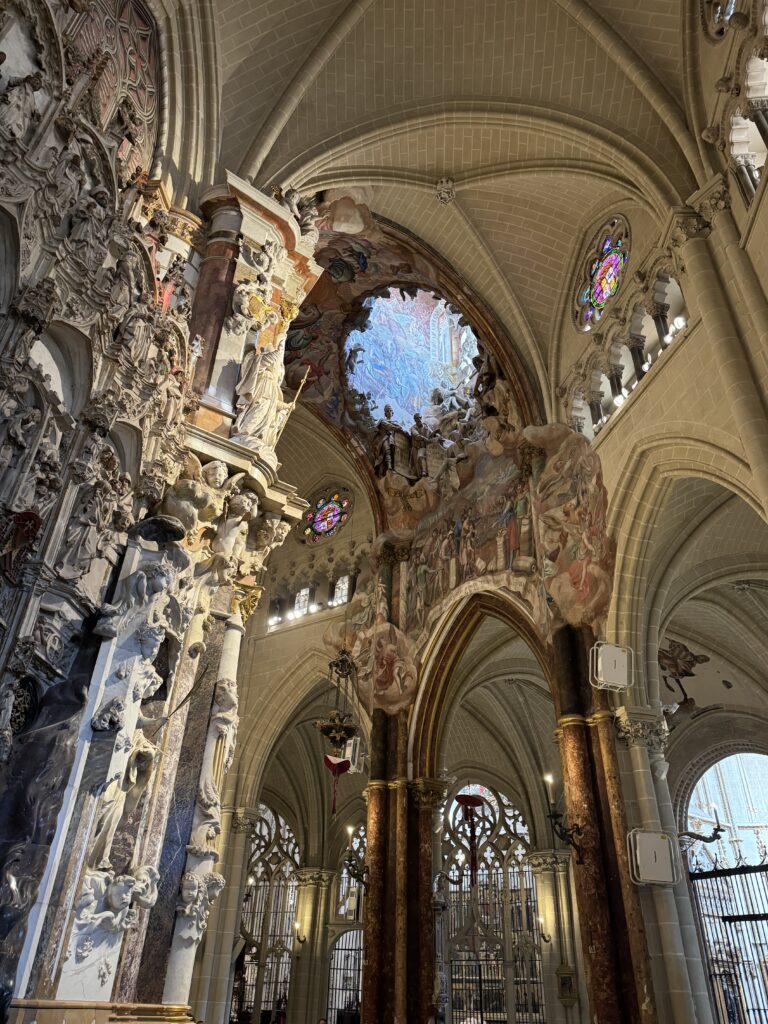
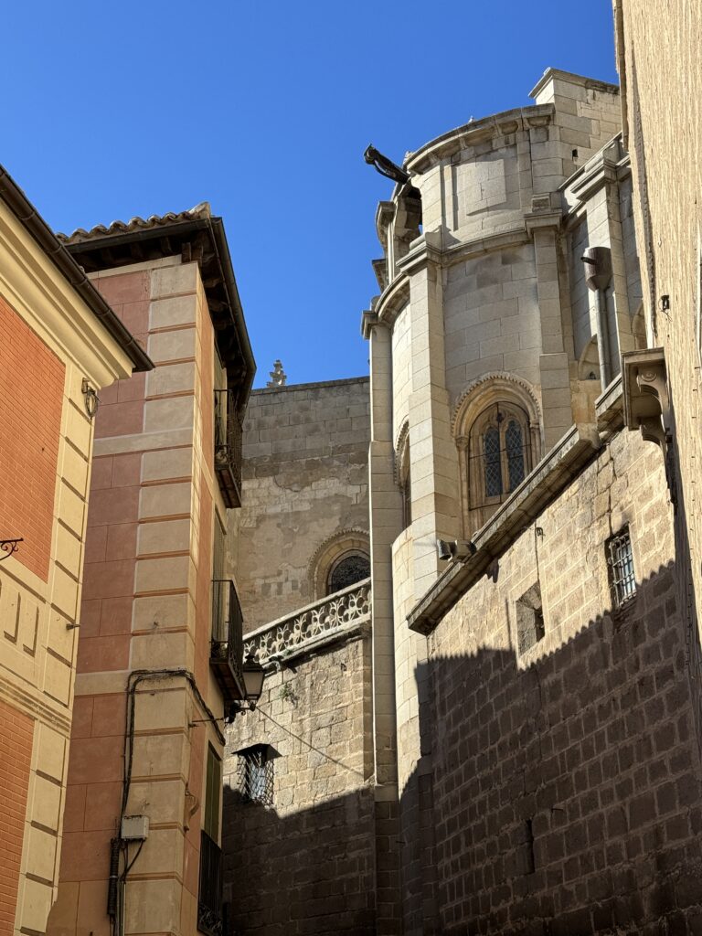
Nearby is the Cathedral, one of the richest and most majestic churches in the world. The essentially Gothic building, with some Mudéjar additions, was constructed in the 13th century on the site of a former mosque. Toledo’s role as the seat of the Church in Spain ensured the cathedral a wide array of patrons, and wealthy Catholics left their mark in the sumptuous decorations visible everywhere. It’s worth exploring all the chapels and side rooms, but the Capilla de la Tome (Tower Chapel) in the northwest corner and the Sacristía (Sacristy) deserve a bit more attention. The latter boasts a graceful vaulted ceiling and a small gallery with works by the painter El Greco (see reading on this page), while the Tower Chapel houses one of the most extraordinary monstrances in existence, the Custodia de Arfe, dating back to the 16th century. With 18 kg of gold and 183 kg of silver, this sparkling mass of metal features a staggering 260 statuettes. Other noteworthy places include the impressive main altar, the Transparente window, and the choir stalls.
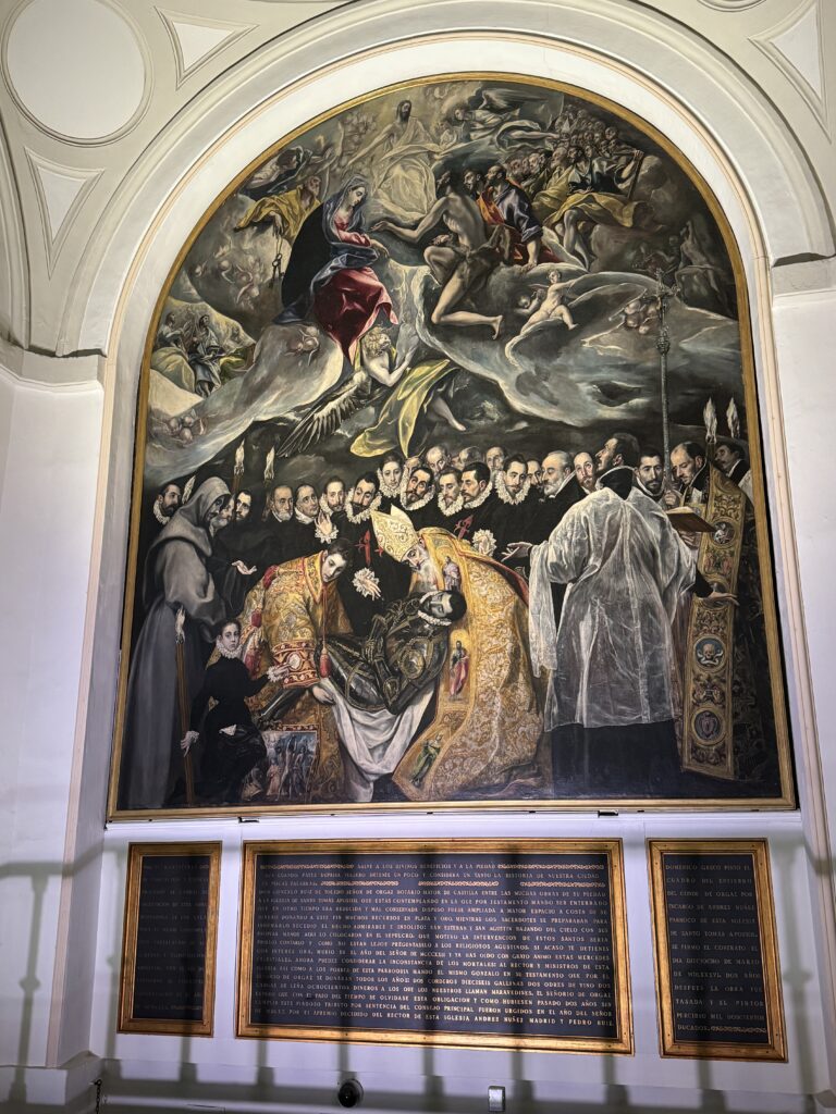
To the southwest of the cathedral is the Judería (Jewish quarter), home to the synagogues of the old city and the heart of the route that retraces the life and works of the painter El Greco. The first stop is the Iglesia de Santa Tomé, where one of El Greco’s masterpieces, El Entierro del Conde de Orgaz (The Burial of the Count of Orgaz), is displayed. The painting tells the legend of the pious count’s funeral in 1323 when St. Augustine and St. Stephen appeared to bury the body in the tomb. The bearded man immediately above St. Stephen (the younger of the two saints in golden clothes) could be a self-portrait of the painter.
Continue El Greco’s itinerary and head towards the Casa-Museo del Greco. This house is not necessarily where the painter lived, but it is decorated in the style of the time. At least twenty of his minor works are exhibited here, along with paintings by his contemporaries. More works by the painter can be found in the Museo de Santa Cruz, near Plaza de Zocodover.
Born in Crete in 1541, Domenikos Theotokopoulos (El Greco) moved to Venice in 1567 to apprentice as a Renaissance artist. Under the influence of masters like Tintoretto, he learned to paint dramatic scenes with few colors, directing the observer’s interest to the faces of the characters he portrayed, leaving the rest in relative darkness—a characteristic that later became one of his distinctive traits. Starting in 1572, he devoted himself to the study of Roman Mannerism and the works left by Michelangelo.
Theotokopoulos arrived in Toledo in 1577 with the hope of securing a commission at El Escorial, but things took a different turn as Philip II did not want him as a court artist. In Toledo, the painter began to work in a style completely different from that of local artists, attracting a wealthy clientele willing to pay high prices for his works. His high opinion of himself and his work, however, drew the hostility of the cathedral administrators, the first among many clients to drag the artist to court to justify his decidedly high fees.
El Greco enjoyed a luxurious lifestyle and took up residence on Paseo del Tránsito, where his meals were often accompanied by performances by musicians. With the decline of Toledo’s fortunes, El Greco’s economic situation also suffered a setback. Although his later works are among his most beautiful, the painter often struggled to gather the money needed to pay rent. He died in 1614, leaving traces of his presence throughout the city, where many of his masterpieces are still located.
Beyond the Casa-Museo del Greco, you will encounter the interesting Museo Sefardí, housed in the Synagogue of El Tránsito, one of the best-preserved remnants of Jewish Spain. This peculiar combination of names refers to the ‘Virgen del Tránsito,’ the name given to this place of worship when it was consecrated as a Christian church. Some breathtaking sculptures adorn the walls, and the museum is an ideal place to deepen your knowledge of Jewish life in medieval Spain.
For a glimpse into Muslim Toledo, head to the Cristo de la Luz Mosque. During the Muslim rule, there were 10 mosques in the city, but this one, a characteristic example of their style, is the only survivor. Don’t miss the horseshoe-shaped arches, both inside and outside, and the inscriptions on the interior walls.
-
Amsterdam
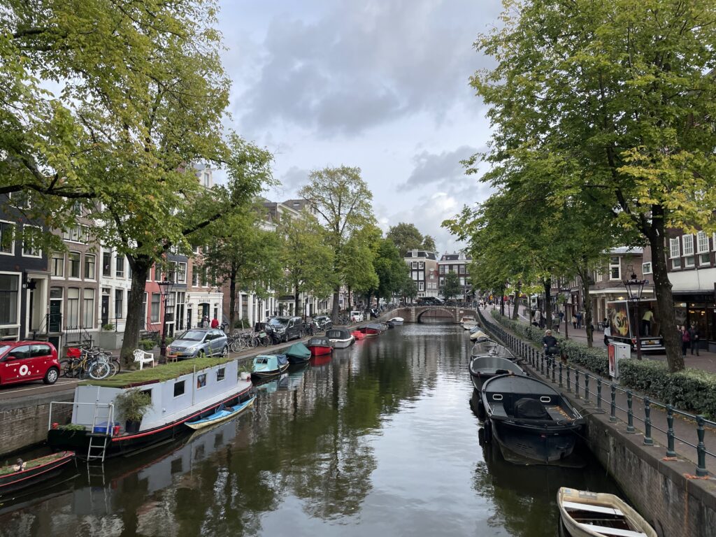
October 4, 2023 /Amsterdam is a city that enchants in various ways: with its typical gabled houses dating back to the Golden Age, with the shimmering canals dotted with boats, and even more so with the centuries-old and cozy bruin cafés (smoke-stained pubs) illuminated by candles, where beer flows freely. Art enthusiasts will find few other cities with such a variety of masterpieces: just think of the richness of the collections housed in the Rijksmuseum, the Van Gogh Museum, the Stedelijk Museum, and the Hermitage. For music lovers, there is a rich lineup of internationally acclaimed concerts, which invariably sell out. For those attracted to the more daring aspects, there are the women in the windows in the red-light district and the coffee shops selling cannabis. Amsterdam is an extremely compact and accessible city, with a limited center to explore on foot and characteristic alleys that always hide some surprises: a hidden garden, an antique book market, a seventeenth-century distillery – authentic microcosms where nothing ever presents itself the same way twice.
Day 1
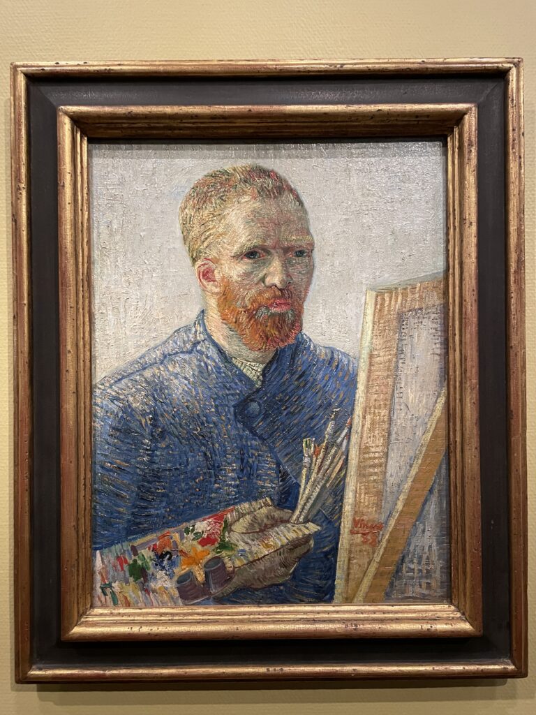
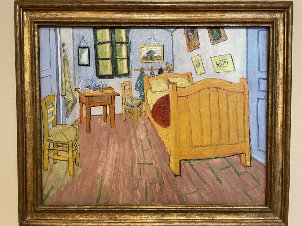
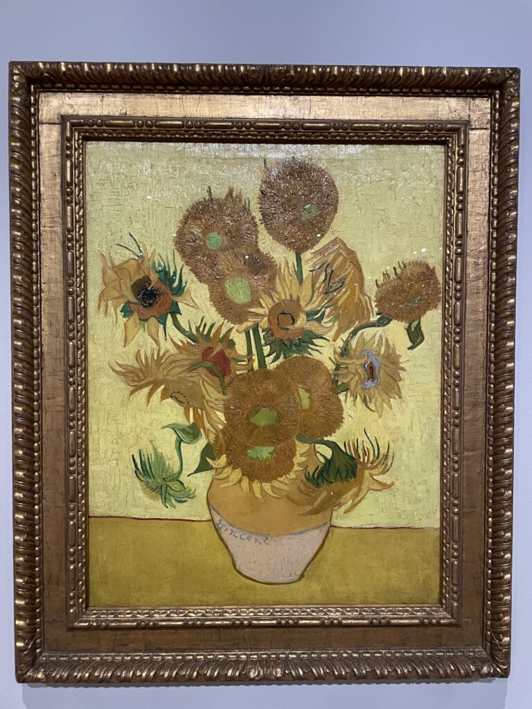
Framed by a new, sparkling glass entrance, the museum housing the world’s most extensive collection of Van Gogh’s works encompasses a magnificent series of masterpieces. Starting from the artist’s early experimental canvases, the museum traces his life, from the phase dominated by the joyful hues of sunflowers to the dark cloud that later descended upon him and his works. The museum also houses paintings by contemporary artists to Van Gogh, such as Gauguin, Toulouse-Lautrec, Monet, and Bernard. The lines to enter can be endless; tickets purchased in advance online and discount cards allow access through separate entrances where the line moves faster.
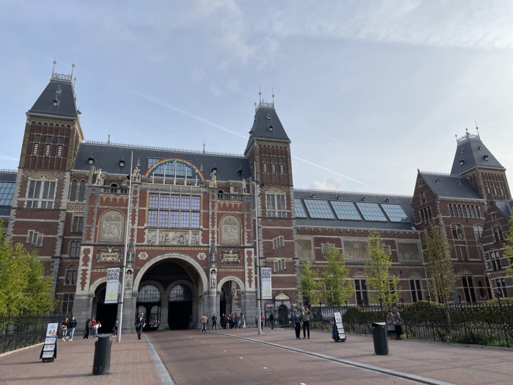
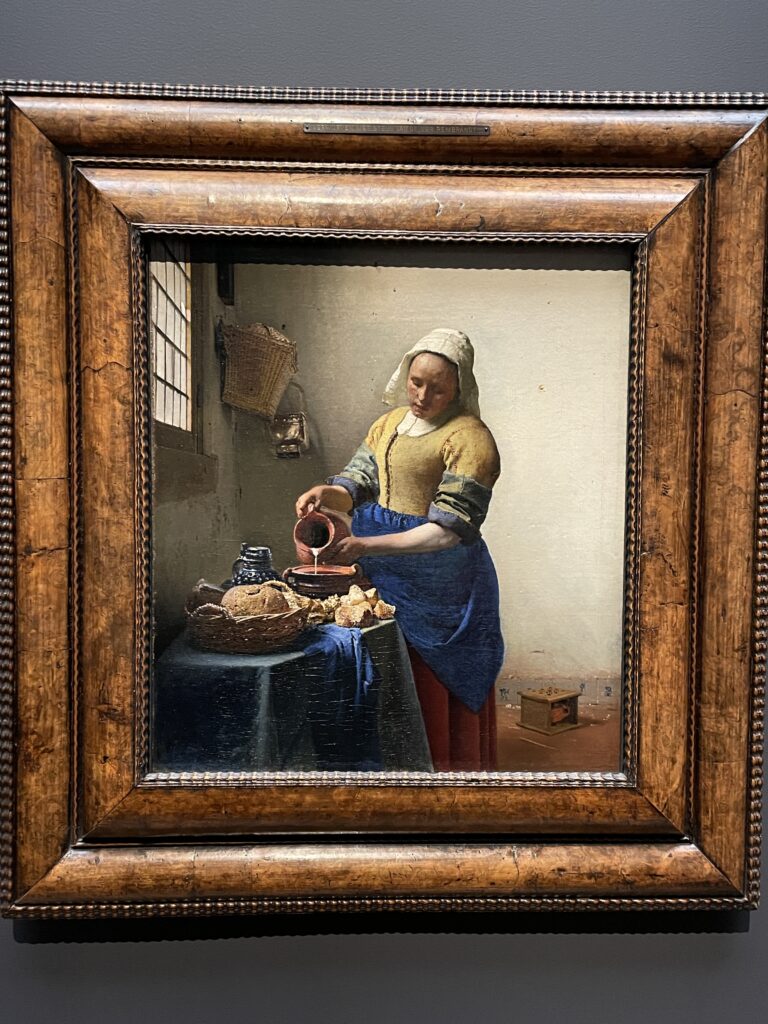
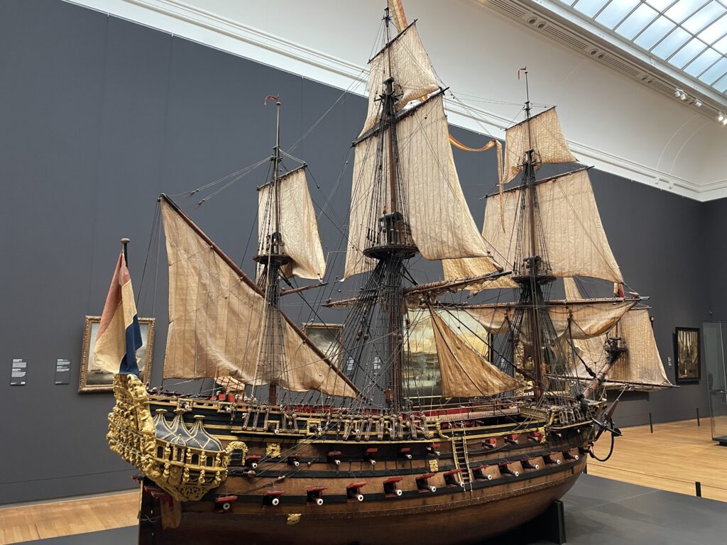
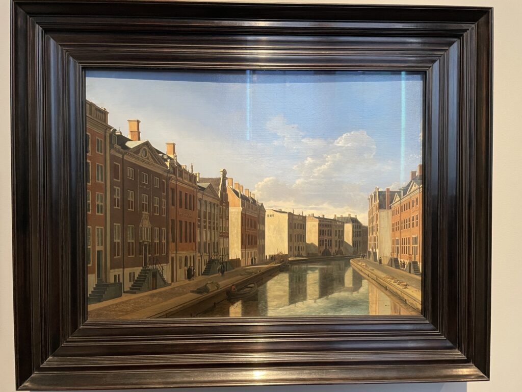
The Rijksmuseum is the most important Dutch art museum: a heritage of works by Rembrandt, Vermeer, and 7,500 masterpieces by other artists spread along 1.5 km of galleries. If you want to avoid the peak of the crowd, we recommend arriving at the museum after 3 PM, or booking tickets online to access a separate entrance with a quicker flow. The highlight of the collection consists of works from the Golden Age: the subjects of still lifes, gentlemen with pleated collars, and landscapes suffused with a pale yellow light are a true feast for the eyes. The centerpiece of the exhibition is Rembrandt’s “The Night Watch” (1642). Initially titled “Company of Captain Frans Banning Cocq,” the painting assumed its current name only a few years later, after it darkened due to a layer of dirt that evoked the evening light. Don’t miss the blue and white Delft ceramics, the incredibly detailed dollhouses, and the brand-new Asian Pavilion. The sculpture garden surrounding the building is free to enter.
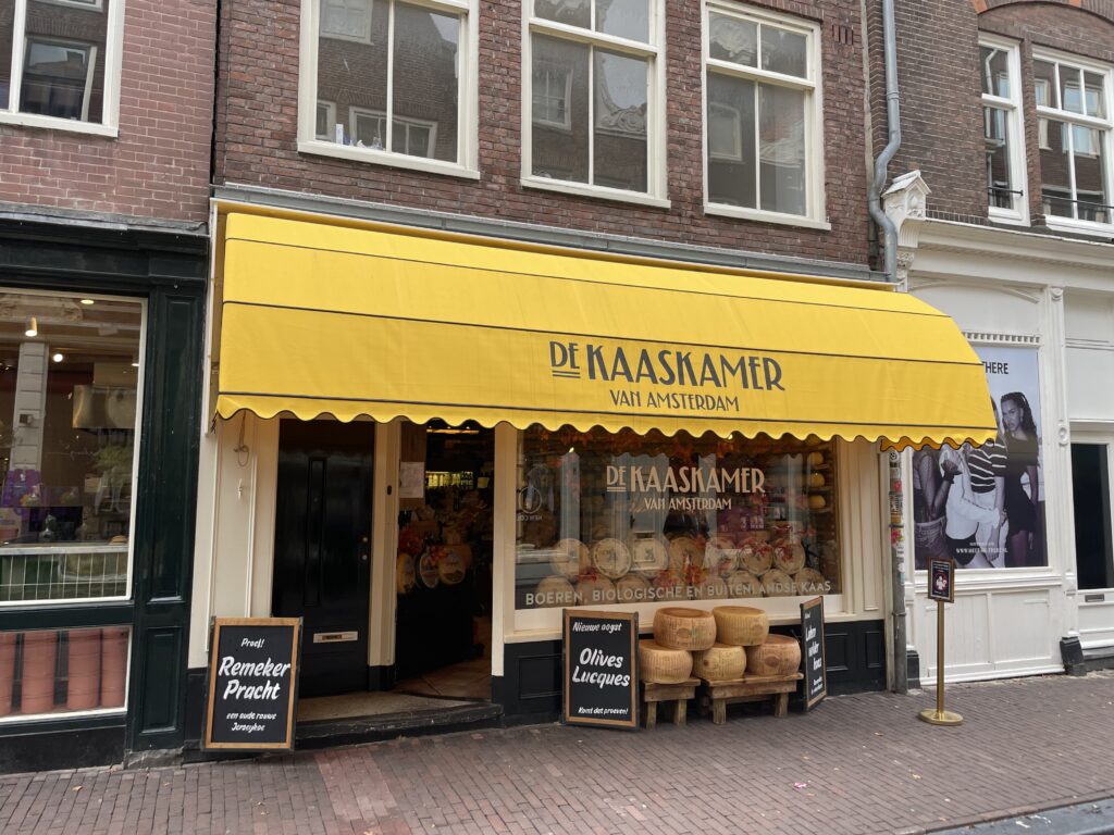
The Dutch consume more than 14 kg of cheese per person every year, mostly sold by De Kaaskamer, where wheels of gouda, edam, and other local varieties form towering stacks that reach the ceiling. The name means “Cheese Room,” and indeed, the place seems to overflow with a wide variety of Dutch and organic cheeses, as well as olives, tapenade, salads, and other products perfect for a picnic. Before making a purchase, you can taste the products; if you can’t take home a wheel of Gouda, at least buy a baguette with cheese and/or deli meat for takeout.
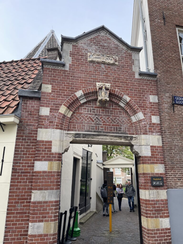
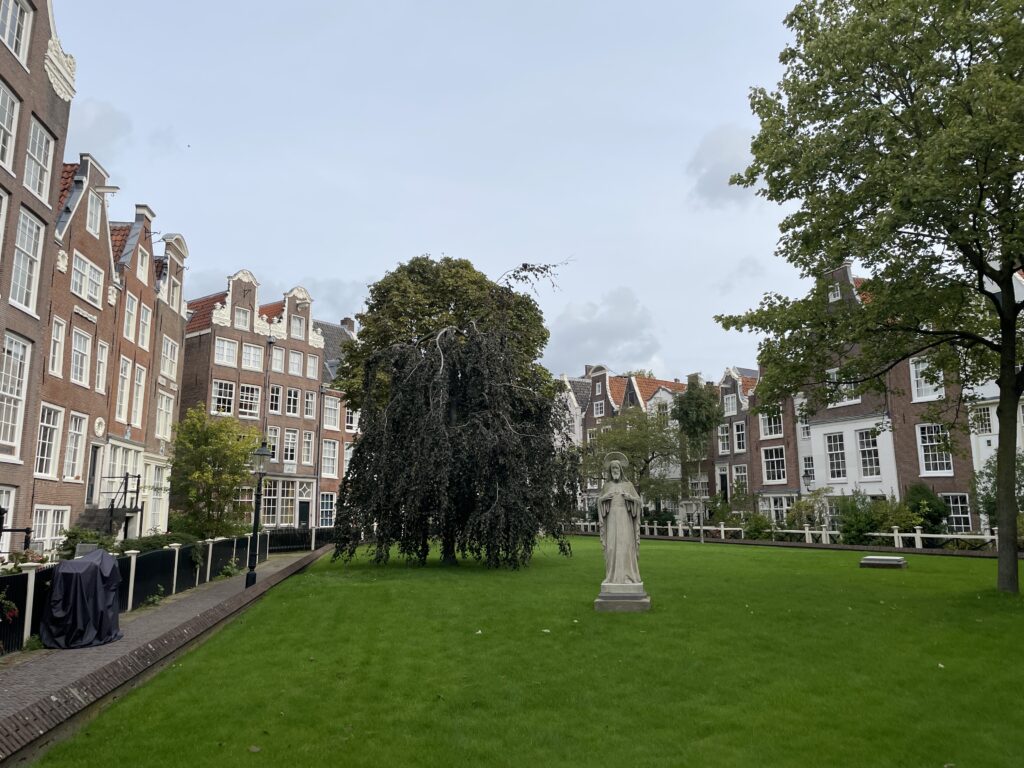
Once you reach Spui Square, just after the American Book Center, you’ll notice a modest wooden door: open it and take a look at the hidden little village called Begijnhof (p44), with its two ancient churches and gardens. Cross the courtyard to the entrance on the opposite side.
This sheltered complex of small houses and tiny gardens was built in the 14th century around the convent for the Beguines, a Catholic order of single or widowed women who cared for the elderly and led a religious life without taking monastic vows. The last true Beguine died in 1971.
Cross the courtyard to the entrance on the opposite side. From Begijnhof, head north for a short distance to the Civic Guard Gallery, filled with portraits of men with pleated collars and stern expressions.
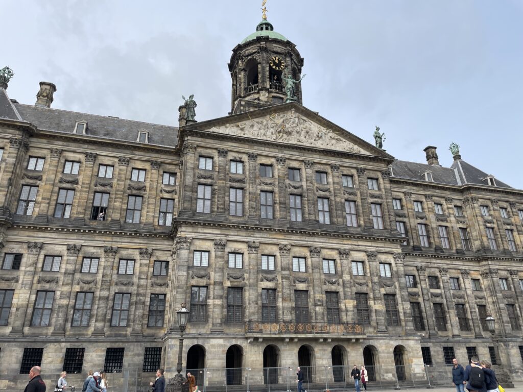
Walk through the gallery and exit into the courtyard of the Amsterdam Museum on Kalverstraat. Continue down Kalverstraat to the Royal Palace, the residence of King Willem-Alexander and Queen Máxima; take a peek at the lavish interiors. Built in 1665 as a sumptuous town hall, in 1808 it became the residence of Napoleon’s brother, who was crowned the King of Holland. The imposing building boasts splendid interiors and magnificent marble decorations, including the inlaid floor with world maps in the grand burgerzaal (civic hall) at its center. At the entrance desk, you can obtain a free audio guide that explains in detail everything you will see. King Willem-Alexander only uses the Royal Palace for ceremonies; check the website for closing periods.
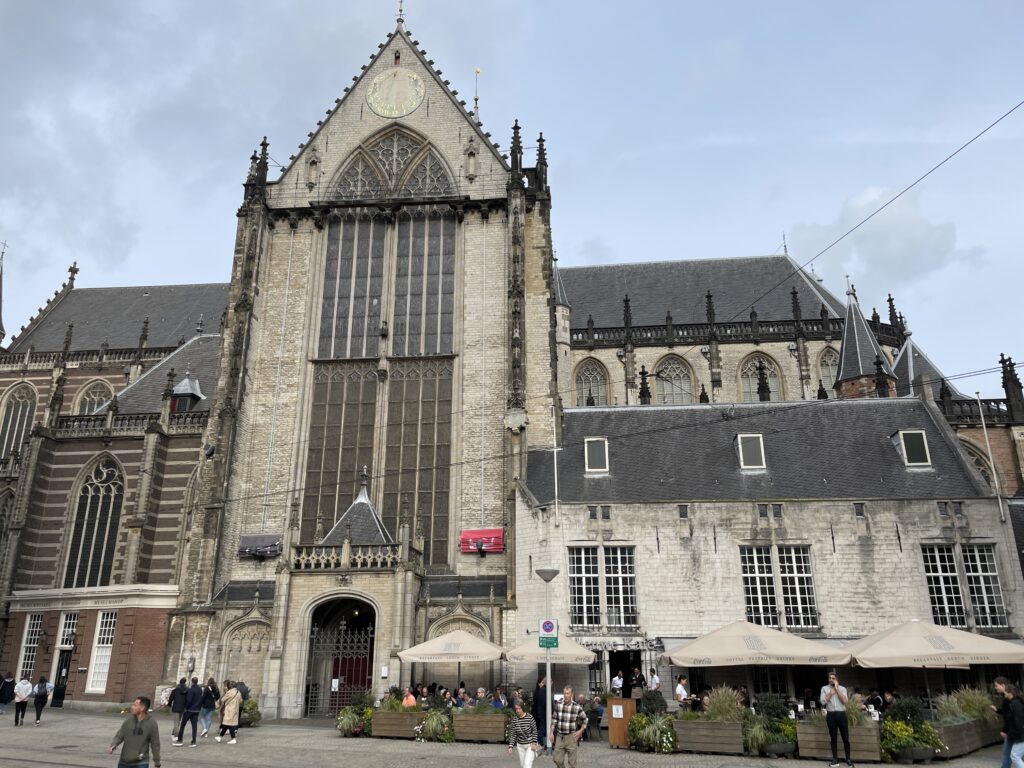
Next door is the New Church, where the Dutch monarchs are crowned. This late Gothic basilica from the 15th century is the place where Dutch monarchs are traditionally crowned and is newer only compared to the Oude (Old) Kerk. Several monumental elements dominate the sparse interior of the church: a magnificent oak wood inlaid chancel, a choir screen in bronze, an imposing organ, and an immense stained glass window depicting historical scenes. The building is also used to host exhibitions and organ concerts. Opening hours and ticket prices vary depending on the ongoing event.
Then, follow the bustling Nieuwendiik and walk to Zoutsteeg. At this point, try to overcome your aversion to raw fish and taste the famous Dutch herring at Rob Wigboldus Vishandel, a tiny place with only three tables. Leave Zoutsteeg and continue on Damrak. Cross Damrak and reach the side of Dam Square where the Nationaal Monument stands. Walk amidst the sea of bicycles, positioning yourself behind the monument to see the urns containing soil from World War II cemeteries.
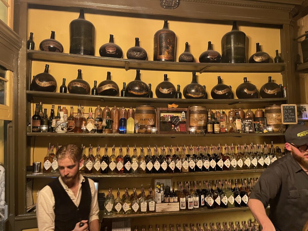
Follow the road behind the NH Grand Hotel Krasnapolsky that leads to Wynand Fockink, a Dutch gin distillery dating back to 1679. This small tasting room, located in a covered gallery behind the Grand Hotel Krasnapolsky, has been serving rivers of jenever and liqueurs since 1679. It doesn’t have chairs or stools, but it’s a pleasant and intimate place to have a drink or two with friends. On weekends (at 3 PM, 4:30 PM, 6 PM, and 7:30 PM), a guided tour of the distillery takes place; conducted in English, it includes six tastings (€17.50, no reservation required).
The bartender will fill your glass to the brim, so follow the Dutch way and lean down to take the first sip: this way, you’ll avoid spilling any drops.
Day 2
In the former Heineken brewery, you can now take part in a self-guided tour, the highlight of which (aside from the tastings included in the price) is the multimedia area where visitors are shaken, sprayed with water, and finally subjected to heat, mimicking the process the beer undergoes. True beer enthusiasts might find it horrifying, but it’s a very fun experience. The entrance ticket includes a 15-minute boat ride that shuttles between the Heineken Brand Store, near Rembrandtplein.
-
Berlin
September 5, 2023 /Day 1 - Mitte
Berlin is an ideal city for those who love walking because, despite its considerable size, it is compact and divided into well-defined neighborhoods, each with its own points of interest and attractions easily reachable on foot. “Day 1- Mitte” is a perfect walk if you are visiting the city for the first time, as it covers the main monuments and famous places in the capital. To understand how the urban landscape has changed since reunification, follow the “Day 2 – Contemporary Architecture” itinerary. Enjoy your walks!
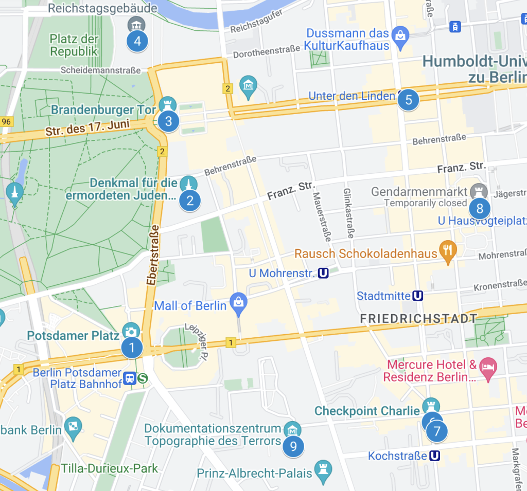
This itinerary, which requires a full day, covers all the classic monuments of Berlin and some fabulous spots in the city that are less known. Along the way, you will see picturesque views, impressive architecture, inviting local eateries to grab a bite, and numerous places you probably know from history books. The itinerary starts from Potsdamer Platz and winds through the new ministerial quarter, reaches Unter den Linden, and then continues through the historic center, ending in Scheunenviertel.
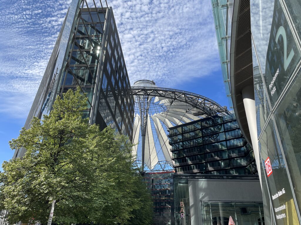
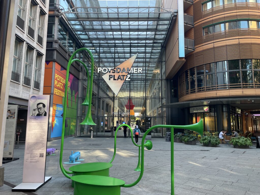
So, start from Potsdamer Platz, the newest area of Berlin, a true showcase of contemporary architecture. Storefront of urban renewal, Potsdamer Platz is perhaps the most visible symbol of the “new Berlin” and a major tourist attraction. This historic square was once a bustling crossroads that became synonymous with metropolitan life and entertainment in the early 20th century. In 1924, Europe’s first traffic light (which operated manually) was installed here, a copy of which has recently been placed in its original location. World War II drained all life from Potsdamer Platz, and the entire area was frozen, cut in two by the Wall, until reunification. In the 1990s, the city administration engaged the best international talents in contemporary architecture, including Arata Isozaki, Rafael Moneo, Richard Rogers, and Helmut Jahn, to realize ‘Potsdamer Platz – Part Two’ as part of architect Renzo Piano’s overall project. Constrained by the city’s zoning regulations, the final result cannot be described as avant-garde, but it is pleasant and, above all, human-scale.
Berliners and visitors have warmly embraced this new urban development, which is divided into three parts: DaimlerCity, the Sony Center, and the Beisheim Center. DaimlerCity, which extends south of Potsdamer Strasse, was the first project to be completed in 1998. The Sony Center, nestled between Potsdamer Strasse, Ben-Gurion-Strasse, and Bellevuestrasse, was inaugurated in 2000. The last of the three projects, the Beisheim Center, is the most recent, opened in 2004, and occupies the triangle formed by Lenné-, Bellevue-, and Ebertstrasse. If you want to get a bird’s-eye view of the area, you can take what is considered the ‘fastest elevator in the world’ at Panorama Punkt
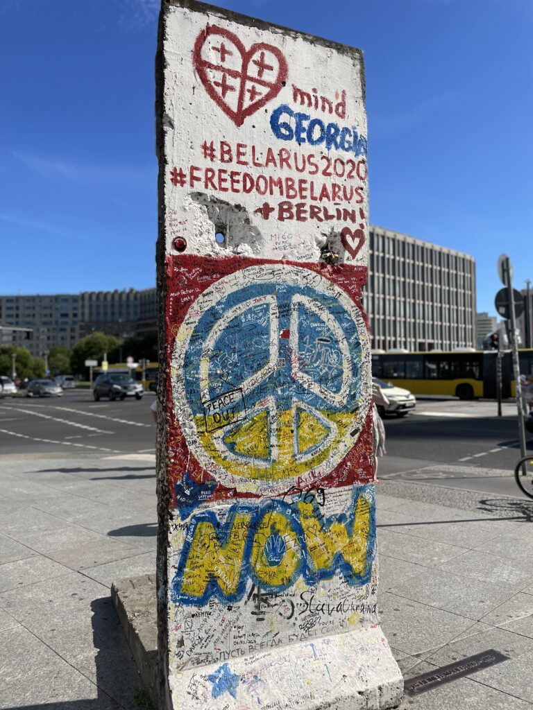
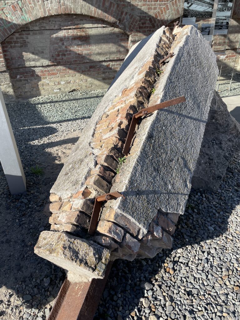
Take a look at the stretches of the Berlin Wall. The word “wall” does not describe the full extent of the barrier which cut Berlin into two halves from 1961 to 1989. The Berlin Wall was, in fact, a wide corridor between two walls. One wall marked the actual border on the west side of the corridor, while a second wall closed off the corridor to the east. The death strip, which included a narrow sentry path for the border guards of the GDR, lay in between. In the inner city, the corridor separated the old city centre along its northern, western and southern boundaries from the West-Berlin districts of Wedding, Tier-garten and Kreuzberg. Today a twin row of cobble-stones stretching several kilometres marks the exact location of the former border wall, and is being gradually extended. The Wall that encircled West-Berlin for almost thirty years had a total length of 160 kilometres. Of these, 45 kilometres separated the west from the east part of the city, while a stretch of 115 kilometres cut it off completely from the neighbouring Land of Brandenburg. More than 100 sites commemorating the victims and particular Wall-related incidents are spread along this route today. In 2001, the Berlin Senate launched its “Berlin Wall Trail” project with the aim of gradually making the entire 160 kilometers of the former Wall accessible to pedestrians and cyclists. Signs indicate the direction, aerial views afford an overall perspective, and information points highlight historically significant sites, thereby complementing the information boards installed by the Geschichtsmeile Berliner Mauer (Berlin Wall History Mile) initiative.

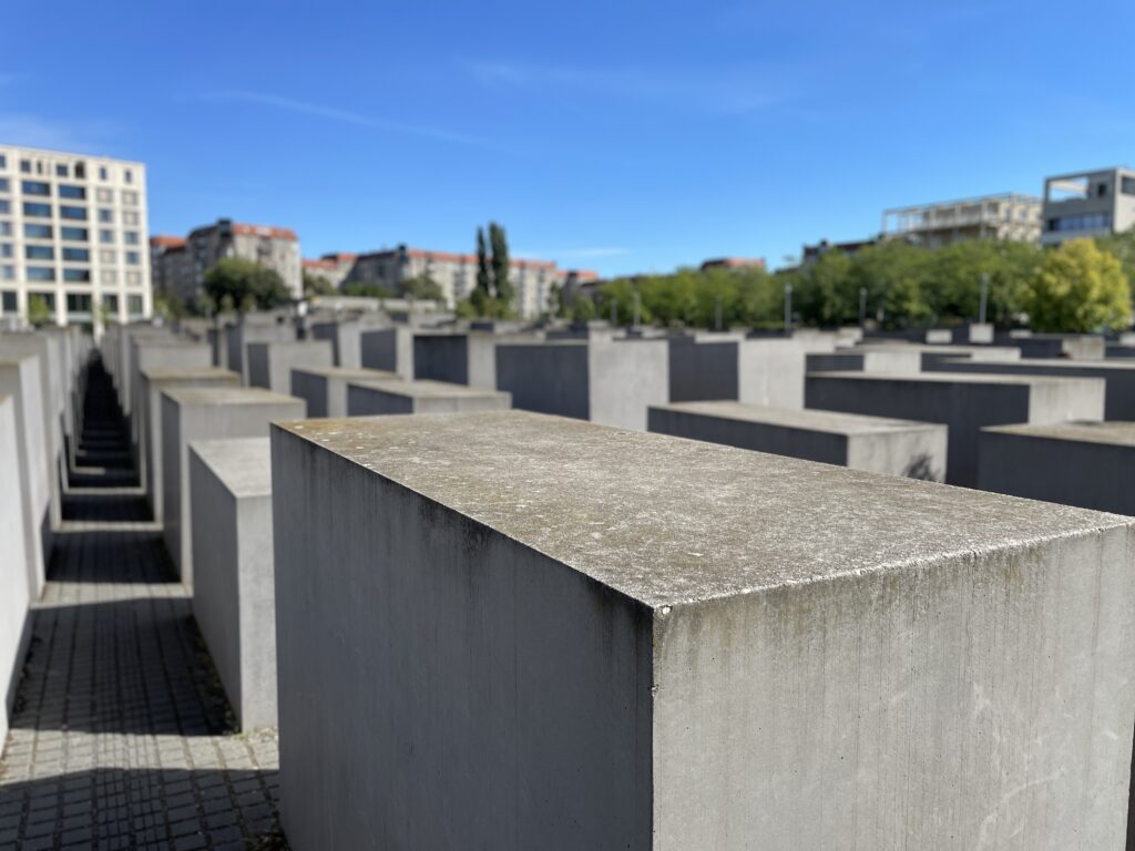
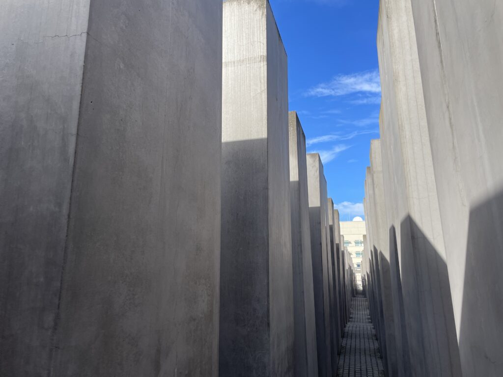
Continue north along Ebertstrasse to the Holocaust Mahnmal 5 (p83), the memorial for the victims of the Holocaust, a visually and emotionally impactful work, especially if you take the time to wander among the tall concrete blocks, appreciating their expressive power.
It took 17 years of discussions, planning, and construction, but finally, on May 8, 2005, the Monument to the Jewish victims of the Nazi genocide during the Second World War was inaugurated. Generally known as the Holocaust Memorial, it occupies a space comparable to a soccer field immediately south of the Brandenburg Gate. The New York architect Peter Eisenmann conceived a vast grid of 2,711 rectangular concrete blocks of varying heights placed on undulating terrain, resembling a kind of giant cemetery. Visitors have unrestricted access to this labyrinth from any point and can move independently.
At first glance, the monument may appear sober and emotionally detached, but give yourself time to appreciate the complexity of the project, to experience the coldness of the stone structures, and to observe the play of light and shadow. To learn more about the tragic historical period to which the monument refers, visit the underground Information Center (Ort der Information), whose entrance is on the eastern side. The timeline graph of the persecution of Jews during the Third Reich is followed by rooms that document the personal history of some victims and entire families through documents.
In a darkened room, the names of the victims and their dates of birth and death are projected onto the four walls, while a low voice reads their brief biographies. It takes nearly seven years of uninterrupted reading to honor the memory of the victims of the extermination.
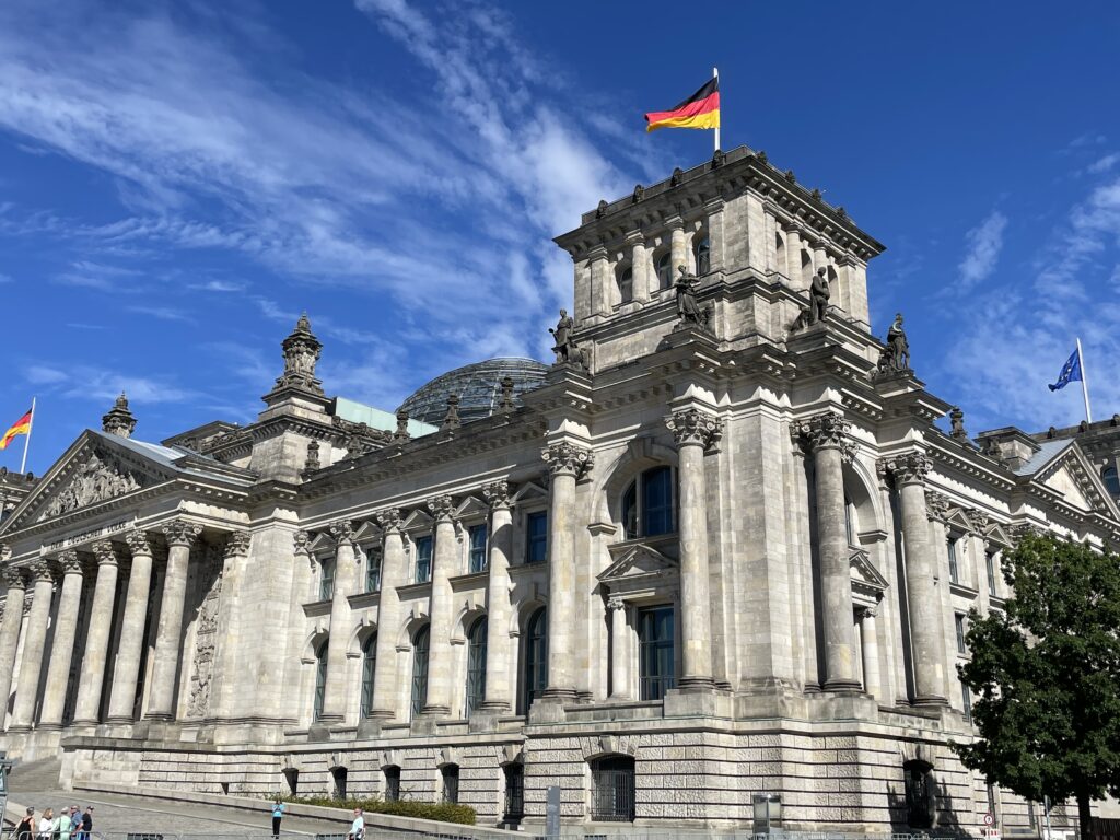
Continuing north along Karl-Liebknecht-Str and Ebertstrasse, you will arrive at the moving Monument to the Victims of the Wall, erected in memory of those who died trying to escape from the DDR. Just a few steps from the monument stands the imposing Reichstag, the seat of the German parliament.
The Reichstag became the seat of the Bundestag, the German Parliament, in 1999 when the restoration overseen by Lord Norman Foster was completed. The renowned English architect transformed the 1894 building, designed by Paul Wallot, into a state-of-the-art complex, preserving only the original external structure and adding extraordinary contemporary elements, such as the sparkling glass dome. The rapid elevator ascent to the top is a must for anyone visiting Berlin, offering a 360° panorama of the city and stunning close-up views of the dome and the mirrored funneled center. The elevator delivers visitors to a panoramic terrace where there is also an expensive restaurant. From here, you can ascend a spiral staircase inside the dome itself, located right above the Plenary Hall. At the top, there are also explanations about the building’s history.
The Reichstag has been at the center of numerous crucial events in German history. After World War I, Philipp Scheidemann proclaimed the republic from one of its windows. The Reichstag fire on February 27, 1933, allowed Hitler to blame the Communists and seize power. A dozen years later, the victorious Soviet army nearly destroyed the building. Restoration, except for the dome, was not completed until 1972. On October 2, 1990, at midnight, the reunification of Germany was proclaimed from here. In the summer of 1995, the Reichstag once again made headlines worldwide when Christo (the famous Bulgarian artist known for ‘wrapping’ public monuments) and his wife Jeanne-Claude wrapped the building in plastic sheets. Lord Norman got to work shortly after.
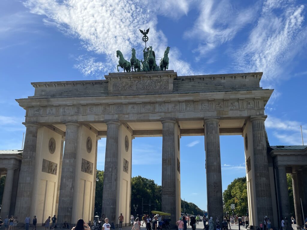
As you continue on, prepare your camera to capture the majestic Brandenburg Gate, the ultimate symbol of German reunification. The famous Brandenburg Gate, recently restored and a symbol of the division between the two Berlins during the Cold War, now stands as a guardian of embassies, an icon of reunified Germany. It was here, in front of this gate, that in 1987 the then-President of the United States, Ronald Reagan, uttered the now-famous words: “Mr. Gorbachev, tear down this wall.” Two years later, the Wall would become a thing of the past. The structure, designed by Carl Gotthard Langhans in 1791, is the only gate that has survived out of the 18 city gates. The Quadriga by Johann Gottfried Schadow, the sculpture of the winged goddess of victory guiding a horse-drawn chariot, proudly stands atop a backdrop of Doric columns. Napoleon seized the sculpture in 1806 and kept it in Paris for years. However, with Napoleon’s defeat, the winged goddess was liberated from a gallant prussian general.
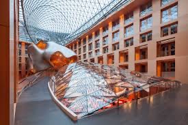
The gate leads to Pariser Platz, a harmoniously proportioned square where you could visit the DZ Bank and ask for permission to take a look at the stunning atrium designed by Frank Gehry.
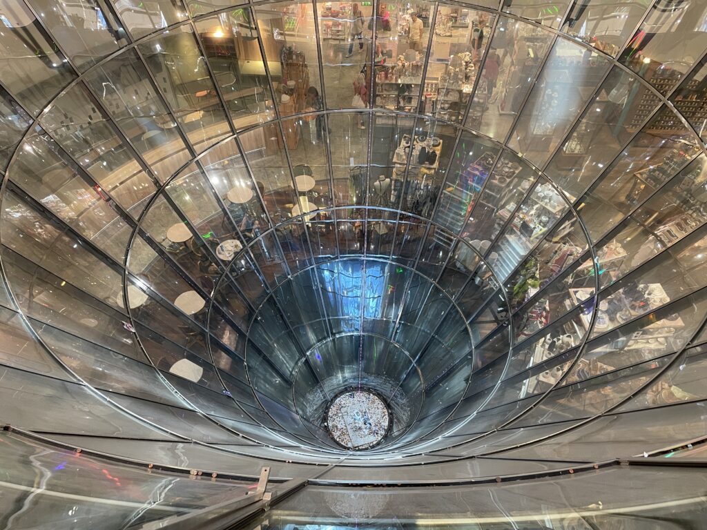
From here you reach Unterden Lunden, Berlin’s historic grand boulevard. As you walk east, you’ll soon spot, on your right, the Russian Embassy, housed in a monumental white marble building. Nearby, you’ll find the elegant Café Einstein, perfect for a refined break. Turning right at Friedrichstrasse, you’ll reach the luxurious Friedrichstadt area. Inside the Galeries Lafayette, designed by architect Jean Nouvel, you can admire the striking glass cone. Remarkable also are the marble decorations by Fienry Cobb and I.M. Pei in Quartier 206. The dining options in Quartier 205 offer various ways to satisfy your hunger.
Just 500 meters from here, you’ll find Checkpoint Charlie, the most famous border crossing between East and West Berlin throughout the Cold War.
Alpha, Bravo, Charlie… The American phonetic alphabet inspired the name of the third Allied checkpoint in post-World War II Berlin. A symbol of the Cold War, Checkpoint Charlie was the primary crossing point for Allies, diplomats, and other foreigners who were permitted to travel between the two Berlins from 1961 to 1990. It was here that American and Soviet tanks faced off in October 1961, bringing the world to the brink of a third world war. To commemorate this historic site, Checkpoint Charlie has been partially reconstructed. There’s a guardhouse from the American military (the original is at the Allierten Museum,) and a replica of the famous sign that warned ‘You are leaving the American sector’ in English, Russian, French, and German. The original sign is now located immediately next door, in the Haus am Checkpoint Charlie Museum. A new office district – with buildings designed by Philip Johnson and other international architects – has arisen around what was once a restricted area.
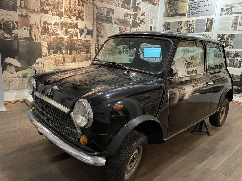
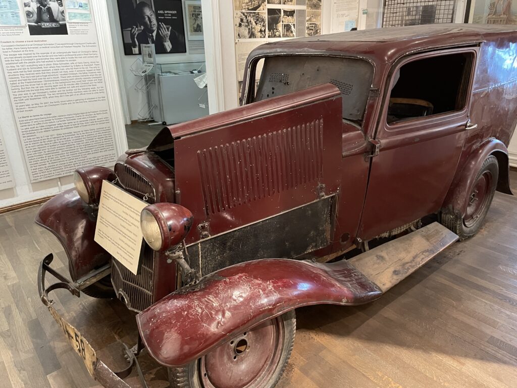
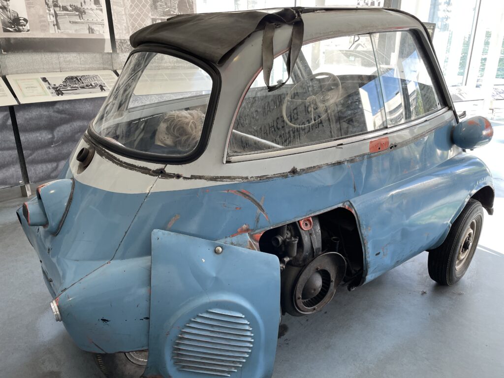
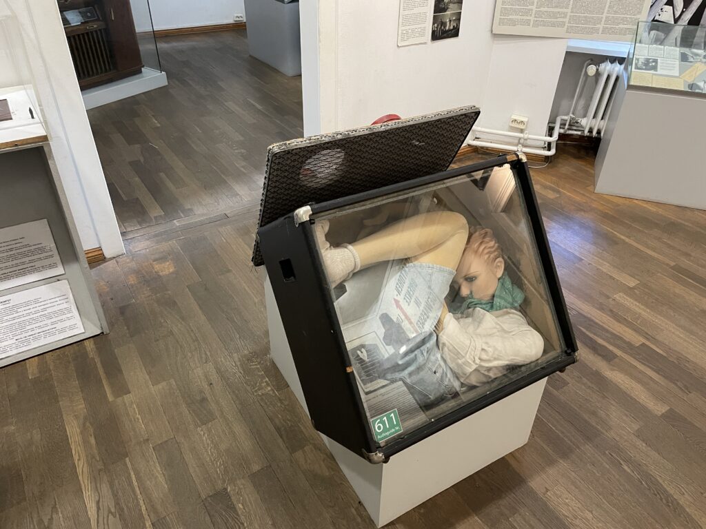
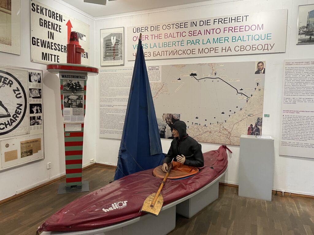
In the nearby Haus am Checkpoint Charlie you’ll find a captivating account of the years of the Cold War, with a strong emphasis on the history and horrors related to the Berlin Wall. Moving is the section that narrates the courage and ingenuity of some citizens of East Germany who attempted to escape to the West using hot air balloons, tunnels, hidden car compartments, and even a submarine with a single crew member. The rest of the museum focuses on the historical events that marked the city’s life, including the Berlin Airlift, the 1953 workers’ uprising in East Berlin, the construction of the Wall, and the reunification. There is also an original section of the white line that marked the border, where American and Soviet tanks faced off at Checkpoint Charlie in 1961. Other rooms are dedicated to human rights heroes (Gandhi, Lech Walesa, and others) and the world’s major religions. Explanatory panels are in various languages, and the museum also features a café and a shop.
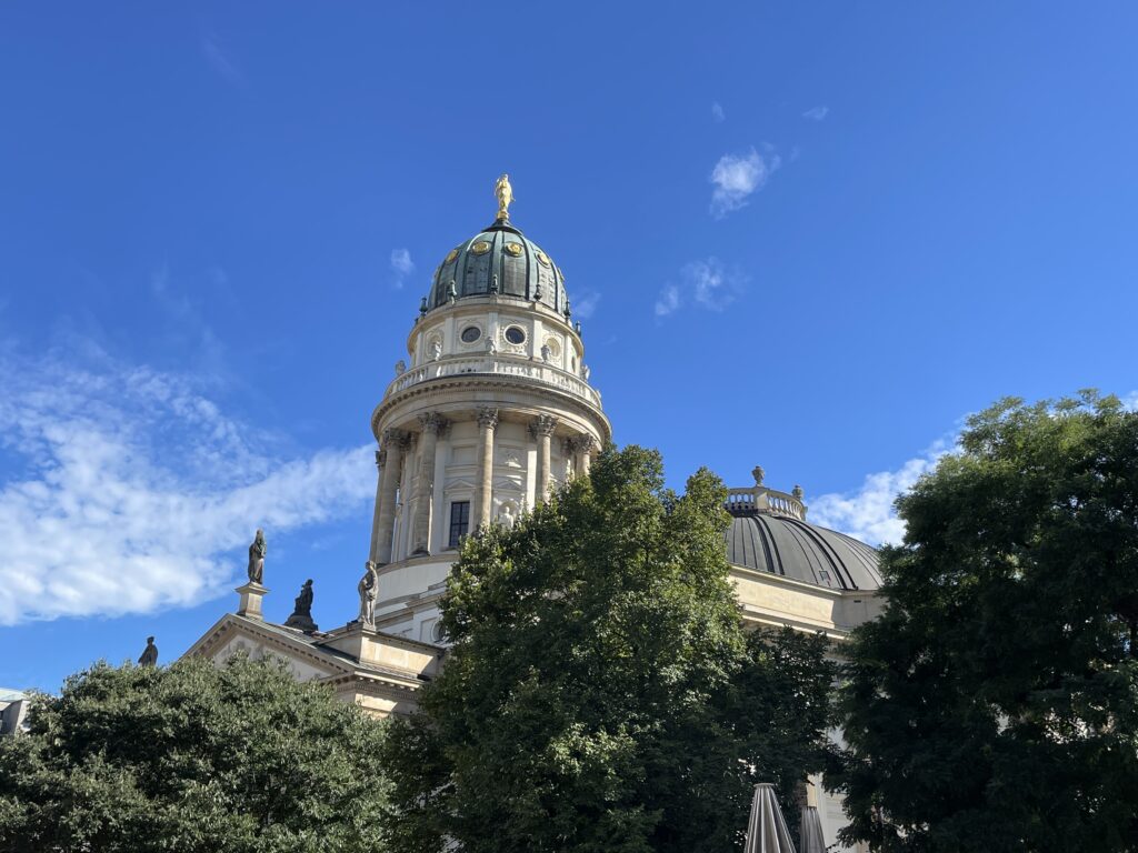
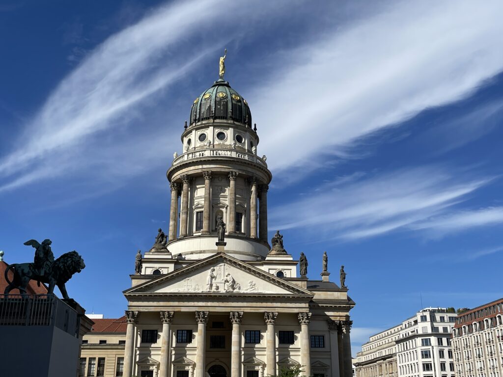
If you’re not interested in the Wall’s history, you can continue your journey directly from Quartier 205 by turning left onto Mohrenstrasse, which will lead you to Gendarmenmarkt, Berlin’s most beautiful square, featuring the Konzerthaus designed by Schinkel and the towering Deutscher Dom and Französischer Dom cathedrals.
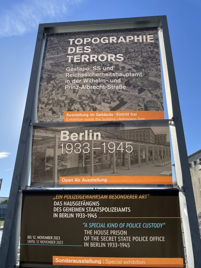
Finish your walk in the abandoned area along Niederkirchner Strasse, the most feared institutions of the Third Reich once stood: the Gestapo headquarters, the central command of the SS, the SS security service, and, after 1939, the central office of Reich security. From their desks, Nazi leaders planned the Holocaust and issued arrest warrants for political opponents, many of whom were tortured and killed in the infamous Gestapo prison. Today, the buildings have been demolished (there are signs indicating their layout), and a eerie atmosphere lingers over the abandoned grounds, whose sinister appearance is accentuated by a short section of the Berlin Wall that still stands. Since 1997, this has been the site of a poignant outdoor exhibition called “Topographie des Terrors” (Topography of Terror), primarily dedicated to the years of the Third Reich, with a particular focus on the historical significance of this site and the brutal institutions that occupied it.
Lorem ipsum dolor sit amet, consectetur adipiscing elit. Ut elit tellus, luctus nec ullamcorper mattis, pulvinar dapibus leo.
Day 2- Contemporary architecture
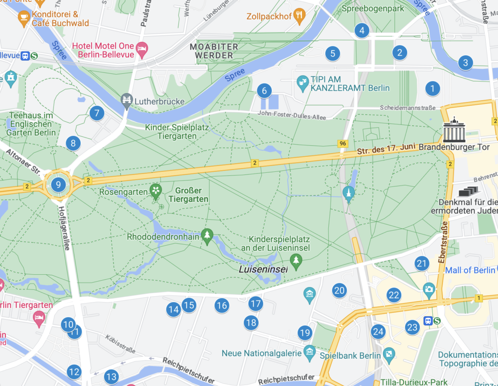
Berlin has always been a testing ground for avant-garde architects, but never more so than during the post-reunification building boom. The fall of the Wall made vast empty spaces available, offering the city an opportunity to reshape its image in stone, steel, and glass. The itinerary that follows covers three main areas: the government district, the diplomatic quarter, and Potsdamer Platz.
Start at the Reichstag, the historic seat of the German parliament and the heart of the new Band des Bundes (federal ribbon), as the new urban complex of ministerial and parliamentary buildings is called.
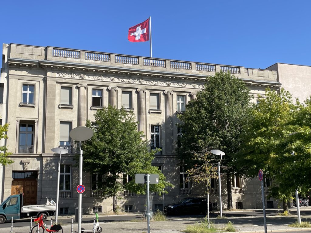
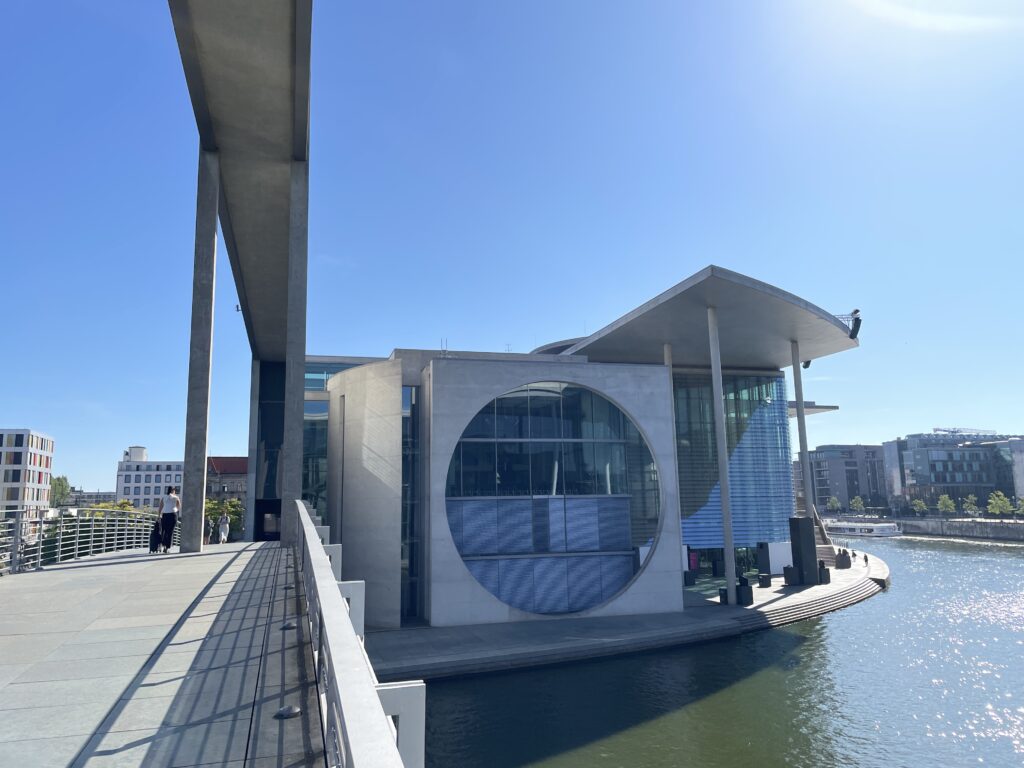
To the north of the Reichstag, turn right onto Paul-Löbe-Allee, pass by the ultramodern Paul-Löbe-Haus (p104), and continue to the Spree River. Following the riverside promenade northward, you’ll spot the futuristic Marie-Elisabeth-Lüders-Haus on the opposite bank. If you want to get a closer look at the building, you can cross the pedestrian bridge, or you can turn west, first skirting the north side of the Paul-Löbe-Haus and later the Swiss Embassy, which has added a postmodern wing to its historic headquarters.
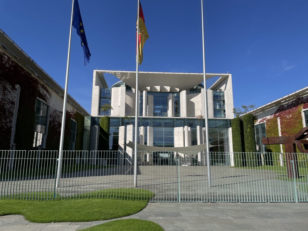
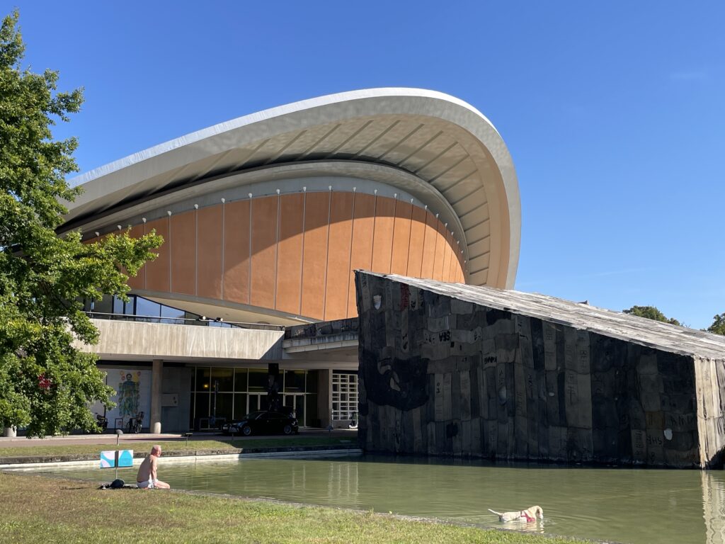
In the meantime, though, your gaze will likely be drawn to the enormous Bundeskanzleramt (Federal Chancellery), where the Chancellor holds cabinet meetings. Heading south on John-Foster-Dulles-Allee, you’ll pass the Haus der Kulturen der Welt.
The extravagant House of World Cultures (Haus der Kulturen der Welt) by Hugh Stubbins represented the American contribution to the 1957 Interbau, an architecture exhibition that brought together the most esteemed international talents in Berlin. Originally designed as a congress hall, its most distinctive design element is the parabolic roof that defies gravity and covers the building like a gigantic shell. Berliners affectionately nicknamed it the ‘pregnant oyster.’ Unfortunately, the architect’s vision was too ahead of its time compared to the technological means available at the time, and the roof partially collapsed in 1980. After reconstruction in 1989, the complex became a cultural center with a rich program of art exhibitions, conferences, seminars, concerts, and other world-class events.
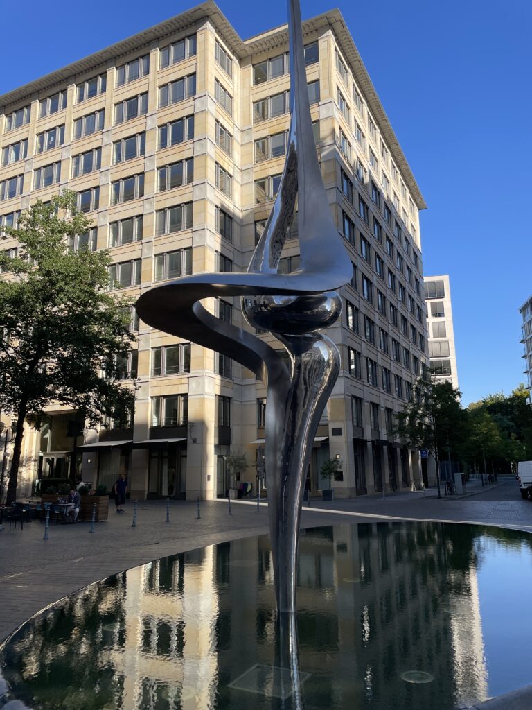
The pond reflects the lines of Henry Moore’s sculpture “Divided Oval: Butterfly,” whose curved profile echoes the building’s design. The 68 bells of the marble and bronze carillon – the largest in Europe – chime at 12 and 18 o’clock every day. On Sundays at 3 o’clock from May to September, a carillonneur performs live concerts, followed by guided tours of the tower.
Continuing west, look across the Spree to where a new residential mega-complex for government employees called Die Schlange, the snake, due to its undulating shape, is taking shape.
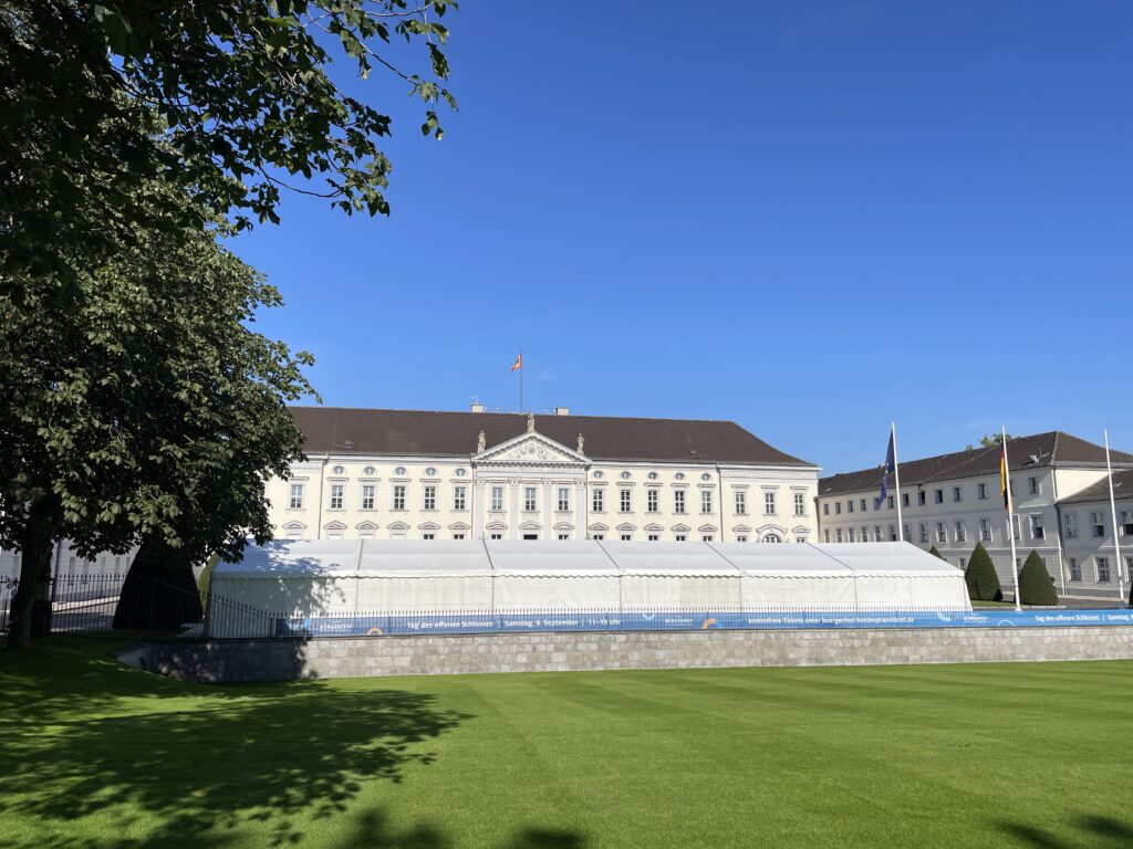
Turning left onto Spreeweg, you’ll pass Schloss Bellevue, the presidential residence. This neoclassical white stucco palace, recently renovated, is located on the northwestern edge of Tiergarten and serves as the official residence of the President of the Republic (at the time of writing this guide, Horst Köhler held the position). It was built in 1785 by Philipp Daniel Boumann for the younger brother of Frederick the Great, then later became a school under Emperor Wilhelm II and an ethnology museum during the Nazi era. The President and their staff have their offices in the Bundespräsidialamt building from 1998, just south of the palace. This essentially is the German version of the ‘Oval Office’ of the American White House, referring in this case to the elliptical shape of the entire building, covered in glass and polished black granite. Architecture enthusiasts might want to take a look at a wavy residential complex that stretches 300 meters called “Die Schlange” (the snake), located northeast of the palace on the other side of the Spree River.
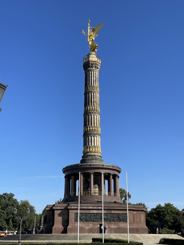
Dominating the landscape is the Siegessäule (Victory Column), a triumphal column commemorating Prussian military victories in the 19th century, particularly against Denmark (1864), Austria (1866), and France (1871). The large golden lady on top (standing at a height of 8.3 meters) represents the goddess of Victory, although locals simply refer to her as ‘Golden Elsa.’ Film enthusiasts may remember her in the iconic scene from Wim Wenders’ 1987 film “Wings of Desire” (Himmel über Berlin). The Nazis relocated it here from its previous location in front of the Reichstag in 1938 and added an extra tier to the column, making it an impressive 67 meters tall. You can climb to the top of the column; admission tickets also allow you to visit the small museum and enjoy discounts at the adjacent café and Biergarten. The Siegessäule has become a symbol of Berlin’s gay community (the city’s most prominent gay publication is named after it) and marks the endpoint of the annual Christopher Street Parade. The park around the column is a popular gathering spot for the LGBTQ+ community, especially around the Löwenbrücke area.
Then proceed along Hofjägerallee.
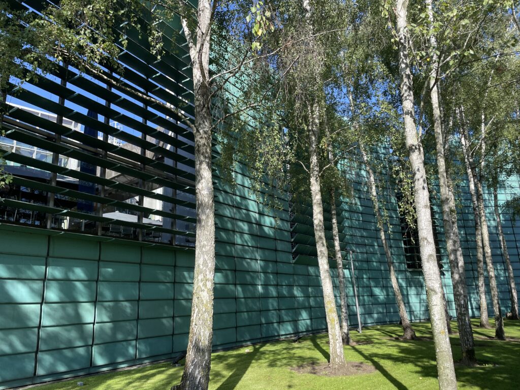
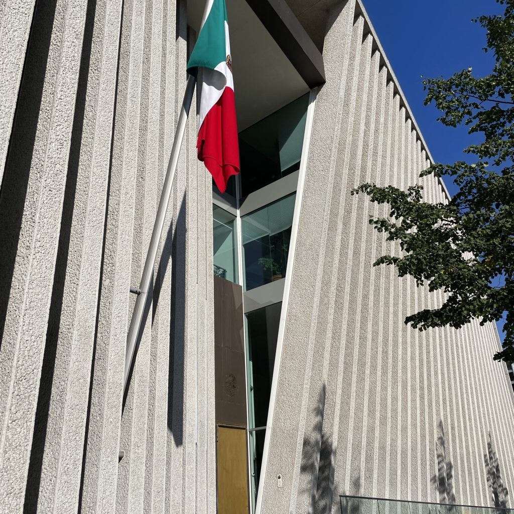
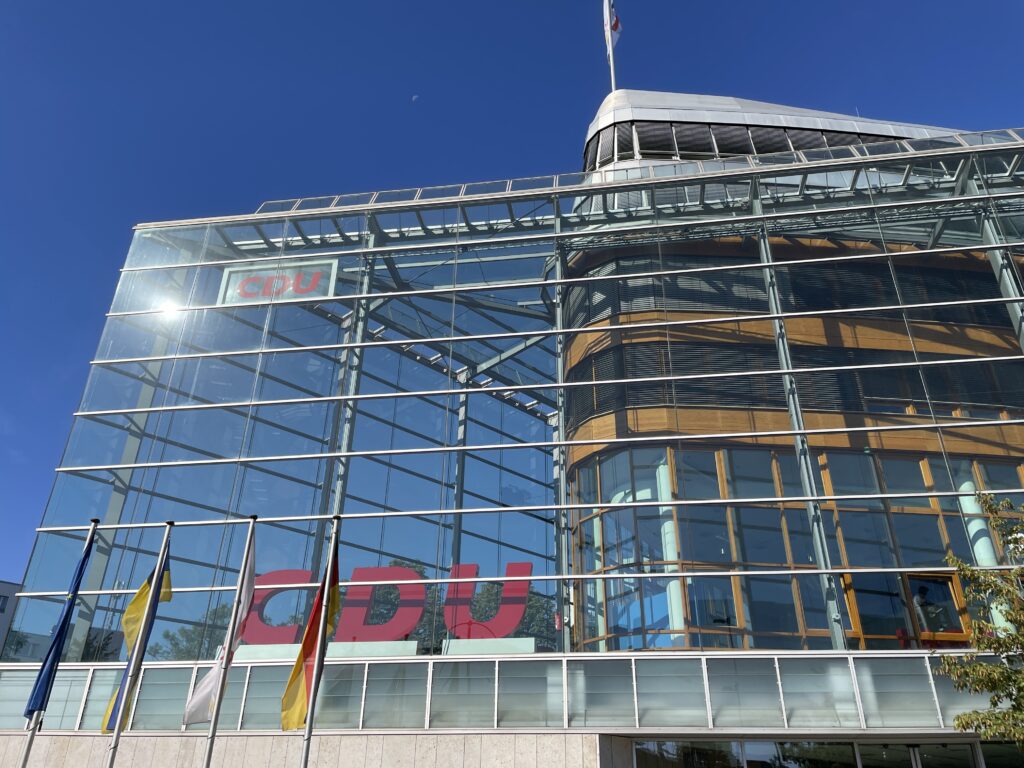
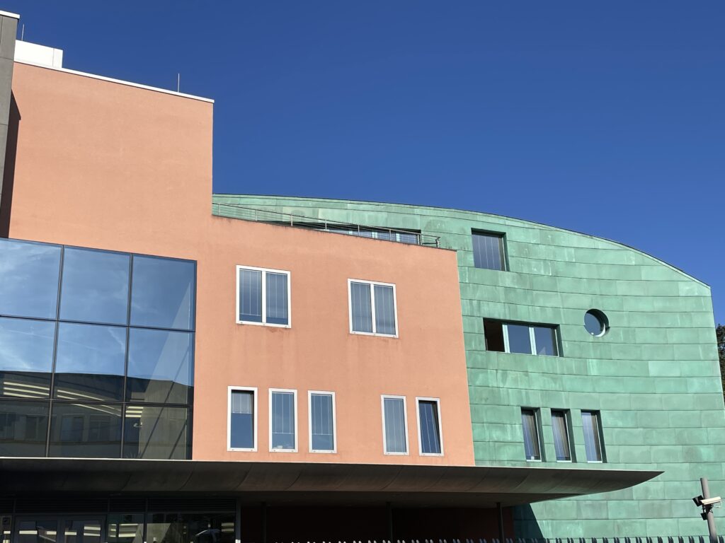
Before long, you’ll see the turquoise façade of the Nordic Embassies (p55) on the other side of the Spree. The complex is very striking at night when it appears as a giant illuminated crystal. Next to it is the equally remarkable Mexican Embassy (p55), preceded by a row of inclined concrete columns. Following the new main quarter of the CDU, one of Germany’s main political parties. The extravagant building resembles a transatlantic liner enclosed in an anvil-shaped glass shell.
On the opposite side of the street is the Bauhaus Archiv, designed by the godfather of modern architecture, Walter Gropius. It’s worth taking a look inside the museum and perhaps stopping for a drink in its café before continuing east along Von-der-Heydt-Strasse and then turning north onto Hiroshimastrasse.
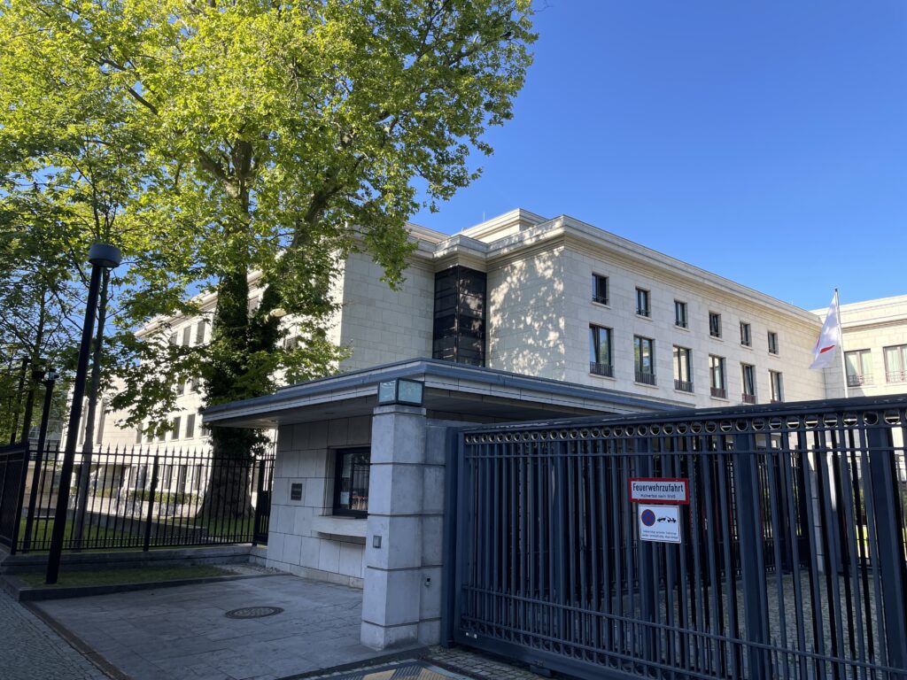
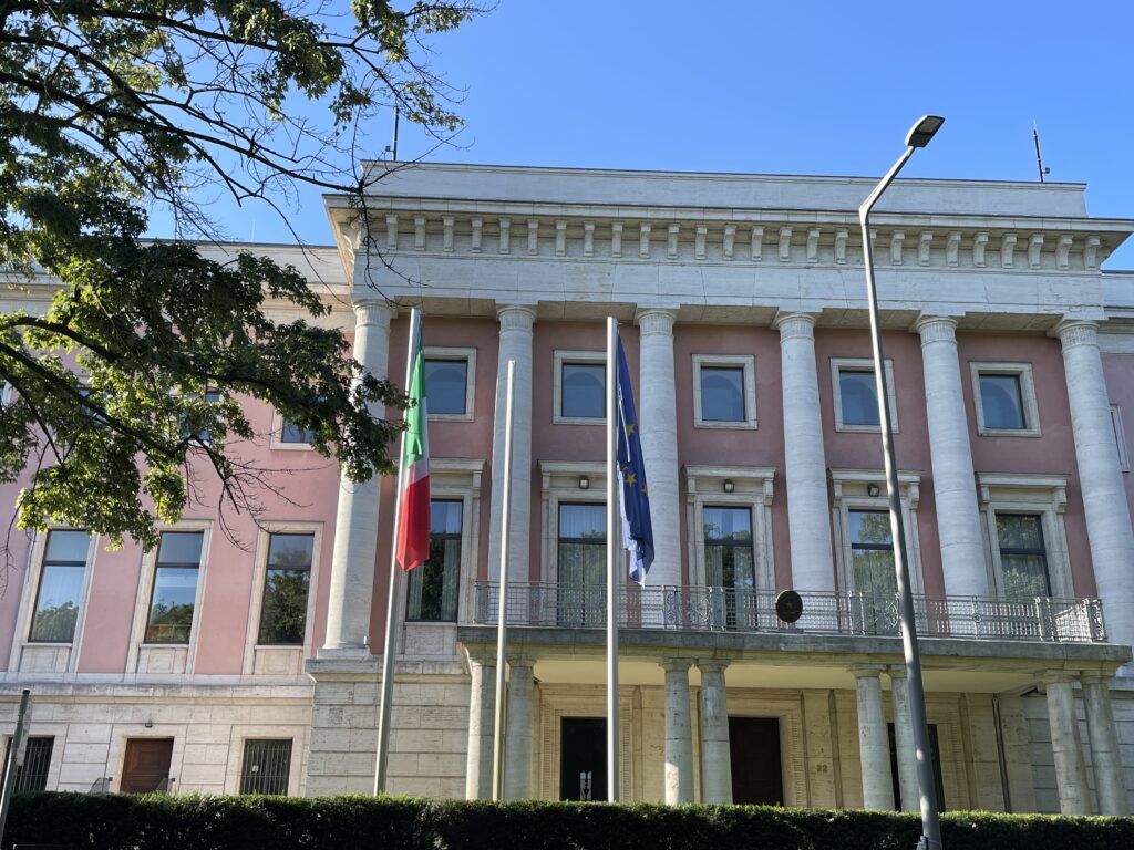
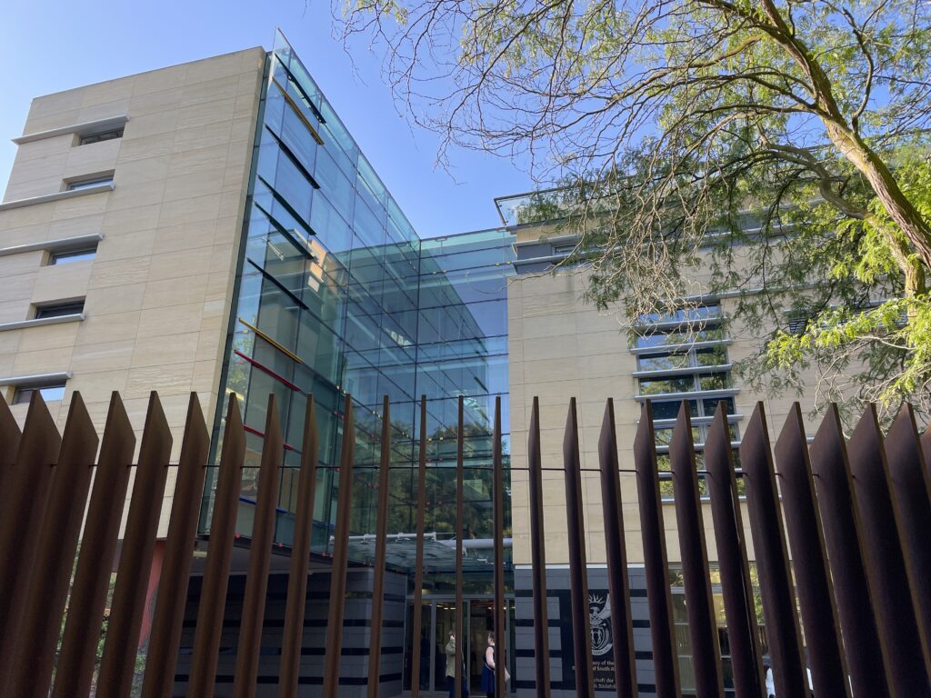
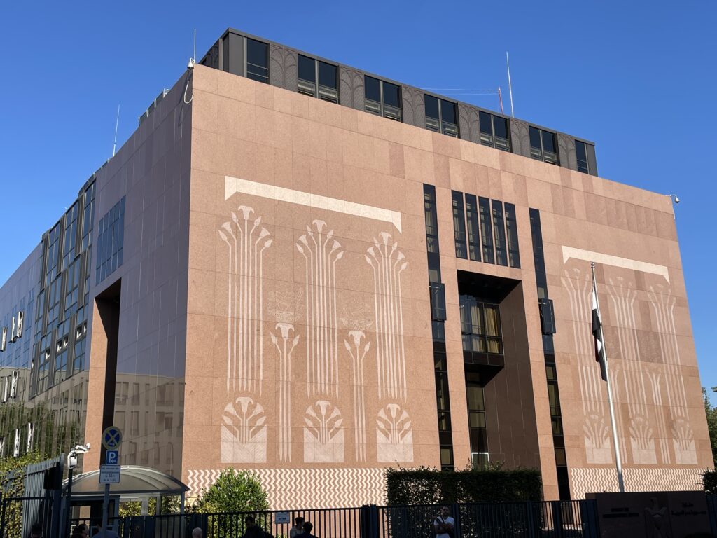
This street features the beige building of the Japanese Embassy M (p51) and the pink one of the Italian Embassy 1 (p50). Both date back to the Nazi era, which explains their pompous style and large size. Continuing east along Tiergartenstrasse, you’ll pass the new South African Embassy V at No. 18, and then turning onto Stauffenbergstrasse, you’ll see the Austrian Embassy (p55). Immediately south of this is the Egyptian Embassy 9 (p55), easily recognizable by the inscriptions decorating its reddish-brown façade.
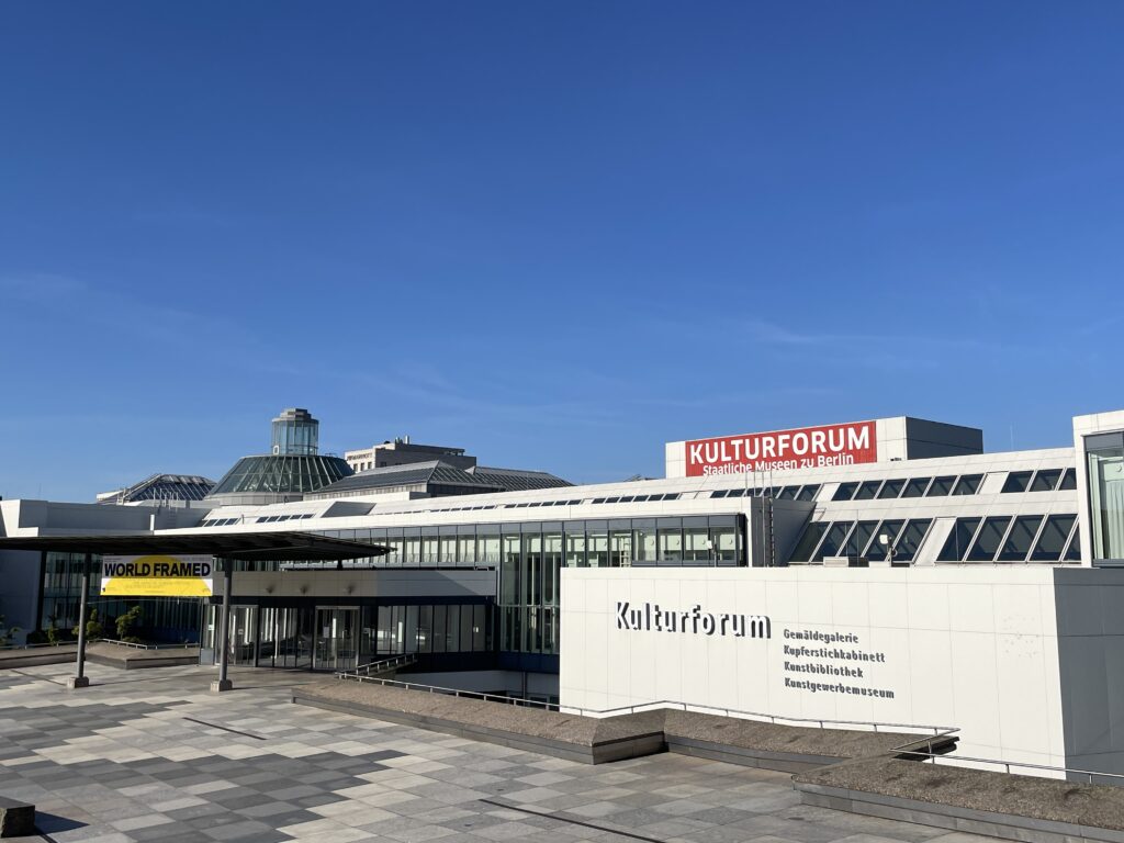
Further on, the diplomatic quarter gives way to the Kulturforum 20, an architectural showcase created between 1961 and 1987. The most eye-catching building here, especially due to its unique roof, is the Philharmonie 2, completed in 1963 by Hans Scharoun.
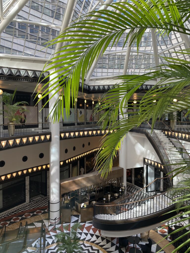
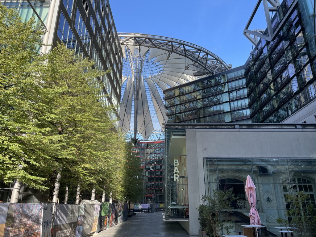
From here, our itinerary continues towards Potsdamer Platz, a true treasure trove of contemporary architecture. Arriving from Bellevuestrasse, you’ll see the Beisheim Center 0D on your left, a building inspired by American skyscrapers from the 1950s. To your right, you’ll spot the Sony Center (p108) with its spectacular covered square and the soaring glass skyscraper of the talented Helmut Jahn. South of Potsdamer Strasse stands the Daimlercity Complex (p107), an expression of the creative talent of various architects from around the world. RafaelMonser Bulato c (so-called io (49363), Renzo Piano’s design for the Daimlerchester Building © (p1OTe deritalporaente, and Kolhoff & Kolhoff Haus @, with its distinctive Volksbank & i brickwork, are worth a visit. If you’re in need of a refreshment, you’ll have plenty of restaurants and cafes to choose from in Potsdamer Platz.
South of Potsdamer Strasse stands the Daimlercity Complex (p107), an expression of the creative talent of various architects from around the world. RafaelMonser Bulato c (so-called io (49363), Renzo Piano’s design for the Daimlerchester Building © (p1OTe deritalporaente, and Kolhoff & Kolhoff Haus @, with its distinctive Volksbank & i brickwork, are worth a visit. If you’re in need of a refreshment, you’ll have plenty of restaurants and cafes to choose from in Potsdamer Platz.
Day 3 - Hamburger Bahnhof
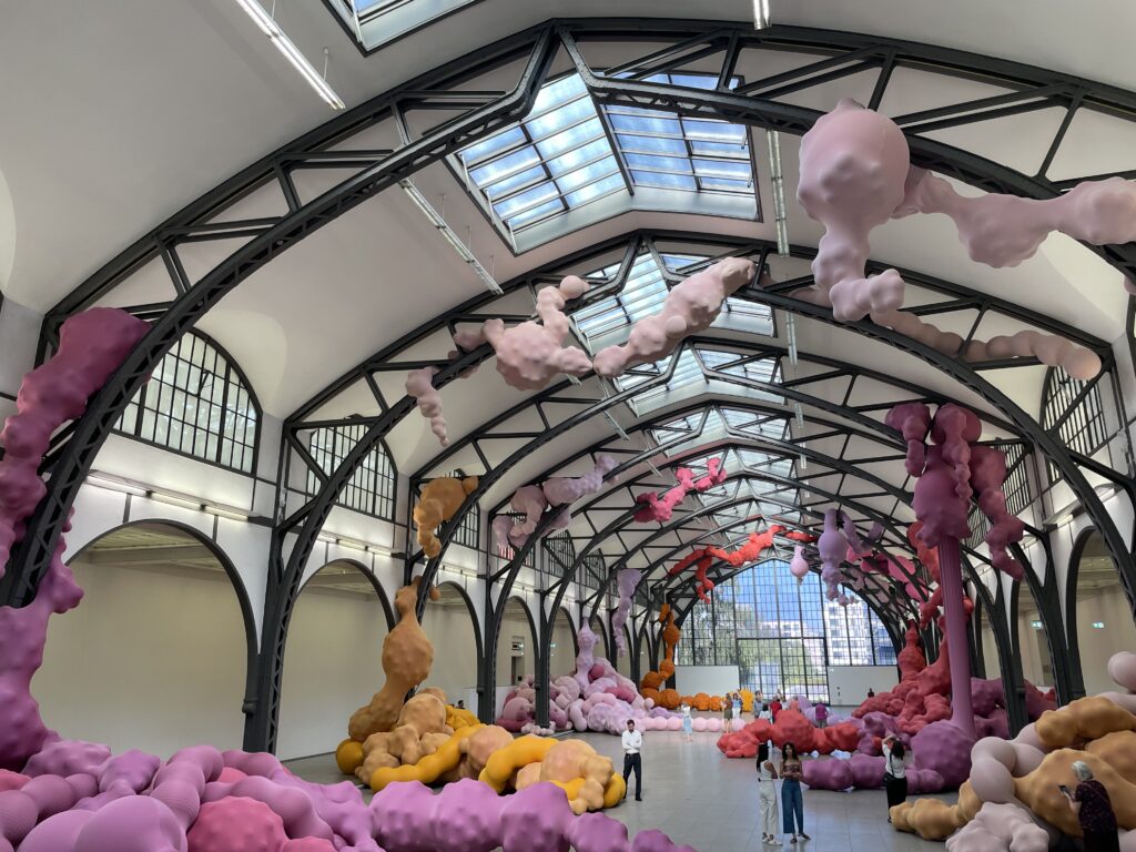
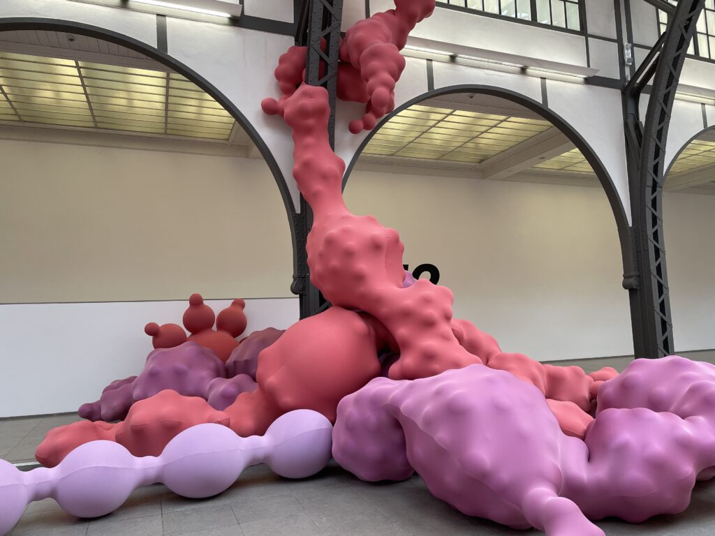
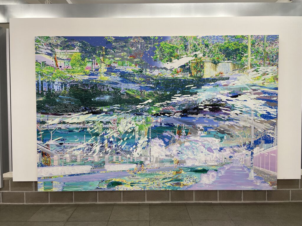
The smiling Mao by Andy Warhol, the luminous abstractions of Cy Twombly, and the provocative installations by Joseph Beuys are part of the collection of Berlin’s most important contemporary art museum, which picks up where the Neue Nationalgalerie (p111) leaves off (around 1950). Beuys enthusiasts will be satisfied, as the entire western wing is dedicated to the enfant terrible of late 20th-century German art. The other exhibitions change periodically, but you’ll probably be able to admire works by Robert Rauschenberg, Roy Lichtenstein, Keith Haring, Duane Hanson, and Cindy Sherman. Just as interesting as the artworks contained here (according to some, even more so) is the architecture of the building, a late Neoclassical-era former train station transformed by Josef Paul Kleihues. The main atrium, a spacious area adorned with iron structures, is the perfect setting for large paintings, installations, and sculptures: Richard Long’s Berlin Circle, Mario Merz’s igloo, Anselm Kiefer’s Blei Bibliothek (iron library). The sparkling white façade exudes great elegance and grandeur, especially at night when a luminous installation by the late Dan Flavin bathes the building in kaleidoscopic shades of blue and green. In 2004, the museum spaces were expanded into the adjacent Rieckhallen, a series of interconnected industrial structures previously used by a transport company. Set within corrugated metal panels resembling a giant container, they house works from the prestigious collection of Friedrich Christian Flick, a German industrialist with a passion for modern and contemporary art. The exhibitions change periodically but often include masterpieces by prominent contemporary artists such as Bruce Naumann, Paul McCarthy, Rodney Graham, and Jason Rhoades, along with notable figures from early 20th-century art, including Sol LeWitt, Marcel Duchamp, Nam June Paik, and Sigmar Polke. The museum lives up to its title of “Museum für Gegenwart” (museum of the present) by also presenting a packed calendar of concerts, readings, films, and meetings with artists.
Day 4-
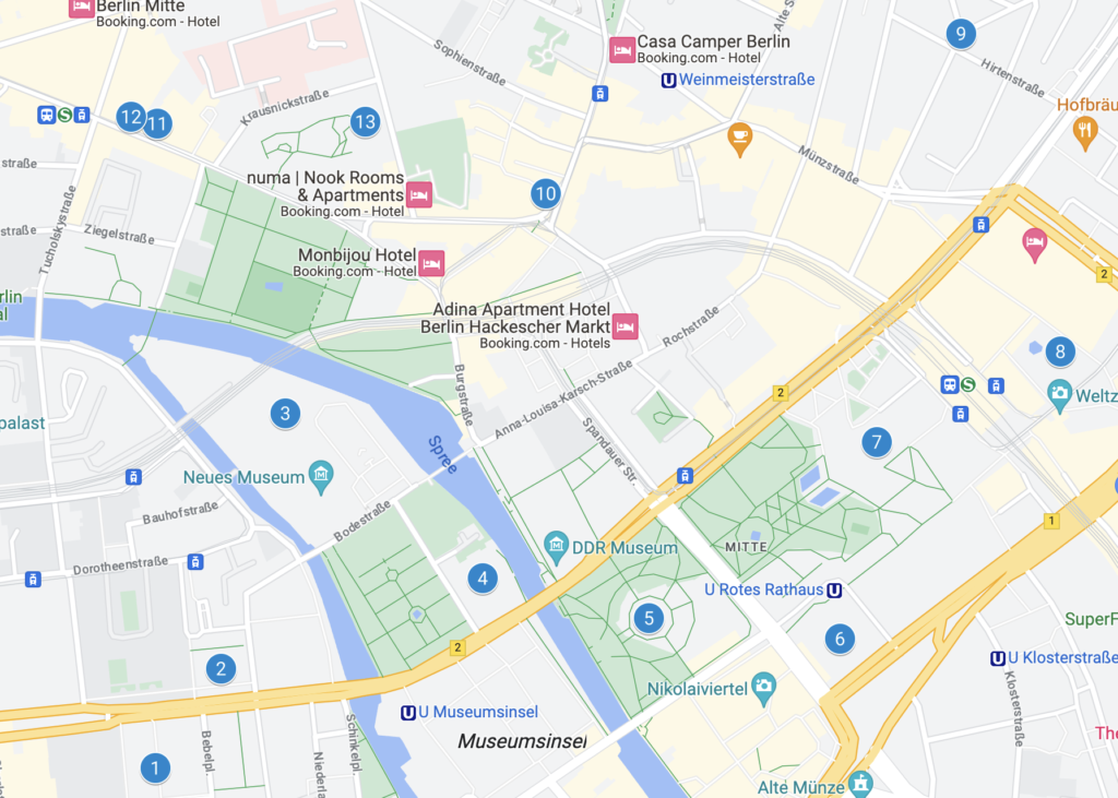
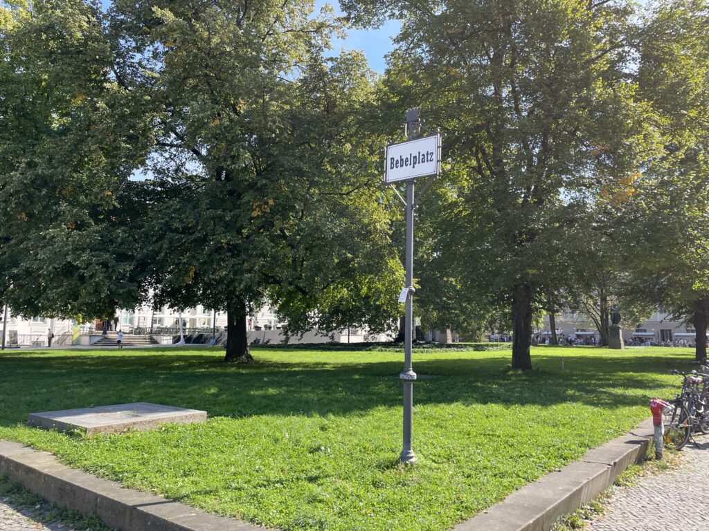
Start your walk from Bebelplatz. This square is named after August Bebel, co-founder of the Social Democratic Party (SPD), and is primarily known because the Nazis organized their first official book burning here on May 10, 1933. During this event, the works of authors considered subversive, including Bertolt Brecht, Thomas Mann, Karl Marx, and others, were set ablaze. It was a terrifying event that marked the end of the cultural greatness that Berlin had acquired in the preceding two centuries. A moving memorial to Micha Ullmann, consisting of an underground library with empty shelves, keeps the memory of this tragic event alive.
Bebelplatz was conceived as the focal point of the Forum Fridericianum, Frederick the Great’s project to create an intellectual and artistic center inspired by ancient Rome. Unfortunately, the king’s costly military ventures depleted the state’s coffers and made it impossible to complete such a grand endeavor.
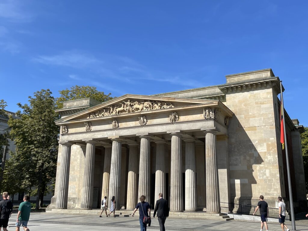
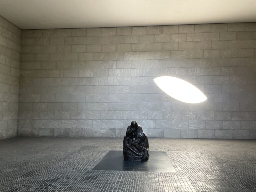
Nevertheless, several of the planned buildings were constructed, including the Alte Königliche Bibliothek on the western side of the square, and across from it, the Staatsoper Unter den Linden and the Sankt-Hedwigs-Kathedrale in the southeast corner. Next to the church stands the new Grand Hotel de Rome, a temple of luxury hospitality in a prestigious location, housed in a building from that was previously occupied by the state bank of the GDR. The hotel is part of a building development project called Operncarré, which also includes residences, offices, and shops. Along Bebelplatz, Unter den Linden also runs, which at this point is flanked by beautiful historical buildings, including Humboldt University and the Neue Wache by Schinkel. Built in 1818, the neoclassical Neue Wache (New Guardhouse) was Schinkel’s first significant commission in Berlin and is now a monument in memory of ‘the victims of war and tyranny.’ Inspired by a classical Roman fortress, it features a double row of columns supporting a pediment adorned with allegorical war scenes, giving it a certain authority. The original inner courtyard was covered in 1931, and the shaft of light that penetrates it strikes the moving sculpture by Käthe Kollwitz, “Mutter mit totem Sohn” (Mother with Dead Son), also known as Pietà. Beneath the austere hall lie the remains of an unknown soldier, a resistance fighter, and soil from nine European theaters of war and concentration camps.
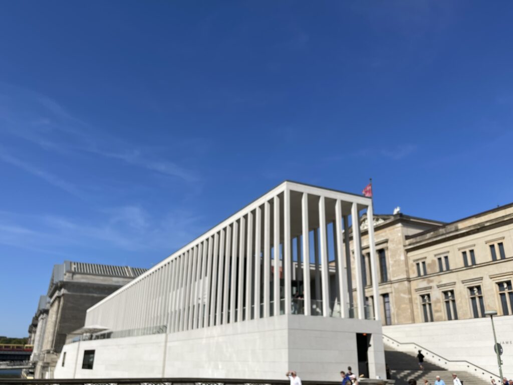
Take a look at the Reiterdenkmal Friedrich des Grossen (statue of Frederick the Great), a western sculpture by Christian Daniel Rauch. The elaborate building you can see a little further ahead on the south side of Unter Den Linden is the Kronprinzenpalais, the former residence of the crown princes, while the pink palace opposite it is the Zeughaus, the old arsenal that now houses the Deutsches Historisches Museum (German Historical Museum). It’s also worth taking a look at the new wing designed by I.M. Pei. Continue to Bodestrasse, then turn east and cross the bridge leading to the Museumsinsel, an exceptional complex of museums with a rich heritage of painting and sculpture.
If you have limited time and need to visit only one of the museums in Berlin, undoubtedly choose the Pergamon Museum. It is a true triumph of classical Greek, Babylonian, Roman, Islamic, and Middle Eastern art and architecture, originating from excavations conducted by German archaeologists in the early 20th century. This gigantic complex, which was only completed in 1930, actually houses three significant collections under the same roof: the Collection of Classical Antiquities, the Museum of the Ancient Near East, and the Museum of Islamic Art. Each one is worth visiting at a leisurely pace, but if you have limited time, focus on the following highlights.
The main artifact from which the museum takes its name is the reconstruction of the Pergamon Altar (165 BC) from Asia Minor (in Bergama, modern-day Turkey). It is a colossal sanctuary dedicated to Zeus, with a staircase leading to a U-shaped colonnade. Incredibly vivid friezes depicting episodes of the Gigantomachy, the battle of the gods against the giants, are carved along the entire base. Ascend the steps of the altar to closely admire the Telephus frieze, which narrates the myth of the founder of Pergamon, the son of Heracles.
The next hall contains another important artifact: the immense Market Gate of Miletus (1st century AD), a masterpiece of Roman architecture. The Museum of Ancient Middle Eastern Antiquities presents a completely different culture: that of Babylon during the time of King Nebuchadnezzar II (604-562 BC).
It is impossible not to feel awe in front of the reconstructions of the Ishtar Gate, the ‘processional way’ leading to the gate, and the façade of the throne room. They are all adorned with bricks painted in cobalt blue and ochre. The rampant lions, horses, and dragons representing the main deities of the Babylonians are so impressive that you can almost hear their roar and the fanfare. Another wonder in the collection is the intricate façades of the Temple of Uruk, decorated with colored clay inserts and highly detailed bas-reliefs. Finally, in the Museum of Islamic Art, don’t miss the palace of the caliph of Mshatta from the 8th century in present-day Jordan, resembling a fortress. Also, highly visited is the Aleppo Room from the 17th century, originating from a Syrian merchant’s house, where the walls are entirely covered with painted and richly decorated wooden panels. Try to allocate at least two hours to this incredible museum.
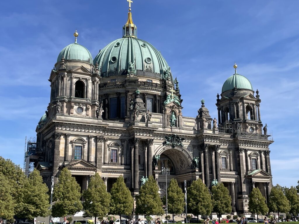
Dominating the island is the silhouette of the magnificent Berliner Dom, where many members of the Hohenzollern dynasty are buried; the cathedral’s gallery offers a splendid panoramic view of the city. Overlooking the cathedral stood the now-demolished Palast der Repubik, demolished in 2007 by the DDR government. They plan to build a replica of the royal palace that originally stood in its place.
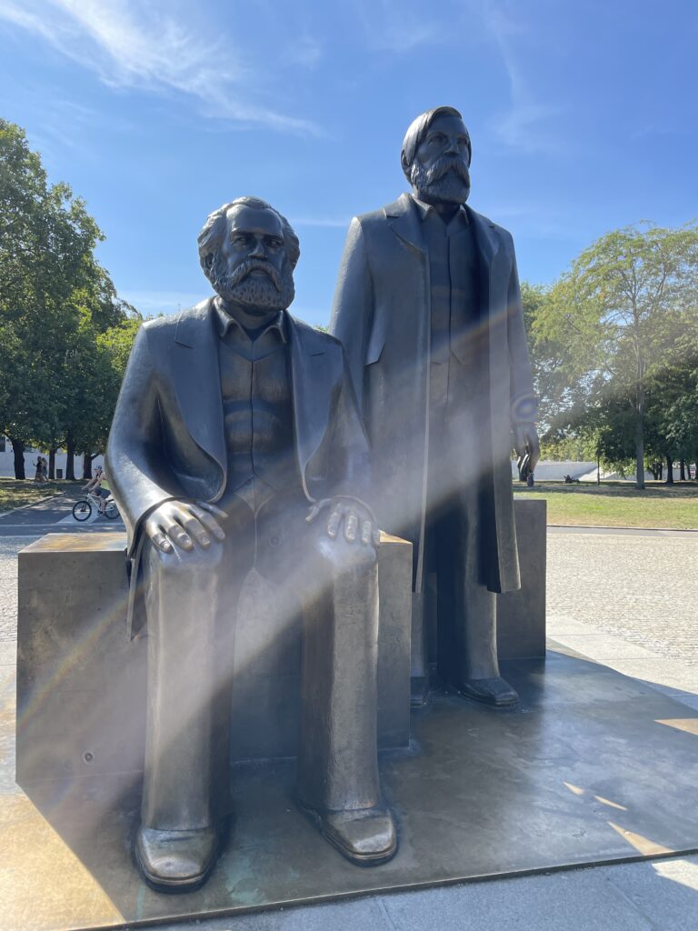
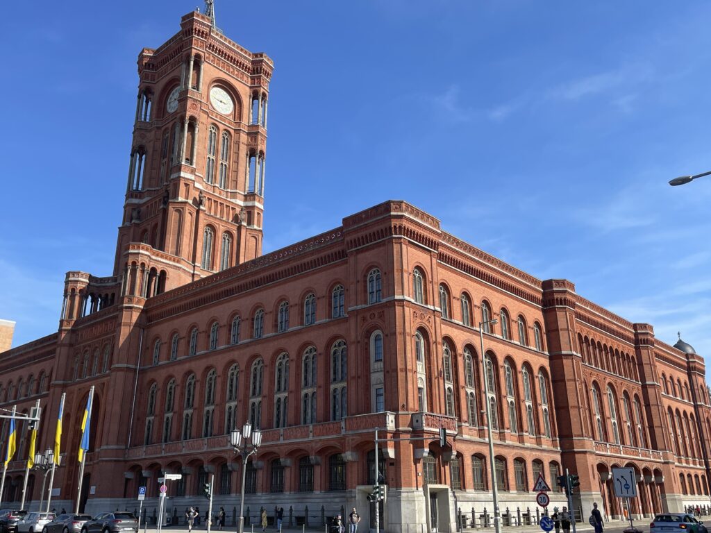
After passing the cathedral, turn right and reach the Mark-Engels Forum, alongside statues of Karl Marx and Friedrich Engels, and continue to the nearby Rotes Rathaus (Red City Hall), the seat of the municipal administration
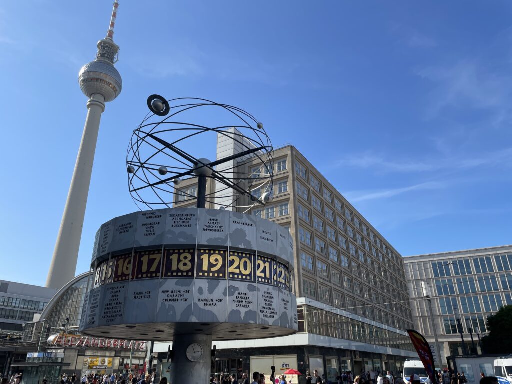
Continue eastward, and if you have time, ascend the Fernsehturm (Television Tower), the tallest building in Berlin, soars to 368 meters towards the sky. From the panoramic platform, located at a dizzying height of 203 meters, you can distinguish the city’s main monuments and points of interest, admire the size of Tiergarten Park, and compare the urban layout of what used to be East and West Berlin. At the top, you’ll find the Telecafé, which serves coffee, snacks, and full meals while completing a full 360° rotation in 30 minutes. Built in 1969, the tower was supposed to showcase the technological superiority of East Germany (DDR), but instead became a source of embarrassment. When illuminated by the sun, the steel sphere beneath the antenna produces a reflection resembling a giant cross – certainly not a welcomed sight in an atheist country where crosses were even removed from church rooftops. Western Berliners wittily nicknamed the phenomenon ‘the Pope’s revenge.’
Head then to Alexanderplatz. Once the hub of commercial activities in East Berlin, Alexanderplatz – often abbreviated as “Alex” – was originally called Ochsenmarkt (Oxen Market), but it later changed its name in honor of Tsar Alexander I, who visited Berlin in 1805. Today, it’s just a shadow of the vibrant neighborhood that Alfred Döblin described as the pulsating heart of a cosmopolitan city in his 1929 novel, “Berlin Alexanderplatz.” Severely damaged during the bombings of World War II, it acquired its current appearance, strictly adhering to socialist principles, in the 1960s thanks to the urban planners of the German Democratic Republic (DDR). The Fernsehturm (TV Tower), the Interhotel Stadt Berlin standing at 123 meters, and the Centrum Warenhaus (now Kaufhof), which was once the DDR’s most important department store, all date back to that era.
Among other famous landmarks are the Brunnen der Völkerfreundschaft (Fountain of Friendship among Peoples) and the Weltzeituhr (World Time Clock). Adjacent to these is the Haus des Lehrers (House of the Teacher) with a frieze by Walter Womacka, which is now part of the nearby Hig Berlin Congress Centre.
Although there are plans to transform Alexanderplatz into a mini-Manhattan dotted with skyscrapers, the program (for now) remains on hold due to a lack of funds and investments. Nevertheless, the square is gradually changing its appearance. In 2005/06, the Kaufhof department store underwent a complete overhaul according to the design of Josef Paul Kleihues. The traditional honeycomb façade was replaced with a sleek glass and travertine covering, along with the addition of a bright central courtyard with a glass dome.
Not far away, the 1929 Berolinahaus by Peter Behrens is being transformed into a branch of the C&A clothing store chain, which opened its first store in Alexanderplatz in 1911. And not too distant, in an area bounded by Alexanderstrasse, Dircksenstrasse, and Grunerstrasse, the new Alexa Shopping Mall is taking shape. The Franco-Portuguese investors hope to be active there by early 2007 with approximately 200 shops and a large fitness center, as well as dining options.
Leave the square and proceed along Münzstrasse, a street leading to Scheunenviertel, the historic Jewish quarter of Berlin, now one of the liveliest areas in the city, filled with excellent restaurants, shops, and nightspots. Turn left at the intersection with Neue Schönhauser Strasse, a street brimming with boutiques and shops offering the most original creations, and then turn left again on Rosenthaler Strasse, arriving at the Hackesche Höfe, a series of beautifully restored interconnected courtyards filled with bars, shops, and entertainment venue. One of the most well-known tourist attractions in Berlin, the Hackesche Höfe (1907), is a complex of eight beautifully restored courtyards filled with cafes, art galleries, fashionable boutiques, and entertainment venues. The most charming is Hof I (entrance from Rosen-thaler Strasse), whose facades are adorned with rich Art Nouveau tiles designed by the artist August Endell. From Hof VII, you can access the Rosenhöfe, a small single courtyard with a rose garden lower than street level. The metal balustrades with intricate flower and branch motifs create a quirky ensemble.
Take Oranienburger Strasse, the main street of Scheunenviertel, and head north, perhaps taking a break by the river at Monbijoupark. Soon, you’ll reach the beautiful Neue Synagogue (New Synagogue), the most prominent symbol of the rebirth of the Berlin Jewish community.
The glittering golden dome of the New Synagogue stands as a symbol of the revived Jewish community in Berlin. Designed in Moorish-Byzantine style by Eduard Knob-Rauch, the original synagogue from 1866 could seat 3,200 people and was the largest synagogue in all of Germany. Thanks to its beauty and rich decorations, it became an important city monument. During the 1938 pogrom, known as Kristallnacht (Night of Broken Glass), a local police superintendent prevented the SS from setting fire to the building, an act of courage commemorated with a plaque. Nevertheless, the Nazis managed to desecrate it, although religious services continued until 1940 when the synagogue was expropriated and turned into a warehouse. Allied bombs nearly destroyed the building in 1943. With the consent of the small East Berlin Jewish community, the East German government demolished much of the ruins in 1958, leaving the main facade as a memorial. In 1988, Honecker announced his government’s decision to rebuild the synagogue, but the regime collapsed before the project could begin. The reunited German government adopted the project, and the New Synagogue was inaugurated in May 1995. It serves not only as a place of worship (though religious services are held in a small room on the second floor) but also as a museum and information center. Permanent exhibitions document the history and architecture of the building and its role in the lives of those who practiced their faith there. Among the items on display are a model of the synagogue, a Torah scroll, and a perpetual lamp from the original structure, unearthed during excavations in 1989.
Guided tours take you behind the building, where a glass and steel structure supports the remaining ruins of the sanctuary, and a stone band outlines the giant profile of the original synagogue. There is also a dedicated space for special exhibitions on the upper floor. The dome is accessible from April to September.
Adjacent to the synagogue is the entrance to the Hackmanhöfe, another creatively restored courtyard complex.
-
Val d’Aosta
July 26, 2021 /Lorem ipsum dolor sit amet, consectetur adipiscing elit. Ut elit tellus, luctus nec ullamcorper mattis, pulvinar dapibus leo.
Gran Paradiso National Park
Day 1 – Colle del Nivolet and lakes tour
It’s the Aostan access to the Colle del Nivolet where you will find the Rifugio Savoia, built in 1860 as a royal hunting manor. From the parking in Port Valsavaranche, yellow signposts point to the start of the dirt path to the Colle del Nivolet. The pathway climbs in a forest of larches, passes a beautiful waterfall and becomes steeper and steeper until the panorama opens up onto the Gran Paradiso glacier. Few bends of the pathway will take you after 1 hour walk to the Arolley Cross (2310 m). Going on, you will walk the open plane of the Nivolet, a 6 km path surrounded by an open nature that reminded us of the Hobbit’s Shire. Walk along the river until you reach the Rifugio Savoia, on the shores of the Lake Nivolet.
Book in advance your bunkbed at the Rifugio Savoia for the night, you will need an early start on Day 2 for the Basei glacier. The Rifugio is not your typical mountain hut with warm people, it’s on the main road and its customers are mainly bikers, but it’s clean and will do for one night.
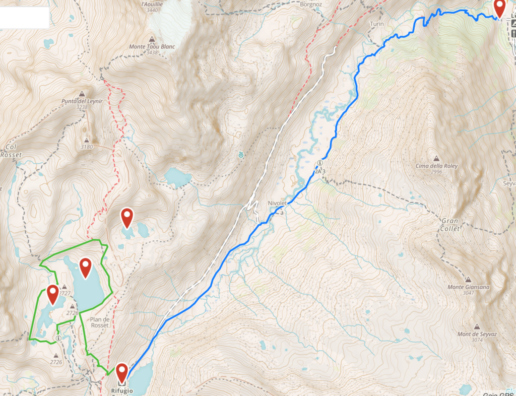
Spend the afternoon exploring the lakes behind the Rifugio. This lakes tour is a magnificent itinerary, not too tiring but instead with an awe-inspiring landscape. Once you have reached the peak of the Colle del Nivolet you have admired the two lakes of Nivolet in front of the Rifugio; now follow the right-side dirt path on the back of the Rifugio (yellow signs) which with a gentle slope will lead you to the plane from where you can explore the three lakes. If you keep walking straight ahead of you, you will reach the Lake Rosset, a transparent pearl that is overhung by the Punta Basei and its glacier. Continue your walk and leave the first lake on your left to reach the Lake Trebecchi, the best place to admire the Gran Paradiso that is reflecting in its waters. Go back towards the Lake Rosset, walk along its shores towards the Punta Basei and you will arrive at the Lake Leita. During your walk you will certainly encounter groundhogs that spy on you from behind the colored flowerbeds.
Day 2 – Punta Basei
An amazing climb in a varied and colorful panorama. The trek is to be considered alpinist only in its final portion that requires some skills on ice and rock climbing, and some equipment (tampons and picks). The path starts behind the Rifugio Savoia and gently rises on a hill next to the Lake Leita (2700 m). At the left edge of the Lake Leita the path starts a steep climb to reach a crossroad where you will take the right path. After a section with lots of debris you will reach a plane from where you can admire the small Basei glacier (your goal) and the Lakes Nivolet below (your starting point). Keep following the path and you will reach the edge of the glacier. Here you can decide whether to continue left and cross the glacier to the peak, or walk towards the right side and the crest of the mountain where in the summer season the terrain is cleared of ice. In the second case, while ascending with the help of fixed metal ropes, you can admire on your right the Val di Rhemes. In few minutes you will reach the cross at the peak of the Basei (3338 m), on of the most panorami peaks of the Gran Paradiso National Park, with a 360 view on the Gran Paradiso, Cervino, Monte Rosa and Monte Bianco.
Day 3 – Aosta
Lorem ipsum dolor sit amet, consectetur adipiscing elit. Ut elit tellus, luctus nec ullamcorper mattis, pulvinar dapibus leo.
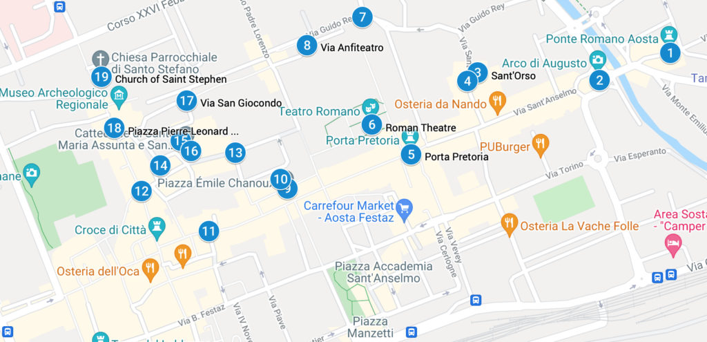
Our tour starts at at the Arch of Augustus (2), the entrance door to the Italian peninsula during the Romans times. It was built to celebrate the victory of Augustus emperor of the 25 BC. The pitched roof is from 1917 and the crucifix above from the XV century. Keep walking beyond the Arch and pass the river Buthier to admire an original Roman bridge (1). The street that now starts from the Arch is via Sant’Anselmo, the heir of the Roman decumanus that was the backbone of the city: keep walking along it and on the right (still outside of the original Roman walls) you will reach the Church of Sant’Orso (3), the most famous religious site of the city of Aosta and still a pilgrimage stop for those walking the Via Francigena.
Once you reach the Church, on your right side you will see the tickets stand for the cloister: while you’re queuing for the tickets, admire the three buildings and the octagonal tower that form the priory in which you are standing. It was built by Giorgio di Challant (the noble aostan family of the Middle Ages) in 1468. The tickets will allow you a visit to the cloister, surrounded by 52 capitelli built from 110 onwards, that tell the story of the life of Saint Orso. A written legend outside of the cloister gives detailed explanation to each capitello. To the left of the cloister, the Church of Saint Orso dates to the year 994: walk the three navels and admire the wooden choir and the glazed windows.
In front of the Church, stop to admire a 400 years old linden and follow the small road to the paleo-christian Church of San Lorenzo (4), now deconsecrated, that hosts in the basement a nice archeological tour of the original church remains and of the adjoined burial ground.
Back to Via Sant’Anselmo you will reach the Pretorian Doorway (5), the true monumental entrance to the Roman city. Enter through one f the three arches and you can still feel the grandiosity of the Roman Empire. Once you are inside the Roman walls, on your right you will be able to admire the Roman Theatre (6) that during the I century BC could host an audience of 3000 people. Its grandiosity had the scope to leave in awe whoever was entering the Roman Empire from Gaul.
Keep walking to Torre dei Balivi (7), the residence of the Savoia representative in the city during the 1200, and turning left you will see the remains of the amphitheater (8) of the I century DC. Another left turn will take you to Piazza Chanoux (9), the heart of the city, built under the rein of Carlo Alberto of Savoia. This huge piazza is the heart of the modern Aosta, where ceremonies, expositions and markets are held. The Hotel de Ville (10) occupies nearly 140 meters of the right side of the piazza. The neoclassical facade is characterized by porches. Being a public office, you may be just able to glimpse the staircase and the ample salon.
Exit the piazza by via Jean-Baptiste de Tillier (11), continue to via Croix de Ville (12) and via Monsignor de Salles (13) to admire the neo-classic buildings, and remember that Calvin flew Aosta from these streets once he failed to convert the city. You will reach piazza Giovanni XXIII (14) that act as a stage for the criptoportico forense (15) and the Cathedral (16).
On the left side of the piazza, by a staircase, you will gain access to the monumental gallery that forms the criptoportico (a hidden porch, basically), that has an horse-shoe plant and had the initial scope of an indoor walk. Between the III and IV century, it became a storage area. When we visited Aosta, the Cathedral (16) was closed but maybe you will have better luck.
Continue your visit to via San Giocondo (17), that used to be the religious part of the city, and reach piazza Roncas (18)that used to be the cardo maximus through which Romans could reach the passo del Gran San Bernardo. On one corner of the piazza you can admire an hidraulic wheel that works over a small channel of Roman origins.
Last stop of our itinerary is the Church of Saint Stephen (19), now outside of the Roman walls, that has a massive wooden statue of San Cristoforo inside.
Monte Bianco
Day 4- Val Veny “Balcony”
Equivalent to anti-clockwise stage 4 in Kev Reynolds’ TMB (Tour Mont Blanc) guidebook. This stage can be walked independently, not as part of the whole 10 day trek. Features a moderate 600m/600m elevation gain/loss, and spectacular and continuous views of the Italian side of the Mont Blanc (Monte Bianco). Total walking time of the full day hike as marked: 5-6 hours excluding optional detours (Lago Miage and Rifugio Elisabetta). Generally recommended from June to September, but check weather forecast and avoid in bad weather.
Get to La Visaille (1800m) at the top of the Val Veny valley road. Either drive all the way up and park between the bridge and the closed gate, or take the hourly Val Veny bus from Courmayeur to the last stop.
Walk up the valley for about an hour (ascending about 200m), and connect to the main TMB trail near Combal (2000m). Optional 30 min detour to Lago Miage (recommended).
Ascend along the TMB for about an hour to the highest point of the trail (2400m), then descend to Rifugio Maison Vieille (2000m).
From Rifugio Maison Vieille you have several options:
a. Easiest: Descend to Courmayeur (1300m) using the Dolonne cable car in July-August only: http://www.courmayeur-montblanc.com/?
b. Longest: Descend to Courmayeur (1300m) on foot, following the main TMB trail
c. Shortest: Descend straight to Val Veny valley (1700m), where the aforementioned bus has multiple stops along the valley road.
d. Closing the loop: Descend back to La Visaille (1800m), where your car is parked – this route is marked on the map.
For options C and D – take trail number 6 which goes north-west from the Rifugio clearing.Day 5 – Dent du Geant and Aiguille du Midi
-
Sirmione
August 28, 2020 /Add Your Heading Text Here
Lorem ipsum dolor sit amet, consectetur adipiscing elit. Ut elit tellus, luctus nec ullamcorper mattis, pulvinar dapibus leo.
Lorem ipsum dolor sit amet, consectetur adipiscing elit. Ut elit tellus, luctus nec ullamcorper mattis, pulvinar dapibus leo.
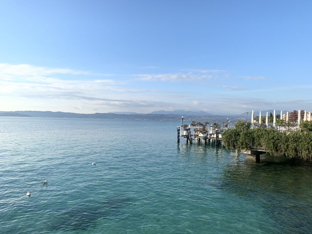
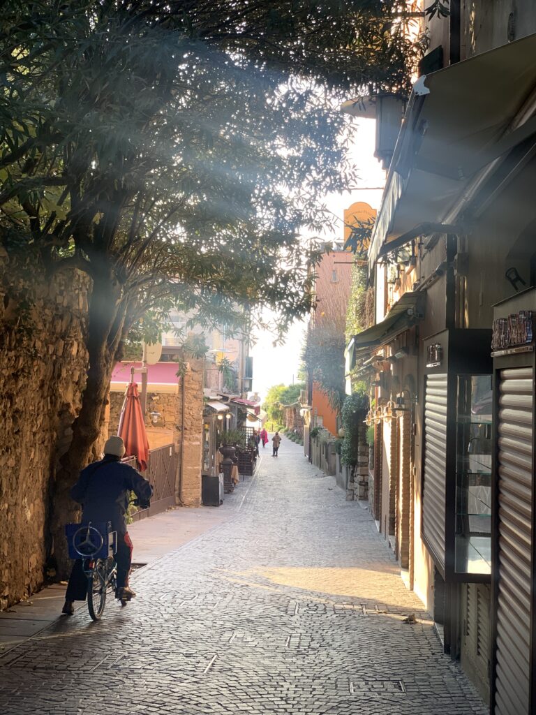
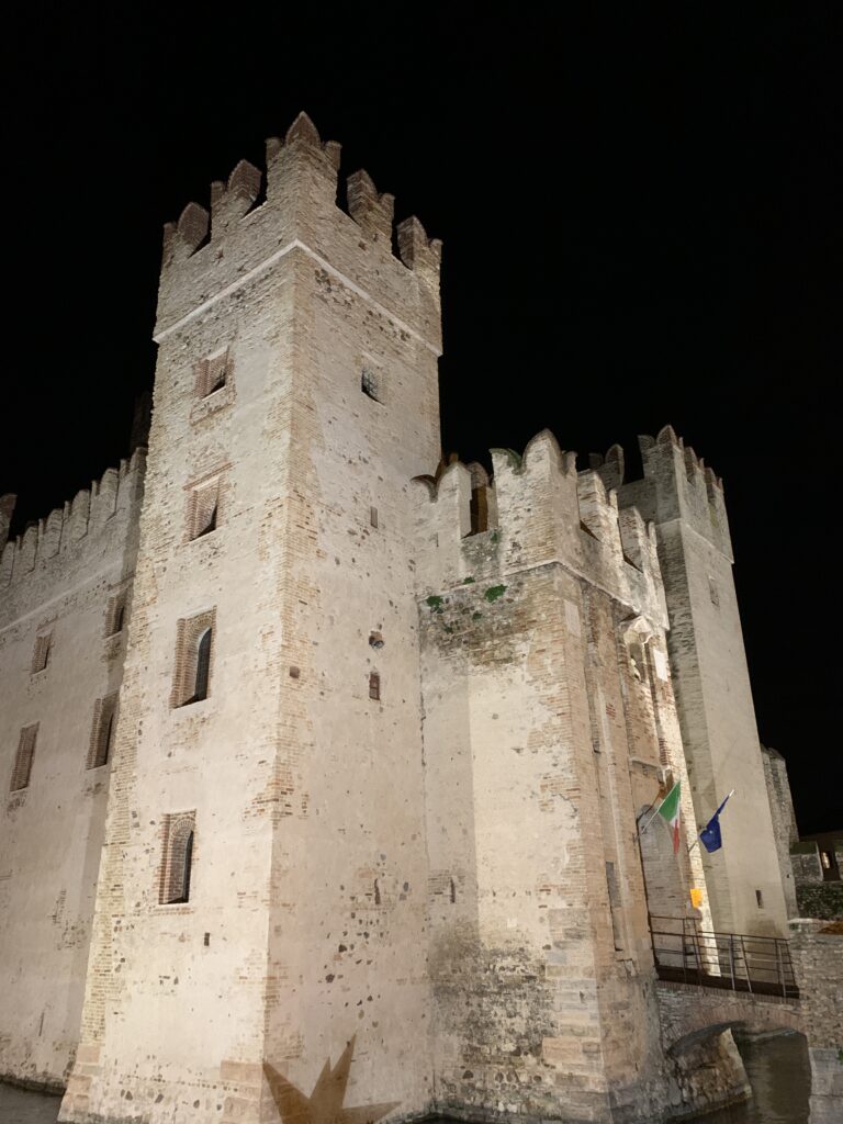
Lorem ipsum dolor sit amet, consectetur adipiscing elit. Ut elit tellus, luctus nec ullamcorper mattis, pulvinar dapibus leo.
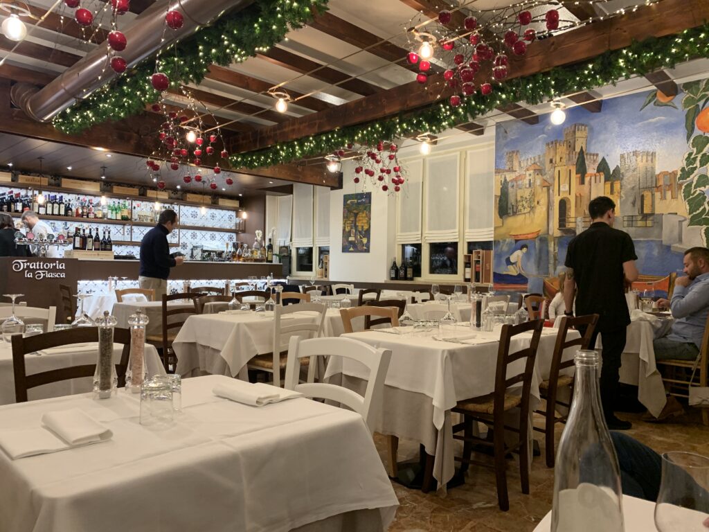
Lorem ipsum dolor sit amet, consectetur adipiscing elit. Ut elit tellus, luctus nec ullamcorper mattis, pulvinar dapibus leo.
Previous
NextAdd Your Heading Text Here
Lorem ipsum dolor sit amet, consectetur adipiscing elit. Ut elit tellus, luctus nec ullamcorper mattis, pulvinar dapibus leo.
-
Bologna
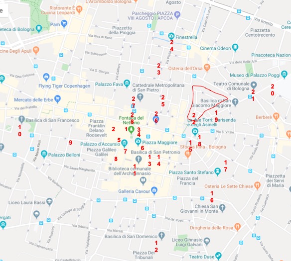
December 14, 2019 /History
The first settlements of Bologna date back to the first millennium BC, years in which it represented an important center for Etruscans and Celts. The two names of the city, Bologna and Felsina, originate respectively from the Celtic “Bona” (fortified center) and from the Etruscan “Fetzna”. The Romans dominated Bologna from 189 BC until the fall of the Empire. In 774 the city was conquered by Charlemagne who handed it over to the Pope. In 1115 it became a municipality, and in the XI-XII century its economy exploded thanks to the system of canals and the silk trade. In 1257 it was the first Italian municipality to promulgate the “Liber Paradisus” with which slavery was abolished, and slaves were bought with public money and freed.
In the XIV century, internal struggles undermined the independence of the city which in a few decades was dominated by various noble families (Pepoli, Visconti, Bentivoglio) until it returned under Pope Julius II in 1506. In 1796 it was conquered by Napoleon who kept it until 1815, the year in which with the Congress of Vienna, the city returned to the Pope. Finally, in 1860, Bologna was annexed to the kingdom of Italy
Tour of the city center
Piazza Maggiore
Start the tour from Piazza del Nettuno (1); in 1564 buildings were demolished to make room for this square, where one of the symbols of Bologna was erected. The statue of Neptune was commissioned by Pius IV as a symbol of papal primacy over the world, and the Flemish Jean de Boulogne (known as Giambologna) was hired to sculpt it. The statue represents the god of the sea, Neptune, surrounded by four cherubs that embrace dolphins, to represent the four largest rivers known at the time (Ganges, Nile, Amazon River and Danube). On the four sides of the tank there are four engravings in Latin that say: made to adorn the square, made for the use of the citizens, made with public money and the date of 1564. As the engravings say, in the past it was used by citizens to draw drinking water and to wash clothes. Giambologna wanted to make the genitals of the god bigger without being admonished by the Church: the thumb of the the left hand seen from a particular position appears to be the erect member.
Piazza del Nettuno with Palazzo Re Enzo in the back
Sala Borsa
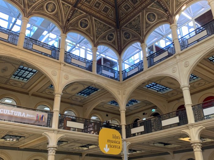
The liberty-style inside Sala Borsa Behind you stands a Milanese-style building commissioned by the Visconti family as the headquarters of the city’s militias. In 1883, with the Kingdom of Italy, the Sala Borsa (2) was built to house the Bologna Stock Exchange (closed in 1903). The art nouveau interior hall had various functions (sports hall) and only since 2001 has it been the seat of the municipal library. It is worth a quick walk inside to see the Roman remains in the trapdoors on the floor.
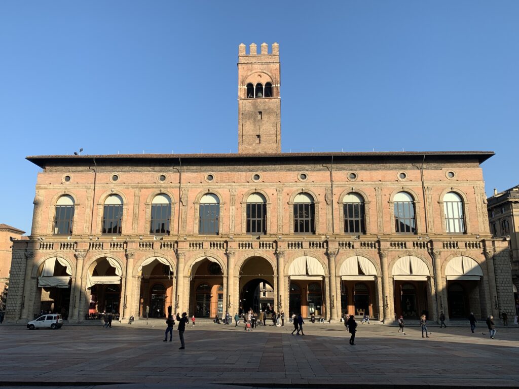
Back in Piazza del Nettuno, the building opposite Sala Borsa is Palazzo Re Enzo (3), built in 1245 as an extension of the Palazzo del Podesta’. It takes its name from being a prison of Enzo, son of Federico Barbarossa, for 23 years. It was apparently a pleasant imprisonment, as Enzo asked to be buried in the city. The vault by the side of the building was the site of the city hangings: the condemned were first blessed in the little church next to it, now deconsecrated.
Between Palazzo Re Enzo and Palazzo del Podesta’ (4) there is a cross vault with the four patron saints of the city at its corners. If two of you stand at two opposite corners and whisper against the column you will be able to clearly hear the other person’s voice: it was a method used by the priests to confess the lepers
Palazzo del Podesta'
Palazzo d'Accursio From the vault, exit towards Piazza Maggiore (5)and turn around to admire the Palazzo del Podesta’ (4) under which you have just passed. The Arengo Tower is one of the largest suspended towers in Italy: its 5 tons bell was hoisted by Aristotele Fioravanti, architect of the Buda Castle in Budapest, and known for having moved the Templar tower in Bologna by 13 meters to look for gold hidden under it. The bell was ringing to call the Bolognese to gather in case of war, and in the last 100 years it tolled at the end of the Second World War and the fall of fascism.
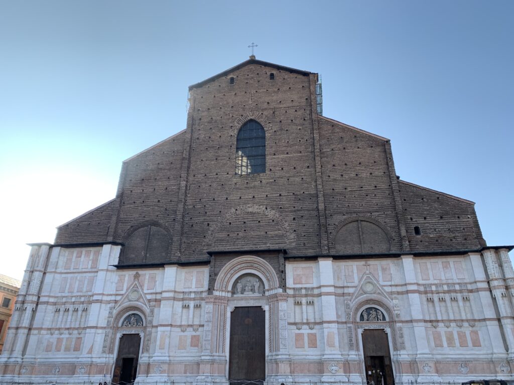
In front of you stands the Church of San Petronio (6), the largest in Bologna, and although unfinished one of the largest in Europe. It’s the largest gothic brick church in the world. It’s dedicated to Petronius, bishop of Bologna in the V century and sent to revive the city from the barbaric invasions. The church was begun in 1390, when Bologna already had a cathedral: the idea of its realization was not born in fact from the Church but for the will of the citizens. The architect Antonio di Vincenzo died 10 years after the workings began. This, together with obstacles from the pontifical prelate, interrupted the constructions for years. In 1514 a new project would have made it bigger than San Pietro in Rome, but it was never put in place. In 1530 Charles V was crowned as emperor of the Holy Roman Empire inside San Petronio.
In 1562 Pope Pius IV decided to give priority to the construction of other surrounding buildings, and the works to complete the church were interrupted for good in 1563. The Church of San Petronio was consecrated only in 1954, and since 2000 has housed the relics of the Saint.
Inside you can see the 4 crosses that for centuries and up to 1798 were outside the gates of the first city walls of Bologna, and which today are oriented as they were then. San Petronio is home to the largest sundial in the world, completed by Cassini in 1657 which measures 67 meters long, and even today misses the astronomical noon by a few seconds only.
Santa Maria Labarum Coeli
San Salvatore Stroll through Via D’Azeglio (7), turn into Piazza dei Celestini and reach the Church of Santa Maria Labarum Coeli (8), from 1700. Labarum Coeli has no Latin translation: the name comes from the fact that the area was frequented by a prostitute named Baroncella . As the Church could not take this name, it was Latinized. Since 2006 it has hosted the Copts of Bologna.
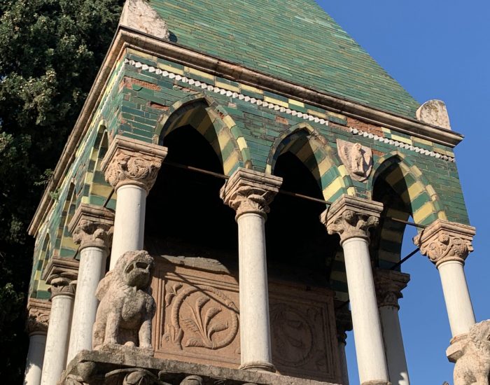
Take a quick detour to admire the church of San Salvatore (9), very ancient and restored in the 1600s. Raise your gaze to the top of the façade: a large caliber bullet fired by the Austrians in 1849 from the hills of Bologna is clearly visible .
From 1213 the Franciscans are in Bologna and begin the construction of the Basilica of San Francesco (10) which ends in less than 30 years. After the arrival of the French in 1796, the church was deconsecrated and emptied. The church also suffered major damage during the Second World War. The facade is Romanesque but the building is in French Gothic style.
Outside the church of San Francesco there are three tombs of the “Glossatori” which preserve the remains of the first university professors of the Middle Ages; at the time the University was above all jurisprudence, and the “Glossatori” commented on Roman law texts with additions to the margins (glosses).
Glossatori Tomb Follow via Porta Nuova to return to Piazza Maggiore. In front of you, on the last side of the square that remains to be explored, opens up the Archiginnasio (11). It was finished in 1563 in order to give a home to the University (lessons were first held in public places) which remained there until 1803. Walking along the Pavaglione portico (which takes its name from “papillon” because here were hanging the silkworms) you will reach the door of the municipal library of the Archiginnasio, founded in 1838.
Palazzo dei Banchi and the Portico del Pavaglione
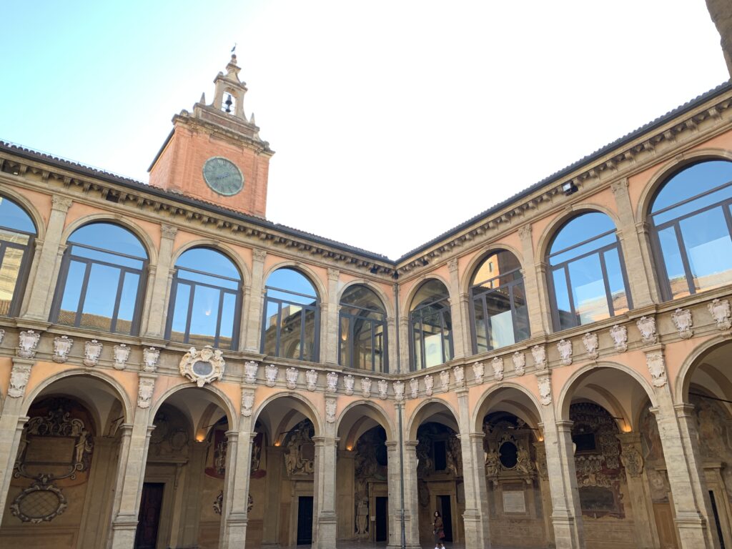
The inside of Archiginnasio Entering the courtyard there are more than 6000 student coats of arms and inscriptions of the professors representing the largest heraldic mural complex in the world. Climb up to the first floor to visit the anatomical theater of 1637. Constructed of fir wood, it has a chair on the right from which the professor read the anatomy books, dominated by a canopy supported by the statues of the skinned, and under it a stand from which the assistant indicated the body parts on the corpse the barber was dissecting on the marble table in the center.
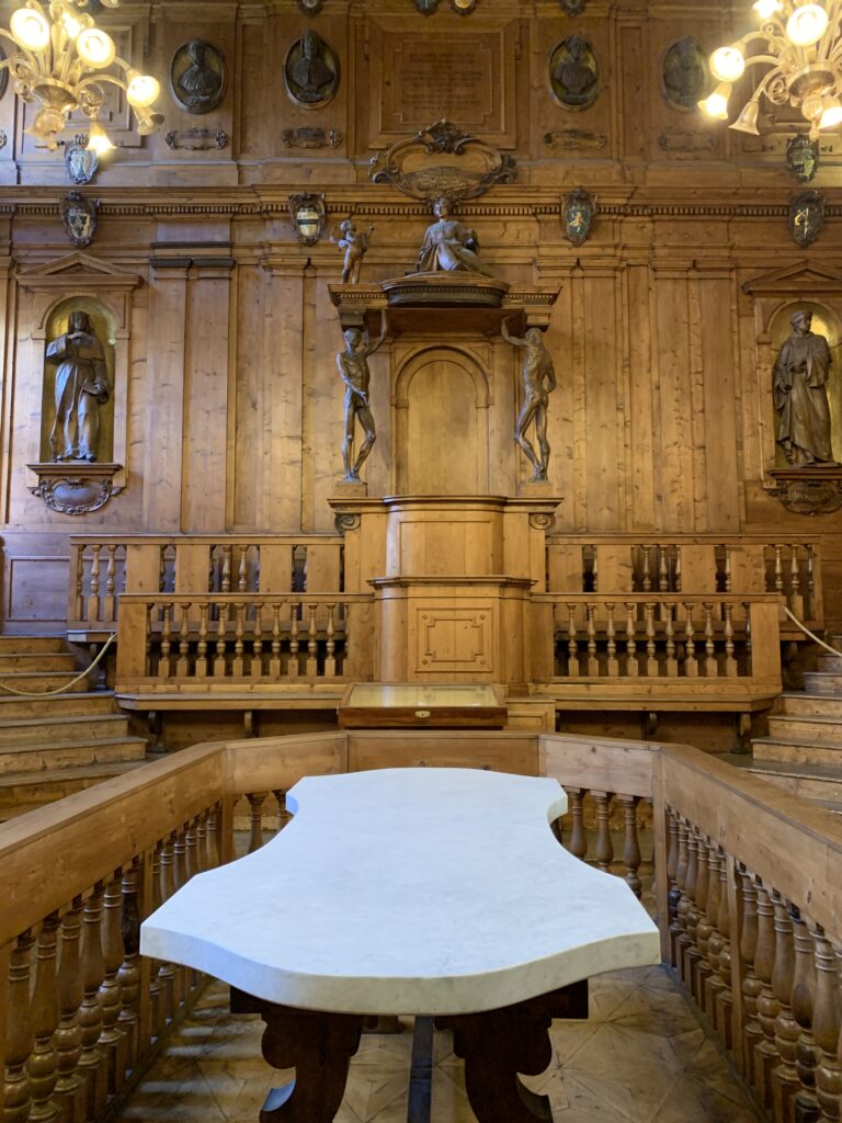
The anatomical theater
The Archiginnasio library Out of the theater turn left under the portico and continue to the church of San Domenico (12). In 1218 the Dominicans arrived in Bologna and in 1240 completed the construction of the Basilica and the convent, inside which the remains of San Domenico (who died in Bologna in 1211) are preserved. In the square in front of the church there are two more tombs of the glossatori , the first medieval university professors.
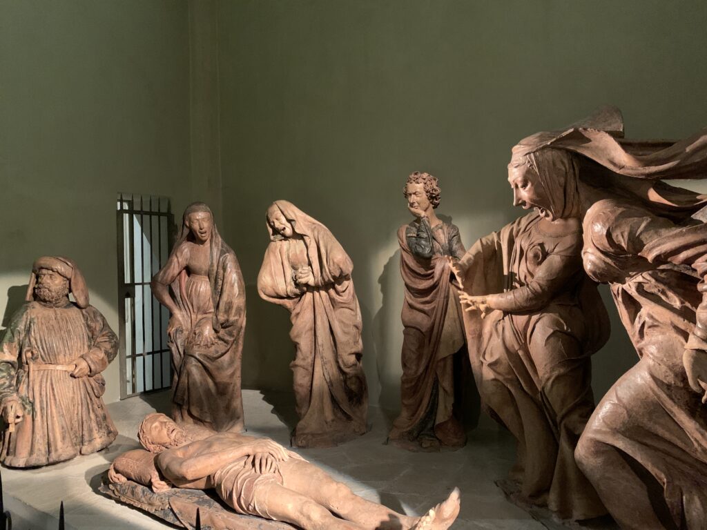
The Quadrilatero
Return to the Pavaglione porch and turn right this time into Via Clavature (13). You are entering the true heart of ancient Bologna, where every street takes its name from the trades that were practiced there. Along Via Clavature, on the left side, is the Church of Santa Maria della Vita (14), founded in the 13th century by the flagellar brotherhood. This religious order was dedicated to welfare activity and in 1287 transformed the Church into the first hospital in Bologna. The hospital occupied the entire building between the Pavaglione and the Church, but when the numbers became excessive the first triage was created, and the patients who were too serious were sent to the portico in front of the church, called the Porch of Death (1347).
Santa Maria della Vita Enter the Church to admire the Compianto of the Dead Christ of Niccolo dell’Arca (second half of the 400).
Continue your walk in the quadrilatero immersing yourself in the ancient craft and commercial traditions: home to barbers, goldsmiths, fishermen, furriers, blacksmiths, to each of whom one of the streets is named.
Exit the quadrilatero in via degli Orefici and turn right to get to Palazzo della Mercanzia (15). In 1382 the Municipality established the seat of the Foro dei Mercanti in this palace built by the same architect as the Church of San Petronio: once the work was completed, the merchant court was established. Today it sacredly preserve the original recipes of the filling of tortellini, Bolognese ragu’, “certosino”, green lasagna, as well as the size of the real tagliatella (8 mm wide, or the 12270th part of the Torre degli Asinelli, and thick from 6 to 8 tenths of a mm). On the façade of the building that gives on Via Castiglione a plaque from the XV century lists the privileges of the students: to them the municipality paid for books, food and clothing.
Piazza Santo Stefano
From right to left, Chiesa del Crocefisso, Chiesa del Sepolcro and Chiesa dei SS Vitale e Agricola. In the back, the Chiesa della Trinita' The walk in Piazza Santo Stefano (16) will let you experience with your feet what the ancient Bolognesi were feeling everyday while walking the strees of the city: the pavement is still made of ancient pebbles. Admire in front of you the beautiful Basilica of Santo Stefano (or delle Sette Chiese, the Seven Churches), a complex of very old churches. The church from which you enter is the Chiesa del Crocefisso, of Lombard origin from the eighth century; in the crypt one of the columns is said to be of the same height as Jesus (1.70 m, very high for the time). At the bottom of the crypt two urns hold the remains of the Saints Vitale and Agricola. The church that is immediately on the left is the Church of the Sepulcher, dating back to the 5th century and built by Petronius as a simulacrum of the Holy Sepulcher of Jerusalem. The hexagonal plan of the church and the numerous pillars suggest that it was built on a temple of Isis. Inside, a shrine contained the relics of the Saint Petronio that the faithful could worship the week after Easter by kneeling through a small door (from 2000 the relics are in San Petronio).
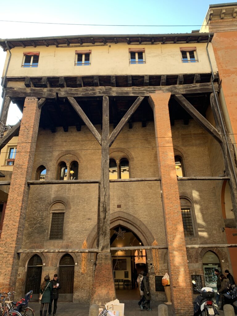
In the past, Bolognese prostitutes went to the Church of the Holy Sepulcher on Easter morning to recite a prayer to Mary Magdalene, a prayer that was never revealed. Look among the columns for the one in black marble, symbol of the flagellation of Jesus: touching it would seem to guarantee 200 years of indulgence in the afterlife. The last basilica on the left is the Church of the Saints Vitale and Agricola, the oldest of the complex and dedicated to the first two martyrs of Bologna, victims of Diocletian’s persecution. The basilica already existed in 393, as suggested by the Roman floor. From the last Basilica exit on the Pilate Courtyard: the distance between this point and San Giovanni in Monte (the only natural hill in the vicinity) is the same existing between the Holy Sepulcher and the Calvary in Jerusalem. The small Church of the Trinity at the end of the courtyard had to have a different shape but it was rebuilt in 1800. Since the time of the Crusades there was a piece of the Holy Cross, later removed in 1950. Much more impressive, however, is the medieval cloister on the right, with capitals and tombstones bearing the names of the fallen Bolognesi of the Great Wars.
The churches are therefore 4 and not 7, and none has the name of Santo Stefano …
Just outside the basilica, under the portico on the right, take Corte Isolani (17) to reach Strada Maggiore. Under the wooden portico of Corte Isolani, look up and sharpen your eyes to find three arrows stuck in the wooden ceiling. There are three legends behind them: one of three assassins sent to kill an adulterous noblewoman who, at the sight of her beauty, hurled the arrows at the top; one of an armed conflict; and one that of a goliardic joke made in 1877 by students to the professor who was restoring the porch.
The portico of Corte Isolani, with the three arrowns
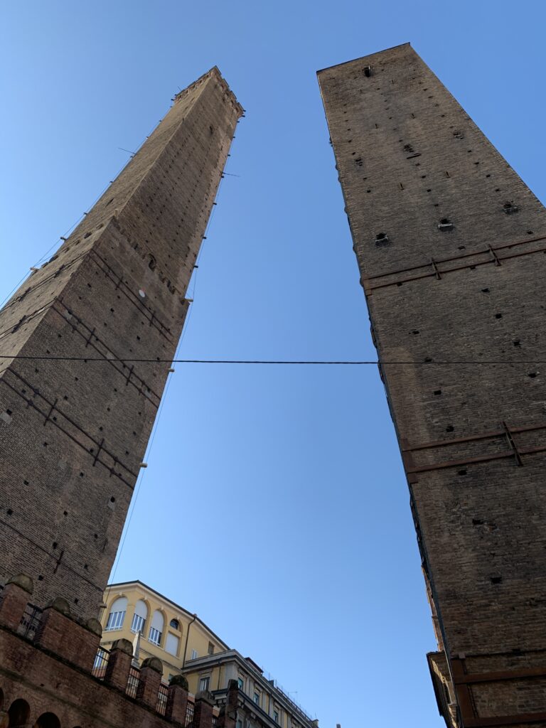
Torre degli Asinelli e Garisenda And now, towards the symbol of Bologna, the two hanging towers (18). They are located at the crossroads of the 5 streets that led to the 5 gates of the city in the year 1000. Despite the names (Torre degli Asinelli and Garisenda), it is not certain that precisely those two families built them.
The Torre degli Asinelli is 97 meters high but from the thickness of the walls of the top floors it is believed that it was originally at least 20 meters higher. Built between 1109 and 1119, its summit was remade in the 1400s. It has a 2.2-meter overhang that makes it the highest hanging tower in Italy. In 1300 it became possession of the Municipality that turned it into a prison. The Visconti made it an observation point, adding a wooden walkway that connected it to the Garisenda. Over the years it has hosted television antennas and during the Second World War it was used to spot bombing and direct relief efforts.
The Garisenda is 48 meters high and has an overhang of 3.2 meters. Initially it was 60 meters high but was cut off in 1351 for the collapse of the foundations. It is mentioned by Dante in the Divine Comedy, and a plaque recalls its verse: if someone leans back against the Tower on a cloudy day and looks up, the moving clouds give the sense that the Tower falls on you.
The University neighbourhood
Walk in via Zamboni (19) and you are in the heart of the university area of Bologna. As you head towards Piazza Verdi, remember that the oldest University in the world went hand in hand with Goliardic associations. And at this point we cannot forget the “taproot” of the goliards. This taproot was originally located in the quadrilateral to prevent access to carriages, but became a meeting place for the Goliardia and a symbol for them. Due to the great rivalries with the other Italian universities, the taproot was repeatedly ripped off and stolen by rivals. When, for urban reasons, it was removed from the original site, the Goliardi raised a protest and occupied the town hall until they obtained the taproot back and carried it in procession and in great pomp in Via Zamboni, where it was walled to the ground (20). After innumerable damage caused by cars, it was restored by the municipality in the 1960s. The engraving on it reads SVQFO (Sacred and venerable order of the taproot).
Piazza Verdi is the heart of the university area. The walls you see behind you are a wreck of those of the second circle. Piazza Verdi hosts the Teatro Comunale (21). it is located in the place where the Bentivoglio Palace was standing until 1507, when it was destroyed by the popular fury. Initiated in 1756, it was the first theater built with public funds and rented by the municipality. Opened in 1763 (only second to the San Carlo in Naples, both La Scala and La Fenice are younger), it is a theater closely linked to Wagner: it was the first theater to host the Parsifal outside Germany. In 1931, the director Toscanini was invited to direct at the Comunale but refused to open the concert with the fascist hymn, and was slapped: since then he left Italy for 15 years.
Retrace your steps and at the beginning of Via Zamboni on the left you will find the entrance to the Ghetto (22), founded in 1556 following a papal bull. There are 3 entrances to the Ghetto, this one in particular still has the hinges of the gate. Lose yourself in the lanes of the ghetto, enjoy the absence of cars and head towards via Marsala (23).
The "Portici" of Bologna
What is missing in the ghetto (the architecture was left to the Jewish community) and that you can find once you arrive in Via Marsala (23), are the “portici”. The famous Bolognese arcades were born in the Middle Ages as spontaneous projection of private buildings on public land. With the boom of the university new houses were needed: the citizens began to extend the beams of the floors of the first floor to the outside, supported first by wooden capitals and then masonry. In 1288 a ban of the municipality established that all the new houses should have a porch and that those already existing should build it, leaving the burden of maintenance to the owner but guaranteeing the use of the land to the municipality. The arcades had to be at least 2.66 meters high (7 Bolognese feet) and wide to allow the passage of a man on horseback. In the poorest areas, very often the measures were not respected. In Via Marsala you can admire the highest portico (of the Officers’ Club) and in front of it the oldest portico. Bologna also boasts the longest portico in the world, the portico of San Luca, with 666 arches and 3796 meters long, built between 1600 and 1700.
The Canals of Bologna
Keep walking towards Via Piella (24). From the river Reno and Savena (west / east) a water network was developed between the XII and XVI. From south to north, Bologna has a drop of about 40 meters. The canals Reno and Savena enter the city together with a stream, the Aposa. The Reno canal is divided into Canale del Cavaticcio (connected to a small hydroelectric power station since 1995) and Canale delle Moline which supplied 15 mills. The Canale delle Moline connects Bologna to Ferrara and flows into the Po, thus linking Bologna to Venice. All this means that until 1950 Bologna had a functioning port. The Bolognese canals served as a means of connection and transport, to regulate the waters of the Apennine rivers during seasonal flow, and to supply energy to the water mills. A series of locks (some attributed to Leonardo) are all that remains of the Bolognese navigable system active from the 12th to the 20th century, without which Bologna could not have developed its economy.
The economic boom of the medieval Bologna was due to silk processing and trading. In 1272 silk processing was exclusive to the city of Lucca, but in that year its secrets were stolen and soon this industry flourished in Bologna. The Bolognesi implemented this industry with the invention of the “bolognese mill”, thanks to which Bologna became one of the most important European silk centers. The Bolognese fleet became notable, so much so as to defeat the Venetian fleet in 1271: the victory granted to the Bolognese favorable commercial duties. Silk was the leading commercial sector in Bologna for a long time and in 1500 40% of the population dealt with silk. In 1600, 119 silk mills were in operation in Bologna.
Admire in Via Piella one of the few uncovered portions of the kilometers of canals that flow under Bologna.
The Towers of Bologna
From Via Piella retrace your steps to see two more of the Bologna towers. The towers of Bologna had a noble and military function, and between 1110 and 1200 there were about a hundred; today there are about 22 left. The towers gave luster to the family that built them, but they could also have offensive or defensive effects. “Tower-houses” were slightly different, lower but with a mainly residential function, less thick walls and more openings. During the 13th century many towers were either cut off, demolished, and some collapsed. The last tower was demolished in 1919. The foundations of the towers go down from 5 to 10 meters under the ground, the base is built with large blocks of selenite and then the tower rises with ever thinner walls. From 3 to 10 years were necessary to build 60 meters of tower.
Reach the Torre Prendiparte (25) (also called Coronata), built in the second half of the 12th century and 59.5 meters high. At 50 meters from the ground there is a “crown” that reduces the thickness of the walls and lightens the tower. In 1700 it was a prison of the Church, various inscriptions of convicts remain including a “held captive for having impregnated two sisters”. A little further on is the Torre Azzoguidi (26), with its 61 meters of height, the second highest in Bologna, and severed as well.
Take a right into Via Atabella and reach San Pietro (27), the true cathedral of Bologna. The first construction dates back to the X-XI century and measured 57 meters in length, but after a fire in 1141 it was completely rebuilt and enlarged in 1184. In light of the numerous basilicas that were being completed all over Bologna, the Church made a (vain) attempt to expand San Pietro and make it more majestic. The current version is from the 1700s, with a baroque facade. The bell tower represents the true jewel of the cathedral: it holds inside a smaller round early Christian bell tower. The largest bell weighs 33 quintals, and together with the other 3 they reach a total of 65 quintals: to ring them, 23 bell ringers are required.
Finish your ride under the portico of Via Indipendenza and look up at the porch ceiling (28). You will notice three writings: “Panis vita”, “Canabis protectio” and “Vinum laetitia” (bread is life, hemp is protection, wine is joy). From 1330 until the second post-war period, the production of hemp with woven use was very widespread between Bologna and Ferrara.
-
Paris – The Hidden Gems
December 1, 2019 /DAY 1
The covered passages of Paris make it possible to walk while visiting the shops sheltered from the mud and the anarchic traffic of the street.
Before the great transformations carried out under Napoleon III by the prefect Haussmann, between 1852-1870, most of the streets were in clay (no paving stones) and no sidewalks. During the French Revolution (1789), the properties of religious people and emigrants were put on sale, and commercial buildings were created generating significant income.
The covered passages were created by wealthy bourgeois to promote trade without opening additional streets, which would take up space without generating profits. There were more than 40 passages in Paris. This section offers a walk through the covered galleries still existing in the 9th and 2nd district of Paris. These are the passages Verdau, Jouffroy, Panoramas, Princes, Vivienne, Colbert, and Choiseul.
If you are traveling by subway, which is the most convenient way, the best is to go to Metro Cadet, line 7 and follow our itinerary.
Most passages are private and are closed at night by gates or doors (usually from 8pm to 8am) and on Sundays.
They are generally classified as historical monuments since 1974, but it is the owners who are in charge of maintaining them. IDurand comme
LE PASSAGE VERDEAU
Take rue Cadet and turn in rue du Faubourg Montmartre, the Verdeau passage is just slightly on your left, on the other side of the road, at number 31 of the street. The glass rooftop makes the passage very luminous and the canopy is divided in in two parts allowing a circulation of air which prevents that the passage becomes an oven during the beautiful days. The passage houses many antique dealers and art dealers as well as restaurants.
LE PASSAGE JOUFFROY
Leaving the Verdeau passage, you just have to cross the street to find yourself in the passage Jouffroy built at the same time in 1847. This is the first passage entirely built in metal. This covered walkway is known to house the Musée Grévin, a wax museum that was inaugurated on January 20, 1882. Next to it,the hotel Chopin dates from the 19th century and it has its entrance directly in the passage. Where the passage overlooks the Rue de la Grange Batelière, the ground was not wide enough to allow 2 rows of shops. There is only one side of shops, with a boutique setting with just the showfront opposite.
LE PASSAGE DES PANORAMAS
One of the first passage to be opened in Europe in 1799 and to experience gas lighting in 1816, you just have to cross the boulevard Montmartre to enter it. The Passage des Panoramas is one of the most beautiful and lively in the capital. A popular place to walk since the 19th century, it is a Parisian Mecca of the trade of stamps for collection. The passage has the particularity of opening on small adjacent galleries. The passage takes its name from the attraction presented by the American inventor Robert Fulton. He financed his inventions (the steamboat, the submarine Nautilus and the torpedo), which he presented in Paris in an exhibition located in 2 rotundas and presenting panoramas of landscapes of Paris, Toulon, Rome.
LA GALERIE COLBERT
It is one of the two most beautiful galleries of the capital with the Vivienne gallery. Its entrance is at 6 rue des Petits Champs, The gallery dates from 1826. It feels like entering a university building rather than a passage. This gallery was indeed bought by the B.N.F. and now houses the National Institute of Art History and the National Institute of Heritage. It is however free to access. though: a guard is at the entrance and opening hours are very limited. We could not get in there. In the center of the rotunda stands a bronze statue representing Eurydice, the wife of Orpheus.
LA GALERIE VIVIENNE
Inaugurated in 1826, the Galerie Vivienne imposes on the visitor its beauty with its elegant glass roof, the intricate pattern of its mosaic floor and the richness of its decor. The Vivienne gallery is the second longest in this presentation. It consists of several sections separated by steps.Today, it houses ready-to-wear and decorative items. The gallery is elegant all along, it seems quite uncrowded on weekends, the neighborhood comes alive especially during the week. The dome is one of the largest in the passages, elegant and sober.
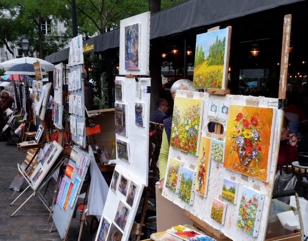
LE PASSAGE DE CHOISEUL
The passage of Choiseul overlooks the 40 rue des petits champs on one side and ends at 23 rue Saint Augustin. The gas lighting was replaced by electric balls and lamps. The passage, very busy when it opened, fell into disuse, then had a revival of activity when the couturier Kenzo settled there in the 1970s, then declined when he left.
DAY 2
Sometimes a bit of jet lag is exactly what you need on vacation to start the day bright and early and don’t lose any time. The plan for this second day is to visit the Marais and the best way to reach is to take the metro to Chatelet (line 1) and walk from there. However, is the sky is blue and the day is warm, you may consider strolling down the Champs-Elysee and found the entrance of the Jardins de Champs-Elysee. Business men and women walking and listening to music, briefcase on hand on their way to work, cafés opening, gardeners keeping up the amazing look of the park.
The walk will take you all the way to Place de la Concorde. The Obelisque standing still in the middle of the square busy with morning traffic deserved a look (and a picture). It’s like nothing or anyone could ever bother it. It’s there now, it will be tomorrow and in a 100 years. Continue your walk inside the Jardins des Tuileries all the way up to the Louvre. Most of you will probably been there before so you may decide to leave out the visit of the museum this time. It’s huge and it would need a whole day (or more) to be visited properly, maybe you can keep the visit for when you’ll end up in Paris in a cold winter day.
Down again into Rue the Rivoli and then towards Les Halles. Les Halles is now a big mall, but was once the spot that hosted the central market of Paris. Next to the main square there is a gothic church that will catch your attention. Like we always do when we find something interesting, you may want to walk inside. It was undergoing renovation works when we visited it, but we still got a glimpse of it. The outside is more impressive than the inside for sure, but what is special about the church (but we came to know afterwards) is that it is the church where Moliere was baptized.
From there walk onwards towards the Beaubourg (better known as Centre Pompidou). It was designed in the style of high-tech architecture by the architectural team of Richard Rogers and Renzo Piano. It houses the Bibliothèque publique d’information, a vast public library; the Musée National d’Art Moderne, which is the largest museum for modern art in Europe; and IRCAM, a centre for music and acoustic research. Here is the link to the website, with more information on opening hours and exhibitions.
Continue your walk and will found on your way the Hotel Sully. It was briefly mentioned in our guide, so we decided to take a look at it and you definitely should do as well.
DAY 3
This itinerary will take you through Ile de la Cité and the Latin Quarter. We took the metro to Louvre-Rivoli (Line 1 and 7) and accidentally noticed at the exit of the metro station a beautiful romanic church. Saint-Germain-L’Auxerrois may not be on the touristic path, but it’s definitely worth a stop. Take Pont Neuf to Ile de la Cité, but instead of turning left on Place Dauphine, turn right and go down the staircase. At their base you’ll see the entrance to a small park (Square du Vert Galant) that covers the tip of the island. On the very tip of the island there are willows and you can see the Seine in front of you, feeling like on the bow of a boat.
Go back up and this time head to Place Dauphine and toward the Sainte Chapelle. The Sainte Chapelle was built in 1248 by orders of Luis IX to host the Crown of Thorns and transform Paris into the Catholic World Capital. While we were queuing a gentleman approached us and told us there was going to be a guided visit starting after few minutes (by the time we exited the queue had grown quite a lot. We definitely suggest to buy the tickets online and check for the free guided visits).
As the chapel for the Royals and their entourage, the Sainte Chapelle is situated in the Ile de la Cité since the Royal Palace used to be right there, before the King of France decided to move it to Versailles. The building that once hosted the Royal Palace is still there, but home to the Palais de Justice. The Sainte Chapelle consists of two different chapels.
The lower Chapel, which is the one you enter in, was meant for the servants of the palace. During the restoration (carried out 150 years ago) there was not enough information to reproduce the ceiling as it used to be, so they just copied the blue ceiling with Fleur de Lis (symbol of the French monarchy) that you can find on the upper Chapel.
Going up a steep staircase you enter the upper Chapel, once directly connected to the personal apartments of Luis IX. This Chapel was strictly reserved to the King and his small entourage. A canopy in the abse used to host 22 relics among which the only survivors are the crown of thorns, a nail and splinter of the Cross. These three until few months ago were preserved in Notre Dame, but after the fire of April 2019, they were moved in the Louvre basements.
The upper Chapel four sides are entirely made of stained glass and the weight of the structure is held by the outside pointed arches, a typical pattern on Gothic architecture. These beautifully painted windows cover an area of almost 700 sqmt and depict the whole Bible, from the Genesis to the Apocalypse which is painted on the giant rose window over the entrance.
Walk then towards Notre Dame (was fenced all around when we were there and we believe it’s going to be for few more years) and take the Pont Saint Louis to stroll around in the nearby Island of Saint Louis. The entire island makes you feel like in a small French village, walking by small family owned businesses, restaurants and lovely townhouses. Stop by for lunch or a sandwich and finish off your break with a nice ice cream at Berthillon Glacier, before taking Pont de la Tournelle, towards the rive gauche.
Strolling along the riverbanks you will soon end up in the Square René Viviani, next to which there is usually a crowd gathering in front of Shakespeare and Co. This independent english bookstore was opened in 1919 and makes for a very nice stop either in the modern bookstore on the ground floor or in the old looking one on the first floor. They will stamp your books, so also a nice idea for a gift/souvenir.
Get lost in the Latin Quarter breathing the air of the artists of early 1900, and find your way towards the Eglise Saint-Sulpice. Not only this is a very nice early Gothic Church, it’s interest lays in the Paris Meridian (the Rose Line mentioned by Dan Brown in The Da Vinci Code). This brass line on the floor is part of a gnomon, a device designed to cast a shadow on the ground in order to determine the position of the sun in the sky. The sunlight passes through a small round opening in the southern stained-glass window of the transept, at a height of 25 meters, forming a small light disk on the floor; this disk will cross the meridian each time the sun reaches its zenith at true noon. The sun will cross different parts of the meridian depending the time of year. At one end of the meridian is a square marble plaque, which corresponds to the position of the sun at the highest at midday, during the summer solstice about 21 June. At the other end is an obelisk, which is lit near its top when the sun is at it lowest at midday.
Walk your way towards the Jardins de Luxemburg and take your time exploring the gardens, maybe sitting in one of the reclining chairs and enjoying the afternoon sun, before hitting the last scientific stop of the day. The Pantheon is a neo-classical building, originally a church, that hosts the tombs of Napoleon, Voltaire, Rousseau, Hugo and Zola. The queue to get inside can be quite long so we definitely advise buying your tickets online. Our main interest inside was the Foucault pendulum, a simple device named after French physicist Léon Foucault that was introduced in 1851 as the first experiment to give simple, direct evidence of the earth’s rotation. The pendulum oscillates along the same line indefinitely while the Earth rotates underneath. In a day the pendulum will have completed a full turn.
At night we enjoyed a very nice dinner at L’Absynth.
DAY 4
Get down at the metro stop Denfert-Rocherau on the line 6 to visit the Catacombs of paris. Try to be there around 9.15 to beat the crowd, the 45 min wait for the doors to open may be alleviated by a take away breakfast at the nearby Paul.
Not every inch of Paris is as romantic as you think – in fact, the Catacombs are downright chilling. Prior to the creation of the Catacombs in the late 18th century, Parisians buried their dead in cemeteries. But as the city continued to grow, burial grounds ran out of space, graves started to become exposed and stunk up surrounding neighborhoods. The limestone quarries located 65 feet beneath Paris eventually became the solution, providing ample and safe space for the city’s deceased loved ones. ones from the defunct Cimetière des Innocents were the first to arrive in 1786, when decomposing bodies started seeping into the cellars of the market at Les Halles, drawing swarms of ravenous rats. It took 12 years to move 6 million bodies from all the Parisien graves.
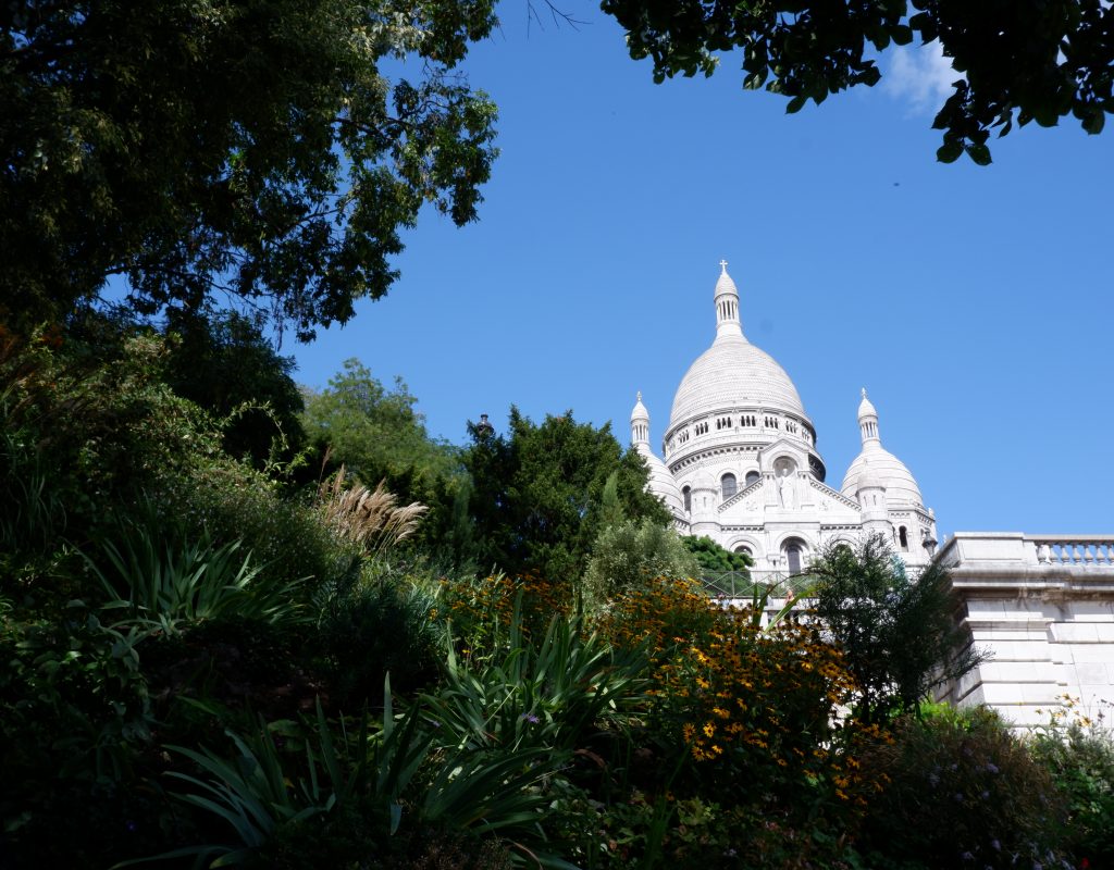
Today, the solemn, skull-and-boned lined tunnels weave beneath the heart of the City of Love, beckoning to visitors with an interest in the departed. The legions of bones dumped here are stacked not by owner but by type—rows of skulls, packs of tibias, and piles of spinal disks, often rather artfully arranged. Among the nameless 6 million or so are the bones of Madame de Pompadour (1721–64), laid to rest with the riffraff after a lifetime spent as the mistress of Louis XV.
The catacombs stretch for miles all over the city, but visitors are only allowed to access a mile’s worth for 45 minutes at the Denfert-Rochereau (lines 4,6 and RER B) metro station.
And because of the attraction’s unique nature and popularity, expect a queue. We went on the previous day and there was an hour (or more) wait. So we were advised by the personnel to come back the day after at 9:15 to beat the crowd. Even if some people are already queuing at that time, the doors open at 10 am and they let in 200 persons. And the wait can be alleviated by a take away breakafast and coffee from the nearby Paul’s.
The same metro line 6 will take you to canal Saint Martin (Oberkampf stop). The Canal Saint-Martin neighborhood is nestled between Gare du Nord and Republique in Northeastern Paris, in the 10th arrondissement. The canal feeds into the Seine River in the South and the Bassin de la Villette and the Canal de l’Ourq in the North.
Napoléon I ordered the construction of the Canal Saint-Martin in 1802. It was originally built to link to the Canal de l’Ourq, further north, to supply fresh water to the city. In the 19th century, the area was mostly occupied by working-class laborers. The canal and its surroundings were entirely reconstructed on set for Marcel Carné’s 1938 film, Hôtel du Nord. Only recently has it started to attract well-to-do professionals eager to take up residence in apartments with views of the canal. As a result, it’s come to be known as an area where fashion boutiques are continually springing up in the neighborhood. In the spring and summer, locals come in droves to the banks of the Saint-Martin Canal to picnic, strum guitars waterside, and bask in the lazy long evenings as dusk settles over the photogenic area.On Sundays, two streets running parallel to the canal, Quai de Valmy and Quai de Jemmapes, are reserved for pedestrians and cyclists—perfect for renting a bike and seeing the city from a fresh angle.
The canal is drained and cleaned every 10–15 years, and it is always a source of fascination for Parisians to discover curiosities and even some treasures among the hundreds of tonnes of discarded objects.
Walk or bike along the canal until you reach Jaures on line 2, and take it to Montparnasse. get out at the stop Blanche.
Montmartre is talked about by Parisians the way New Yorkers talk about the Village: It’s not what it used to be, It’s like Disneyland, the artists can’t afford to live here anymore, too many tourists etc. There is some truth these opinions, but there are two ways of approaching this incredibly unique village within the metropolis. The first is to follow the herd instinct and stampede your way up the famous hill, take a picture of yourself on the steps of the basilica, buy an overpriced crepe at the Place du Tertre, get conned into having your portrait sketched, and walk back down clutching newly bought key-rings, postcards, gaudy T-shirts feeling a little mystified about what all the fuss is about. The second method is to keep a map in your pocket (just in case) and try to lose yourself in the steep and cobbled streets of one of the most historic and interesting neighborhoods in Paris. Remember that the Basilica of Sacre-Coeur sits on the crest of the hill, so as long as you are heading uphill there is little possibility of being lost for long. At the bottom of the hill is the Boulevard de Clichy which is lined with bars, kebab shops, and more sex shops and peep-shows than you can possibly pretend you are not looking at. If you think of a triangle, consider the base of it to be the section of Blvd. de Clichy and Blvd. de Rochechouart between the metro stations Blanche and Anvers. The tip of the triangle would be the Basilica of Sacre-Coeur. The area between these three points is roughly the area of interest.
You can begin your walk at any point along the base of the hill, but because all the great poets have told us the journey is more important than the destination, we recommend you start at metro Blanche (Moulin Rouge) and gradually enter the “village”. This will make it feel more like a pilgrimage toward the place that nurtured most of the great artists and writers living in France this past century.
After enjoying the eagle-eyed view of Parsi from the Sacre Coeur, walk the staircase towards the feet of the hill. The closest metro station at the bottom of the stairs is Anvers. From there, reach the metro stop La Muette on line 9. In a tranquil, upscale neighborhood of the 16th Arrondissement, hidden in plain sight, is the world’s largest collection of the paintings of Impressionist master, Claude Monet. Housed in a mansion that was designed as a hunting lodge for the Duke of Valmy, the Musée Marmottan Monet features one of the most complete collections of Impressionist and Post-Impressionist paintings. The collection was bequeathed by a friend of the family and by Claude’s son, Michel Monet, in 1966, and represents a highly personal selection of works. The mansion, which is decorated with Napoleonic era decorative elements, contains 66 of Monet’s paintings. In addition to the works by Monet, the museum also houses works by Impressionist painters such as Manet, Pissarro, Renoir, Rodin or Sisley and a significant number of creations by Berthe Morisot, Manet’s wife. Now in a specially designed room on the lower floor of the museum, the collection gives you the rare opportunity to follow the master’s career and experience his technical and artistic evolution. The Marmottan Monet Museum displays Monet’s treasures from his early Impression: Sunrise work to some of his large-scale water lilies.
Day 5
Sadly, the overuse of Monet’s art to decorate coffee mugs, coasters, and calendars has likely served to oversimplify and dilute his extraordinary body of work in the minds of the public. His celebrated water lilies start to feel cliche when you see them on too much merchandise, in other words. The cure to this is a visit at his house in Giverny.
Monet settled in Giverny in 1883 and lived in this house until his death in 1926. This place was for him a source of inspiration and he invested heavily in its beautification and maintenance.
Claude Monet discovered the house in Giverny, Normandy, while looking out of a train window during a trip from Vernon to Gasny. He immediately fell in love with the place. Monet rented the house where he would spend the rest of his life in May 1883 and immediately begun to create the garden in front of the house, which is called “Clos Normand.” In November 1890 he was able to buy the house and the land. In 1893 he purchased another piece of land, back then behind the train tracks that run at the edge of the property. Here he created a water garden, the “Jardin d’Eau,” with the famous water lily pond.
Claude Monet supervised the renovation of the house himself. He made sure that the colors of the house and its interior were matching the colors of his palette. He chose a bright pink for the outside of the house and had the windows, doors, and shutters painted in a bright green. The dining room was painted bright yellow and the main color in the kitchen is blue. On the walls are many of the Japanese prints that Monet was fascinated with and collected. Many of the rooms are open to visitors, including the salon, the dining room, the bedroom, and the studio. Inside the house, rooms have been restored to their 19th century condition, just as they were in Monet’s time. Monet’s studios are complete with reproductions of his paintings, and bedrooms are also open for public viewing.
The visit begins with his workshop where multiple paintings reproductions are exposed on the walls. This is his first workshop where he worked until 1899. A first staircase then leads into the private apartments where we discover Monet’s room, his bathroom, the room of Alice (his wife). Back to the ground floor the yellow dining room and blue kitchen are particularly memorable, one entirely furnished in bright shades of yellow, the other in tranquil blue. The furniture painted in this color was then very modern for the time. Passionate about Japan, he had covered the walls with multiple Japanese prints (211 are on display) and constituted an exceptional collection.
Many of his paintings were painted in Giverny, the village where his home is located, especially in his own gardens.
The French artist drew inspiration from his home in the village of Giverny in Northern France from 1883. Visiting his house and gardens today— now the Foundation Claude Monet Museum—you can see the Japanese bridge, waterlilies, and weeping willows that were the subjects of some of his iconic paintings.
When Monet moved to Giverny, the house had a huge garden of 1 hectare composed of an apple orchard and a vegetable garden. Passionate about gardening, Monet invested a lot in improving the garden. In 1893, he bought a piece of land at the end of Clos Normand and hijacked the little arm of the Epte to create a pond that became “the water garden”. When he created the Clos Normand he transferred all his knowledge about color, light, and perspective from his paintings to his garden. The main path of Clos Normand is covered with metallic arches on which roses grow. Straight lines and groups of colors dominate the whole garden. He built a Japanese bridge, certainly inspired by one of his Japanese prints and painted in green to stand out from the red traditionally used in Japan. It creates an oriental atmosphere via plants such as bamboo, lily flowers, weeping willows which surround the pond. At the bottom of the pond, he also planted water lilies he began to paint in 1897.
Walking through these gardens is like stepping into one of Claude Monet’s famous paintings.