South America
-
Curaçao
March 12, 2026 /Curaçao is one of those Caribbean islands that surprises visitors almost immediately. The water is impossibly clear, the coastline alternates between wild cliffs and hidden coves, and the capital, Willemstad, looks more like a small Dutch town painted in bright tropical colors than a typical Caribbean port.
Located just 65 kilometers off the coast of Venezuela, Curaçao sits outside the hurricane belt and enjoys a dry, sunny climate year-round. This geography shapes much of the island’s character. The landscape is rugged and arid rather than lush, dominated by cacti, low shrubs, and rocky hills. Beaches are rarely long stretches of sand. Instead, they tend to be small coves where limestone cliffs drop into turquoise water, creating some of the best snorkeling and diving conditions in the Caribbean.
Curaçao’s history is layered and complex, shaped by Indigenous cultures, European colonization, and centuries of global trade.
Before Europeans arrived, the island was inhabited by the Arawak Caquetío people, who had migrated from the northern coast of South America. They lived primarily from fishing, agriculture, and trade with mainland communities.
In 1499 the island was encountered by Spanish explorers led by Alonso de Ojeda. Spain initially considered Curaçao of limited value due to its dry climate and lack of precious metals, and for several decades it remained sparsely populated.
Everything changed in 1634, when the Dutch West India Company captured the island from Spain. The Dutch quickly recognized Curaçao’s strategic importance. Its natural deep harbor, the Schottegat, became one of the most important ports in the Caribbean. During the 17th and 18th centuries, Willemstad developed into a major trading hub linking Europe, Africa, and the Americas.
Like much of the Caribbean, Curaçao was deeply involved in the transatlantic slave trade. Enslaved Africans were brought to the island and redistributed across the region. This painful chapter left a lasting cultural imprint that still shapes Curaçao’s identity today.
Slavery was officially abolished in the Dutch colonies in 1863, after which the island gradually transitioned toward commerce, shipping, and later oil refining. In the 20th century, the construction of a large Royal Dutch Shell refinerytransformed Curaçao into a key energy hub in the southern Caribbean.
Today Curaçao is a constituent country within the Kingdom of the Netherlands, alongside Aruba and Sint Maarten. While it has internal self-government, the Netherlands remains responsible for defense and foreign affairs.
Culture and Identity
One of Curaçao’s most distinctive features is its cultural mix. The island’s population reflects centuries of migration and trade, blending African, Dutch, Spanish, Portuguese, and Caribbean influences.
This diversity is reflected in the languages spoken. Papiamentu, a Creole language that combines elements of Portuguese, Spanish, Dutch, African languages, and Arawak, is widely spoken and forms an important part of the island’s identity. Dutch and English are also official languages, and Spanish is commonly heard due to the proximity of Venezuela and Colombia.
Religion, food, music, and architecture all reveal this cultural layering. Dutch colonial buildings line the waterfront in Willemstad, Caribbean rhythms fill the streets during festivals, and local cuisine mixes African, Latin American, and European traditions.
Willemstad and the Heart of the Island
Most visitors arrive through Willemstad, a UNESCO World Heritage Site famous for its pastel-colored colonial buildings along the harbor. The city is divided into two historic districts, Punda and Otrobanda, connected by the floating Queen Emma Bridge. Walking through these neighborhoods gives an immediate sense of Curaçao’s maritime past and its cosmopolitan character.
Beyond the capital, the island quickly becomes quieter and more natural. The western side of Curaçao is dotted with national parks, small beaches, and traditional fishing villages, while the northern coast is dramatic and rugged, where the Caribbean waves crash directly against limestone cliffs.
What Makes Curaçao Different
Compared with many Caribbean islands, Curaçao feels less like a resort destination and more like a place with a strong local identity. The beaches are spectacular but rarely crowded. The island rewards exploration, from hidden coves and snorkeling spots to small local restaurants and historic neighborhoods.
It is also an island of contrasts. Within a short drive you can move from colorful colonial streets to cactus-covered hills, from calm turquoise bays to wild, wind-swept cliffs.
For travelers willing to explore beyond the main beaches, Curaçao reveals itself as a place shaped by history, trade, migration, and the sea.
Day 1
Morning: Cas Abao Beach
Start the day at Cas Abao Beach, one of the most famous beaches on the island and a good introduction to Curaçao’s coastline.
Unlike many of the small rocky coves around the island, Cas Abao is wide and sandy, with calm turquoise water protected by the surrounding cliffs. The beach is very well maintained and offers good facilities. There are sunbeds, umbrellas, showers, and a beach bar. For families, it is also one of the easiest beaches to enjoy with children.
The water is exceptionally clear, and snorkeling is excellent along the rocky edges of the bay. Fish tend to concentrate near the cliffs, where coral formations create natural shelters. Even a short swim can reveal parrotfish, angelfish, and sometimes sea turtles.
The only drawback is that Cas Abao is popular. It is best to arrive in the morning, ideally before 10:00, when the beach is still quiet and the water is perfectly calm.
Afternoon: Playa Daai Booi
In the afternoon drive about fifteen minutes north to Playa Daai Booi. This beach has a completely different atmosphere.
Daai Booi is much smaller and more local. Fishermen often keep their colorful boats on the sand, and the beach feels less organized and more authentic. There are usually fewer visitors, especially later in the day.
The bay is deep and narrow, surrounded by cliffs, which makes the water calm and excellent for snorkeling. Sea turtles are often seen here, especially near the rocky areas on the sides of the beach.
There is a simple beach bar where you can buy drinks and basic food. The setting is relaxed and unpretentious, which makes it a pleasant contrast after the more structured environment of Cas Abao.
Late afternoon is a particularly nice time to visit, when the light becomes softer and many people leave the beach.
Evening: Dinner at Landhuis Daniel
After the beach, drive a few minutes inland to Landhuis Daniel, one of the most charming places to have dinner in this part of the island.
The restaurant is located inside a restored 18th-century plantation house (a landhuis), part of the colonial estates that once structured agricultural life on the island. The building itself is beautiful, with thick stone walls, a shaded courtyard, and a relaxed open-air dining area.
The cuisine focuses on Caribbean and Dutch-Caribbean dishes, prepared with local ingredients. Typical plates include grilled fish, Caribbean stews, and slow-cooked meats. The atmosphere is informal but refined, and the setting feels very authentic compared with many tourist restaurants closer to Willemstad.
After a day of beaches and sun, it is the perfect place to end the first day on the island before heading back to your accommodation.
Day 2
The Story of Blue Curaçao at Landhuis Chobolobo
One of the most interesting cultural stops in Curaçao is Landhuis Chobolobo, the historic distillery where the island’s famous Curaçao liqueur is produced.
While most visitors know the bright blue bottles from cocktail bars around the world, few realize that the drink originates from a very specific local fruit and a centuries-old tradition that began on this island.
The key ingredient of Curaçao liqueur is the Laraha, a bitter orange that grows only on the island.
The fruit originally descended from the Valencia orange, introduced by Spanish settlers in the 16th century. Curaçao’s dry climate and rocky soil transformed the fruit over time through natural mutation. The result was something quite different from the original orange. The Laraha became extremely bitter and essentially inedible, but its peel developed a very intense aromatic oil.
Harvesting the fruit requires care. The oranges cannot simply be pulled from the tree because the branches are fragile. Instead they are cut with knives and collected by hand. Once harvested, the fruit is opened and the pulp is discarded, often used as compost. Only the peel is kept for the liqueur.
The peels are then sun-dried for several days, which concentrates the aromatic oils responsible for the distinctive citrus aroma.
After drying, the peels are placed in small fabric bags that resemble large tea bags. These bags contain not only Laraha peel but also a blend of spices. The exact proportions remain secret, but they include ingredients such as cardamom and cloves, traditionally imported from India.
Sugar for the liqueur is sourced from Colombia, while the neutral alcohol base historically comes from the Netherlands. The alcohol used for extraction is extremely strong, about 96 percent, and is poured over the spice-filled bags inside the distillation system.
The distillery still uses a copper still that is more than 120 years old, and remarkably it remains fully operational. The spice bags steep in alcohol for about ten days, slowly releasing the aromatic oils. The result is a concentrated citrus extract.
After this extraction stage, the concentrate is transferred into tanks where it is diluted and sweetened. A typical batch may include roughly 280 liters of concentrate and around 400 kilograms of sugar.
From there, the liquid becomes the base of Curaçao liqueur.
Originally, Curaçao liqueur was colorless, similar to other orange liqueurs such as triple sec. In fact, Curaçao-style liqueur was already known in Europe before the modern brand identity of Blue Curaçao emerged.
In the 1960s, producers introduced bright colors to distinguish the product visually and make it more appealing for cocktails. Blue became the most iconic version, representing the Caribbean sea surrounding the island. Other colors were also introduced:
Green for the island’s cacti
Yellow for the tropical sun
Red for the sunset
Despite the different colors, they are all chemically the same triple sec, typically bottled at about 31 percent alcohol.
The bottle itself is distinctive and was deliberately designed to represent the Laraha fruit.
Its round shape mimics the orange, the textured glass reflects the fruit’s rough peel, and the small decorative element around the neck represents the branch from which the fruit grows. While the brand patented the bottle design, it is of course impossible to patent the island or the fruit itself.
All bottles and caps are imported and fully recyclable, and the distillery emphasizes avoiding plastic in the packaging process.
The filling machine used in the factory is also historic. It does not fill bottles completely to the top, so each bottle must be manually topped up before sealing.
Production at Landhuis Chobolobo remains relatively artisanal compared with industrial spirits.
In a typical small production cycle of around twenty days, the distillery produces roughly 2,000 bottles. The concentrated base is now produced continuously, but when the factory shifts fully to the classic triple sec production, output can reach about 160,000 bottles per year.
Over time the distillery expanded the range with additional flavored liqueurs. Unlike the classic Curaçao, these are not based on Laraha peel and are bottled at lower alcohol levels, around 26 percent.
Examples include flavors such as Chocolate Coffee, Rum Raisin, and Tamarind, which was introduced in 2016.
An interesting historical note involves the distillery’s ownership. At one point the senior owners were Jewish, which meant that the production process followed kosher requirements. For this reason, the distillery still maintains kosher certification, and a rabbi visits periodically to verify compliance with the rules.
Besides the liqueurs, the distillery also produces a few small specialty items derived from the same aromatic oils, including things such as cooling lotions and fragrances, sometimes marketed under names like Glacier.
The tour at Landhuis Chobolobo offers a rare chance to see the full story of Curaçao liqueur, from the unusual Laraha fruit to the century-old copper still that still drives production today.
It is a reminder that behind the bright blue bottles seen in bars across the world there is a very local product, rooted in the island’s climate, agriculture, and history.
Visiting the Curaçao Ostrich Farm
The second stop of the day is a place that surprises many visitors: the Curaçao Ostrich Farm. Located in the dry northeastern part of the island, the farm sits in a landscape of cacti, dust, and low hills that feels almost African. In fact, the climate here is remarkably similar to parts of Namibia and South Africa, which is why ostriches adapt so well to this environment.
The farm was established in the late 1990s and today hosts hundreds of ostriches, making it one of the largest ostrich farms outside Africa. Visits are organized as guided tours, usually by open safari truck, which drives through the different enclosures while guides explain the biology and behavior of these unusual birds.
Ostriches are remarkable animals. They are the largest birds on Earth, reaching up to 2.5 meters in height and weighing well over 100 kilograms. Despite their size, they are built for speed rather than flight. Their powerful legs allow them to run at up to 70 km/h, making them the fastest birds on land.
Each foot has only two toes, a unique feature among birds. One of them forms a large, hoof-like structure that acts almost like a running shoe, giving them stability and propulsion when sprinting across open terrain.
Another interesting detail guides often point out concerns the difference between males and females, which is surprisingly easy to see.
Male ostriches have striking black feathers with white wing and tail plumes, while females are covered in soft grey-brown feathers that provide camouflage when nesting.
One amusing observation visitors quickly notice is that female ostriches have a noticeably featherless rear end. This bare patch of skin helps with temperature regulation and hygiene, especially when the birds are sitting on eggs during long incubation periods. The exposed skin allows heat to dissipate more efficiently in hot climates like Curaçao.
It also gives the females a rather distinctive appearance when they walk away from the tour vehicles, something that guides often jokingly point out during the visit.
One of the most striking things visitors see on the tour is the ostrich egg, which is enormous compared with chicken eggs. A single egg can weigh around 1.5 kilograms and is roughly equivalent to two dozen chicken eggs.
The shell is extremely thick and strong. Guides often demonstrate that it can support the weight of a person standing on it without breaking. In cooking terms, one egg is enough to prepare a massive omelet that can feed a large group.
One of the most famous myths about ostriches is that they bury their heads in the sand when frightened. In reality, they do not do this. The misunderstanding comes from the way ostriches lower their heads to the ground when turning eggs during nesting or when searching for food.
From a distance, this posture can give the illusion that the head has disappeared underground.
Although ostriches look almost comical, they can be surprisingly aggressive when they feel threatened. Their legs are extremely powerful, and a defensive kick can be dangerous.
Each foot has a sharp claw that can reach several centimeters in length. In the wild, ostriches use these kicks to defend themselves against predators such as lions. For this reason, the farm’s guides emphasize that visitors should never try to approach the animals outside the controlled areas.
Another surprising fact is that ostriches often swallow small stones. These stones accumulate in the bird’s gizzard and help grind food during digestion, functioning almost like natural teeth.
Their diet consists mostly of plants, seeds, and insects, but they are opportunistic eaters and will sometimes swallow small objects if available.
Historically, ostriches were farmed for several products. Their feathers were once extremely valuable in the fashion industry, especially in the 19th century. Today, farms focus more on meat, leather, and eggs.
Ostrich leather is particularly prized because it is both durable and flexible, and its distinctive pattern of feather follicles gives it a recognizable texture used in luxury goods.
The presence of an ostrich farm might seem unexpected in the Caribbean, but Curaçao’s environment actually makes it suitable. The island is relatively dry compared with other Caribbean destinations, with cactus landscapes and open terrain that resemble the birds’ native habitats.
The result is an unusual but memorable experience, especially for families. After a few days of beaches and turquoise water, visiting the ostrich farm adds a completely different side to the island.
Day 3
The third day combines one of the most spectacular beaches on the island with an afternoon exploring the historic center of Willemstad.
Morning: Grote Knip
Start the morning at Playa Kenepa Grandi, better known as Grote Knip. Many consider it the most beautiful beach on the island.
The viewpoint above the beach already offers one of the most iconic panoramas in Curaçao. From the cliff you can see the entire bay below, a perfect crescent of white sand framed by rocky hills and bright turquoise water.
The beach itself is simple and natural. There are a few basic facilities, but the main attraction is the water. Visibility is excellent and snorkeling along the rocky sides of the bay often reveals schools of tropical fish and occasionally sea turtles.
Access to Grote Knip is free, which is relatively rare on the island, and this makes it popular with locals. Arriving early in the morning is the best way to enjoy the beach before it becomes crowded.
Afternoon: Walking Through Willemstad
The afternoon is dedicated to exploring Willemstad, whose historic center is a UNESCO World Heritage Site.
It is worth stopping briefly at the large Curaçao Sign. These oversized colorful letters spelling Curaçao have become a popular photo spot on the island. The sign is located along the waterfront near the cruise terminal, with the harbor and the city skyline as a backdrop.
It is a quick stop, but it gives a nice panoramic view of the harbor and is a fun place for a photo before heading into the historic center.
The most recognizable view is the row of colorful Dutch colonial houses lining the harbor in the district of Punda. The buildings, painted in pastel tones of yellow, blue, and pink, reflect in the water and create one of the most distinctive urban landscapes in the Caribbean.
Punda and Otrobanda, the two historic halves of the city, are connected by the famous Queen Emma Bridge, a floating pontoon bridge that opens to allow ships into the harbor. Walking across it while boats pass through the channel is one of the classic experiences in the city.
Spend some time wandering through the narrow streets behind the waterfront, where small shops, cafés, and historic buildings reveal the Dutch colonial heritage of the island.
A good stop in the afternoon is Gio’s Gelateria, located just steps from the harbor.
Despite being in the Caribbean, the gelato is very authentic. Classic Italian flavors like pistachio, stracciatella, and hazelnut sit alongside more tropical options. Sitting outside with a cone while watching people cross the bridge and boats entering the harbor is one of the small pleasures of visiting Willemstad.
Dinner: Pasawa Box Eatery
For dinner head to Pasawa Box Eatery, a lively street-food style food hall rather than a traditional restaurant.
The venue is built around a collection of small food stands, each serving different styles of cuisine. Visitors can mix and match dishes, from Caribbean flavors to international street food. The atmosphere is informal and energetic, with communal tables and a constant flow of people picking up food from different stalls.
It is a very different experience from the more classic restaurants on the island. Instead of a formal dinner, the evening becomes more like a casual food market, where everyone can try different dishes and flavors.
After a day that started on one of Curaçao’s most beautiful beaches and ended wandering the colorful streets of Willemstad, it is a relaxed and fun way to close the day.
-
Rio de Janeiro
June 25, 2025 /Rio de Janeiro isn’t just beaches and samba. It’s a spectacular city where nature collides with urban life in the most dramatic way—mountains plunging into the sea, jungle meeting pavement, and colonial facades framed by graffiti and bougainvillea. In just four days, you can capture the essence of the Cidade Maravilhosa, from sunrise on mountaintops to nights dancing in centuries-old streets.

To really appreciate Rio de Janeiro, you have to picture it first. The city unfurls along Brazil’s southeastern coast in a spectacular tangle of granite mountains, golden beaches, and deep tropical forests. The southern part of Rio is where most visitors spend their time: neighborhoods like Copacabana, Ipanema, and Leblon hug the Atlantic shoreline, framed by dramatic peaks like the Dois Irmãos and Pedra da Gávea. Between the mountains, a narrow river was dammed to form the Lagoa Rodrigo de Freitas, a mirror-like lagoon ringed by bike paths and overlooked by the towering Christ the Redeemer.
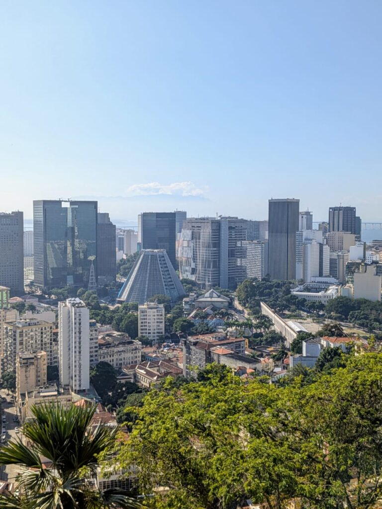
To the north lies the historic city center, the Centro, where colonial churches, financial buildings, and samba bars crowd together. Nearby, the massive Maracanã Stadium rises like a temple to Brazilian football. On the eastern edge of the city, Sugarloaf Mountain (Pão de Açúcar) juts out into the bay like a giant sentinel, offering some of the most iconic views in South America.
And across the 13-kilometer-long Rio–Niterói Bridge, you reach Niterói, a quieter, charming city with beaches, modernist architecture (including Oscar Niemeyer’s spaceship-like museum), and a spectacular view looking back at Rio’s skyline—one of the rare places where you can actually see all of Rio at once.
Founded by the Portuguese in 1565 as a strategic port to defend against French colonists, Rio later became the capital of the Portuguese Empire in exile, and then Brazil’s own capital until 1960. But more than political history, what defines Rio is its energy: vibrant, chaotic, sensuous. The rhythm of samba pulses beneath your feet, even when the streets are still. Over the next four days, we’ll explore its peaks and promenades, beaches and backstreets—always with music in the air and ocean at your side.
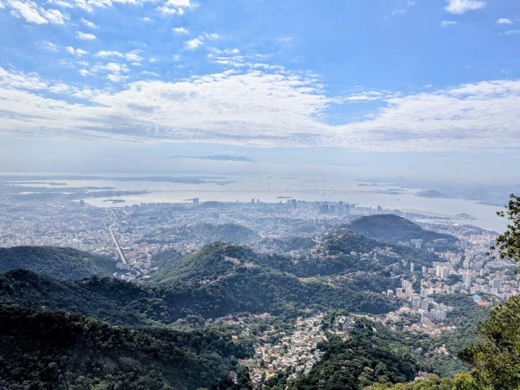
North Rio 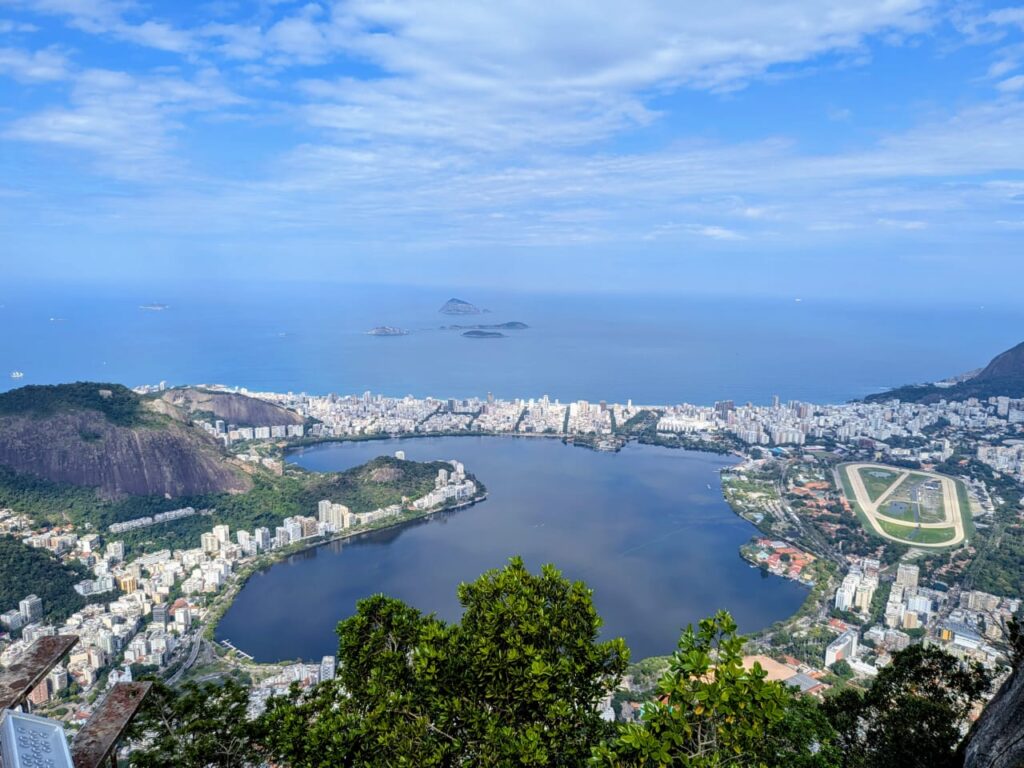
South Rio Day 1 - Postcards and Promenades: Sugarloaf and the Beaches
Your first morning in Rio starts with one of the city’s most iconic sights: Sugarloaf Mountain (Pão de Açúcar). The name dates back to colonial times when blocks of refined sugar were shaped like rounded cones—just like this towering granite peak. Two separate cable cars take you first to Morro da Urca and then to the summit, where the city stretches out beneath you: beaches, favelas, jungle, sea. It’s especially magical in the early morning light, before the crowds and the haze roll in.
After descending, head toward Copacabana. The long curving beach, with its classic black-and-white tiled promenade, is pure Rio. You’ll see locals jogging, playing beach volleyball, or sipping fresh coconut water at street kiosks. Continue west and you’ll hit Ipanema—stylish, elegant, with art galleries tucked between modernist apartment buildings. If time allows, end the day at Posto 9, where locals gather to watch the sun set behind the Dois Irmãos hills. The sky turns pink, music drifts on the breeze, and the rhythm of the city starts to slow.
Day 2 - Christ the Redeemer and Colonial Corners

No journey through Rio would be complete without visiting Christ the Redeemer, nestled atop Corcovado within Tijuca National Park, the largest urban forest in the world. The best route is the charming cog train that travels through dense rainforest—this historic rail, originally built in the late 19th century, became a gateway to the statue once slaves were freed, intended as a gesture of gratitude to Christ .
Construction of the monument began in the 1920s and it was unveiled in 1931. It’s built of reinforced concrete, covered entirely in soapstone tiles mined in Minas Gerais. Interestingly, the head and hands were sculpted in France under sculptor Paul Landowski’s direction—and it’s said the hands were modeled after a Brazilian woman’s, bringing a touch of local humanity to the piece.
Today, you ride through the heart of the forest, glimpsing the lush canopy restored during Emperor Pedro II’s era—reforested by freed slaves to protect the city’s water sources between 1861 and 1887—and now alive with waterfalls, monkeys, and toucans.
From the summit, you stand beneath the vast arms of Christ and gaze upon all of Rio—from sparkling beaches to the tangled hills speckled with favelas. It’s a powerful fusion of human history, engineering, nature, and faith. For safety, stick to the train path, avoid hiking the trail after dark, and skip quieter paths that edge into less secure areas.
After your morning at Christ the Redeemer, spend the afternoon wandering through Santa Teresa, a bohemian enclave perched on the hills above downtown Rio. The neighborhood originated in the 1750s around a Carmelite convent built on Morro Desterro, named in honor of St. Teresa of Ávila. In its early days, the area attracted upper-class families seeking refuge from yellow fever—elegant French-inspired villas still line the winding, cobbled streets above lush valleys .
Santa Teresa’s charm comes alive with the iconic bonde tram, the historic yellow streetcar that, since the late 1800s, has climbed over the majestic Carioca Aqueduct (Arcos da Lapa) and snaked through the neighborhood along ancient tram lines. The aqueduct itself once carried clean water to the city but eventually became obsolete—and even turned into a source of sewage overflow—until repurposed for urban transport.
By the mid-20th century, Santa Teresa declined, but in the 1970s and 1980s a new generation of artists, poets, and musicians began buying up the grand villas. Their studios and galleries turned the area into “Rio’s Montmartre,” a creative pulse that still beats today in places like Parque das Ruínas, where a once-abandoned mansion now hosts concerts framed by sweeping city views.
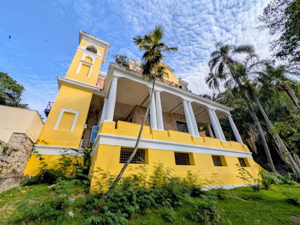
One of the neighborhood’s cultural treasures is the Glória Maria Municipal Park, formerly known as Parque das Ruínas. Once the grand mansion of socialite and Belle Époque patroness Laurinda Santos Lobo, the estate became a gathering place for artists and intellectuals in the early 1900s. The house was later abandoned until the 1990s, when the city restored the ruins and reimagined them as a cultural center with galleries, concert spaces, and an open-air theater.
This spot is more than a ruin—it’s a panoramic vantage point offering sweeping views of Guanabara Bay and the Centro, framed by the skeletal remains of ornate walls and contemporary steel beams. In 2023, it was renamed in honor of beloved journalist Glória Maria, and now features walls painted by Brazilian street artist Kobra, a vibrant homage that blends past and present in technicolor.
After your morning at Christ the Redeemer, spend the afternoon wandering through Santa Teresa, a bohemian enclave perched on the hills above downtown Rio. The neighborhood originated in the 1750s around a Carmelite convent built on Morro Desterro, named in honor of St. Teresa of Ávila. In its early days, the area attracted upper-class families seeking refuge from yellow fever—elegant French-inspired villas still line the winding, cobbled streets above lush valleys .
Santa Teresa’s charm comes alive with the iconic bonde tram, the historic yellow streetcar that, since the late 1800s, has climbed over the majestic Carioca Aqueduct (Arcos da Lapa) and snaked through the neighborhood along ancient tram lines. The aqueduct itself once carried clean water to the city but eventually became obsolete—and even turned into a source of sewage overflow—until repurposed for urban transport.
By the mid-20th century, Santa Teresa declined, but in the 1970s and 1980s a new generation of artists, poets, and musicians began buying up the grand villas. Their studios and galleries turned the area into “Rio’s Montmartre,” a creative pulse that still beats today in places like Parque das Ruínas, where a once-abandoned mansion now hosts concerts framed by sweeping city views.
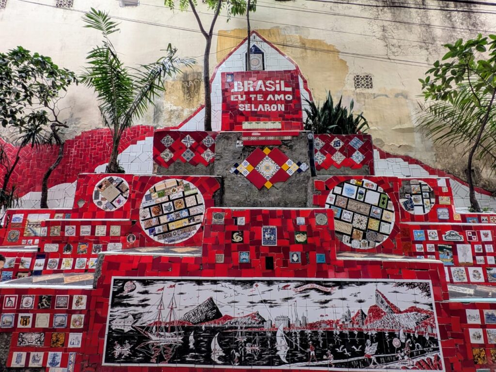
After visiting Parque Glória Maria, make your way downhill toward one of Rio’s most astonishing—and emotional—works of public art: the Escadaria Selarón. This 125‑meter staircase of 215 steps connects Lapa and Santa Teresa, its every tile a story.
Chilean-born artist Jorge Selarón began tiling the steps in 1990 as a modest tribute to his adopted home, Brazil, splashing the steps in green, yellow, and blue—the colors of the Brazilian flag. Neighbors scoffed, but Selarón, who had already roamed more than 50 countries, remained devoted. Sourcing broken tiles from local dump heaps and discarded building sites, he first covered his doorstep, then steadily expanded—never stopping, declaring his work “a crazy and unique dream” that would only end the day he died.
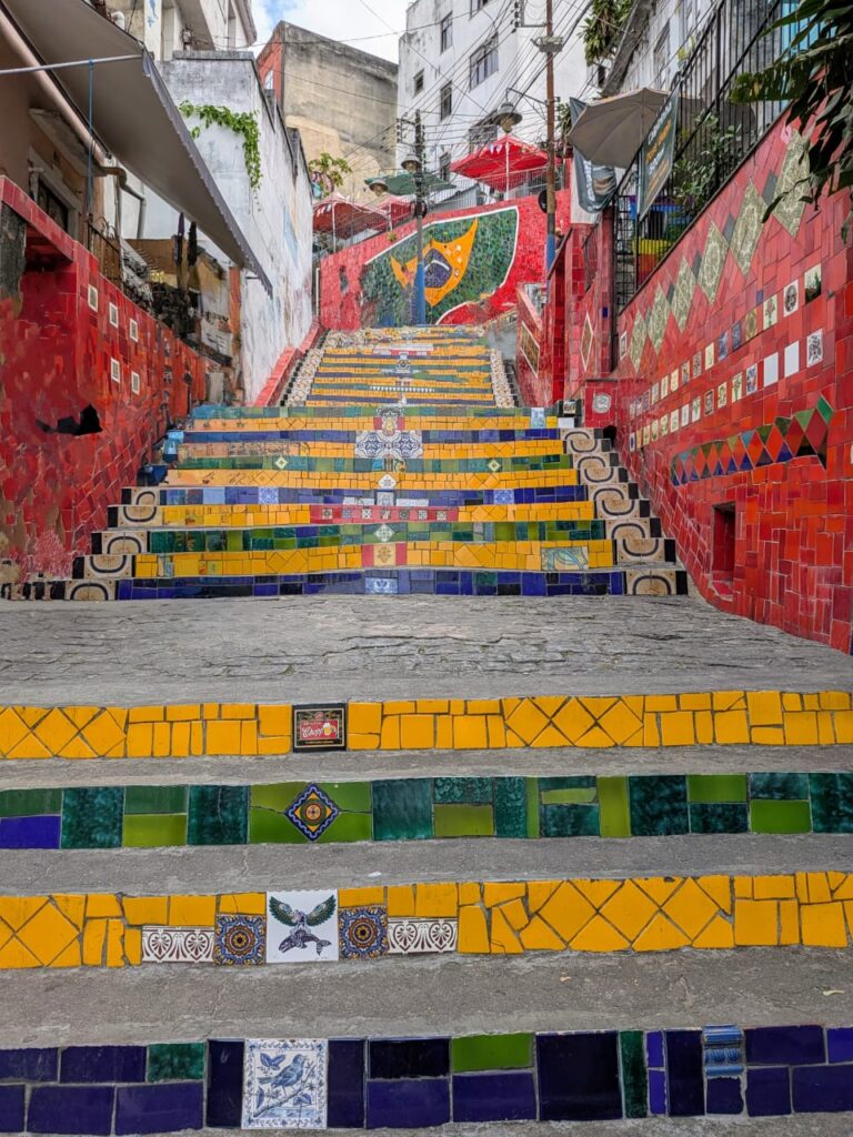
Over time, visitors began donating tiles from around the world. The steps now feature over 2,000 distinct tiles from more than 60 countries, a living mosaic that evolves as Obsessively as the city itself. Selarón continually replaced tiles—breaking and rearranging sections—to keep the installation fresh, likening it to a living artwork with “never complete” status.
Among the most haunting motifs are nearly 300 hand-painted tiles of a pregnant Black woman. The image first appeared in his paintings from 1977 and carried into the steps, a figure Selarón said represented “a personal problem from my past”. Some scholars connect this image to his late wife, who died while pregnant—an echo of grief embedded in mosaic.
Selarón lived at the base of the steps and became part of the scene: painting by day, chatting with visitors by night. He funded his work by selling portraits—often of the pregnant woman—and postcards, fueling his obsession with color and narrative. In 2005, in recognition of his cultural contribution, the city officially declared the stairs part of Rio’s heritage and made him an honorary carioca.
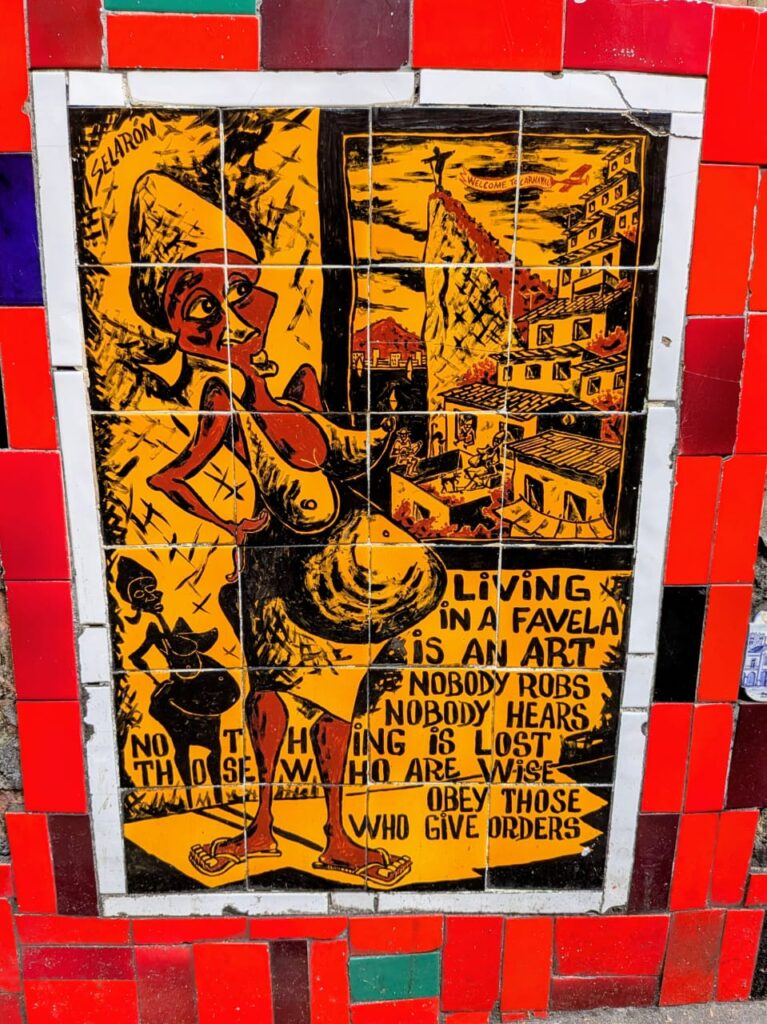
Tragically, on January 10 2013, Selarón was found dead on his own stairs, burned—some suspecting suicide, others suspecting foul play after he’d received threats. His final act, it seems, was closing the full circle of his “never‑ending” creation—and as he predicted, the staircase did end the day he died.
Today, the steps pulse with life: tourists hunting for tiles from their countries, musicians filming videos (U2, Snoop Dogg), and locals stepping through color and memory. This is no static monument—it’s a testament to devotion, memory, diaspora, and grief… and an unforgettable, surreal Rio moment.
Day 3 - A Tropical Jungle Within the City
Few cities in the world can boast a rainforest within city limits, but Rio can. The Tijuca National Park is a miracle of reforestation—once cleared for coffee plantations in the 19th century, today it’s a thriving ecosystem and the lungs of the city. You could spend an entire day hiking here. One popular route leads to Pedra Bonita, a rocky summit with sweeping views of the beaches and the statue of Christ in the distance.
Along the way, you might encounter waterfalls, howler monkeys, or flashes of bright toucans. For those who prefer something less strenuous, a guided jeep tour offers a comfortable but immersive option. Later in the day, cool off at the Jardim Botânico, founded in 1808 by the Portuguese king João VI. With its towering imperial palms, orchid pavilions, and giant water lilies, the garden is a peaceful escape from the heat and traffic—a place to slow down and breathe.
Day 4 - Football, Museums, and a Final Sunset
Begin your final day at Maracanã, one of the most storied football stadiums in the world. Even if you’re not a sports fan, the tour is worth it—walk through the locker rooms, stand at pitch-side, and imagine the roar of 78,000 fans. It’s not just a stadium, but a temple to Brazilian identity.
In the afternoon, if you’re in the mood for more culture, head to the futuristic Museum of Tomorrow (Museu do Amanhã), built on the former docks with sweeping lines and science-driven exhibits on climate, cities, and the future of humanity. Or if you prefer something slower, explore the refined streets of Leblon, the city’s most upscale neighborhood, where you can browse bookstores, sip a quiet espresso, or do some last-minute shopping.
As the sun begins to sink, join locals at Mureta da Urca. It’s not a formal bar or even a restaurant—just a stone wall by the bay where people gather with cold beer, conversation, and a view of the boats bobbing in the harbor. It’s humble, authentic, and oddly perfect—just like Rio.
-
Parque Nacional Los Glaciares
March 21, 2023 /Los Glaciares National Park is located in the area known as Austral Andes in Argentina, in the south west of Santa Cruz on the border with Chile. By his magnificent natural beauty, it constitutes a wonder in the world, and was declared “World Heritage” by UNESCO in 1981.
This park shows a scenario of mountains, lakes and woods, including a large portion of the Andes practically under ice and snow to the west, and the arid Patagonian steppe to the east.
Its name refer to the glaciers that are born on the Ice Caps – the largest continental ice extension after Anctartica- which occupies almost half its area. Also known as Patagonic Continental Ice, creates 47 big glaciers, 13 of which flow to the Atlantic. There are also more than 200 smaller glaciers, unconnected to the Ice Caps.
All over the world glaciers are over 2500 mts over sea level, but here, in Santa Cruz, they are originated on the Ice Caps, at 1500 mts over sea level, and flow down to 200 mts, having the possibility of an unique approach and view.
As a result of the enormous pressure of the antique ice and the subsequent thaw, three big lakes, two of them inside the NP appeared: Lago Argentino and Lago Viedma, the waters of which flow as Rio Santa Cruz to the Atlantic Ocean crossing the province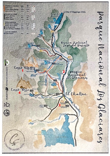
Cerro Fitz Roy - Laguna de Los Tres
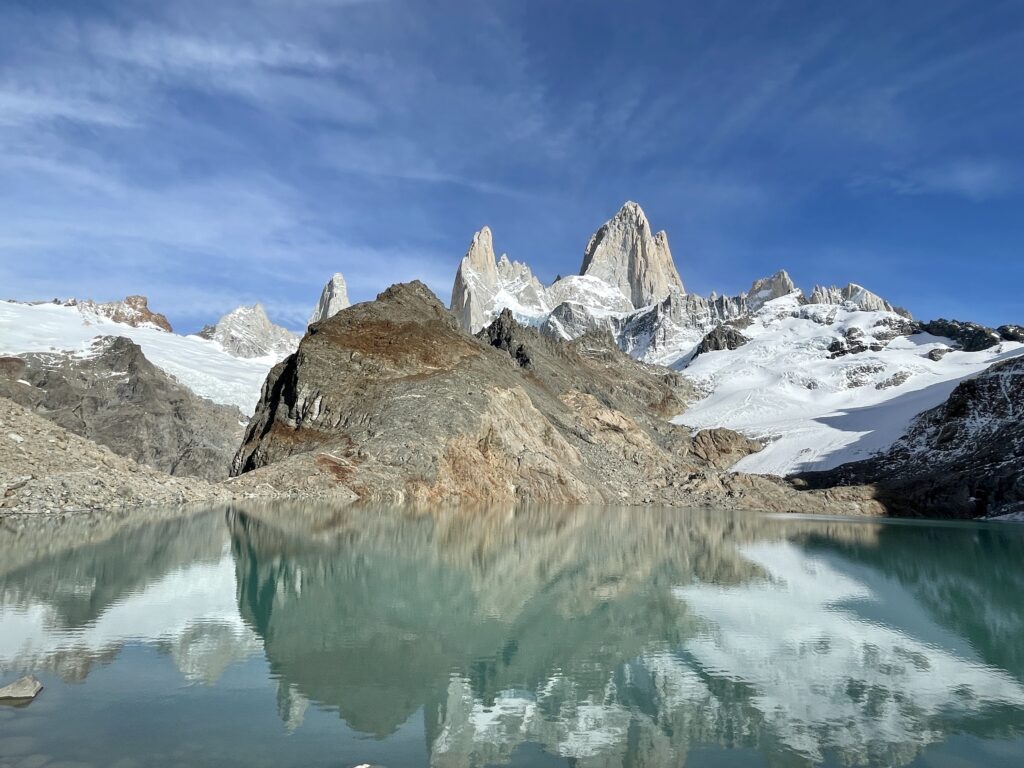
Laguna de Los Tres is one of the most iconic hikes in Patagonia and the best trek you can do from El Chalten in Argentina. It’s also known as Fitz Roy hike because the trail will take you to the classic viewpoint of Mount Fitz Roy and the lake.
Laguna de Los Tres means in English Lake of the Three, and the number three represents here three peaks towering above the lagoon – the highest Mount Fitz Roy, Cerro Torre, and Mount Poincenot.Finding trailhead to Laguna de Los Tres couldn’t be easier.
The trail starts at the north end of the urban area of El Chalten. You only need to follow Avenida San Martin until you reach the parking lot on your left.
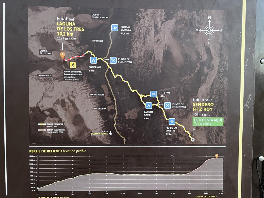
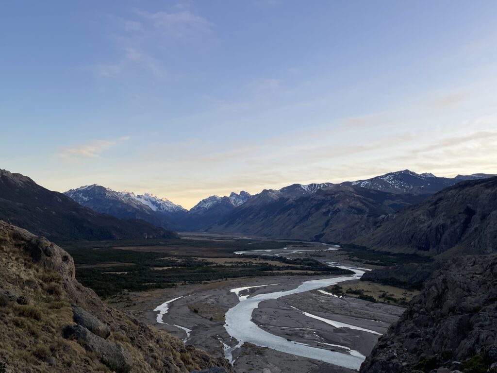
From the parking lot, the trail starts quite steeply up. The first ascent lasts about an hour, but in the end, you will be rewarded by a splendid view of De las Vueltas river sneaking through the valley.
From this mirador, the path continues up, but not that steeply. You will walk on a narrow path partially hidden in the forest until you reach a fork where you can decide to turn right and walk through the Mirador del Fitz Roy or turn left and go via Laguna Capri.
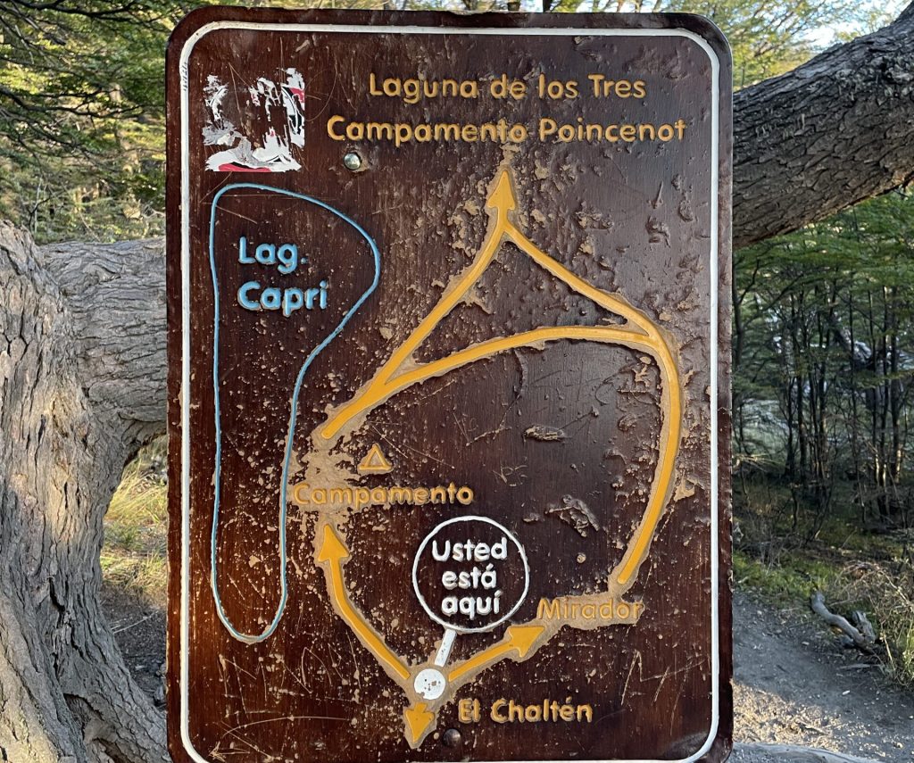
Generally, it does not matter which option you’ll take as you can walk the other side on the way back.
But if the weather is pleasant, you should go via the viewpoint first as the situation can change any time, and it might be the only time you’ll get the chance to see the iconic Fitz Roy from a distance.
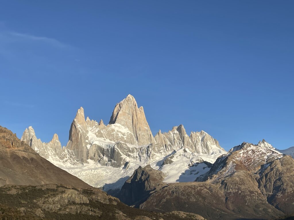
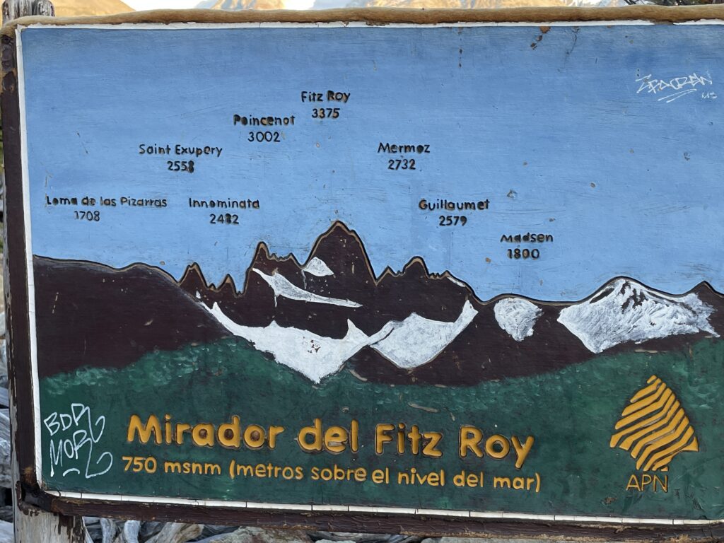
After you enjoy the panoramic views, the path continues down and soon became flat, which will be a welcoming change.
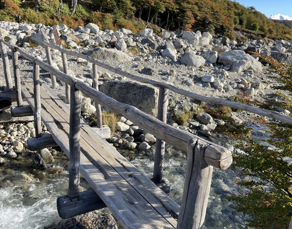
The path will now wind through the low thicket, along Del Salto Stream, and later you emerge in an open valley and walk a very scenic section where you will go across wetlands, so from time to time, it will be necessary to cross wooden boardwalks.
At the end of this part, you will find a campground in the woods, where you can have a snack and recharge as you have the most challenging one-kilometer-long section ahead of you.
On this last kilometer, you will gain 400 meters in elevation and have to walk the rocky trail – watch every step as it is easy to lose balance here.
If you bring trekking poles, they will help you a lot in this section.
Finally, after approximately 45 minutes, you will reach the end of the trail and be rewarded with stunning views of the lake and three towering peaks behind.
Chorillo del Salto
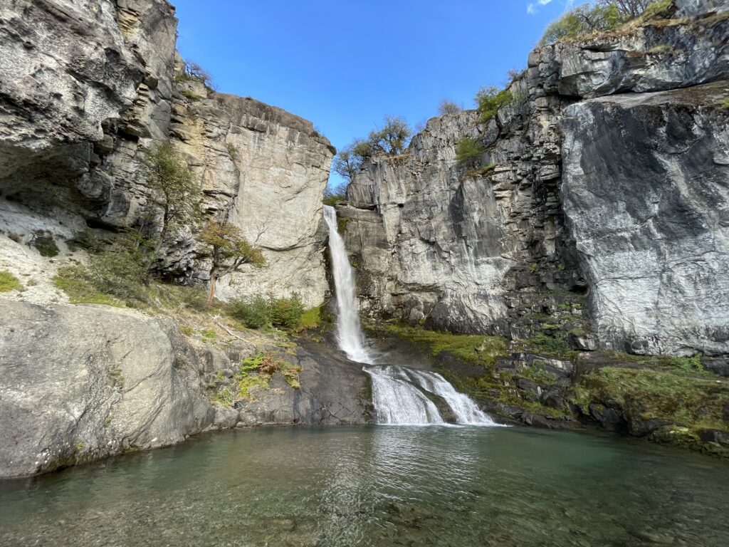
This pleasant trek is perfect for a first contact with the natural environment of El Chaltén, you walk through a forest area in a footpath with no difficulty. At the end of the trail a lovely waterfall and its stream invite you to take a break for contemplation at the shelter of the native forest.The trail begins in El Chaltén, at the end of Av. San Martín, on the same trailhead towards Laguna De los Tres; You must take the path going to the right. In a short time the trail ascends and immediately after it descends until you reach the unpaved route that leads to the Lago del Desierto (Provincial Route 41). Shortly after you will find a signpost on your right hand side indicating the entrance to the “Bicisenda”(bike trail) -a path exclusively for cycling, do not enter- and after a few minutes more, you will see another signpost to your left indicating that the path to the Chorrillo del Salto continues crossing the low forest of Ñires entering the foothill area again.In less than half an hour you will reach the last stretch of the trail where there is a car park area; It means that you can also get here by car or bicycle. In the last section of the trail you enter only on foot, it is forbidden to enter with bicycles. This beautiful footpath is completely flat, between low trees. The distant sound of the waterfall anticipates that you are approaching the end of the route.The waterfall is on the last leg of the Arroyo del Salto, before it flows into the De las Vueltas river. The total distance of this trek is less than 4 km from El Chaltén.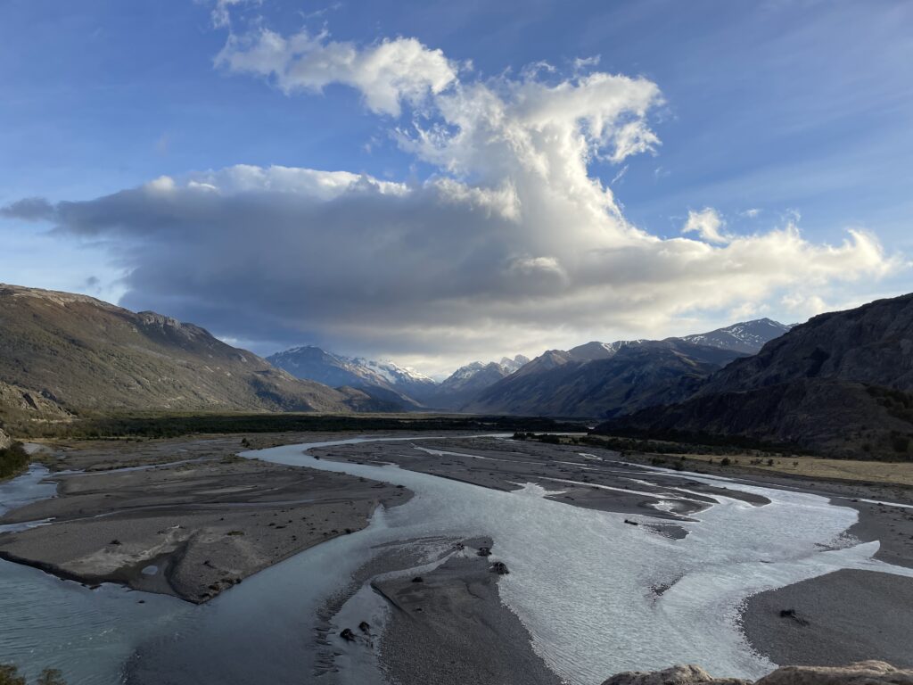
Mirador de Los Condores - Mirador de Las Aguilas
Starting from El Chaltén, you cross over the access bridge of the Fitz Roy river and then continue along to the trailhead starting at the National Park Visitors’ Centre. After a short walk you cross a small gate with a sign indicating the way to the left, and a few steps further you will see a second sign showing you the trail plan. From here it will be another half hour until you reach the Los Cóndores viewpoint. This footpath is relatively new, since it has been opened in 2004. It is well signposted and on its way you will find several informative signs that will let you appreciate the landscape around you. As its name indicates, the viewpoint is strategically located for the eventual observation of condors in their frequent flight between the valleys of the De Las Vueltas river and the Fitz Roy river. Furthermore it is an excellent alternative for admiring the impressive granite peaks and glaciers dominating the horizon.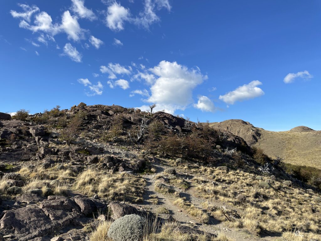
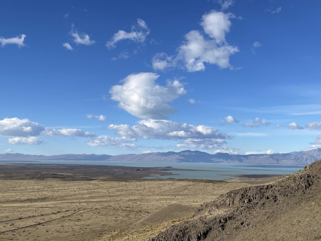 The trail to the Las Águilas viewpoint begins at the signposted bifurcation about ten minutes before arriving at the Los Cóndores viewpoint. This short trail has a gentle slope and as you go along you will discover the great Viedma lake on the horizon. The viewpoint is a natural balcony with a panoramic view over the steppe and the Viedma lake to the south, the Cerro Huemul to the west and the Cerro Piramide to the east.
Cerro Torre - Laguna Torre
From El Chaltén there are two head trails to Laguna Torre ; both paths merge within 5 minutes walk. Although the trek to the lake is quite long – 9 kilometers one way, the trail gains only 250 meters in elevation during this distance, and the majority at the beginning of the trail. The trail enters the valley of the Fitz Roy river and follows up alongside the stream to its source. At only 15 minutes walk you will access the first viewpoint located at the gorge of the Fitz Roy river which offers an impressive panoramic view of the Cerro Solo, Adela range, Cerro Torre and the Mount Fitz Roy. Across the river canyon lies the Margarita waterfall. Once you get to the Mirador Cascada Margarita, the first viewpoint, the hike from this point is not demanding, and you will walk mostly on a flat path, with occasional up and down sections.
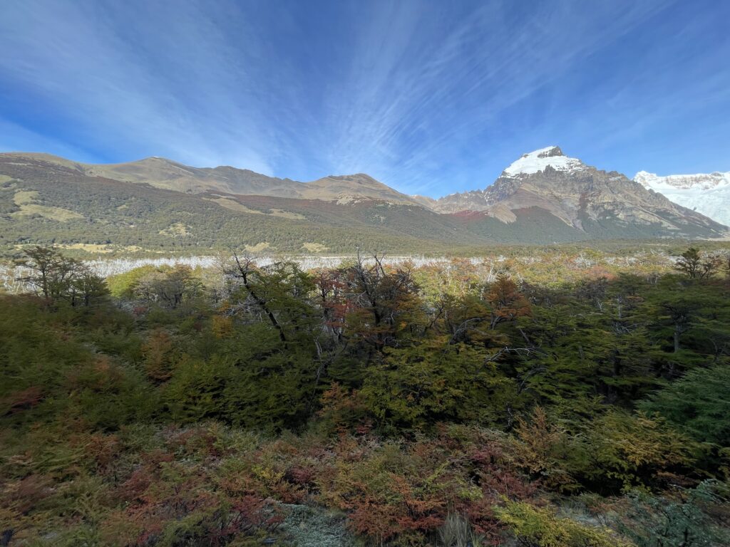
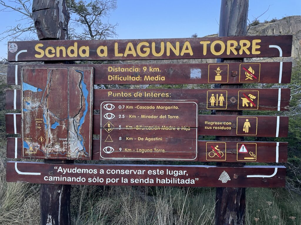
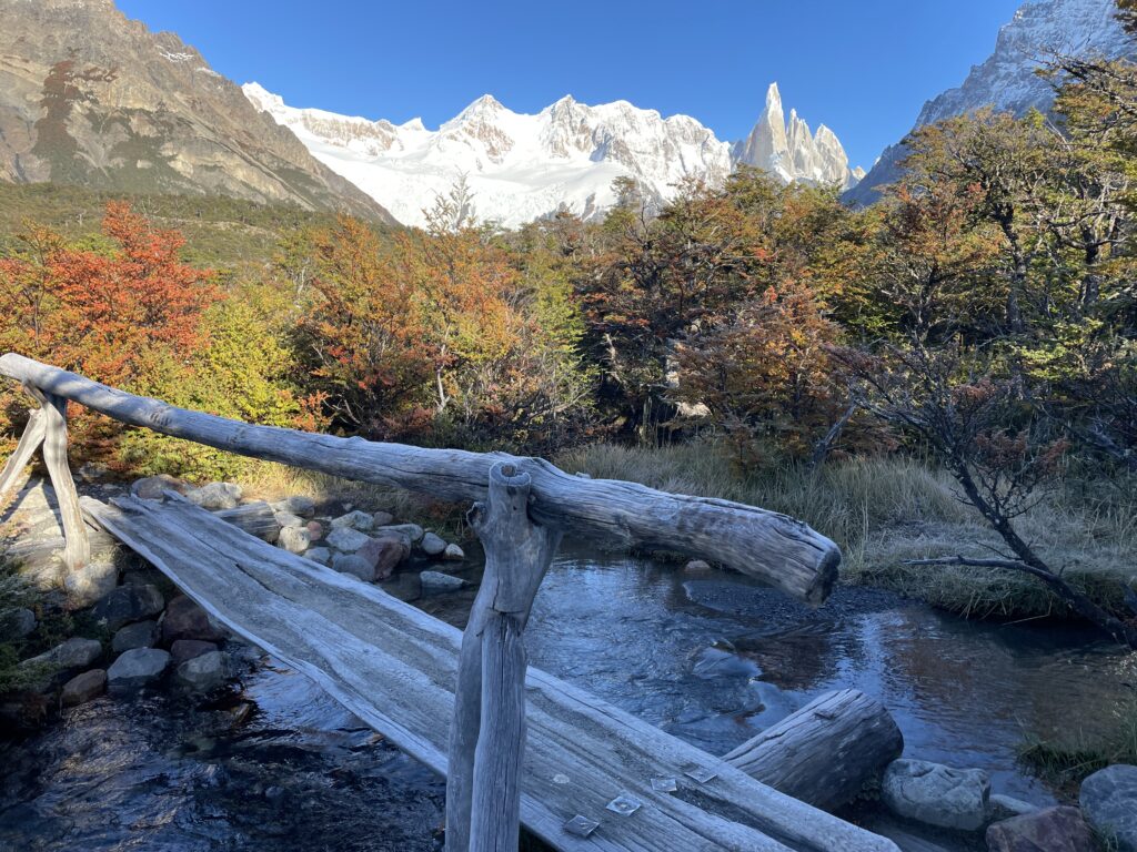
Halfway through the path you will reach a natural viewpoint with magnificent panoramic views of the Adela range, Cerro Torre and the satellite granite needles. Finally the trail crosses the De Agostini base camp where it is possible to spend the night in your tent.
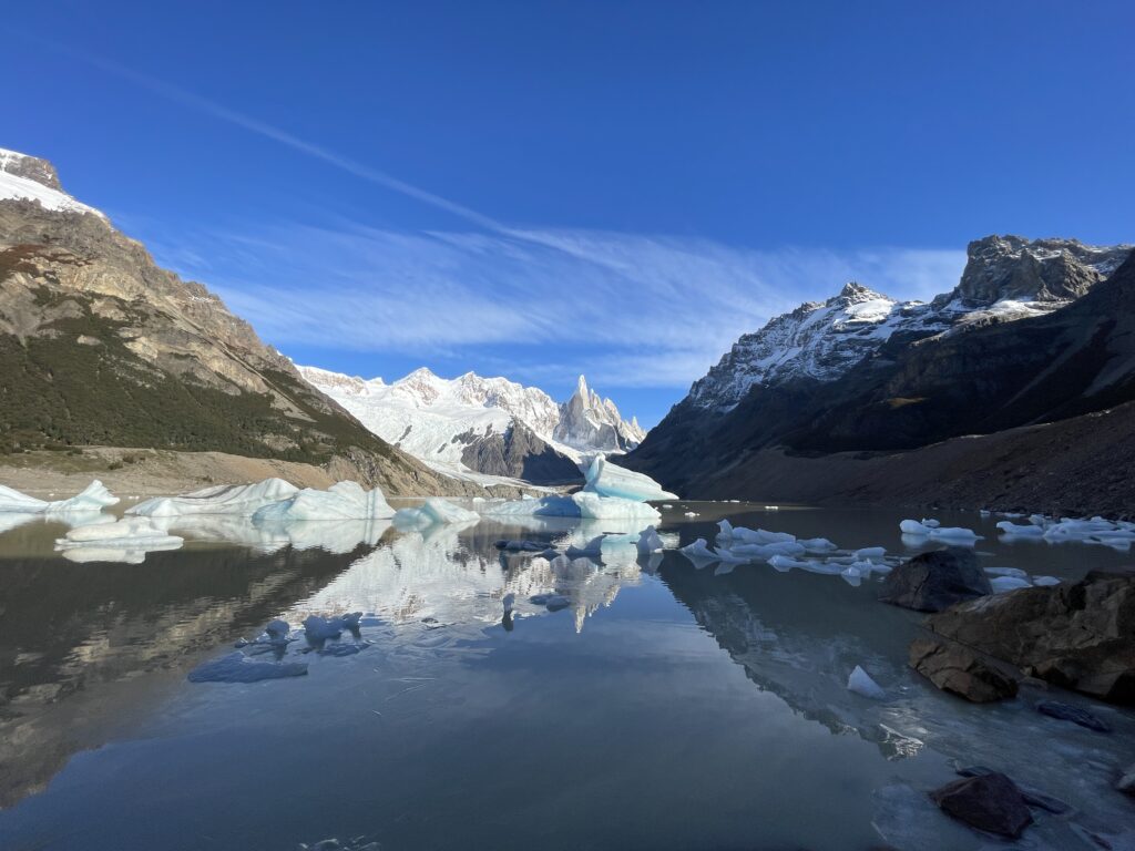
Leaving behind the campground, the path continues towards the frontal moraine, which ascends until reaching its crest after walking for 15 minutes. From there it is possible to go down to the Torre lagoon. This lagoon tends to group numerous icebergs on its shore which has fallen off from the front face of the Grande glacier.
If you have enough energy and want to get a better view of the glacier, it is possible to extend the trip and climb up from Laguna Torre to Mirador Maestri. This detour will add approximately 2 kilometers one way (depending on how far you want to go) and a minimum 1 hour.

Other treks
Loma del Pliegue Tumbado
The trail starts at the National Park Ceferino Fonzo Visitors` Centre, where a small fence indicates two paths: to the left, the trail goes to Los Cóndores and Las Águilas viewpoints, and to the right towards Pliegue Tumbado and Laguna Toro / Paso del Viento. This trail maintains an ascending slope of approximately 1100 metres in total (3,610 miles), until reaching the viewpoint located at about 1500 metres (4,920 feet) above sea level. Due to its height, the absence of trees and the total exposure to the wind, you should go prepared with a windproof jacket and warm clothes since a small snowfall is not uncommon even in the middle of summer. Having walked for about an hour, the trail crosses a plain called “Pampa De las Carretas”, from where you can appreciate the impressive Mount Huemul, the Viedma lake to the south and the whole imposing Andes to the northwest where Mount Torre and Mount Chaltén stand out. The trail then enters a beautiful forest until reaching an altitude of approximately 1000 metres above sea level, where the landscape changes abruptly: the trees turn to bushes and scrubby vegetation, and among the many stones on the way it is possible to find the remains of marine fossils which are bout 100 million years old. The last part of the trail fades away but it is still marked with yellow sticks until you reach the top of the Pliegue Tumbado -which can be snowed and if this is the case it is not recommended to continue- with an extraordinary panoramic view.
Huemul Glacier - Lago del Desierto
This trek takes place in the Southern region of Lago Del Desierto, 37 km from El Chaltén. To get there you can take the services of private transfers. This trek is the usual option for those who arrive at the lake and have little time to spend in the area. You will be able to enjoy the extraordinary views of the north face of Mount Chaltén and the valley of the De las Vueltas river. The trailhead starts a few metres away from the free parking area. Remember you must pay the entrance fee since the entire trek is in private property. The footpath quickly enters the Lenga forest and after a few minutes it begins its ascent on a well-marked trail. n little more than half an hour you will reach a moraine ridge with breathtaking views of the De las Vueltas river valley and the Mount Fitz Roy. Towards the NE you will see the Lago del Desierto and the snowcapped mountains of the Del Bosque range. After walking along the moraine ridge for about 15 minutes you will arrive at the beautiful Huemul lagoon, fed by the glacier of the same name.