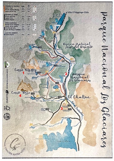
Los Glaciares National Park is located in the area known as Austral Andes in Argentina, in the south west of Santa Cruz on the border with Chile. By his magnificent natural beauty, it constitutes a wonder in the world, and was declared “World Heritage” by UNESCO in 1981.
This park shows a scenario of mountains, lakes and woods, including a large portion of the Andes practically under ice and snow to the west, and the arid Patagonian steppe to the east. Its name refer to the glaciers that are born on the Ice Caps – the largest continental ice extension after Anctartica- which occupies almost half its area. Also known as Patagonic Continental Ice, creates 47 big glaciers, 13 of which flow to the Atlantic. There are also more than 200 smaller glaciers, unconnected to the Ice Caps. All over the world glaciers are over 2500 mts over sea level, but here, in Santa Cruz, they are originated on the Ice Caps, at 1500 mts over sea level, and flow down to 200 mts, having the possibility of an unique approach and view. As a result of the enormous pressure of the antique ice and the subsequent thaw, three big lakes, two of them inside the NP appeared: Lago Argentino and Lago Viedma, the waters of which flow as Rio Santa Cruz to the Atlantic Ocean crossing the province
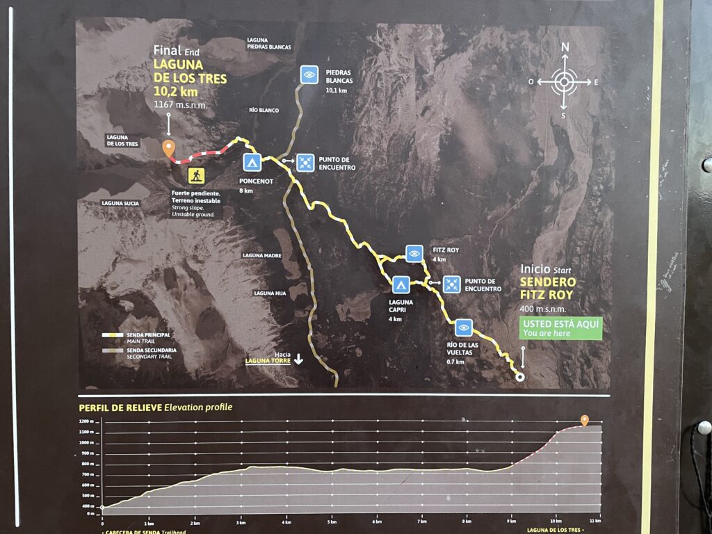
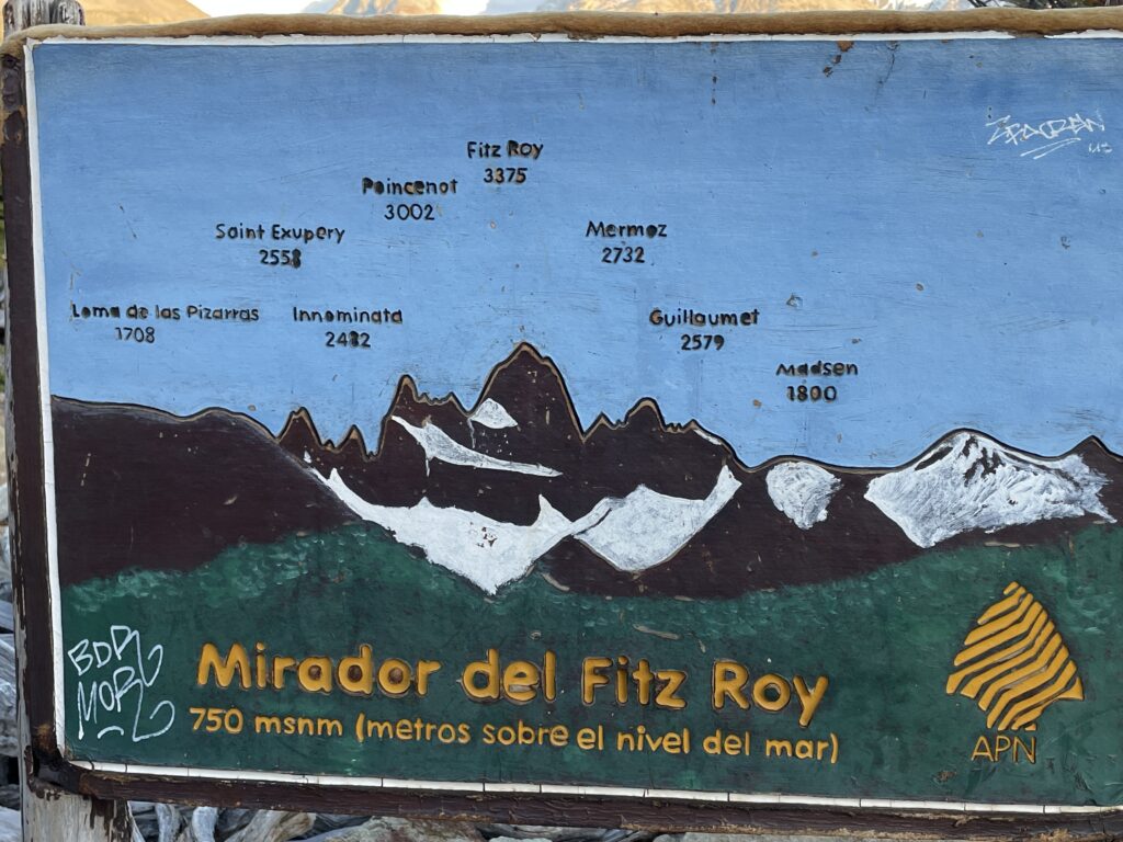
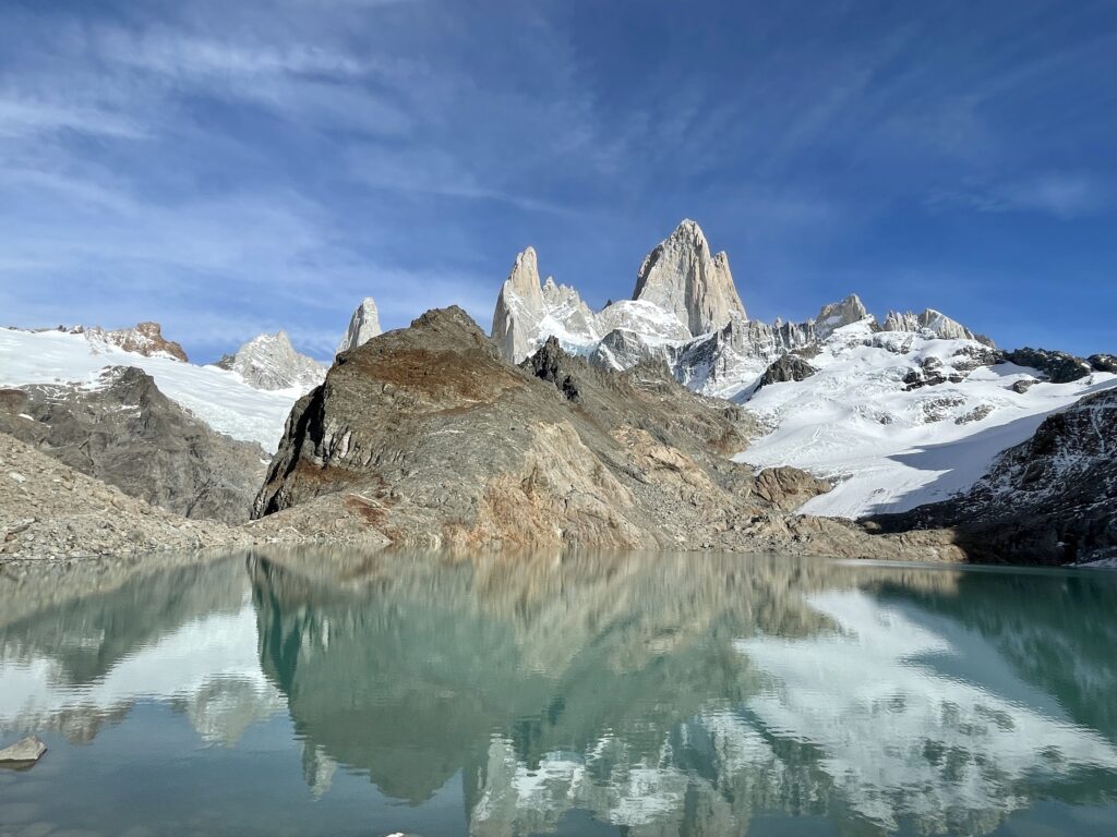
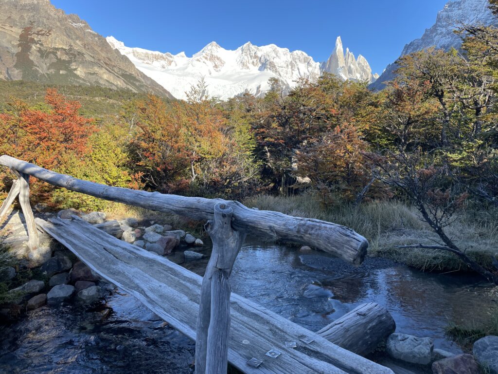
Cerro Fitz Roy - Laguna de Los Tres
Laguna de Los Tres is one of the most iconic hikes in Patagonia and the best trek you can do from El Chalten in Argentina. It’s also known as Fitz Roy hike because the trail will take you to the classic viewpoint of Mount Fitz Roy and the lake.
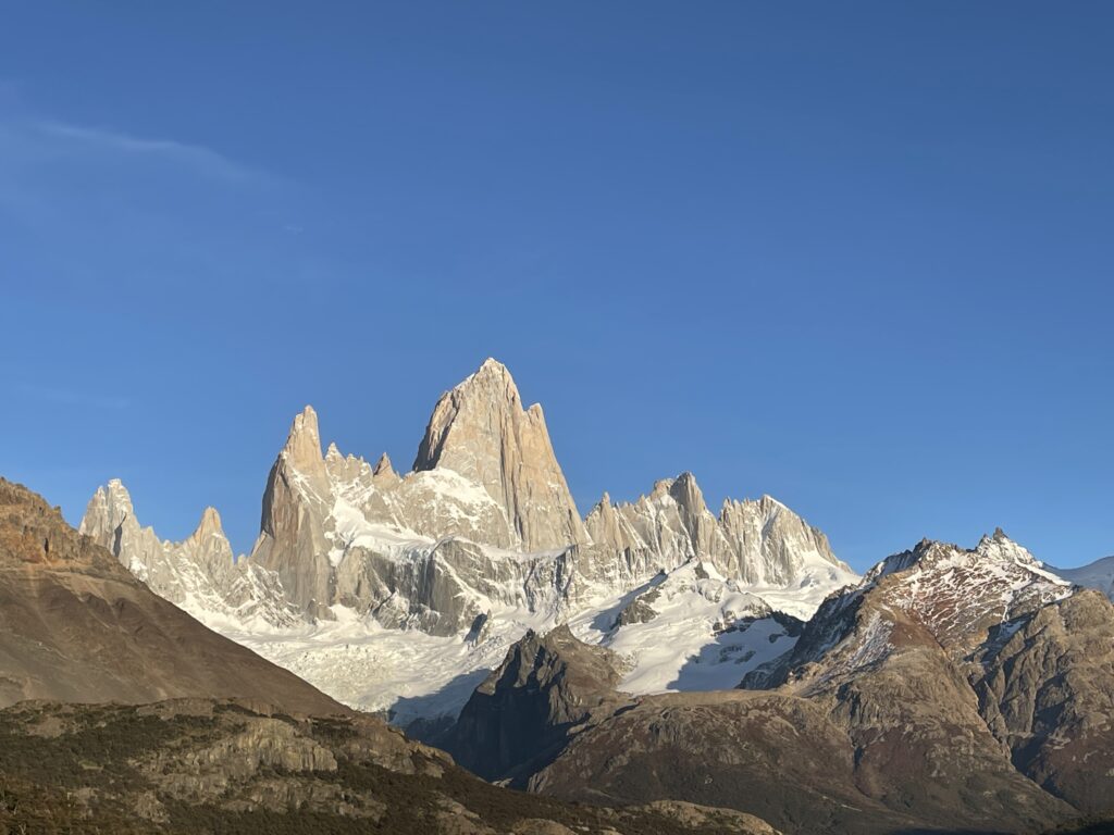
Laguna de Los Tres means in English Lake of the Three, and the number three represents here three peaks towering above the lagoon – the highest Mount Fitz Roy, Cerro Torre, and Mount Poincenot.Finding trailhead to Laguna de Los Tres couldn’t be easier.
The trail starts at the north end of the urban area of El Chalten. You only need to follow Avenida San Martin until you reach the parking lot on your left.
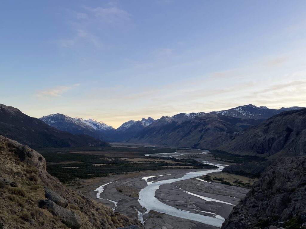
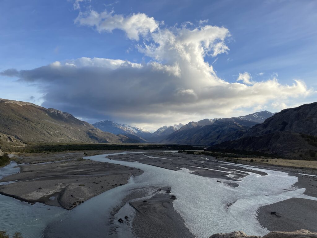
From the parking lot, the trail starts quite steeply up. The first ascent lasts about an hour, but in the end, you will be rewarded by a splendid view of De las Vueltas river sneaking through the valley.
From this mirador, the path continues up, but not that steeply. You will walk on a narrow path partially hidden in the forest until you reach a fork where you can decide to turn right and walk through the Mirador del Fitz Roy or turn left and go via Laguna Capri.
Generally, it does not matter which option you’ll take as you can walk the other side on the way back.
But if the weather is pleasant, you should go via the viewpoint first as the situation can change any time, and it might be the only time you’ll get the chance to see the iconic Fitz Roy from a distance.
After you enjoy the panoramic views, the path continues down and soon became flat, which will be a welcoming change.
The path will now wind through the low thicket, along Del Salto Stream, and later you emerge in an open valley and walk a very scenic section where you will go across wetlands, so from time to time, it will be necessary to cross wooden boardwalks.
At the end of this part, you will find a campground in the woods, where you can have a snack and recharge as you have the most challenging one-kilometer-long section ahead of you.
On this last kilometer, you will gain 400 meters in elevation and have to walk the rocky trail – watch every step as it is easy to lose balance here.
If you bring trekking poles, they will help you a lot in this section.
Finally, after approximately 45 minutes, you will reach the end of the trail and be rewarded with stunning views of the lake and three towering peaks behind.
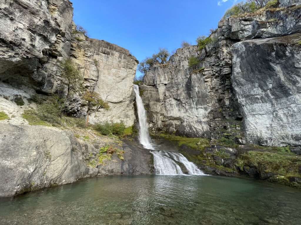
Chorillo del Salto
This pleasant trek is perfect for a first contact with the natural environment of El Chaltén, you walk through a forest area in a footpath with no difficulty. At the end of the trail a lovely waterfall and its stream invite you to take a break for contemplation at the shelter of the native forest.The trail begins in El Chaltén, at the end of Av. San Martín, on the same trailhead towards Laguna De los Tres; You must take the path going to the right. In a short time the trail ascends and immediately after it descends until you reach the unpaved route that leads to the Lago del Desierto (Provincial Route 41). Shortly after you will find a signpost on your right hand side indicating the entrance to the “Bicisenda”(bike trail) -a path exclusively for cycling, do not enter- and after a few minutes more, you will see another signpost to your left indicating that the path to the Chorrillo del Salto continues crossing the low forest of Ñires entering the foothill area again.In less than half an hour you will reach the last stretch of the trail where there is a car park area; It means that you can also get here by car or bicycle. In the last section of the trail you enter only on foot, it is forbidden to enter with bicycles. This beautiful footpath is completely flat, between low trees. The distant sound of the waterfall anticipates that you are approaching the end of the route.The waterfall is on the last leg of the Arroyo del Salto, before it flows into the De las Vueltas river. The total distance of this trek is less than 4 km from El Chaltén.
Mirador de Los Condores - Mirador de Las Aguilas
Starting from El Chaltén, you cross over the access bridge of the Fitz Roy river and then continue along to the trailhead starting at the National Park Visitors’ Centre. After a short walk you cross a small gate with a sign indicating the way to the left, and a few steps further you will see a second sign showing you the trail plan. From here it will be another half hour until you reach the Los Cóndores viewpoint. This footpath is relatively new, since it has been opened in 2004. It is well signposted and on its way you will find several informative signs that will let you appreciate the landscape around you.
As its name indicates, the viewpoint is strategically located for the eventual observation of condors in their frequent flight between the valleys of the De Las Vueltas river and the Fitz Roy river. Furthermore it is an excellent alternative for admiring the impressive granite peaks and glaciers dominating the horizon.
The trail to the Las Águilas viewpoint begins at the signposted bifurcation about ten minutes before arriving at the Los Cóndores viewpoint.
This short trail has a gentle slope and as you go along you will discover the great Viedma lake on the horizon.
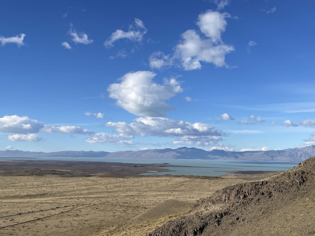
The viewpoint is a natural balcony with a panoramic view over the steppe and the Viedma lake to the south, the Cerro Huemul to the west and the Cerro Piramide to the east.
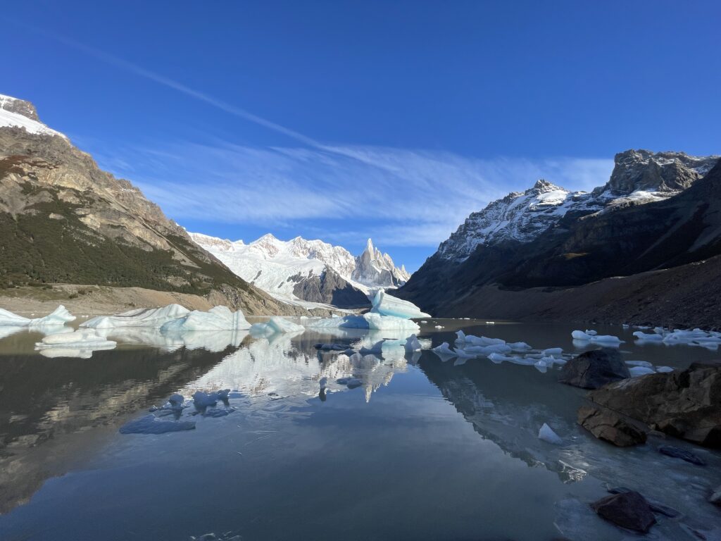
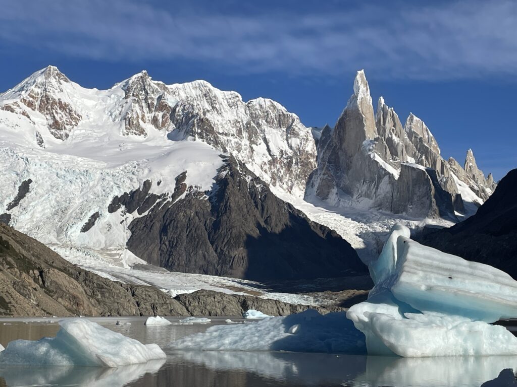
Cerro Torre - Laguna Torre
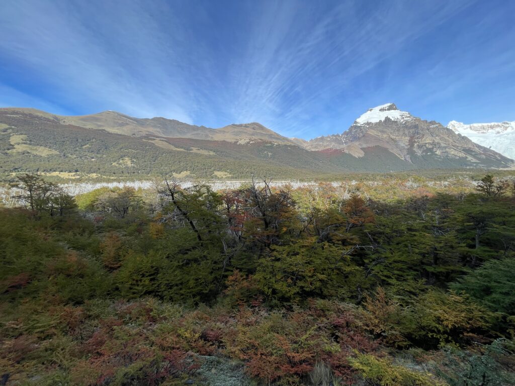
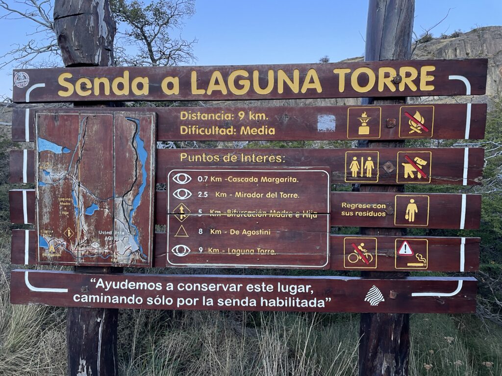
From El Chaltén there are two head trails to Laguna Torre ; both paths merge within 5 minutes walk. Although the trek to the lake is quite long – 9 kilometers one way, the trail gains only 250 meters in elevation during this distance, and the majority at the beginning of the trail. The trail enters the valley of the Fitz Roy river and follows up alongside the stream to its source. At only 15 minutes walk you will access the first viewpoint located at the gorge of the Fitz Roy river which offers an impressive panoramic view of the Cerro Solo, Adela range, Cerro Torre and the Mount Fitz Roy. Across the river canyon lies the Margarita waterfall. Once you get to the Mirador Cascada Margarita, the first viewpoint, the hike from this point is not demanding, and you will walk mostly on a flat path, with occasional up and down sections.
Halfway through the path you will reach a natural viewpoint with magnificent panoramic views of the Adela range, Cerro Torre and the satellite granite needles. Finally the trail crosses the De Agostini base camp where it is possible to spend the night in your tent.
Leaving behind the campground, the path continues towards the frontal moraine, which ascends until reaching its crest after walking for 15 minutes. From there it is possible to go down to the Torre lagoon. This lagoon tends to group numerous icebergs on its shore which has fallen off from the front face of the Grande glacier.
If you have enough energy and want to get a better view of the glacier, it is possible to extend the trip and climb up from Laguna Torre to Mirador Maestri. This detour will add approximately 2 kilometers one way (depending on how far you want to go) and a minimum 1 hour.
Other treks
Loma del Pliegue Tumbado
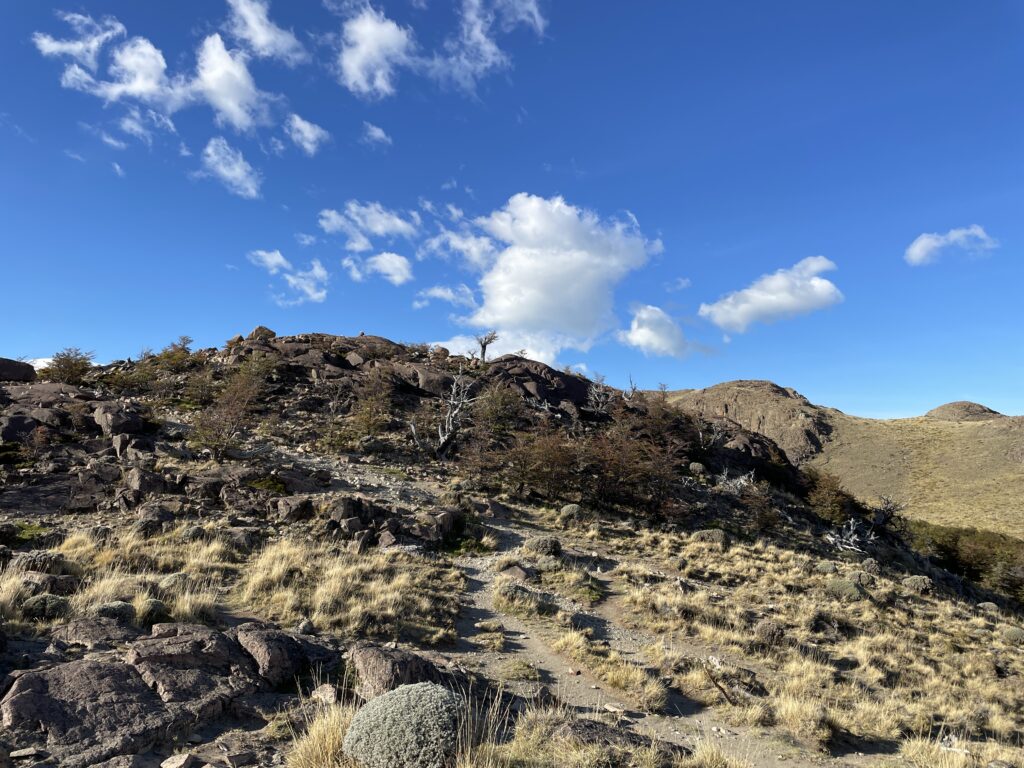
The trail starts at the National Park Ceferino Fonzo Visitors` Centre, where a small fence indicates two paths: to the left, the trail goes to Los Cóndores and Las Águilas viewpoints, and to the right towards Pliegue Tumbado and Laguna Toro / Paso del Viento. This trail maintains an ascending slope of approximately 1100 metres in total (3,610 miles), until reaching the viewpoint located at about 1500 metres (4,920 feet) above sea level. Due to its height, the absence of trees and the total exposure to the wind, you should go prepared with a windproof jacket and warm clothes since a small snowfall is not uncommon even in the middle of summer. Having walked for about an hour, the trail crosses a plain called “Pampa De las Carretas”, from where you can appreciate the impressive Mount Huemul, the Viedma lake to the south and the whole imposing Andes to the northwest where Mount Torre and Mount Chaltén stand out. The trail then enters a beautiful forest until reaching an altitude of approximately 1000 metres above sea level, where the landscape changes abruptly: the trees turn to bushes and scrubby vegetation, and among the many stones on the way it is possible to find the remains of marine fossils which are bout 100 million years old. The last part of the trail fades away but it is still marked with yellow sticks until you reach the top of the Pliegue Tumbado -which can be snowed and if this is the case it is not recommended to continue- with an extraordinary panoramic view.
Huemul Glacier - Lago del Desierto
This trek takes place in the Southern region of Lago Del Desierto, 37 km from El Chaltén. To get there you can take the services of private transfers. This trek is the usual option for those who arrive at the lake and have little time to spend in the area. You will be able to enjoy the extraordinary views of the north face of Mount Chaltén and the valley of the De las Vueltas river. The trailhead starts a few metres away from the free parking area. Remember you must pay the entrance fee since the entire trek is in private property. The footpath quickly enters the Lenga forest and after a few minutes it begins its ascent on a well-marked trail. n little more than half an hour you will reach a moraine ridge with breathtaking views of the De las Vueltas river valley and the Mount Fitz Roy. Towards the NE you will see the Lago del Desierto and the snowcapped mountains of the Del Bosque range. After walking along the moraine ridge for about 15 minutes you will arrive at the beautiful Huemul lagoon, fed by the glacier of the same name.